Category:Farringdon, Hampshire
Aller à la navigation
Aller à la recherche
village britannique  | |||||
| Téléverser des médias | |||||
| Nature de l’élément | |||||
|---|---|---|---|---|---|
| Lieu | East Hampshire, Hampshire, Angleterre du Sud-Est, Angleterre | ||||
 | |||||
Sous-catégories
Cette catégorie comprend 8 sous-catégories, dont les 8 ci-dessous.
F
L
U
Média dans la catégorie « Farringdon, Hampshire »
Cette catégorie comprend 124 fichiers, dont les 124 ci-dessous.
-
 50 Miles from London - geograph.org.uk - 2821188.jpg 3 216 × 4 288 ; 3,66 Mio
-
 A32 approaches junction with Kitcombe Lane - geograph.org.uk - 3248863.jpg 3 270 × 2 346 ; 1,27 Mio
-
 A32 east of Southfield Farm - geograph.org.uk - 4070181.jpg 3 648 × 2 736 ; 2,52 Mio
-
 A32 leaves Lower Farringdon - geograph.org.uk - 3248868.jpg 3 648 × 2 432 ; 1,84 Mio
-
 A32 towards Alton - geograph.org.uk - 4842005.jpg 640 × 480 ; 108 kio
-
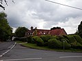
 All Saints' Church, Farringdon - geograph.org.uk - 4901983.jpg 640 × 427 ; 72 kio
-
 All Saints, Upper Farringdon - geograph.org.uk - 2821790.jpg 4 288 × 3 216 ; 3,76 Mio
-
 Angerton, Upper Farringdon.jpg 4 128 × 3 096 ; 4,51 Mio
-
 Approaching Bush Down - geograph.org.uk - 2845077.jpg 4 288 × 3 216 ; 3,64 Mio
-
 Approaching Montlings Plantation - geograph.org.uk - 2820975.jpg 4 288 × 3 216 ; 3,52 Mio
-
 Atlas Cedar Cones - geograph.org.uk - 2821459.jpg 4 288 × 3 216 ; 3,6 Mio
-
 Barn southwest of the Manor House, Upper Farringdon.jpg 4 128 × 3 096 ; 12,22 Mio
-
 Berry Cottage, Upper Farringdon.jpg 4 128 × 3 096 ; 4,96 Mio
-
 Bridge and stile east of the A32 - geograph.org.uk - 4123580.jpg 600 × 800 ; 268 kio
-
 Bridge by Round Groves Copse - geograph.org.uk - 2822822.jpg 4 288 × 3 216 ; 3,56 Mio
-
 Bridleway at Annetts Farm - geograph.org.uk - 2821261.jpg 4 288 × 3 216 ; 3,69 Mio
-
 Bridleway by Annetts Farm - geograph.org.uk - 2821246.jpg 4 288 × 3 216 ; 3,64 Mio
-
 Bridleway by Noar Copse - geograph.org.uk - 2844937.jpg 4 288 × 3 216 ; 3,62 Mio
-
 Bridleway South of Upper Farringdon - geograph.org.uk - 2821320.jpg 4 288 × 3 216 ; 3,46 Mio
-
 Brightstone Copse - geograph.org.uk - 4073787.jpg 640 × 480 ; 174 kio
-
 Brightstone Lane - geograph.org.uk - 3872540.jpg 800 × 607 ; 133 kio
-
 Byway at Manor Farm, Upper Farringdon (May 2021).JPG 3 600 × 2 600 ; 1,63 Mio
-

-
 Byway going south from Brightstone Lane - geograph.org.uk - 3872543.jpg 800 × 600 ; 186 kio
-
 Byway in the Meon Valley - geograph.org.uk - 2820997.jpg 4 288 × 3 216 ; 3,28 Mio
-
 Caker Stream - geograph.org.uk - 2822553.jpg 3 216 × 4 288 ; 3,42 Mio
-
 Choice of Throughways - geograph.org.uk - 2822584.jpg 4 288 × 3 216 ; 3,46 Mio
-
 Cottage at Upper Farringdon, Hampshire - geograph.org.uk - 1416504.jpg 640 × 428 ; 101 kio
-
 Cottage at Upper Farringdon, Hampshire - geograph.org.uk - 1416508.jpg 640 × 428 ; 91 kio
-
 Cottages at Upper Farringdon, Hampshire - geograph.org.uk - 1416071.jpg 640 × 428 ; 99 kio
-
 Derelict barn, Hall Lane, Farringdon - geograph.org.uk - 4809800.jpg 640 × 480 ; 110 kio
-
 Farmland and track, Farringdon - geograph.org.uk - 2230078.jpg 640 × 480 ; 151 kio
-
 Farmland, Farringdon - geograph.org.uk - 2229898.jpg 640 × 480 ; 146 kio
-
 Farmland, Farringdon - geograph.org.uk - 2230081.jpg 640 × 480 ; 124 kio
-
 Farringdon Churchyard - geograph.org.uk - 2822502.jpg 4 288 × 3 216 ; 3,78 Mio
-
 Field Boundary near Lower Farringdon - geograph.org.uk - 4905798.jpg 3 264 × 1 840 ; 2,28 Mio
-

-
 Field of maize - geograph.org.uk - 4073811.jpg 640 × 480 ; 109 kio
-
 Field with pylon near Upper Farringdon - geograph.org.uk - 2218154.jpg 800 × 600 ; 130 kio
-
 Field with sheep - geograph.org.uk - 4809770.jpg 640 × 480 ; 130 kio
-
 Fields at Upper Farringdon (May 2021).JPG 3 600 × 2 600 ; 1,77 Mio
-
 Fields by Barleywood Farm - geograph.org.uk - 2844911.jpg 4 288 × 3 216 ; 3,57 Mio
-
 Footpath and farmland, Farringdon - geograph.org.uk - 2229059.jpg 640 × 480 ; 155 kio
-
 Footpath between Newton Valence and Upper Farringdon (May 2021).JPG 3 600 × 2 600 ; 1,59 Mio
-
 Footpath by Noar Copse - geograph.org.uk - 2844953.jpg 4 288 × 3 216 ; 3,68 Mio
-
 Footpath from Stapley's Farm - geograph.org.uk - 2218131.jpg 600 × 800 ; 160 kio
-
 Footpath goes north from Woodside Lane - geograph.org.uk - 4123201.jpg 800 × 600 ; 232 kio
-
 Footpath joins Woodside Lane from the north - geograph.org.uk - 3902475.jpg 800 × 600 ; 192 kio
-
 Footpath junction north of Woodside Road - geograph.org.uk - 4123207.jpg 800 × 600 ; 252 kio
-
 Footpath leaves byway south of Brightstone Lane - geograph.org.uk - 3872548.jpg 800 × 600 ; 233 kio
-
 Footpath near Upper Farringdon - geograph.org.uk - 1343801.jpg 481 × 640 ; 157 kio
-
 Footpath sign north of Upper Farringdon - geograph.org.uk - 4122885.jpg 800 × 600 ; 227 kio
-
 Footpath south of Upper Farringdon - geograph.org.uk - 2218144.jpg 800 × 600 ; 107 kio
-
 Footpath through paddock joins byway at stile - geograph.org.uk - 3872551.jpg 800 × 600 ; 234 kio
-
 Footpath towards Alton - geograph.org.uk - 4809792.jpg 640 × 480 ; 145 kio
-
 Footpath using the old railway line route - geograph.org.uk - 4905842.jpg 3 264 × 1 840 ; 3,66 Mio
-
 Footpath with a promise of free range eggs - geograph.org.uk - 2218124.jpg 800 × 600 ; 97 kio
-
 Footpath, Upper Farringdon - geograph.org.uk - 1343762.jpg 480 × 640 ; 209 kio
-
 Gate into field on Woodside Lane - geograph.org.uk - 4123195.jpg 800 × 600 ; 170 kio
-
 Gated farm track - geograph.org.uk - 4809786.jpg 640 × 480 ; 176 kio
-
 Gnarled Yew, Upper Farringdon - geograph.org.uk - 2821815.jpg 4 288 × 3 216 ; 3,47 Mio
-
 Green and Pleasant Land - geograph.org.uk - 2844928.jpg 4 288 × 3 216 ; 3,52 Mio
-
 Hall Lane at Upper Farringdon - geograph.org.uk - 2218142.jpg 600 × 800 ; 112 kio
-
 Hillside by Annetts Farm - geograph.org.uk - 2821272.jpg 4 288 × 3 216 ; 3,3 Mio
-
 Holly Cottage, Upper Farringdon.jpg 4 128 × 3 096 ; 7,08 Mio
-
 Layby on Gosport Road, Lower Farringdon - geograph.org.uk - 5043894.jpg 2 304 × 1 728 ; 826 kio
-
 Logpile at Upper Farringdon - geograph.org.uk - 2821341.jpg 4 288 × 3 216 ; 3,69 Mio
-

-
 Lower Woodside Farm, Farringdon 01.jpg 2 816 × 2 112 ; 1,46 Mio
-
 Lower Woodside Farm, Farringdon 02.jpg 2 816 × 2 112 ; 1,45 Mio
-
 Mackerel Sky - geograph.org.uk - 2821440.jpg 4 288 × 3 216 ; 2,56 Mio
-
 Mackerel Sky Above Upper Farringdon - geograph.org.uk - 2821429.jpg 4 288 × 3 216 ; 3,21 Mio
-
 Major Redevelopment of a Large House - geograph.org.uk - 4905755.jpg 3 264 × 1 840 ; 1,86 Mio
-
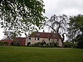 Manor House, Upper Farringdon.jpg 4 128 × 3 096 ; 11,93 Mio
-
 Meon Valley by Farringdon - geograph.org.uk - 2821310.jpg 4 288 × 3 216 ; 3,43 Mio
-
 Muddy Bridleway, Northfield Hill - geograph.org.uk - 2844966.jpg 4 288 × 3 216 ; 3,82 Mio
-
 Near Upper Farringdon - geograph.org.uk - 3611073.jpg 1 600 × 1 200 ; 675 kio
-
 Norton Farm - geograph.org.uk - 2845086.jpg 4 288 × 3 216 ; 3,59 Mio
-

-
 One for my grandmother - geograph.org.uk - 1100037.jpg 640 × 480 ; 113 kio
-
 Pasture, Chawton - geograph.org.uk - 2230044.jpg 640 × 480 ; 139 kio
-
 Pasture, Farringdon - geograph.org.uk - 2229061.jpg 640 × 427 ; 122 kio
-
 Pasture, Farringdon - geograph.org.uk - 2229973.jpg 640 × 480 ; 143 kio
-
 Pasture, Farringdon - geograph.org.uk - 2230086.jpg 640 × 480 ; 116 kio
-
 Path near Upper Woodside Farm - geograph.org.uk - 4905730.jpg 3 264 × 1 840 ; 3,55 Mio
-
 Path, Upper Farringdon - geograph.org.uk - 1343599.jpg 480 × 640 ; 188 kio
-
 Permissive Access, Chawton Estate - geograph.org.uk - 2820132.jpg 4 288 × 3 216 ; 3,88 Mio
-
 Plank Bridge, Caker Stream - geograph.org.uk - 2822567.jpg 4 288 × 3 216 ; 3,43 Mio
-
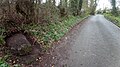 Pudding Stone on roadside in Farringdon, Hampshire.jpg 3 072 × 1 728 ; 2,75 Mio
-
 Pylon below Bush Down - geograph.org.uk - 4809808.jpg 640 × 480 ; 104 kio
-
 Ruddicks Copse from Upper Woodside - geograph.org.uk - 736690.jpg 640 × 480 ; 183 kio
-
 Saint Swithun's Way - Woodland near Four Marks - geograph.org.uk - 4905726.jpg 3 264 × 1 840 ; 3,16 Mio
-
 Saint Swithun's Way near Lower Farringdon - geograph.org.uk - 4905767.jpg 3 264 × 1 840 ; 2,5 Mio
-
 Saint Swithun's Way using old Railway Route - geograph.org.uk - 4905850.jpg 3 264 × 1 840 ; 3,34 Mio
-
 Scotts Pines in Woodland - geograph.org.uk - 4905721.jpg 1 840 × 3 264 ; 3 Mio
-
 Snowdrops - geograph.org.uk - 2821402.jpg 4 288 × 3 216 ; 2,78 Mio
-
 Stile by Gosport Road - geograph.org.uk - 2820057.jpg 4 288 × 3 216 ; 3,61 Mio
-
 Stile on footpath north of Upper Farringdon - geograph.org.uk - 4122889.jpg 800 × 600 ; 187 kio
-
 Stile on footpath with field ahead - geograph.org.uk - 4122891.jpg 800 × 600 ; 153 kio
-
 Thatched Cottage at Upper Farringdon (May 2021).JPG 3 600 × 2 600 ; 1,79 Mio
-

-

-
 The Inner Yew - geograph.org.uk - 2821800.jpg 4 288 × 3 216 ; 3,64 Mio
-
 The northern bend on Woodside Lane looking north - geograph.org.uk - 3902467.jpg 800 × 600 ; 136 kio
-
 The only bit of road in this grid square - geograph.org.uk - 2266858.jpg 800 × 600 ; 108 kio
-
 The southern bend on Woodside Lane looking south - geograph.org.uk - 3902463.jpg 800 × 600 ; 181 kio
-
 The southern bend on Woodside Lane looking west - geograph.org.uk - 3902454.jpg 800 × 600 ; 193 kio
-
 The turning from the A32 to Park Cottage - geograph.org.uk - 4123572.jpg 800 × 800 ; 260 kio
-
 This way to Alton - geograph.org.uk - 1416134.jpg 640 × 428 ; 132 kio
-
 To the Nearest Quarter - geograph.org.uk - 1416163.jpg 428 × 640 ; 115 kio
-
 Towards Farringdon - geograph.org.uk - 3931101.jpg 640 × 480 ; 65 kio
-

-
 Track East near Annetts Farm - geograph.org.uk - 5047867.jpg 1 600 × 1 200 ; 924 kio
-
 Trees in old pit - geograph.org.uk - 4809761.jpg 640 × 480 ; 142 kio
-
 Upper Farringdon House - geograph.org.uk - 2218141.jpg 800 × 600 ; 153 kio
-
 Upper Farringdon Ridgeway - geograph.org.uk - 2843660.jpg 4 288 × 3 216 ; 3,62 Mio
-
 Upper Woodside Farm Cottage, Farringdon.jpg 2 816 × 2 112 ; 1,47 Mio
-
 Weekend Leisure - geograph.org.uk - 2843715.jpg 4 288 × 3 216 ; 3,51 Mio
-

-
 Woodlands by Gosport Road, Lower Farringdon - geograph.org.uk - 5043901.jpg 2 304 × 1 728 ; 1,93 Mio
-
 Woodlands by Gosport Road, Lower Farringdon - geograph.org.uk - 5043904.jpg 1 728 × 2 304 ; 818 kio
-
 Woodside Lane - geograph.org.uk - 4905759.jpg 3 264 × 1 840 ; 2,36 Mio
-
 Hall Farm, Upper Farringdon, Hampshire - geograph.org.uk - 1416497.jpg 640 × 428 ; 90 kio
-
 Near Greenwood's Copse - geograph.org.uk - 283440.jpg 640 × 406 ; 49 kio


.JPG)


.JPG)


.JPG)


.JPG)


