Category:Lower Farringdon
Jump to navigation
Jump to search
English: Lower Farringdon is a hamlet in the civil parish of Farringdon, in the East Hampshire district, in the county of Hampshire, England.
village in Hampshire, United Kingdom | |||||
| Upload media | |||||
| Instance of | |||||
|---|---|---|---|---|---|
| Location | Farringdon, East Hampshire, Hampshire, South East England, England | ||||
 | |||||
Subcategories
This category has the following 2 subcategories, out of 2 total.
F
- The Forge, Lower Farringdon (2 F)
R
- Royal Oak, Lower Farringdon (4 F)
Media in category "Lower Farringdon"
The following 33 files are in this category, out of 33 total.
-
 A32 crossroads with Brightstone Lane - geograph.org.uk - 3248866.jpg 3,272 × 2,101; 1.05 MB
-
 Bench in Lower Farringdon - geograph.org.uk - 5020227.jpg 2,304 × 1,728; 786 KB
-
 Book exchange in Lower Farringdon - geograph.org.uk - 5020232.jpg 1,728 × 2,304; 851 KB
-
 Brightstone Lane, Lower Farringdon - geograph.org.uk - 5020241.jpg 2,304 × 1,728; 806 KB
-
 Car park on Upper Farringdon Road - geograph.org.uk - 5020238.jpg 2,304 × 1,728; 824 KB
-
 Cottage on Brightstone Lane, Farringdon - geograph.org.uk - 2229988.jpg 640 × 480; 122 KB
-

-

-
 Former shop, Farringdon - geograph.org.uk - 4842077.jpg 640 × 428; 78 KB
-
 Gosport Road - Lower Farringdon - geograph.org.uk - 1161734.jpg 640 × 427; 69 KB
-
 Gosport Road at the junction of Brightstone Lane - geograph.org.uk - 5020225.jpg 2,304 × 1,728; 831 KB
-
 Gosport Road, Lower Farringdon - geograph.org.uk - 5020226.jpg 2,304 × 1,728; 855 KB
-
 Gosport Road, Lower Farringdon - geograph.org.uk - 5020243.jpg 2,304 × 1,728; 830 KB
-
 House sign on the A32 - geograph.org.uk - 4123231.jpg 800 × 600; 159 KB
-
 Houses at Lower Farringdon - geograph.org.uk - 1416532.jpg 640 × 428; 66 KB
-
 I bet this was once a public house - geograph.org.uk - 4123135.jpg 800 × 600; 120 KB
-
 Inside the telephone box, Lower Farringdon - geograph.org.uk - 4610759.jpg 3,872 × 2,592; 4.63 MB
-

-

-
 Lower Farringdon - geograph.org.uk - 2821232.jpg 4,288 × 3,216; 3.51 MB
-
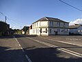
 Lower Farringdon, Hampshire - geograph.org.uk - 1416600.jpg 640 × 428; 57 KB
-
 Lower Farringdon, Hampshire - geograph.org.uk - 1416611.jpg 640 × 428; 69 KB
-
 Map of Farringdon - geograph.org.uk - 5020230.jpg 2,304 × 1,728; 845 KB
-

-
 Old Milestone by the A32, Lower Farringdon (geograph 6035640).jpg 1,021 × 1,496; 296 KB
-
 Path through Farringdon Business Park - geograph.org.uk - 5047878.jpg 1,600 × 1,200; 767 KB
-
 Playing field in Lower Farringdon - geograph.org.uk - 5020235.jpg 2,304 × 1,728; 814 KB
-
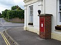 Postbox, Lower Farringdon - geograph.org.uk - 1343521.jpg 640 × 481; 108 KB
-
 Street House Farm, Lower Farringdon - geograph.org.uk - 5028728.jpg 2,304 × 1,728; 1.32 MB
-
 Telephone box and junction with the A32, Lower Farringdon - geograph.org.uk - 4610769.jpg 3,872 × 2,592; 4.16 MB
-
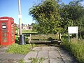
 Telephone box, Lower Farringdon - geograph.org.uk - 1343504.jpg 640 × 480; 132 KB
-

-


.jpg)


