Category:Fenton, Staffordshire
Vai alla navigazione
Vai alla ricerca
town in Staffordshire, UK  | |||||
| Carica un file multimediale | |||||
| Istanza di | |||||
|---|---|---|---|---|---|
| Luogo | City of Stoke-on-Trent, Staffordshire, Midlands Occidentali, Inghilterra | ||||
| Distinto da | |||||
 | |||||
English: Fenton is one of the six towns of the Stoke-on-Trent conurbation which were federated in 1910. It is situated in the south-east of the city. Arnold Bennett called his fictionalised version of Stoke on Trent the "Five Towns", and Fenton has been dubbed the town Arnold Bennett forgot.
Italiano: Fenton è una delle sei comunità che, aggregate, formano la città di Stoke-on-Trent, nella contea dello Staffordshire, in Inghilterra.
Svenska: Fenton är en av de sex städer som år 1925 förenades för att forma staden Stoke-on-Trent, Staffordshire, England. Den är belägen sydöst om staden. Arnold Bennett kallade sin fiktionaliserade version av Stoke-on-Trent för de "fem städerna" och Fenton har därför blivit kallad staden som Arnold Bennett glömde.
Sottocategorie
Questa categoria contiene le 6 sottocategorie indicate di seguito, su un totale di 6.
B
- Berryhill Fields (16 F)
F
- Fenton Park (14 F)
- Fenton railway station (3 F)
File nella categoria "Fenton, Staffordshire"
Questa categoria contiene 105 file, indicati di seguito, su un totale di 105.
-
 1st Contact Physiotherapy, Fenton.jpg 4 608 × 3 456; 3,59 MB
-
 Albert Square, Fenton - geograph.org.uk - 5704773.jpg 640 × 453; 77 KB
-
 Albert Square, Fenton - geograph.org.uk - 5704778.jpg 640 × 480; 70 KB
-
 Berry Hill Fields - geograph.org.uk - 5190823.jpg 4 896 × 3 672; 6,74 MB
-
 Berry Hill Fields - geograph.org.uk - 5190843.jpg 4 896 × 3 672; 6,93 MB
-
 Berry Hill Fields - geograph.org.uk - 5190849.jpg 4 896 × 3 672; 6,85 MB
-
 Berry Hill Fields and Fenton Industrial Estate - geograph.org.uk - 5193580.jpg 4 896 × 3 672; 4,5 MB
-
 Berry Hill Fields from Bassilow Road - geograph.org.uk - 5190798.jpg 4 896 × 3 672; 7,04 MB
-
 Berry Hill Fields, horse shelter - geograph.org.uk - 5192525.jpg 4 896 × 3 672; 4,9 MB
-
 Berry Hill Fields, puddle on path - geograph.org.uk - 5190865.jpg 4 896 × 3 672; 6,76 MB
-
 Berry Hill Fields, stile into paddock - geograph.org.uk - 5190860.jpg 4 896 × 3 672; 7,07 MB
-
 Bottle Oven - geograph.org.uk - 587177.jpg 355 × 640; 79 KB
-
 Carron Street, Fenton.jpg 4 608 × 3 456; 3,37 MB
-
 City Road in Fenton - geograph.org.uk - 3676222.jpg 1 500 × 999; 145 KB
-
 Colville Street, Fenton - geograph.org.uk - 3215821.jpg 640 × 480; 74 KB
-

-
 Erikssonmap.JPG 495 × 358; 38 KB
-
 Fenton - former Fire Station - geograph.org.uk - 3193860.jpg 1 600 × 1 230; 523 KB
-
 Fenton - former Lloyds Bank - geograph.org.uk - 3198424.jpg 1 170 × 1 600; 520 KB
-
 Fenton - houses on Hitchman Street - geograph.org.uk - 3193862.jpg 1 600 × 1 200; 650 KB
-
 Fenton - houses on Victoria Road - geograph.org.uk - 3193856.jpg 1 600 × 1 193; 602 KB
-
 Fenton - Keeling ^ Walker works - geograph.org.uk - 3172171.jpg 1 024 × 1 016; 304 KB
-
 Fenton - shops on Christchurch Street - geograph.org.uk - 3198415.jpg 1 600 × 1 218; 579 KB
-
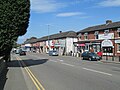
 Fenton - shops on City Road - geograph.org.uk - 3194052.jpg 1 600 × 883; 377 KB
-
 Fenton - The Limes Care Home - geograph.org.uk - 3194068.jpg 1 195 × 1 600; 579 KB
-
 Fenton Allotments - geograph.org.uk - 5195332.jpg 3 264 × 2 448; 2,4 MB
-
 Fenton Cemetery - geograph.org.uk - 5192570.jpg 4 721 × 3 540; 5,32 MB
-
 Fenton Cemetery - geograph.org.uk - 5192579.jpg 4 896 × 3 672; 7,28 MB
-
 Fenton Cemetery - geograph.org.uk - 5192593.jpg 4 896 × 3 672; 4,84 MB
-
 Fenton Cemetery - geograph.org.uk - 5192610.jpg 4 896 × 3 672; 5,22 MB
-
 Fenton Cemetery - geograph.org.uk - 5192612.jpg 4 896 × 3 672; 7,4 MB
-
 Fenton Cemetery - geograph.org.uk - 5193533.jpg 4 896 × 3 672; 5,12 MB
-
 Fenton Cemetery - geograph.org.uk - 5193673.jpg 4 896 × 3 672; 6,75 MB
-
 Fenton Cemetery, car park - geograph.org.uk - 5192623.jpg 4 896 × 3 672; 6,82 MB
-
 Fenton Cemetery, notices - geograph.org.uk - 5192553.jpg 4 896 × 3 672; 6,48 MB
-
 Fenton Cricket Club, Stoke-on-Trent.jpg 4 608 × 3 456; 3,39 MB
-

-
 Fenton Industrial Estate - geograph.org.uk - 5195337.jpg 3 264 × 2 448; 2,01 MB
-
 Fenton Industrial Estate - geograph.org.uk - 5195340.jpg 2 885 × 2 166; 1,58 MB
-
 Fenton Industrial Estate from Berry Hill Fields - geograph.org.uk - 5190878.jpg 4 896 × 3 672; 6,46 MB
-
 Fenton Industrial Estate from Berry Hill Fields - geograph.org.uk - 5190897.jpg 4 896 × 3 672; 5,2 MB
-
 Fenton Industrial Estate, Govan Road - geograph.org.uk - 5195343.jpg 3 264 × 2 448; 1,76 MB
-

-
 Fenton Industrial Estate, Premier House - geograph.org.uk - 5196129.jpg 3 264 × 2 448; 1,99 MB
-
 Fenton Industrial Estate, tenants and map - geograph.org.uk - 5196161.jpg 3 264 × 2 448; 2,36 MB
-
 Fenton Local Centre, Stoke-on-Trent.jpg 4 320 × 3 240; 3,62 MB
-
 Fenton Masts - geograph.org.uk - 5112867.jpg 1 500 × 1 000; 1,03 MB
-
 Fenton Muslim Cemetery - geograph.org.uk - 5193555.jpg 4 896 × 3 672; 3,65 MB
-
 Fenton Park, football pitch - geograph.org.uk - 5195305.jpg 4 896 × 3 672; 3,9 MB
-
 Fenton Park, Morville Close entrance - geograph.org.uk - 5195316.jpg 3 264 × 2 448; 4,58 MB
-
 Fenton Park, pavilions - geograph.org.uk - 5195311.jpg 4 896 × 3 672; 4,3 MB
-
 Fenton Park, sign inside Morville Close entrance - geograph.org.uk - 5195313.jpg 2 448 × 3 264; 3,37 MB
-
 Fenton Pet Shop.jpg 4 608 × 3 456; 3,49 MB
-
 Fenton, Alfred Street - geograph.org.uk - 5195322.jpg 3 264 × 2 448; 2,39 MB
-
 Fenton, car park for Topps Tiles and The Range - geograph.org.uk - 5149181.jpg 3 264 × 2 448; 2,5 MB
-
 Fenton, electricity substation off Victoria Road - geograph.org.uk - 5196174.jpg 3 264 × 2 448; 3,09 MB
-
 Fenton, Lloyd and Jones - geograph.org.uk - 5196199.jpg 3 264 × 2 448; 3,11 MB
-
 Fenton, Morville Close from Dewsbury Road - geograph.org.uk - 5195328.jpg 3 264 × 2 448; 2,34 MB
-
 Fenton, Ravenside Retail Park - geograph.org.uk - 5227198.jpg 3 258 × 2 027; 1,85 MB
-

-
 Fenton, Swinnerton Cycles - geograph.org.uk - 5196238.jpg 3 264 × 2 448; 2,14 MB
-
 Fenton, vandalised phone box on the corner of Alfred Street - geograph.org.uk - 5196210.jpg 3 264 × 2 448; 3,22 MB
-
 Fenton, Victoria Court - geograph.org.uk - 5196217.jpg 3 264 × 2 448; 1,98 MB
-
 Fenton, Victoria Road - geograph.org.uk - 5196185.jpg 3 264 × 2 448; 2,38 MB
-
 Fenton.JPG 2 530 × 1 518; 222 KB
-
 Foley Arms Hotel, Fenton.jpg 4 320 × 3 240; 2,75 MB
-
 Footbridge, Hawkins Street, Fenton - geograph.org.uk - 4447341.jpg 640 × 428; 121 KB
-
 Footpath between Fenton Park and Cemetery - geograph.org.uk - 5190755.jpg 4 896 × 3 672; 6,67 MB
-
 Footpath between Fenton Park and Cemetery - geograph.org.uk - 5190786.jpg 4 896 × 3 672; 7,13 MB
-
 Former Newtown pub, Fenton.jpg 4 608 × 3 456; 3,4 MB
-
 Former Salvation Army Citadel, Fenton.jpg 4 608 × 3 456; 3,67 MB
-
 Gates to Fenton Cemetery - geograph.org.uk - 5190747.jpg 3 264 × 2 448; 2,26 MB
-

-
 Inside Burslem Pottery - geograph.org.uk - 587181.jpg 640 × 507; 111 KB
-
 King Street in Fenton - geograph.org.uk - 5546594.jpg 1 500 × 1 125; 138 KB
-
 King Street in Longton - geograph.org.uk - 5546591.jpg 1 500 × 1 125; 137 KB
-
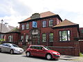 Magistrate's Clerk's Offices, Fenton.jpg 4 320 × 3 240; 2,86 MB
-
 Magistrates Clerks Offices, Fenton - geograph.org.uk - 344187.jpg 640 × 480; 79 KB
-
 Magistrates Court, Fenton - geograph.org.uk - 5704783.jpg 640 × 477; 86 KB
-
 Malt 'N' Hops, Fenton.jpg 4 320 × 3 240; 2,39 MB
-
 Mouse House estate agents sign, Carron Street, Fenton.jpg 4 608 × 3 456; 3,51 MB
-
 Oatcake shop menu.jpg 4 032 × 3 024; 2,92 MB
-
 Old Pottery - geograph.org.uk - 587174.jpg 640 × 428; 148 KB
-
 Plaza Snooker Club, Fenton.jpg 4 320 × 3 240; 2,43 MB
-
 Roundabout - Fenton - geograph.org.uk - 3990594.jpg 4 468 × 2 683; 5,23 MB
-
 Shops on City Road, Fenton - geograph.org.uk - 4520500.jpg 1 600 × 1 200; 558 KB
-
 Shops on City Road, Fenton.jpg 4 608 × 3 456; 3,33 MB
-
 Sign at Fenton Muslim Cemetery - geograph.org.uk - 5193596.jpg 2 330 × 3 107; 1,98 MB
-
 Stoke on Trent 2022 Montage.jpg 3 264 × 3 264; 9,13 MB
-

-
 The Allotments - geograph.org.uk - 587187.jpg 640 × 382; 140 KB
-
 The Allotments - geograph.org.uk - 587189.jpg 640 × 415; 137 KB
-
 The Fenton Monument.jpg 4 608 × 3 456; 3,56 MB
-
 The Old Fire Station - geograph.org.uk - 587183.jpg 624 × 640; 109 KB
-
 The Pit Stop (Car Wash) in Longton - geograph.org.uk - 4714462.jpg 640 × 428; 99 KB
-
 William Baker drinking fountain, Fenton.jpg 3 240 × 4 320; 4,22 MB
-
 Early 18th Century Cottages - geograph.org.uk - 330943.jpg 640 × 480; 58 KB
-

-

-
 Glebe Hill - geograph.org.uk - 155170.jpg 640 × 480; 210 KB
-
 Glebe Hill View - geograph.org.uk - 155168.jpg 640 × 480; 140 KB
-
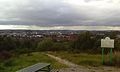
 Hanley City - geograph.org.uk - 155173.jpg 640 × 480; 156 KB
-
-
 Oldfield Business Park, Fenton - geograph.org.uk - 158522.jpg 640 × 480; 65 KB
-
 Shop gable end on City Road, Fenton - geograph.org.uk - 333085.jpg 552 × 414; 55 KB


_in_Longton_-_geograph.org.uk_-_4714462.jpg)


