Category:Stoke-on-Trent
Jump to navigation
Jump to search

city in Staffordshire, England   | |||||
| Upload media | |||||
| Instance of | |||||
|---|---|---|---|---|---|
| Location | City of Stoke-on-Trent, Staffordshire, West Midlands, England | ||||
| Official language | |||||
| Inception |
| ||||
| Population |
| ||||
| Area |
| ||||
| Elevation above sea level |
| ||||
| Different from | |||||
| official website | |||||
 | |||||
Subcategories
This category has the following 18 subcategories, out of 18 total.
- Maps of Stoke-on-Trent (9 F)
B
C
D
H
M
P
- Politics of Stoke-on-Trent (5 F)
S
T
W
- Westport Lake, Stoke-on-Trent (54 F)
Media in category "Stoke-on-Trent"
The following 200 files are in this category, out of 905 total.
(previous page) (next page)-
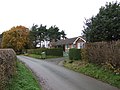
 "Fieldway" Care Home, Blythe Bridge - geograph.org.uk - 313492.jpg 640 × 480; 96 KB
-
 1 Bethesda Street (geograph 7429940).jpg 4,032 × 3,024; 3.01 MB
-
 2 - 4, Winton Square, Stoke on Trent. ST4 2AE.jpg 1,200 × 900; 216 KB
-
 2016, a year on Geograph (Day 122) - geograph.org.uk - 4932252.jpg 640 × 480; 70 KB
-
 A Ditch in a Field - geograph.org.uk - 291538.jpg 640 × 427; 78 KB
-
 A Stoke pottery - geograph.org.uk - 4836966.jpg 640 × 426; 50 KB
-
 A Stoke pottery - geograph.org.uk - 4836968.jpg 640 × 426; 48 KB
-

-
 A50 and footbridge, Heron Cross - geograph.org.uk - 3413486.jpg 640 × 447; 57 KB
-
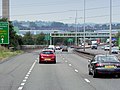
 A50 Approaching Stoke-on-Trent - geograph.org.uk - 4241597.jpg 640 × 427; 220 KB
-
 A50 at Heron Cross - geograph.org.uk - 3654737.jpg 1,936 × 2,592; 1.66 MB
-
 A50 bridge - geograph.org.uk - 4325133.jpg 640 × 430; 57 KB
-
 A50 eastbound approaching footbridge - geograph.org.uk - 3593027.jpg 640 × 480; 55 KB
-
 A50 eastbound near Heron Cross - geograph.org.uk - 3593031.jpg 640 × 481; 52 KB
-
 A50 Heron Cross - geograph.org.uk - 4242538.jpg 640 × 480; 262 KB
-

-
 A50 overbridge at junction with A500 - geograph.org.uk - 5571042.jpg 1,600 × 1,280; 759 KB
-
 A50, Sideway - geograph.org.uk - 4242571.jpg 640 × 480; 264 KB
-
 A50, Stoke, in traffic - geograph.org.uk - 3654755.jpg 1,936 × 2,592; 1.58 MB
-
 A500 and buildings adjacent - geograph.org.uk - 3654820.jpg 2,592 × 1,936; 1.59 MB
-
 A500 approaching City Road junction - geograph.org.uk - 2343621.jpg 640 × 480; 57 KB
-
 A500 at Boothen - geograph.org.uk - 2343597.jpg 640 × 480; 60 KB
-
 A500 in traffic - geograph.org.uk - 3654791.jpg 1,936 × 2,592; 1.75 MB
-

-
 A500 underpass beneath City Road - geograph.org.uk - 5571041.jpg 1,600 × 1,333; 805 KB
-
 A500, Hanford - geograph.org.uk - 4242596.jpg 640 × 480; 247 KB
-
 A5006 bridge over A500 - geograph.org.uk - 5571043.jpg 1,600 × 1,068; 672 KB
-
-
 A52 - geograph.org.uk - 4836971.jpg 640 × 391; 54 KB
-
 A52 heading north east - geograph.org.uk - 4068558.jpg 640 × 500; 74 KB
-
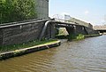
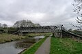 Abbey Farm First Pipe Bridge, Caldon Canal - geograph.org.uk - 5748270.jpg 3,776 × 2,520; 4.24 MB
-
 Aberdeen F.C. on Tour - geograph.org.uk - 1992010.jpg 2,560 × 1,920; 1.71 MB
-
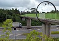
 Access bridge over A50 for Britannia Stadium - geograph.org.uk - 3593228.jpg 1,024 × 731; 94 KB
-
 Across the meadow - geograph.org.uk - 2295217.jpg 2,045 × 1,352; 632 KB
-
 Aerial photograph of Stoke on Trent.jpg 1,748 × 1,311; 661 KB
-
 Albion Street Graffiti, Stoke-on-Trent.jpg 2,048 × 1,152; 615 KB
-
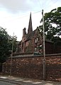
 All Saints Church - geograph.org.uk - 4068565.jpg 640 × 480; 52 KB
-
 Alleyway in Basford - geograph.org.uk - 5685025.jpg 2,896 × 3,594; 3.01 MB
-
 Alleyway in Basford - geograph.org.uk - 5685036.jpg 3,952 × 2,964; 3.77 MB
-
 Alleyway in Basford - geograph.org.uk - 5685037.jpg 4,032 × 3,024; 4.82 MB
-
 Alleyway in Basford - geograph.org.uk - 5685042.jpg 2,916 × 3,888; 4.49 MB
-
 An A500 Underpass - Stoke on Trent - geograph.org.uk - 3307844.jpg 4,278 × 2,399; 1.97 MB
-
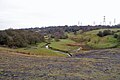
 An Off-Road Route to Bury Bank - geograph.org.uk - 291063.jpg 640 × 427; 85 KB
-
 Approaching Trentham Lock, Staffordshire - geograph.org.uk - 2470267.jpg 800 × 600; 342 KB
-
 Apsley House Branch Surgery, Norton - geograph.org.uk - 2462103.jpg 2,560 × 1,920; 1.73 MB
-
 Astbury Mere Country Park - geograph.org.uk - 158433.jpg 640 × 480; 49 KB
-
 At the entrance to the Britannia Stadium - geograph.org.uk - 4572971.jpg 1,024 × 771; 174 KB
-
 B5045 heading west - geograph.org.uk - 4991335.jpg 640 × 480; 58 KB
-
 Baines's Chimney - geograph.org.uk - 3319924.jpg 640 × 338; 46 KB
-
 Ball Hayes Road, Chell Heath - geograph.org.uk - 5076669.jpg 1,600 × 1,200; 469 KB
-
 Banksy-esque Graffiti - geograph.org.uk - 4447458.jpg 640 × 428; 94 KB
-
 Barge-Inn Booze narrowboats - geograph.org.uk - 6105673.jpg 640 × 480; 100 KB
-
 Barlaston Road - geograph.org.uk - 383250.jpg 572 × 640; 129 KB
-
 Barlaston Road - geograph.org.uk - 383255.jpg 640 × 427; 80 KB
-
 Barncroft Road, Chell Heath - geograph.org.uk - 5076685.jpg 1,600 × 1,200; 529 KB
-
 Basford Consulting Rooms - geograph.org.uk - 5685062.jpg 3,305 × 2,480; 4.11 MB
-
 Basford noticeboard - geograph.org.uk - 5685055.jpg 4,032 × 3,024; 2.47 MB
-
 Bathpool - panoramio.jpg 2,048 × 1,536; 1.09 MB
-
 Bend in the Canal - geograph.org.uk - 2593198.jpg 640 × 429; 69 KB
-
 Bentilee - geograph.org.uk - 342697.jpg 640 × 480; 68 KB
-
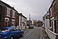
 Beresford Street, Stoke - geograph.org.uk - 6207561.jpg 1,024 × 768; 140 KB
-
 Bird watchers - geograph.org.uk - 2176316.jpg 2,592 × 1,944; 1.96 MB
-
 Blurton High School - geograph.org.uk - 383182.jpg 640 × 389; 53 KB
-
 Boat on the Trent ^ Mersey Canal - geograph.org.uk - 5695999.jpg 603 × 640; 76 KB
-
 Boathorse Road at Ravenscliffe - geograph.org.uk - 4578725.jpg 800 × 600; 133 KB
-
 Boatyard on the Trent ^ Mersey - geograph.org.uk - 2593164.jpg 640 × 429; 62 KB
-
 Booth Street Drill Hall - Entrance - geograph.org.uk - 3935116.jpg 1,064 × 1,600; 382 KB
-
 Booth Street Drill Hall - geograph.org.uk - 3935111.jpg 1,600 × 1,064; 394 KB
-
 Botteslow Street, Hanley - geograph.org.uk - 1092992.jpg 640 × 480; 76 KB
-
 Bottle Kiln - geograph.org.uk - 2396781.jpg 480 × 640; 109 KB
-
 Bottle kiln - panoramio.jpg 960 × 1,280; 937 KB
-
 Bottle Oven - panoramio.jpg 3,456 × 2,304; 1.34 MB
-
 BottleKilns.jpg 6,016 × 4,000; 12.39 MB
-
 Boughey Road - geograph.org.uk - 4068552.jpg 640 × 480; 63 KB
-
 Bridge 15, Caldon Canal - geograph.org.uk - 5564170.jpg 1,600 × 1,200; 755 KB
-
 Bridge 5B, Caldon Canal, Hanley Park - geograph.org.uk - 5588387.jpg 3,776 × 2,520; 3.66 MB
-
 Bridge near Abbey Hulton - geograph.org.uk - 3855954.jpg 1,600 × 1,200; 559 KB
-
-

-

-
 Brindley Ford Recreation Ground - geograph.org.uk - 4899575.jpg 1,280 × 857; 1 MB
-
 Britannia Stadium from the A50 - geograph.org.uk - 3413492.jpg 640 × 480; 36 KB
-
 Britannia Stadium, Stoke - geograph.org.uk - 2207429.jpg 640 × 370; 53 KB
-
 BritishCeramicsBiennial2021,SpodeRoseGarden-JennyHarper-14.jpg 6,000 × 4,000; 18.75 MB
-
 Brookside Business Park - geograph.org.uk - 267721.jpg 640 × 480; 75 KB
-
 Brown's Bridge - geograph.org.uk - 279078.jpg 640 × 480; 103 KB
-
 Bucknall Hospital - geograph.org.uk - 339394.jpg 640 × 421; 95 KB
-
 Bungalows and lane near Aspley - geograph.org.uk - 279082.jpg 640 × 480; 96 KB
-
 Burslem, Stoke-on-Trent.JPG 320 × 240; 12 KB
-
 Burslem.JPG 640 × 480; 64 KB
-
 Businesses on Etruria Road, Newcastle-under-Lyme - geograph.org.uk - 4907717.jpg 1,200 × 799; 322 KB
-
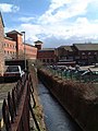
 By the Caldon Canal at Shelton, Stoke-on-Trent - geograph.org.uk - 2468052.jpg 1,024 × 635; 390 KB
-
-
 Canal at Planet Lock near Shelton, Stoke-on-Trent - geograph.org.uk - 6110626.jpg 1,440 × 960; 1.51 MB
-

-
 Canal tunnel and incinerator in Stoke-on-Trent - geograph.org.uk - 6112124.jpg 1,080 × 1,416; 1.66 MB
-
 Canal ^ Incinerator Chimney - geograph.org.uk - 2593189.jpg 429 × 640; 63 KB
-
 Canal, boat and incinerator near Stoke-on-Trent - geograph.org.uk - 4224941.jpg 888 × 1,024; 449 KB
-
 Canalside apartments south of Hanley, Stoke-on-Trent - geograph.org.uk - 5575091.jpg 960 × 1,280; 1.31 MB
-
-
 Carmountside Cemetery - geograph.org.uk - 6040357.jpg 2,000 × 1,333; 2.93 MB
-
 Carmountside Crematorium - geograph.org.uk - 6040360.jpg 2,000 × 1,333; 2.71 MB
-
 Cauldon Park and College - geograph.org.uk - 5183236.jpg 4,530 × 3,208; 3.88 MB
-
 Cauldon Road, Stoke - geograph.org.uk - 6207558.jpg 1,024 × 768; 244 KB
-
 Caverswall Signal Box - geograph.org.uk - 2618280.jpg 3,809 × 2,843; 2.2 MB
-
 Chatterley Whitfield Colliery - geograph.org.uk - 3329868.jpg 640 × 417; 72 KB
-
 Chatterley Whitfield Colliery - geograph.org.uk - 3350593.jpg 640 × 427; 53 KB
-
 Chatterley Whitfield colliery - geograph.org.uk - 3351572.jpg 640 × 421; 73 KB
-
 Chatterley Whitfield Colliery - geograph.org.uk - 5273559.jpg 640 × 427; 50 KB
-
 Chatterley Whitfield Colliery - geograph.org.uk - 5278522.jpg 427 × 640; 46 KB
-
 Chatterley Whitfield Colliery - geograph.org.uk - 5446173.jpg 640 × 427; 71 KB
-
 Chatterley Whitfield Colliery - geograph.org.uk - 5446288.jpg 640 × 427; 40 KB
-
 Chatterley Whitfield Colliery 2017 - geograph.org.uk - 5278527.jpg 640 × 427; 77 KB
-
-
 Chatterley Whitfield Heritage Country Park - geograph.org.uk - 4899635.jpg 1,024 × 686; 198 KB
-
 Chatterly Whitfield Colliery - geograph.org.uk - 4900395.jpg 1,280 × 857; 1.01 MB
-
 Christmas at The Range - geograph.org.uk - 5155458.jpg 3,264 × 2,448; 2.81 MB
-
 Church Tower - geograph.org.uk - 4836736.jpg 640 × 426; 35 KB
-
 Church Tower, Stoke On Trent - geograph.org.uk - 1218186.jpg 640 × 430; 40 KB
-
 City Rd - geograph.org.uk - 4378044.jpg 640 × 430; 50 KB
-
 Clare Street and Victoria Street, Basford - geograph.org.uk - 4566241.jpg 1,600 × 1,200; 558 KB
-
 Clarice Cliff Court connecting Bridge - panoramio.jpg 3,072 × 2,304; 1.99 MB
-
 Coat of arms of Stoke-on-Trent.svg 512 × 713; 216 KB
-
 Colin Minton Statue, Stoke - geograph.org.uk - 5635820.jpg 1,000 × 1,500; 1.1 MB
-
 Coltsfoot - geograph.org.uk - 2295229.jpg 961 × 751; 295 KB
-
 Commercial units in Basford - geograph.org.uk - 5685073.jpg 3,990 × 2,989; 2.71 MB
-
 Common Alder on Brindley Meadow - geograph.org.uk - 2295282.jpg 1,343 × 1,872; 684 KB
-
 Cones and catkins - geograph.org.uk - 2295293.jpg 1,341 × 1,783; 849 KB
-
 Cottages, Brindley Ford - geograph.org.uk - 4900438.jpg 1,280 × 857; 1.06 MB
-
 Dalby Pottery Bottle Kiln, Trent Mersey Canal - geograph.org.uk - 5473655.jpg 4,032 × 3,024; 3.9 MB
-

-

-
-

-
 Demolition of housing at Trubshaw Cross.JPG 2,345 × 1,942; 789 KB
-

-

-
 Derelict land at Shelton, Stoke-on-Trent - geograph.org.uk - 2467830.jpg 800 × 481; 234 KB
-
 Derelict land at Shelton, Stoke-on-Trent - geograph.org.uk - 2467883.jpg 800 × 515; 240 KB
-
 Detached semi-detached, Hartshill - geograph.org.uk - 940909.jpg 640 × 457; 159 KB
-
 Disused railway bridge - geograph.org.uk - 1501953.jpg 640 × 480; 353 KB
-
 Disused railway Bridge crossing the Canal - geograph.org.uk - 6080362.jpg 2,000 × 1,500; 3.42 MB
-
-
 Disused Railway Crossing - geograph.org.uk - 6080367.jpg 2,000 × 1,500; 4.14 MB
-

-

-

-

-

-

-
-
 Dome on Liverpool Road, Stoke - geograph.org.uk - 391979.jpg 492 × 640; 134 KB
-
 Doulton fountain in Cauldon Park - geograph.org.uk - 5183244.jpg 4,896 × 3,672; 4.76 MB
-
 Downspout (43647598595).jpg 4,032 × 3,024; 3.06 MB
-
 Dudson Ware.jpg 1,792 × 1,147; 341 KB
-
 E Engineering - geograph.org.uk - 4836975.jpg 640 × 426; 57 KB
-
 Eastern part of Ashford Street, Stoke - geograph.org.uk - 6207550.jpg 1,024 × 768; 148 KB
-
 Eastwood football ground - geograph.org.uk - 3236172.jpg 960 × 540; 60 KB
-
 Eastwood Hanley vs Accrington Stanley - geograph.org.uk - 2305472.jpg 1,000 × 628; 192 KB
-
 Eaves Lane, Abbey Hulton - geograph.org.uk - 3568354.jpg 1,600 × 1,200; 1,012 KB
-
 Electricity Substation - geograph.org.uk - 250893.jpg 640 × 480; 71 KB
-

-
 Entrance to Boothen Garden.JPG 3,456 × 4,608; 3.39 MB
-
 Entrance to the Screwfix Warehouse - geograph.org.uk - 3307808.jpg 4,196 × 2,187; 1.91 MB
-
 Esperanto Way, Stoke-on-Trent.jpg 4,608 × 3,456; 3.46 MB
-
 Festival Way - geograph.org.uk - 1548762.jpg 640 × 480; 56 KB
-
 Film Photo Whitfield Colliery.jpg 6,738 × 4,332; 12.5 MB
-
 Fisher Street, Brindley Ford - geograph.org.uk - 4900426.jpg 1,280 × 857; 997 KB
-
 Flag of Stoke-on-Trent.png 4,131 × 2,476; 2.92 MB
-
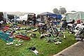 Flickr - ronsaunders47 - STOKE CLASSIC BIKE SHOW. OCT 2010. AUTOJUMBLE..jpg 2,545 × 1,702; 1.18 MB
-
 Flickr - ronsaunders47 - STOKE CLASSIC BIKE SHOW. OCT 2010. UK..jpg 3,008 × 2,000; 1.9 MB
-
 Focalradio.jpg 159 × 133; 13 KB
-
 Footbridge across the A50 - geograph.org.uk - 4572922.jpg 1,024 × 717; 191 KB
-
 Footbridge at Heron Cross - geograph.org.uk - 2920620.jpg 2,922 × 2,525; 2.75 MB
-
 Footbridge at Heron Cross - geograph.org.uk - 4242540.jpg 640 × 480; 264 KB
-
 Footbridge over A50 west of Heron Cross - geograph.org.uk - 3593224.jpg 1,024 × 585; 68 KB
-
 Footbridge over the A50 - geograph.org.uk - 3413470.jpg 800 × 509; 71 KB
-
 Footpath Across Fields - geograph.org.uk - 291065.jpg 640 × 427; 58 KB
-
 Ford Green Hall near Hanley - geograph.org.uk - 6005146.jpg 5,184 × 2,920; 5.81 MB
-
 Former Access Bridge - geograph.org.uk - 2396465.jpg 640 × 431; 77 KB
-
 Former Boundary Works (geograph 5932670).jpg 1,024 × 768; 178 KB
-
 Former canal side works - geograph.org.uk - 2396469.jpg 640 × 431; 124 KB
-
 Former colliery parkland - geograph.org.uk - 4899627.jpg 1,280 × 857; 1,004 KB
-
-
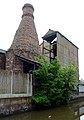
 Former Smithfield Pottery And Bottle Oven.jpg 2,048 × 1,152; 268 KB
-
 Fowlea Brook - geograph.org.uk - 393245.jpg 427 × 640; 139 KB
-
 Fowlea Brook, Stoke - geograph.org.uk - 344910.jpg 480 × 640; 74 KB
-
 Goldendale Stoke on Trent.jpg 720 × 405; 87 KB
-
 Goods Yard at DHL Stoke - geograph.org.uk - 1471276.jpg 640 × 480; 50 KB
-
 Gordon Banks Drive near the Britannia Stadium - geograph.org.uk - 4572947.jpg 1,024 × 733; 145 KB
-
-
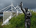
 Gordon Banks Statue, Bet 365 Stadium, Stoke on Trent - geograph.org.uk - 5770044.jpg 1,500 × 1,000; 1.58 MB
-
 Gordon Banks, Britannia Stadium - geograph.org.uk - 4935231.jpg 640 × 480; 78 KB
-
 Gordon Street, Burslem - geograph.org.uk - 4049468.jpg 1,600 × 1,200; 482 KB
-
 Graffiti Owl Stoke-on-Trent.jpg 1,152 × 2,048; 507 KB
-
 Grass tussock - geograph.org.uk - 2296861.jpg 1,842 × 1,389; 852 KB
-
 Great Crested Grebe (31467928694).jpg 1,600 × 1,200; 587 KB
-
 Greenway Hall Road.JPG 2,048 × 1,536; 2.01 MB
-
 Grove Road in Heron Cross - geograph.org.uk - 4571161.jpg 1,024 × 722; 251 KB
-
 Hamil Road Clowes Methodist Church, Burslem - geograph.org.uk - 4049341.jpg 1,600 × 1,200; 465 KB

.jpg)

_-_geograph.org.uk_-_4932252.jpg)


.jpg)


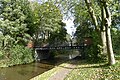
,_Caldon_Canal,_Staffordshire_-_geograph.org.uk_-_591169.jpg)


.jpg)


.jpg)


