Category:Ficksches Schloss
Jump to navigation
Jump to search
| Object location | | View all coordinates using: OpenStreetMap |
|---|
church building in Boxberg, Stuttgart Government Region, Bade-Württemberg, Germany  | |||||
| Upload media | |||||
| Instance of | |||||
|---|---|---|---|---|---|
| Location | Angeltürn, Boxberg, Main-Tauber-Kreis, Heilbronn-Franken, Stuttgart Government Region, Baden-Württemberg, Germany | ||||
| Heritage designation | |||||
 | |||||
Media in category "Ficksches Schloss"
The following 6 files are in this category, out of 6 total.
-
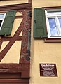 Angeltürn Ficksches Schloss Schnitzereien.jpg 1,272 × 1,756; 476 KB
-
 Angeltürn Ficksches Schloss und Wehrkirche.jpg 1,280 × 720; 184 KB
-
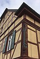 Angeltürn Ficksches Schloss.jpg 1,158 × 1,686; 468 KB
-
 Ficksches Schloss Angeltürn.jpg 2,016 × 1,512; 886 KB
-
 Wappen der Freiherren von Fick.jpg 1,002 × 1,240; 202 KB
-
 Wappen der Freiherren von Fick.png 575 × 753; 1.04 MB


