Category:Flugplatz Straubing
Jump to navigation
Jump to search
- IATA: RBM
- ICAO: EDMS
| Object location | | View all coordinates using: OpenStreetMap |
|---|
aerodrome in Germany  | |||||
| Upload media | |||||
| Instance of |
| ||||
|---|---|---|---|---|---|
| Named after | |||||
| Location | Atting, Straubing-Bogen, Lower Bavaria, Bavaria, Germany | ||||
| Date of official opening |
| ||||
| Elevation above sea level |
| ||||
| IATA airport code |
| ||||
| ICAO airport code |
| ||||
| official website | |||||
 | |||||
Subcategories
This category has the following 2 subcategories, out of 2 total.
Media in category "Flugplatz Straubing"
The following 12 files are in this category, out of 12 total.
-
 Aerial image of the Straubing airfield.jpg 5,200 × 3,300; 6.04 MB
-
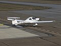
 D-MSHP 2.jpg 2,560 × 1,920; 3.65 MB
-
 D-MSHP 3.jpg 2,560 × 1,920; 3.7 MB
-
 Diamond DA20-C1-D-EKLI 2.jpg 2,560 × 1,920; 3.7 MB
-
 Diamond DA20-D-ETWR 1.jpg 2,560 × 1,920; 3.42 MB
-
 Diamond DA20-D-ETWR 2.jpg 2,560 × 1,344; 2.67 MB
-
 F-GUAB D-IAAM.JPG 2,560 × 1,920; 3.52 MB
-
 Flugplatz Straubing EDMS.JPG 2,560 × 1,920; 3.22 MB
-
 Fw 44 Stieglitz, Oberschleissheim, Flugtag So. 1987 (1).jpg 1,181 × 768; 144 KB
-
 Fw 44 Stieglitz, Oberschleissheim, Flugtag So. 1987 (2).jpg 1,181 × 768; 125 KB
-
 OE-FMW am Flughafen Straubing 09-2013.jpg 3,872 × 2,592; 5.61 MB
-
 Scheibe D-KEFC 1.JPG 2,560 × 1,920; 3.44 MB


.jpg)
.jpg)

