Category:Ford, Northumberland
Aller à la navigation
Aller à la recherche
English: Ford is a small village in Northumberland, England, about from Berwick-upon-Tweed. Ford shares a parish with Etal.
Article Wikipédia principal : Ford, Northumberland.

village britannique  | |||||
| Téléverser des médias | |||||
| Nature de l’élément | |||||
|---|---|---|---|---|---|
| Lieu | Northumberland, Angleterre du Nord-Est, Angleterre | ||||
| Population |
| ||||
 | |||||
Sous-catégories
Cette catégorie comprend 12 sous-catégories, dont les 12 ci-dessous.
B
- Bareless (5 F)
C
E
F
- Ford Castle (23 F)
H
- Heatherslaw Mill (14 F)
- Housedon Hill (9 F)
K
- Kypie Hill (1 F)
L
- Lady Waterford Hall (13 F)
P
- Pallinsburn House (1 F)
Média dans la catégorie « Ford, Northumberland »
Cette catégorie comprend 776 fichiers, dont les 200 ci-dessous.
(page précédente) (page suivante)-
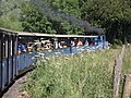
 'Bunty' arriving at Heatherslaw station - geograph.org.uk - 5554636.jpg 1 600 × 1 060 ; 631 kio
-
 'Bunty' goes round the bend - geograph.org.uk - 5825697.jpg 4 000 × 3 000 ; 3,41 Mio
-
 'Bunty' on the turntable, Etal station - geograph.org.uk - 5554664.jpg 1 600 × 1 060 ; 520 kio
-
 A Chill Beside The Till - geograph.org.uk - 5264520.jpg 1 003 × 1 600 ; 385 kio
-
 A dead tree - geograph.org.uk - 2059389.jpg 2 873 × 3 984 ; 2,66 Mio
-
 A polite notice - geograph.org.uk - 3640457.jpg 1 024 × 768 ; 161 kio
-
 A quiet time for Ford and Etal - geograph.org.uk - 3398978.jpg 2 139 × 1 510 ; 1,61 Mio
-
 A row of white houses - geograph.org.uk - 1195309.jpg 640 × 480 ; 63 kio
-
 A truck heads for Callerburn Farm - geograph.org.uk - 5049446.jpg 1 600 × 1 164 ; 264 kio
-
 A twisty road - geograph.org.uk - 4857206.jpg 1 600 × 1 181 ; 260 kio
-
 A view towards Blinkbonny farm - geograph.org.uk - 2059374.jpg 4 000 × 3 000 ; 4,19 Mio
-
 A697 east of Pallinsburn - geograph.org.uk - 1939155.jpg 1 024 × 768 ; 239 kio
-
 A697 northbound - geograph.org.uk - 3188037.jpg 640 × 480 ; 80 kio
-
 A697 northbound - geograph.org.uk - 3188043.jpg 640 × 480 ; 65 kio
-
 A697 northbound - geograph.org.uk - 3188047.jpg 640 × 480 ; 99 kio
-
 A697 northbound - geograph.org.uk - 3188050.jpg 640 × 480 ; 81 kio
-
 A697 northbound - geograph.org.uk - 3188192.jpg 640 × 480 ; 87 kio
-
 A697 northbound - geograph.org.uk - 3188237.jpg 640 × 480 ; 49 kio
-
 A697 northbound - geograph.org.uk - 3394775.jpg 640 × 480 ; 52 kio
-
 A697 northbound - geograph.org.uk - 3394778.jpg 640 × 480 ; 59 kio
-
 A697 northbound - geograph.org.uk - 3394782.jpg 640 × 507 ; 56 kio
-
 A697 northbound - geograph.org.uk - 3394785.jpg 640 × 495 ; 54 kio
-
 A697 northbound - geograph.org.uk - 3394787.jpg 640 × 468 ; 42 kio
-
 A697 northbound - geograph.org.uk - 3394792.jpg 640 × 462 ; 61 kio
-
 A697 northbound - geograph.org.uk - 3394804.jpg 640 × 399 ; 34 kio
-
 A697 northbound - geograph.org.uk - 3394811.jpg 640 × 493 ; 77 kio
-
 A697 northbound - geograph.org.uk - 3394827.jpg 640 × 440 ; 46 kio
-
 A697 westbound - geograph.org.uk - 3188206.jpg 640 × 480 ; 47 kio
-
 A697 westbound - geograph.org.uk - 3188228.jpg 640 × 480 ; 56 kio
-
 A697 westbound - geograph.org.uk - 3394820.jpg 640 × 480 ; 39 kio
-
 A697 westbound - geograph.org.uk - 3394823.jpg 640 × 480 ; 39 kio
-
 Abandoned Grazing - geograph.org.uk - 4774949.jpg 1 142 × 1 600 ; 442 kio
-
 Above The Floods - geograph.org.uk - 4774914.jpg 1 600 × 1 201 ; 376 kio
-
 Across the Till - geograph.org.uk - 4155620.jpg 640 × 428 ; 121 kio
-
 All quiet at Branxton and Flodden Field - geograph.org.uk - 3655399.jpg 3 264 × 2 448 ; 3,63 Mio
-
 Along the River Till - geograph.org.uk - 4155618.jpg 640 × 428 ; 145 kio
-
 Animal carvings, Goats Crag rock shelter - geograph.org.uk - 1898500.jpg 767 × 1 024 ; 366 kio
-
 Another Collapsed OB - geograph.org.uk - 4751379.jpg 1 600 × 1 201 ; 872 kio
-
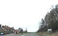
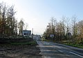
 Approach to Ford Village - geograph.org.uk - 1237498.jpg 640 × 430 ; 65 kio
-
 Approaching Blinkbonny - geograph.org.uk - 3647194.jpg 3 024 × 2 240 ; 1,05 Mio
-
 Approaching Hay Farm - geograph.org.uk - 5017042.jpg 640 × 480 ; 65 kio
-
 Approaching the A697 - geograph.org.uk - 5110733.jpg 640 × 480 ; 51 kio
-
 Approaching the B6354 - geograph.org.uk - 5017047.jpg 640 × 480 ; 68 kio
-
 Arable field beside Redscar Wood - geograph.org.uk - 3931306.jpg 1 024 × 768 ; 180 kio
-
 Arable field south of Ford - geograph.org.uk - 4260448.jpg 2 048 × 1 152 ; 980 kio
-
 Arable field south of Ford - geograph.org.uk - 4260451.jpg 2 048 × 1 536 ; 1,13 Mio
-
 Arable land by Crookham Westfield - geograph.org.uk - 3655381.jpg 3 264 × 2 448 ; 3,7 Mio
-
 Arable land east of Ford Hill - geograph.org.uk - 4215847.jpg 2 048 × 1 536 ; 731 kio
-
 Arable land east of Kimmerston - geograph.org.uk - 4215111.jpg 2 048 × 1 536 ; 844 kio
-
 Arable land east of Kimmerston - geograph.org.uk - 4215112.jpg 2 048 × 1 536 ; 821 kio
-
 Arable land, Barelees - geograph.org.uk - 2346290.jpg 640 × 359 ; 192 kio
-
 At Heatherslaw station - geograph.org.uk - 5554614.jpg 1 600 × 1 060 ; 586 kio
-
 Autumn colours at Etal - geograph.org.uk - 5583704.jpg 640 × 480 ; 376 kio
-
 Awaiting departure, Etal station - geograph.org.uk - 5553657.jpg 1 600 × 1 060 ; 442 kio
-
 B6353 beside Fullerton's Whin - geograph.org.uk - 5017058.jpg 640 × 480 ; 56 kio
-
 B6353 near Ford Moss Nature Reserve - geograph.org.uk - 5430748.jpg 4 896 × 3 672 ; 6,13 Mio
-
 B6353 northeast of Ford - geograph.org.uk - 3200743.jpg 640 × 480 ; 52 kio
-
 B6353 towards Lowick - geograph.org.uk - 5017064.jpg 640 × 480 ; 64 kio
-
 B6353 towards Lowick - geograph.org.uk - 5017069.jpg 640 × 480 ; 52 kio
-
 B6353, Ford - geograph.org.uk - 3843463.jpg 640 × 480 ; 292 kio
-
 B6354 - geograph.org.uk - 4158442.jpg 640 × 428 ; 71 kio
-
 B6354 - geograph.org.uk - 5765921.jpg 1 000 × 662 ; 789 kio
-
 B6354 at Ford - geograph.org.uk - 3640356.jpg 1 024 × 768 ; 209 kio
-
 B6354 near Ford - geograph.org.uk - 3844601.jpg 640 × 480 ; 323 kio
-
 B6354 near Ford - geograph.org.uk - 6373874.jpg 1 024 × 576 ; 308 kio
-
 B6354 towards Ford - geograph.org.uk - 5017011.jpg 640 × 480 ; 60 kio
-
 B6354 towards Ford - geograph.org.uk - 5017024.jpg 640 × 480 ; 58 kio
-
 Bales, Cookstead - geograph.org.uk - 4778237.jpg 1 024 × 683 ; 271 kio
-
 Barley field, Watchlaw - geograph.org.uk - 863545.jpg 640 × 480 ; 106 kio
-
 Barmoor Windfarm - geograph.org.uk - 5584208.jpg 640 × 480 ; 216 kio
-
 Beacon burning bright - geograph.org.uk - 5973107.jpg 1 600 × 1 200 ; 237 kio
-
 Beam pump engine house, Ford Moss Colliery - geograph.org.uk - 1899095.jpg 1 024 × 768 ; 209 kio
-
 Beautifully-tilled field between Crookham Westfield and Cookstead - geograph.org.uk - 3655284.jpg 3 176 × 2 326 ; 1,61 Mio
-
 Beech Hedge - geograph.org.uk - 3870019.jpg 2 560 × 1 920 ; 1,21 Mio
-
 Beech hedge with a quiff at Crookham Eastfield, Northumberland - geograph.org.uk - 3999451.jpg 3 648 × 2 736 ; 4,63 Mio
-
 Belted Galloway cattle at Ford (1) - geograph.org.uk - 3640344.jpg 1 024 × 768 ; 392 kio
-
 Belted Galloway cattle at Ford (2) - geograph.org.uk - 3640350.jpg 1 024 × 768 ; 259 kio
-
 Bench and path beside the Till - geograph.org.uk - 4155622.jpg 640 × 428 ; 118 kio
-
 Bend on A697 south of Crookham - geograph.org.uk - 1933343.jpg 1 024 × 768 ; 260 kio
-
 Berryhill beyond the cereals - geograph.org.uk - 5395270.jpg 1 600 × 1 067 ; 226 kio
-
 Bird Scarer near Fordwood House - geograph.org.uk - 4215118.jpg 2 048 × 1 536 ; 1,24 Mio
-
 Blinkbonny - geograph.org.uk - 1933734.jpg 1 024 × 769 ; 274 kio
-
 Blinkbonny - geograph.org.uk - 4778327.jpg 1 024 × 683 ; 313 kio
-
 Blinkbonny Farm cottages - geograph.org.uk - 1933674.jpg 1 024 × 769 ; 208 kio
-
 Bluebells in the churchyard - geograph.org.uk - 1324347.jpg 640 × 480 ; 179 kio
-
 Boiler House Chimney - geograph.org.uk - 3880333.jpg 2 504 × 1 844 ; 2,9 Mio
-
 Boulder south of Goatscrag Hill - geograph.org.uk - 1895214.jpg 1 024 × 768 ; 289 kio
-
 Bradford Burn - geograph.org.uk - 3842296.jpg 640 × 480 ; 351 kio
-
 Bradford Burn - geograph.org.uk - 5058453.jpg 1 600 × 1 343 ; 569 kio
-
 Bradford Burn north of Kimmerston - geograph.org.uk - 4260433.jpg 1 536 × 2 048 ; 1,81 Mio
-
 Brassica crop, Flodden Edge - geograph.org.uk - 2612931.jpg 640 × 480 ; 270 kio
-
 Bridge across Cannon Burn - geograph.org.uk - 4260443.jpg 2 048 × 1 536 ; 1,31 Mio
-
 Bridge at Heatherslaw - geograph.org.uk - 5554629.jpg 1 600 × 1 060 ; 461 kio
-
 Bridge by Heatherslaw Mill - geograph.org.uk - 3648219.jpg 4 356 × 3 090 ; 1,98 Mio
-
 Bridge over the Cannon Burn - geograph.org.uk - 3640392.jpg 1 024 × 768 ; 405 kio
-
 Bridge over the Duddonmill Burn - geograph.org.uk - 5583631.jpg 640 × 480 ; 431 kio
-
 Bridge over the River Till - geograph.org.uk - 3477971.jpg 1 920 × 1 280 ; 1,56 Mio
-
 Bridge, Black Burn - geograph.org.uk - 3843801.jpg 640 × 480 ; 298 kio
-
 Bridge, Ford Moss - geograph.org.uk - 3845754.jpg 640 × 480 ; 274 kio
-
 Bridleway along the river - geograph.org.uk - 4155606.jpg 428 × 640 ; 155 kio
-
 Bridleway along the Till - geograph.org.uk - 4155609.jpg 428 × 640 ; 149 kio
-
 Bridleway ford over the River Till at Etal - geograph.org.uk - 5583608.jpg 640 × 480 ; 393 kio
-
 Broom Ridge from Goats Crag Hill - geograph.org.uk - 1898576.jpg 1 024 × 768 ; 251 kio
-
 Broomie Knowe - geograph.org.uk - 863555.jpg 640 × 480 ; 72 kio
-
 Broomridgedean Burn - geograph.org.uk - 2609671.jpg 480 × 640 ; 381 kio
-
 Brownridge Moor - geograph.org.uk - 3845734.jpg 640 × 480 ; 265 kio
-
 Burn to the west of West Kimmerston bridge - geograph.org.uk - 3640427.jpg 1 024 × 768 ; 357 kio
-
 Bus shelter, Crookham - geograph.org.uk - 4778334.jpg 1 024 × 683 ; 346 kio
-
 By a Till oxbow - geograph.org.uk - 6393988.jpg 1 600 × 1 200 ; 1,04 Mio
-
 Byway for 260 yds only - geograph.org.uk - 5058506.jpg 1 600 × 1 200 ; 495 kio
-
 Cannon Burn - geograph.org.uk - 4260447.jpg 1 536 × 2 048 ; 1,61 Mio
-
 Cannons at Etal Castle - geograph.org.uk - 5553554.jpg 1 600 × 1 060 ; 510 kio
-
 Cannot fault the Post Office for service at Crookham Eastfield - geograph.org.uk - 3999413.jpg 3 648 × 2 736 ; 4,67 Mio
-
 Carved bench beside the River Till - geograph.org.uk - 5583626.jpg 640 × 480 ; 347 kio
-
 Cattle grazing in front of Coronation Wood - geograph.org.uk - 4215865.jpg 2 048 × 1 536 ; 1,14 Mio
-
 Cattle in pasture by farm - geograph.org.uk - 4614631.jpg 1 600 × 1 073 ; 311 kio
-
 Cereal ready to harvest - geograph.org.uk - 5058483.jpg 1 600 × 1 310 ; 390 kio
-
 Cereals and sheep in pasture - geograph.org.uk - 5058514.jpg 1 600 × 1 170 ; 313 kio
-
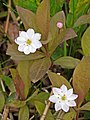 Chickweed wintergreen (Trientalis europaea) - geograph.org.uk - 1898902.jpg 769 × 1 024 ; 170 kio
-
 Clearance cairn north of Goatscrag Hill - geograph.org.uk - 1895229.jpg 1 024 × 768 ; 285 kio
-
 Clump of Scots Pines at Ford Common Farm - geograph.org.uk - 5583771.jpg 640 × 480 ; 339 kio
-
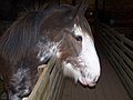 Clydesdale mare - geograph.org.uk - 4240036.jpg 2 304 × 1 728 ; 417 kio
-
 Collapsed Bolt Hole, Duddo Auxiliary Unit Operational Base - geograph.org.uk - 4751384.jpg 1 185 × 1 600 ; 722 kio
-
 Colliery chimney, Ford Moss - geograph.org.uk - 1899351.jpg 767 × 1 024 ; 214 kio
-
 Cottages on B6352 - geograph.org.uk - 6353330.jpg 1 024 × 768 ; 299 kio
-
 Cottages on the Berryhill Road - geograph.org.uk - 3653066.jpg 3 005 × 2 210 ; 863 kio
-
 Country road at White Hill - geograph.org.uk - 4215097.jpg 2 048 × 1 536 ; 960 kio
-
 Country road in Northumberland - geograph.org.uk - 2374488.jpg 640 × 480 ; 48 kio
-
 Country road junction east of Kimmerston - geograph.org.uk - 4215108.jpg 2 048 × 1 536 ; 718 kio
-
 Country road near Fenton (1) - geograph.org.uk - 2171090.jpg 640 × 428 ; 138 kio
-
 Country road to Fenton - geograph.org.uk - 3931311.jpg 1 024 × 768 ; 160 kio
-
 Country road towards Kimmerston - geograph.org.uk - 4215102.jpg 2 048 × 1 536 ; 674 kio
-
 Cows by the railway near Etal - geograph.org.uk - 5554647.jpg 1 600 × 1 060 ; 243 kio
-
 Cows ^ calves near Inch Plantation - geograph.org.uk - 1939064.jpg 1 024 × 768 ; 278 kio
-
 Crag, Flodden Edge - geograph.org.uk - 2612939.jpg 640 × 480 ; 272 kio
-
 Cricket Ground - geograph.org.uk - 3479082.jpg 1 920 × 1 280 ; 1,27 Mio
-
 Crookham Westfield - geograph.org.uk - 5283613.jpg 1 600 × 1 024 ; 245 kio
-
 Crookham Westfield Farm - geograph.org.uk - 3655349.jpg 3 228 × 2 398 ; 1,33 Mio
-
 Crop field and hedgerow near Etal Rhodes - geograph.org.uk - 5017031.jpg 640 × 480 ; 56 kio
-
 Crop field and hedgerow, Barleymill Bank - geograph.org.uk - 5017014.jpg 640 × 480 ; 71 kio
-
 Crop field east of Kimmerston - geograph.org.uk - 5017108.jpg 640 × 480 ; 57 kio
-
 Crop field near Kimmerston - geograph.org.uk - 5017096.jpg 640 × 480 ; 62 kio
-
 Crop field near Kimmerston - geograph.org.uk - 5017103.jpg 640 × 480 ; 71 kio
-
 Crop field, Barleymill Bank - geograph.org.uk - 5017012.jpg 640 × 480 ; 64 kio
-

-
 Cultivated field - geograph.org.uk - 2346286.jpg 640 × 359 ; 182 kio
-
 Cup ^ ring carved outcrop, Broom Ridge - geograph.org.uk - 1898631.jpg 1 024 × 768 ; 292 kio
-
 Curious building - geograph.org.uk - 4857827.jpg 1 600 × 1 200 ; 281 kio
-
 Cycle track through a copse - geograph.org.uk - 3638617.jpg 1 024 × 768 ; 574 kio
-
 Direction Sign - Signpost by the B6353 on Ford Common - geograph.org.uk - 6102770.jpg 1 094 × 1 687 ; 145 kio
-
 Disused quarry at south-west end of Goatscrag Hill - geograph.org.uk - 1898602.jpg 1 024 × 768 ; 309 kio
-
 Disused quarry at west end of Goatscrag Hill - geograph.org.uk - 1898609.jpg 1 024 × 768 ; 308 kio
-
 Do-do-do-do-do-you-remember^ - geograph.org.uk - 3647191.jpg 3 070 × 2 304 ; 1,24 Mio
-
 Dovehole Boulders - geograph.org.uk - 3845712.jpg 640 × 480 ; 302 kio
-
 Dovehole Boulders - geograph.org.uk - 4215116.jpg 2 048 × 1 536 ; 1,07 Mio
-
 Dovehole Crag - geograph.org.uk - 5058521.jpg 1 600 × 1 200 ; 529 kio
-
 Down the hill to Crookham - geograph.org.uk - 3647202.jpg 4 467 × 3 154 ; 2,64 Mio
-
 Drainage channel on north side of Ford Moss - geograph.org.uk - 1899400.jpg 1 024 × 768 ; 179 kio
-
 Drink weary pilgrim, rest and stay, by the well of Sybil Grey - geograph.org.uk - 2059383.jpg 4 000 × 3 000 ; 4,2 Mio
-
 Drive, Pallinsburn - geograph.org.uk - 4778289.jpg 1 024 × 683 ; 314 kio
-
 Dry farm track near Crookham Westfield in Northumberland - geograph.org.uk - 3999003.jpg 3 648 × 2 736 ; 4,75 Mio
-
 East end of Ford Moss - geograph.org.uk - 1895177.jpg 1 024 × 768 ; 221 kio
-
 East of Crookham Dean - geograph.org.uk - 1933376.jpg 1 024 × 768 ; 267 kio
-
 Eastfield Strip near Crookham Eastfield, Northumberland - geograph.org.uk - 3999606.jpg 3 648 × 2 736 ; 4,77 Mio
-
 Eccles -Ryton power line - geograph.org.uk - 3842343.jpg 640 × 480 ; 242 kio
-
 Eccles -Ryton power line - geograph.org.uk - 3842352.jpg 640 × 480 ; 258 kio
-
 Edge of Ford Moss Nature Reserve - geograph.org.uk - 5430763.jpg 4 896 × 3 672 ; 6,26 Mio
-
 Edge of Moornook Wood - geograph.org.uk - 863552.jpg 640 × 480 ; 111 kio
-
 End of woodland strip near Crookham Eastfield, Northumberland - geograph.org.uk - 3999471.jpg 3 648 × 2 736 ; 4,73 Mio
-
 Entering Ford Village - geograph.org.uk - 5017051.jpg 640 × 437 ; 60 kio
-
 Entering Ford Village on the B6353 - geograph.org.uk - 3398983.jpg 2 184 × 1 626 ; 1,61 Mio
-

-
 Entrance to Callerburn Farm - geograph.org.uk - 3647192.jpg 3 589 × 2 484 ; 1,53 Mio
-
 Entrance to Ford Moss Nature Reserve - geograph.org.uk - 5430753.jpg 4 896 × 3 672 ; 5,61 Mio
-
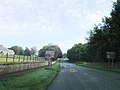
 Entrance to Ford Village - geograph.org.uk - 2696250.jpg 640 × 448 ; 68 kio
-
 Entrance to Ford Village - geograph.org.uk - 3200735.jpg 640 × 480 ; 56 kio
-
 Entrance to Heatherslaw Mill Shop - geograph.org.uk - 1555460.jpg 640 × 480 ; 79 kio
-
 Entrance to Kimmerston Farmhouse - geograph.org.uk - 3641215.jpg 2 736 × 3 648 ; 2,67 Mio
-
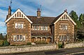 Estate house, Ford - geograph.org.uk - 5763790.jpg 1 000 × 662 ; 773 kio
-
 Estate house, Ford - geograph.org.uk - 5763792.jpg 1 000 × 662 ; 831 kio
-
 Etal Castle - geograph.org.uk - 6236129.jpg 2 592 × 1 944 ; 1,46 Mio
-
 Etal Castle - geograph.org.uk - 6467215.jpg 1 799 × 1 199 ; 294 kio
-
 Etal railway station - geograph.org.uk - 5825698.jpg 4 000 × 3 000 ; 3,63 Mio
-
 Etal sewage pumping station - geograph.org.uk - 5553635.jpg 1 600 × 1 060 ; 621 kio
-
 Etal village - geograph.org.uk - 6467213.jpg 1 799 × 1 199 ; 300 kio
-
 Ewes and lambs, Berryhill - geograph.org.uk - 3374889.jpg 640 × 480 ; 253 kio
-
 Exit Path from the Railway Station - geograph.org.uk - 3477775.jpg 1 920 × 1 280 ; 2,35 Mio
-
 Exmoor ponies, Ford Moss - geograph.org.uk - 2134582.jpg 1 024 × 768 ; 263 kio
-
 Farm buildings, Etal - geograph.org.uk - 5017030.jpg 640 × 480 ; 52 kio
-
 Farm cottages at Crookham Eastfield, Northumberland - geograph.org.uk - 3999415.jpg 3 648 × 2 736 ; 4,77 Mio
-
 Farm near the River Till - geograph.org.uk - 3477739.jpg 1 920 × 1 280 ; 1,38 Mio
-
 Farm road - geograph.org.uk - 2345929.jpg 640 × 359 ; 249 kio
-
 Farm road, Cookstead - geograph.org.uk - 4778283.jpg 1 024 × 683 ; 312 kio
-
 Farm shed at Crookham Eastfield, Northumberland - geograph.org.uk - 3999398.jpg 3 648 × 2 736 ; 4,64 Mio
-
 Farm shed beside the road - geograph.org.uk - 4215859.jpg 2 048 × 1 536 ; 645 kio
-
 Farm steading at Crookham Eastfield, Northumberland - geograph.org.uk - 3999402.jpg 3 648 × 2 736 ; 4,71 Mio
-
 Farm track - geograph.org.uk - 3188135.jpg 640 × 480 ; 78 kio
-
 Farm track east of Kimmerston - geograph.org.uk - 5017107.jpg 640 × 480 ; 68 kio
-
 Farm track near Crookham Westfield, Northumberland - geograph.org.uk - 3999164.jpg 3 648 × 2 736 ; 4,88 Mio
-
 Farm track towards Kimmerston - geograph.org.uk - 5017104.jpg 640 × 480 ; 73 kio


_-_geograph.org.uk_-_3640344.jpg)
_-_geograph.org.uk_-_3640350.jpg)


_-_geograph.org.uk_-_1898902.jpg)


_-_geograph.org.uk_-_2171090.jpg)


