Category:Forest of Bowland
Przejdź do nawigacji
Przejdź do wyszukiwania
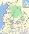
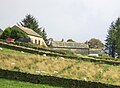
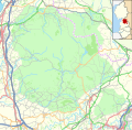
English: The Forest of Bowland, also known as the Bowland Fells, is an area of barren gritstone fells, deep valleys and peat moorland, mostly in north-east Lancashire, England. A small part lies in North Yorkshire, and much of the area was historically part of the West Riding of Yorkshire. Once described as the "Switzerland of England", it has been designated an Area of Outstanding Natural Beauty (AONB) since 1964, and is used for grouse shooting, walking and cycling, though it is relatively unfrequented by tourists. One of the best known features of the area is Pendle Hill, which is separated from the main part of the Forest of Bowland AONB by the Ribble Valley. (→Forest of Bowland)
Polski: Forest of Bowland – wyżynna kraina w północno-zachodniej Anglii, położona na zachód od Gór Pennińskich, w północno-wschodniej części hrabstwa Lancashire oraz na zachodnim skraju North Yorkshire. (→Forest of Bowland)
area in northeast Lancashire, England  | |||||
| Prześlij plik multimedialny | |||||
| Jest to |
| ||||
|---|---|---|---|---|---|
| Miejsce | |||||
| Składa się z | |||||
| Status dobra kultury | |||||
| Kategoria obszaru chronionego IUCN | |||||
| Najwyższy punkt | |||||
| Powierzchnia |
| ||||
 | |||||
Podkategorie
Poniżej wyświetlono 4 spośród wszystkich 4 podkategorii tej kategorii.
B
- Browsholme Hall (13 plików)
H
- Hayshaw Fell (8 plików)
Pliki w kategorii „Forest of Bowland”
Poniżej wyświetlono 74 spośród wszystkich 74 plików w tej kategorii.
-
 101 4491 Wolf Hole.jpg 2576 × 1716; 1,66 MB
-
 101 4492 Inside the wolf hole.jpg 2576 × 1716; 1,59 MB
-
 101 4493 The "Wolf Hole" at Wolf Hole Crag.jpg 2576 × 1716; 1,12 MB
-

-
 2.1.16 4 North of Slaidburn 9 (23842410410).jpg 6016 × 4000; 8,98 MB
-
 Approaching Whitendale Farm - geograph.org.uk - 39967.jpg 640 × 480; 128 KB
-
 Bowland & Lancs labelled with UK.png 600 × 714; 356 KB
-
 Bowland & Lancs with UK.png 600 × 714; 350 KB
-
 Bowland Knotts - geograph.org.uk - 879172.jpg 640 × 426; 158 KB
-
 Bowland sunset.jpg 2952 × 381; 179 KB
-
 Burnslack - geograph.org.uk - 1713415.jpg 2272 × 1712; 1,24 MB
-
 Cairn, Gallows Hill - geograph.org.uk - 1136512.jpg 640 × 480; 65 KB
-
 Cairn, High Stephen's Head - geograph.org.uk - 1136515.jpg 640 × 480; 71 KB
-
 Carr House, Littledale.jpg 4351 × 3263; 2,34 MB
-
 Cold Stone - geograph.org.uk - 1462025.jpg 640 × 480; 70 KB
-
 Cross Ghyll.jpg 4455 × 3341; 2,23 MB
-
 Dunsop Bridge.jpg 4032 × 3024; 4,03 MB
-
 Entering the Forest of Bowland - geograph.org.uk - 768026.jpg 640 × 480; 92 KB
-
 Fence on Wolfhole Crag path - geograph.org.uk - 962665.jpg 640 × 480; 61 KB
-

-
 Gates, High Stephen's Head - geograph.org.uk - 1136516.jpg 640 × 480; 71 KB
-
 Hawes House.jpg 3697 × 2698; 2,34 MB
-
 Hawthorwaite fell.JPG 1280 × 960; 295 KB
-
 Jubilee Tower - geograph.org.uk - 858553.jpg 640 × 479; 46 KB
-
 Jubilee Tower - geograph.org.uk - 947956.jpg 439 × 640; 62 KB
-
 Location map United Kingdom Forest of Bowland.svg 946 × 924; 6,09 MB
-
 Location relief map United Kingdom Forest of Bowland.svg 946 × 924; 2,61 MB
-
 Millers House - geograph.org.uk - 1772656.jpg 640 × 480; 75 KB
-
 Mountain Biking in the Forest of Bowland.jpg 4000 × 2667; 1,15 MB
-
 On Harrop Fell - geograph.org.uk - 1192848.jpg 640 × 480; 89 KB
-
 On Hawthornthwaite Fell - geograph.org.uk - 928535.jpg 640 × 480; 91 KB
-
 Ordnance Survey One-Inch Sheet 95 Blackburn & Burnley, Published 1947.jpg 10 928 × 12 741; 18,88 MB
-
 Ordnance Survey One-Inch Sheet 95 Blackburn & Burnley, Published 1961.jpg 8277 × 9911; 12,97 MB
-

-
 Peat on Tarnbrook Fell - geograph.org.uk - 1726881.jpg 2272 × 1712; 587 KB
-

-
 Pool, Austwick Common - geograph.org.uk - 770080.jpg 640 × 480; 75 KB
-
 Rocky wall - geograph.org.uk - 879187.jpg 640 × 420; 214 KB
-
 Roots in a Hagg - geograph.org.uk - 990803.jpg 640 × 480; 120 KB
-
 Sheepfold on the bank of Tarnbrook Wyre - geograph.org.uk - 506569.jpg 640 × 380; 382 KB
-
 Shooter's Road, Brown Syke - geograph.org.uk - 962572.jpg 640 × 480; 50 KB
-
 Shooting Hut Black Clough - geograph.org.uk - 83798.jpg 640 × 369; 49 KB
-
 Stake House - geograph.org.uk - 698991.jpg 640 × 480; 40 KB
-
 Stile over boundary fence Brown Syke - geograph.org.uk - 970219.jpg 640 × 404; 70 KB
-
 Stocks Farmhouse.png 720 × 540; 660 KB
-
 Stone trough - geograph.org.uk - 624286.jpg 640 × 480; 189 KB
-
 Stones at Millers House - geograph.org.uk - 1772643.jpg 640 × 480; 75 KB
-
 Tarn Black Side of Wards Stone - geograph.org.uk - 94898.jpg 640 × 480; 87 KB
-
 The Cragg Farm barn.jpg 4608 × 3456; 6,31 MB
-
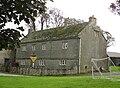 The Cragg Farm.jpg 4293 × 3160; 3,22 MB
-
 The plateau of Wards Stone - geograph.org.uk - 506518.jpg 640 × 362; 240 KB
-
 The watershed fence near Grey Crag - geograph.org.uk - 970185.jpg 640 × 389; 87 KB
-
 Top of Wards Stone - geograph.org.uk - 1004839.jpg 640 × 480; 98 KB
-

-
 Trig Pillar and Wards Stone - geograph.org.uk - 1003355.jpg 640 × 480; 72 KB
-
 Trig Pillar, Wolfhole Crag - geograph.org.uk - 770706.jpg 640 × 480; 59 KB
-
 Trig Point at night, Beacon Fell - geograph.org.uk - 740379.jpg 640 × 456; 47 KB
-
 Trig point Wolf Hole Crag - geograph.org.uk - 993600.jpg 640 × 466; 95 KB
-
 Trough - geograph.org.uk - 368266.jpg 480 × 640; 156 KB
-
 Trough road from Rams Clough - geograph.org.uk - 710920.jpg 640 × 427; 91 KB
-
 Udale Beck.jpg 3455 × 4607; 4,28 MB
-
 Udale Bridge.jpg 4503 × 3377; 3,68 MB
-
 Upland Pasture by Little Beck - geograph.org.uk - 144403.jpg 640 × 480; 82 KB
-
 Wall Near Grey Crag - geograph.org.uk - 770744.jpg 640 × 480; 42 KB
-
 Wall, Millers House - geograph.org.uk - 1773988.jpg 640 × 480; 68 KB
-
 Ward's Stone - geograph.org.uk - 770781.jpg 640 × 480; 68 KB
-
 Wards Stone and Trig. Pillar - geograph.org.uk - 711095.jpg 640 × 452; 89 KB
-
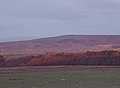 Wards stone at sunset.JPG 649 × 478; 31 KB
-
 Wards Stone Trig. Pillar - geograph.org.uk - 711101.jpg 640 × 460; 103 KB
-
 Watershed wall - geograph.org.uk - 993613.jpg 640 × 471; 120 KB
-
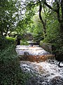
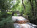
 Whitendale River - geograph.org.uk - 770664.jpg 480 × 640; 109 KB
-
 Wolfhole Crag, Gritstone formations - geograph.org.uk - 959870.jpg 640 × 480; 53 KB
-
 Wolfhole Cragg from Hawth.JPG 362 × 286; 11 KB
-
 Shooting Hut, Black Clough - geograph.org.uk - 691353.jpg 640 × 427; 75 KB


.jpg)


