Category:Moorlands, bogs and swamps
Jump to navigation
Jump to search
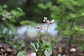
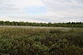
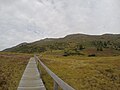
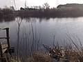
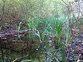
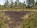
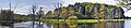
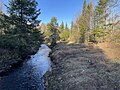
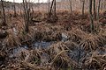
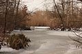
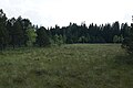
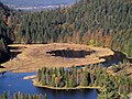
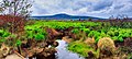
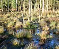
English: Moorlands, bogs, and swamps natural habitats and plant communities.
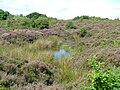
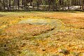
- A Bog or mire is a wetland type that accumulates acidic peat (Montane, Temperate, or Tropical grasslands, savannas, and shrublands Biomes)
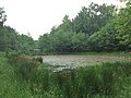
- A Swamp is a wetland featuring temporary or permanent inundation of large areas of land, by shallow bodies of water (Flooded grasslands and savannas Biome)
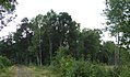
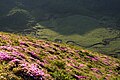
- A Moorland or moor is a type of habitat found in upland areas, characterised by low growing vegetation on acidic soils (Temperate grasslands, savannas, and shrublands Biome).
- See also: List of bogs (wikipedia).
Français : Une Tourbière (en anglais, bog) est une zone humide dans laquelle la tourbe s'accumule de façon progressive.
Deutsch: moorlands:Moor, bog:Sumpf mit Torf, swamp:Sumpf, Überschwemmungsland (siehe auch englische Erklärung)
Walon : Fagnes, maraxhes, troufires
type of habitat found in upland areas with (sometimes marshy) poor acid soil and overgrown with low vegetation  | |||||
| Upload media | |||||
| Instance of |
| ||||
|---|---|---|---|---|---|
| Subclass of |
| ||||
| Different from | |||||
| |||||
Subcategories
This category has the following 22 subcategories, out of 22 total.
A
B
- Bog butter (4 F)
C
- Cowles Bog (28 F)
F
M
- Moorland slump (2 F)
N
- Niknąca Łąka (17 F)
P
- Tourbière de Landemarais (31 F)
- Pilatussee (5 F)
- Poor fens (1 F)
R
- Reichardtsluch (9 F)
S
- Smirdgrāvis (3 F)
W
- Wolfsmoor (16 F)
Pages in category "Moorlands, bogs and swamps"
This category contains only the following page.
B
Media in category "Moorlands, bogs and swamps"
The following 150 files are in this category, out of 150 total.
-
 NPS map symbol marsh.png 150 × 60; 3 KB
-
 013 096 Isle aux Coudres tourbiere.jpg 4,106 × 2,730; 3.95 MB
-
 013 097 Isle aux Coudres.jpg 4,117 × 2,752; 4.59 MB
-
 013 098 Isle aux Coudres tourbiere 950 633.jpg 950 × 633; 510 KB
-
 013 098 Isle aux Coudres tourbiere.jpg 4,106 × 2,741; 4.28 MB
-
 1884-1895 Fritz Mackensen Großgemälde Öl auf Leinwand "Gottesdienst im Moor".jpg 3,215 × 2,000; 1.04 MB
-
 930901 16a 17 lac Noir.jpg 3,505 × 1,769; 5.68 MB
-
-
 A wet area on Baildon Moor - geograph.org.uk - 748471.jpg 640 × 480; 130 KB
-
 Acrotelm catotelm.png 2,070 × 1,024; 70 KB
-
 Aerial view of Okavango.jpg 983 × 694; 641 KB
-
 Akrotelm Katotelm.png 2,070 × 1,024; 33 KB
-
 Alpine Bogs (4896490163).jpg 2,592 × 1,936; 2.2 MB
-
 Ansicht-NSG-Bewerlohmoor-1.jpg 1,656 × 972; 657 KB
-
 Ansicht-NSG-Bewerlohmoor-2.jpg 2,000 × 1,124; 1.16 MB
-
 Aster umbellatus 016.jpg 6,240 × 4,160; 5.63 MB
-

-
 Bajcsy-Zsilinszky Straße, Feuchtgebiet, 2023 Gomba.jpg 2,272 × 1,704; 971 KB
-
 Birch aa.jpg 480 × 641; 86 KB
-
 Bogaturu.jpg 800 × 533; 118 KB
-
 Boggy area on Waldridge Fell.jpg 2,848 × 2,136; 1.64 MB
-
 Bulte 1.jpg 1,600 × 1,200; 699 KB
-
 Bulte horst.jpg 1,600 × 1,200; 1.43 MB
-
 Bulte torfmoos.jpg 1,600 × 1,200; 1.82 MB
-
 Carex rostrata - Tourbière Aubrac.jpg 3,000 × 4,000; 2.66 MB
-
 Chimaphila umbellata 007.jpg 6,240 × 4,160; 6.3 MB
-
 Clyne common.jpg 4,160 × 3,120; 4.47 MB
-
 CullodenMoor.jpg 1,280 × 960; 592 KB
-
 Dünenlandschaft List.jpg 4,032 × 3,024; 5.37 MB
-
 Entstehung HM.gif 393 × 700; 42 KB
-
 Eriophorum-vaginatum.JPG 480 × 640; 110 KB
-
 Eroded peat moorland, Bleaklow, Derbyshire.JPG 2,304 × 3,072; 4.05 MB
-

-

-
-

-

-

-

-
 Hamburg, Naturschutzgebiet Höltigbaum, Großer Tümpel im Stellmoorer Tunneltal.jpg 3,264 × 2,448; 2.76 MB
-
 Haut Grande Ligne 001.jpg 3,456 × 2,304; 3.29 MB
-
 Havre St Pierre 028.jpg 1,600 × 1,200; 360 KB
-
 HolzstegMoor.JPG 4,000 × 3,000; 2.65 MB
-
 Im Salemer Moor 01.jpg 2,176 × 1,446; 1.96 MB
-
 Im Salemer Moor 02.jpg 2,176 × 1,446; 1.69 MB
-
 Im Salemer Moor 03.jpg 2,176 × 1,446; 1.93 MB
-
 Inconnue 2 bis Tourbière Aubrac.jpg 3,000 × 4,000; 3.96 MB
-
 Inconnue 2 Tourbière Aubrac.jpg 4,000 × 3,000; 3.01 MB
-
 Koigakubo moor 1.jpg 1,600 × 1,200; 903 KB
-
 Kraniche rasten im Tister Bauernmoor.JPG 1,447 × 1,157; 1.8 MB
-
 Lago di Sibolla.jpg 1,600 × 1,200; 480 KB
-
 Lanke Wunderlich's Moor lub 2023-08-11.jpg 4,032 × 3,024; 8.72 MB
-
 Lascar Contrasting bright sky and dark moorland at 3800m (4463909979).jpg 3,216 × 2,136; 1.78 MB
-
 Láprét-kép.jpg 1,060 × 1,605; 961 KB
-
 Maianthemum canadense 005.jpg 3,456 × 2,304; 3.16 MB
-
 Marsh.jpg 1,600 × 1,200; 1.31 MB
-
 Matley bog near kings passage.jpg 2,112 × 2,816; 1.96 MB
-
 Medeola virginiana 004.jpg 3,456 × 2,304; 2.87 MB
-
 Monotropa uniflora 014.jpg 6,240 × 4,160; 6.7 MB
-
 Montirargues RNR - G. Caillon (2).jpg 5,472 × 3,648; 13.92 MB
-
 Moor in Moorsum.jpg 4,592 × 2,576; 4.03 MB
-
 Moor Obergurgl MS 1244.JPG 1,600 × 1,200; 1.21 MB
-
 Moorauge.jpg 1,600 × 1,064; 1.5 MB
-
 MoorgewässerNov.JPG 332 × 500; 83 KB
-
 Moorland view (35703770806).jpg 4,032 × 3,024; 2.72 MB
-
 Moorlandschaft bei Sittensen.JPG 5,184 × 3,456; 13.29 MB
-
 Mosedannelse.gif 250 × 181; 29 KB
-
 Naturschutzgebiet Warscheneck-Süd-Wurzeralm, Teichlboden.JPG 2,048 × 1,536; 1.64 MB
-
 Nebelabend im Moor bei Sittensen.JPG 5,184 × 3,456; 7.09 MB
-
 Niddaquelle Moor.jpg 1,600 × 1,054; 634 KB
-
 Notre Dame du Mont Carmel 039.jpg 4,032 × 3,024; 3.68 MB
-
 Notre Dame du Mont Carmel 049.jpg 4,032 × 3,024; 4.43 MB
-
 Novembernebel im Tister Bauernmoor.JPG 5,184 × 3,456; 6.17 MB
-
 NSG Wolfsloecher K7340-064.jpg 7,360 × 4,912; 25.5 MB
-
 Origin of swamp RU.gif 250 × 181; 19 KB
-
 Parc Coeur Nature 005.jpg 2,048 × 1,536; 1.29 MB
-
 Parc Coeur Nature 006.jpg 1,536 × 2,048; 1.35 MB
-
 Parc Coeur Nature 007.jpg 4,032 × 3,024; 4.9 MB
-
 Parc Coeur Nature 008.jpg 4,032 × 3,024; 4.68 MB
-
 Parc Coeur Nature 025.jpg 4,032 × 3,024; 8.18 MB
-
 Parc Coeur Nature 030.jpg 4,032 × 3,024; 5.45 MB
-
 Parc Coeur Nature 038.jpg 4,032 × 3,024; 5.15 MB
-
 Parc Coeur Nature 041.jpg 4,032 × 3,024; 4.06 MB
-
 Parc Coeur Nature 046 3801 2795.jpg 3,801 × 2,795; 11.34 MB
-
 Parc Coeur Nature 066.jpg 4,032 × 3,024; 6.09 MB
-
 Parc Coeur Nature 068.jpg 4,032 × 3,024; 6.84 MB
-
 Parc Coeur Nature 076.jpg 4,032 × 3,024; 6.58 MB
-
 Parc Coeur Nature panneau.jpg 4,032 × 3,024; 5.11 MB
-
 Perham (2281577570).jpg 2,304 × 1,382; 3.5 MB
-
 Regeneration Hochmoor.jpg 1,600 × 1,064; 1.07 MB
-
 Rejviz trail.JPG 2,048 × 1,360; 788 KB
-
 Reserve ecologique Lac a-la Tortue 024a.jpg 4,032 × 3,024; 3.88 MB
-
 Rhynchospora fusca - Tourbière Aubrac.jpg 4,000 × 3,000; 2.73 MB
-
 Rhynchosporaalba2.jpg 2,048 × 1,536; 838 KB
-
 Rotes moor moorweiher.jpg 1,534 × 1,024; 362 KB
-
 Royère de Vassivière Tourbière d'Auzoux.JPG 3,264 × 2,448; 1.62 MB
-
 Réserve écologique de la Tourbière-de-Shannon map.svg 2,014 × 1,600; 1.24 MB
-
 Saint Maurice 056.jpg 4,032 × 3,024; 6.25 MB
-
 Saint Maurice 059a.jpg 4,032 × 3,024; 5.78 MB
-
 Saint Maurice 064a.jpg 4,032 × 3,024; 6.67 MB
-
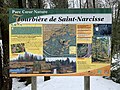
 Saint Narcisse 021.jpg 4,032 × 3,024; 6.92 MB
-
 Sarracenia purpurea juillet 1996.jpg 2,283 × 3,541; 7.49 MB
-
 Schifflache.JPG 2,048 × 1,536; 1.08 MB
-
 Schlenke 0600716.jpg 1,600 × 1,200; 532 KB
-
 Seachtn - Kesselmoor bei Andechs - Panorama I.jpg 14,291 × 3,071; 24.76 MB
-
 Secteur Lac Pratte 003.jpg 4,032 × 3,024; 5.54 MB
-
 Secteur Lac Pratte 007.jpg 4,032 × 3,024; 5.75 MB
-
 Secteur Shawinigan Sud 005.jpg 4,032 × 3,024; 3.59 MB
-
 Seebek 5.JPG 3,456 × 2,592; 3.09 MB
-
 Sonnenaufgang über dem Tister Moorsee.JPG 5,184 × 3,456; 8.11 MB
-
 Sphagnum.JPG 1,600 × 1,152; 388 KB
-
 Spiegelungen im Moor.JPG 5,184 × 3,456; 7.32 MB
-
 Spruce Hole Bog-very large photo.jpeg 2,753 × 2,002; 929 KB
-
 Stagnant Bog.jpg 686 × 1,000; 88 KB
-
 StedtlingerMoor.jpg 2,102 × 1,181; 282 KB
-
 Swamp lake Balarus.jpg 900 × 675; 155 KB
-
 Teufelsbruch Berlin Hakenfelde Moor IMG 3830.jpg 5,184 × 3,456; 13.04 MB
-
 Teufelsbruch Berlin Hakenfelde Moor IMG 3855.jpg 5,184 × 3,456; 13.22 MB
-
 Teufelsbruch Berlin Hakenfelde Moor IMG 3857.jpg 5,184 × 3,456; 13.53 MB
-
 Teufelsbruch Berlin Hakenfelde Moor IMG 3876.jpg 5,184 × 3,456; 11.21 MB
-
 Th. Kittelsen- Prinsessen plukker myrdun (12899203093).jpg 5,000 × 3,211; 30.47 MB
-
 Tiefwerderwiesen Berlin Spandau DSCN 1427.jpg 4,320 × 3,240; 7.74 MB
-
 Tiefwerderwiesen Berlin Spandau DSCN̞ 1432.jpg 4,320 × 3,240; 8.56 MB
-
 Tiefwerderwiesen Berlin Spandau Winter̠DSCN 14.jpg 5,184 × 3,456; 10.76 MB
-
 Torfowisko przejściowe - transitional bog 01.JPG 1,920 × 1,080; 724 KB
-
 Torfowisko przejściowe - transitional bog 02.JPG 1,642 × 1,076; 485 KB
-
 Tourbe.jpg 1,158 × 1,728; 443 KB
-
 Tourbiere du Lac a la Tortue 003.jpg 4,032 × 3,024; 3.87 MB
-
 Tourbiere frasne 25-0882.JPG 6,000 × 4,000; 6.19 MB
-
 Tourbiere-du-peuil-hiver.jpg 1,080 × 715; 65 KB
-
 Tourbière et lac de Lispach - Cliché Vosagus 16-10-2005.jpg 2,592 × 1,944; 1.11 MB
-
 Tourbière frasne 25 0873.JPG 4,000 × 6,000; 8.84 MB
-
 Tourbières après l'incendie 2022.jpg 4,640 × 2,088; 14.6 MB
-
 Turbera egmont.JPG 2,112 × 2,816; 2.21 MB
-
 Turf Machine - at Hill-of-Down Co. Meath, Ireland - May 2012 (7326273226).jpg 3,648 × 2,736; 2.18 MB
-
 Valdegutur Pantano de Añamaza 064.JPG 2,720 × 2,040; 1.21 MB
-
 Velke mechove jezirko Rejviz.JPG 2,048 × 1,360; 813 KB
-
 Vertical Bog Mt Kenya.JPG 2,592 × 1,944; 1.16 MB
-
 View towards Laughermore - geograph.org.uk - 611748.jpg 640 × 480; 97 KB
-
 Waschven.jpg 1,544 × 575; 137 KB
-
 WE 202 Everstenmoor Pfad.jpg 4,000 × 3,000; 4.98 MB
-
 WE 202 Everstenmoor Weg.jpg 3,264 × 2,448; 4.35 MB
-
 Wieder vernässtes Moor bei Sittensen.JPG 4,106 × 3,456; 17.47 MB
-
 Wurzacher-Ried Riss-Wuerm-Glaziale.jpg 1,200 × 800; 231 KB
-
 Wurzacher-Ried Wuerm-Zeit Endmoraenen-Stausee.jpg 1,200 × 1,200; 885 KB
-
 Yellow Bog, Bingley Moor - geograph.org.uk - 44704.jpg 640 × 480; 174 KB
-
 Ökologische Moortypen.png 500 × 553; 22 KB
-
 Ökologische Moortypen.svg 470 × 549; 15 KB
-
 Überflutungsmoor.png 640 × 253; 5 KB
-
 Болото Селигер.JPG 2,880 × 2,160; 2.82 MB


.jpg)


_2020.JPG)


_In_the_climatic_zone_(taiga,_forest-tundra)_of_the_Arkhangelsk_region._1.jpg)
_In_the_climatic_zone_(taiga,_forest-tundra)_of_the_Arkhangelsk_region._2.jpg)
_In_the_climatic_zone_(taiga,_forest-tundra)_of_the_Arkhangelsk_region._3.jpg)
_In_the_climatic_zone_(taiga,_forest-tundra)_of_the_Arkhangelsk_region._4.jpg)
_In_the_climatic_zone_(taiga,_forest-tundra)_of_the_Arkhangelsk_region._7.jpg)
_In_the_climatic_zone_(taiga,_forest-tundra)_of_the_Arkhangelsk_region.5.jpg)
_In_the_climatic_zone_(taiga,_forest-tundra)_of_the_Arkhangelsk_region.jpg)


.jpg)


.jpg)


.jpg)


.jpg)


.jpg)


.jpg)


