Category:Fort Duchesne, Utah
Jump to navigation
Jump to search
census-designated place in Uintah County, Utah, United States  | |||||
| Upload media | |||||
| Instance of | |||||
|---|---|---|---|---|---|
| Location | Uintah and Ouray Indian Reservation, Uintah County, Utah | ||||
| Population |
| ||||
| Area |
| ||||
| Elevation above sea level |
| ||||
 | |||||
Media in category "Fort Duchesne, Utah"
The following 4 files are in this category, out of 4 total.
-
 Lt. Styer, and Ute Amigos. Near Fort Duchesne, Utah,1886 - NARA - 533076.jpg 3,000 × 1,875; 1.1 MB
-
-
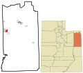
 Uintahcounty ut.png 616 × 1,099; 46 KB
-
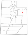 UTMap-doton-FortDuchesne.PNG 238 × 300; 18 KB


Categories:
- Census-designated places in Utah
- Populated places in Uintah County, Utah
- Populated places on the Uintah and Ouray Indian Reservation
- Populated places in the Uinta Basin
- Locations along U.S. Route 40 in Uintah County, Utah
- Locations along U.S. Route 191 in Uintah County, Utah
- Locations along Utah State Route 6 (1910-1977) in Uintah County, Utah
- Locations along the Dinosaur Diamond Prehistoric Highway in Uintah County, Utah