Category:Four Corners (United States)
Zur Navigation springen
Zur Suche springen
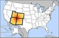
Stelle, an der die vier US-Bundesstaaten Utah, Colorado, New Mexico und Arizona aufeinandertreffen   | |||||
| Medium hochladen | |||||
| Ist ein(e) |
| ||||
|---|---|---|---|---|---|
| Ist Teil von |
| ||||
| Benannt nach |
| ||||
| Ort |
| ||||
| Verschieden von | |||||
 | |||||
English: Media related to the Four Corners, the common state border point between Arizona, Colorado, New Mexico, and Utah in the southwestern United States.
Unterkategorien
Diese Kategorie enthält folgende Unterkategorie:
In Klammern die Anzahl der enthaltenen Kategorien (K), Seiten (S), Dateien (D)
F
Medien in der Kategorie „Four Corners (United States)“
Folgende 45 Dateien sind in dieser Kategorie, von 45 insgesamt.
-
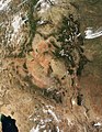
 00 1029 The Four Corners - USA.jpg 2.327 × 1.400; 2,92 MB
-
 Air quality tour (5622329766).jpg 513 × 640; 59 KB
-
 Anasazi Map USA1.png 661 × 706; 126 KB
-
 Ancestral Puebloan territory.svg 912 × 1.122; 47 KB
-
 Ancient-Regions.svg 929 × 1.008; 1,82 MB
-
 AREA NEAR FOUR CORNERS POWER PLANT - NARA - 544393.jpg 3.000 × 2.025; 1,04 MB
-
 Author Phil Slattery, July 29, 2019 in the Bisti Wilderness.jpg 770 × 578; 40 KB
-
 Borders of Four Corners, USA survey years.svg 240 × 250; 63 KB
-
 Edge of Mesa Verde Area, Four Corners Region, Colorado (14497120462).jpg 4.000 × 3.000; 6 MB
-
 Evolution of borders at Four Corners, USA - June 2013.gif 1.000 × 758; 617 KB
-
 Four Corners (6682767665).jpg 4.608 × 3.072; 3,17 MB
-
 Four Corners (MODIS 2020-02-24).jpg 2.649 × 2.120; 766 KB
-
 Four Corners (MODIS).jpg 2.383 × 1.923; 476 KB
-
 Four Corners Marker (6682766653).jpg 4.608 × 3.072; 3,66 MB
-
 Four Corners, Southwestern U.S.jpg 2.200 × 2.200; 2,73 MB
-
 Four Corners, United States of America (MODIS 2017-12-14).jpg 2.523 × 2.003; 812 KB
-
 Four Corners, US (ASTER).jpg 1.170 × 1.089; 257 KB
-
 Four corners.jpg 4.500 × 5.800; 4,33 MB
-
 Four Corners.svg 928 × 588; 86 KB
-
 Four-corners-states-(LT).png 842 × 551; 18 KB
-
 Four-corners-states.png 842 × 551; 16 KB
-
 Fourcorners-us.jpg 280 × 183; 10 KB
-
 FourCorners.jpg 461 × 516; 39 KB
-
 FourCornersSurveyYears.jpg 2.949 × 3.072; 413 KB
-
 Háájí Diné kéédahat'í Final-02.jpg 5.334 × 4.267; 1,59 MB
-
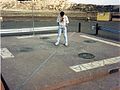 John at Four Corners 1987 (9890270).jpg 1.354 × 1.012; 3,05 MB
-
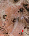
 Karte der Navajo Volcanic Fields.jpg 1.280 × 1.467; 565 KB
-
 Little Biddy Trucks (15089188622).jpg 5.184 × 3.456; 6,12 MB
-

-
 Map Anasazi, Hohokam and Mogollon cultures-en.svg 912 × 1.122; 71 KB
-
 Map Anasazi, Hohokam and Mogollon cultures-nl.svg 912 × 1.122; 69 KB
-
 Map of the Navajo Volcanic Fields.jpg 1.280 × 1.467; 568 KB
-
 NE AZ-NW NM NASA.jpg 990 × 830; 645 KB
-
 Plateau laccoliths NASA.jpg 900 × 1.124; 324 KB
-
 San Juan Basin Prehistoric Roads.jpg 334 × 336; 123 KB
-

-
 San Juan River near Navajo Dam, New Mexico.jpg 3.264 × 2.448; 3,98 MB
-

-
 Snow across the Four Corners (MODIS).jpg 3.563 × 2.816; 1,69 MB
-
 Southwestern Colorado, Four Corners Region (14311711758).jpg 4.000 × 3.000; 1,62 MB
-
 That Golden Hour Light (14871942828).jpg 5.184 × 3.456; 6,06 MB
-
 The American journal of science (1913) (18153915521).jpg 2.928 × 2.000; 1,02 MB
-
 Trail of the Ancients - Flags on the Four Corners Monument - NARA - 7722496.jpg 1.660 × 1.112; 343 KB
-
 Trail of the Ancients - Four Corners Monument - NARA - 7722485.jpg 3.060 × 2.048; 329 KB
-
 Trail of the Ancients - Happy Visitors at the Four Corners Monument - NARA - 7722484.jpg 2.079 × 1.351; 1,47 MB

.jpg)


.jpg)

.jpg)
.jpg)
.jpg)
.jpg)
.jpg)
.jpg)


.png)


.jpg)

.jpg)
.jpg)


.jpg)

.jpg)
.jpg)
.jpg)
.jpg)
_(18153915521).jpg)


Kategorien:
- Colorado Plateau
- Geography of San Juan County, Utah
- Geography of Apache County, Arizona
- Geography of San Juan County, New Mexico
- Geography of Montezuma County, Colorado
- State lines
- Quadripoints
- Trail of the Ancients Scenic and Historic Byway in Colorado
- Locales in San Juan County, Utah
- Locales in Arizona
- Locales in Colorado
- Locales in New Mexico
- Colorado-Utah border
- Colorado-New Mexico border
- Arizona-New Mexico border
- Arizona-Utah border