Category:Colorado Plateau
Jump to navigation
Jump to search
- Español: Meseta del Colorado, Estados Unidos.
plateau in the Four Corners region of the Southwest United States   | |||||
| Upload media | |||||
| Instance of | |||||
|---|---|---|---|---|---|
| Location | Arizona | ||||
| Partially coincident with |
| ||||
 | |||||
Subcategories
This category has the following 22 subcategories, out of 22 total.
*
+
- Maps of the Colorado Plateau (1 F)
B
C
- Carrizo Mountains (8 F)
E
F
G
M
P
R
S
- Simon Canyon Pueblito (10 F)
U
W
Pages in category "Colorado Plateau"
This category contains only the following page.
Media in category "Colorado Plateau"
The following 51 files are in this category, out of 51 total.
-
 Colorado Plateaus map.png 324 × 353; 18 KB
-
 Colorado Plateaus map2.jpg 131 × 135; 5 KB
-
 Colorado Plateau Shrublands map.svg 1,712 × 1,992; 348 KB
-
 024 - Hite Crossing campsite (6267113121).jpg 4,752 × 3,168; 1.55 MB
-
 10a - Romano Bench - 08 copy (534891432).jpg 1,500 × 1,004; 998 KB
-
 10a - Romano Bench - 45 (534891456).jpg 1,500 × 1,004; 1.74 MB
-
 10a - Romano Bench - 46 (534891470).jpg 1,500 × 1,004; 2.09 MB
-
 14 - Angel Point - morning- 01 (534921936).jpg 1,500 × 1,004; 1.79 MB
-
 An Astronaut's View of the Colorado Plateau.jpg 1,440 × 960; 557 KB
-
 AS09-20-3138 (21750454388).jpg 4,400 × 4,600; 1.43 MB
-
 AS09-20-3139 (21315580094).jpg 4,400 × 4,600; 1.38 MB
-
 AS09-20-3140 (21938311055).jpg 4,400 × 4,600; 1.32 MB
-
 AS09-20-3141 (21938310705).jpg 4,400 × 4,600; 1.39 MB
-
 AS09-20-3142 (21751419459).jpg 4,400 × 4,600; 1.39 MB
-

-
 CAMPSITE (7-20-2015) 9600 ft, near bristol head, mineral co, co -08 (20557361275).jpg 2,222 × 1,481; 1.84 MB
-
 CAMPSITE (7-22-2015) gunnison sage grouse country, south of gunnison, co (1) (20563117942).jpg 4,752 × 3,168; 11.81 MB
-
 Cockscomb cottonwood.jpg 1,024 × 766; 300 KB
-
 Colorado Plateau (2220167435).jpg 3,008 × 1,193; 4.05 MB
-
 Colorado Plateau - Flickr - Joe Parks.jpg 3,903 × 2,602; 6.42 MB
-
 Colorado Plateau ecoregion map.jpg 440 × 473; 140 KB
-
 Colorado Plateau, Mojave desert.jpg 1,024 × 768; 166 KB
-
 Dutton Point and Masonic Temple.jpg 4,187 × 2,731; 3.48 MB
-
 Four Corners and the Colorado Plateau (MODIS 2021-04-13).jpg 3,555 × 2,671; 3.24 MB
-
 Four corners.jpg 4,500 × 5,800; 4.33 MB
-
 Grand Canyon Dutton Pt, Masonic Temple.jpg 2,560 × 1,937; 1.26 MB
-
 Grandjunctionalpineloop 032.jpg 2,304 × 1,728; 563 KB
-
 Grandjunctionalpineloop 035.jpg 2,304 × 1,728; 685 KB
-
 Green River, eastern Utah.jpg 1,024 × 576; 139 KB
-
 Heaven (2178240415).jpg 3,008 × 2,000; 5.93 MB
-
 ISS-34 Colorado Plateau.jpg 4,288 × 2,848; 1.31 MB
-
 Masonic temple AZ.jpg 1,760 × 1,177; 2.2 MB
-
 McElmo Creek.JPG 4,608 × 3,456; 2.25 MB
-
 Meadow & cabin near Big Lake, AZ.jpg 3,402 × 2,277; 1.06 MB
-
 MODIS1000013.jpg 1,172 × 912; 470 KB
-
 Monographs of the United States Geological Survey BHL35147175.jpg 3,651 × 2,756; 1.26 MB
-
 New tracks in North America BHL32610066.jpg 3,168 × 1,888; 1.08 MB
-
 Paria Plateau in fog.jpg 1,230 × 900; 941 KB
-

-
 Report upon the Colorado River of the West (PLATE VII) BHL32611407.jpg 4,039 × 2,832; 1.82 MB
-
 San Rafael River Overlook (7488669268).jpg 4,915 × 3,255; 3.08 MB
-
 SEUtahStrat.JPG 3,161 × 1,794; 2.5 MB
-
 Singleleaf Ash Fraxinus anomala, Zion Canyon, Utah.jpg 3,648 × 2,736; 6.86 MB
-
 Stone House Vermilion Cliffs.jpg 3,872 × 2,592; 2.3 MB
-
 Stratotypes for members of the Morrison Formation.jpg 3,101 × 4,561; 3.27 MB
-
 Sunset Crater BonitoLF 140428.JPG 5,184 × 3,456; 6.93 MB
-
 The American journal of science (1913) (18153915521).jpg 2,928 × 2,000; 1.02 MB
-
 This reminds me of Alaska! (14351806855).jpg 640 × 551; 112 KB
-

-
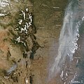 Wallow fire satphoto, June 7, 2011.jpg 720 × 720; 222 KB
-
 Wpdms nasa topo wind river range.jpg 335 × 280; 30 KB


.jpg)
.jpg)
.jpg)
.jpg)
.jpg)

.jpg)
.jpg)
.jpg)
.jpg)
.jpg)
_9600_ft,_near_bristol_head,_mineral_co,_co_-08_(20557361275).jpg)
_gunnison_sage_grouse_country,_south_of_gunnison,_co_(1)_(20563117942).jpg)


.jpg)


.jpg)


_BHL32611407.jpg)
.jpg)


_(18153915521).jpg)
.jpg)


_9600_ft,_near_bristol_head,_mineral_co,_co_-04_(20548436922).jpg)
.jpg)