Category:Foxton, Leicestershire
Jump to navigation
Jump to search
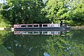
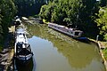
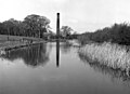
English: Foxton is a village in Leicestershire, England, to the north-west of Market Harborough. It is on the Grand Union Canal and is the site of the Foxton Locks and Foxton Inclined Plane.
village and civil parish in Leicestershire, England  | |||||
| Upload media | |||||
| Instance of | |||||
|---|---|---|---|---|---|
| Location | Harborough, Leicestershire, East Midlands, England | ||||
| Population |
| ||||
| Area |
| ||||
 | |||||
Subcategories
This category has the following 2 subcategories, out of 2 total.
Media in category "Foxton, Leicestershire"
The following 200 files are in this category, out of 474 total.
(previous page) (next page)-
 'Black Swan' at Foxton Locks - geograph.org.uk - 6271098.jpg 1,280 × 851; 605 KB
-
 2 solutions to 1 problem - geograph.org.uk - 5537843.jpg 1,280 × 1,280; 728 KB
-

-
 A6 Harborough Road towards Kibworth Harcourt - geograph.org.uk - 2888973.jpg 1,975 × 1,448; 1.05 MB
-
 A6 Harborough Road towards Market Harborough - geograph.org.uk - 2888966.jpg 1,029 × 838; 303 KB
-
 A6 layby - geograph.org.uk - 5152264.jpg 480 × 640; 71 KB
-
 Air raid shelters - geograph.org.uk - 6053559.jpg 1,024 × 768; 190 KB
-
 Airfield building - geograph.org.uk - 6041801.jpg 768 × 1,024; 342 KB
-
 Along Gallow Field Road towards Foxton School - geograph.org.uk - 6041783.jpg 1,024 × 768; 148 KB
-
 Approaching Foxton on Cycle Route 6 - geograph.org.uk - 2558131.jpg 4,000 × 3,000; 2.84 MB
-
 B6047 Harborough Road - geograph.org.uk - 6192746.jpg 1,024 × 684; 364 KB
-
 Balance beams at Foxton Locks in Leicestershire - geograph.org.uk - 5892065.jpg 1,280 × 1,280; 1.76 MB
-
-
 Beauchamp Farm and Debdale Lane - geograph.org.uk - 3386984.jpg 2,527 × 1,860; 1.44 MB
-
 Black Horse Bridge (No 3), from the south-east - geograph.org.uk - 5553684.jpg 1,024 × 768; 269 KB
-
 Black Horse Bridge No 3 - geograph.org.uk - 6329100.jpg 800 × 545; 186 KB
-
 Black Horse Bridge No 3 - geograph.org.uk - 6329103.jpg 800 × 597; 149 KB
-
 Bottom Lock and Pool - geograph.org.uk - 862841.jpg 640 × 428; 80 KB
-
 Branch of the Grand Union Canal Foxton - geograph.org.uk - 6288259.jpg 4,000 × 3,000; 5.42 MB
-

-

-
-

-

-
 Bridge 60 - geograph.org.uk - 3117960.jpg 3,072 × 2,048; 1.78 MB
-
 Bridge 61 and Bridge 61 - geograph.org.uk - 3117996.jpg 3,072 × 2,048; 1.26 MB
-

-
 Bridge 61, (Old) Grand Union Canal - geograph.org.uk - 3100130.jpg 4,000 × 3,000; 4.7 MB
-

-
 Bridges, Foxton Junction - geograph.org.uk - 5537822.jpg 1,280 × 720; 401 KB
-
 Canal approaching Foxton Locks in Leicestershire - geograph.org.uk - 5889752.jpg 1,440 × 911; 1.32 MB
-
 Canal bridge - geograph.org.uk - 167592.jpg 640 × 480; 113 KB
-
 Canal bridge at Foxton Locks in Leicestershire - geograph.org.uk - 5894395.jpg 1,280 × 960; 1.52 MB
-
 Canal near Gumley - geograph.org.uk - 5373150.jpg 4,608 × 3,456; 4.3 MB
-
 Canalside scene, Foxton Junction - geograph.org.uk - 5104675.jpg 640 × 427; 89 KB
-

-
 Caution^ Unprotected drop at Foxton - geograph.org.uk - 5562739.jpg 1,024 × 768; 225 KB
-
 Chapel doors, Foxton - geograph.org.uk - 5287707.jpg 480 × 640; 98 KB
-
 Church of St Andrew, Foxton - geograph.org.uk - 2558160.jpg 4,000 × 3,000; 2.9 MB
-
 Clarkes Bridge (No 5) - geograph.org.uk - 407246.jpg 640 × 427; 156 KB
-
 Clarkes bridge (No 5), from the east - geograph.org.uk - 5552759.jpg 1,024 × 768; 286 KB
-
 Clarkes Bridge No 5 - geograph.org.uk - 5324285.jpg 800 × 600; 180 KB
-
 Clarkes Bridge No 5 - geograph.org.uk - 6329086.jpg 800 × 600; 251 KB
-
 Clarkes Bridge No 5 - geograph.org.uk - 6329088.jpg 800 × 603; 263 KB
-
 Clarkes Bridge, Market Harborough Arm - geograph.org.uk - 4615910.jpg 1,280 × 851; 346 KB
-

-
 Clear moon - geograph.org.uk - 5850107.jpg 1,024 × 768; 93 KB
-
 Close look - geograph.org.uk - 6041802.jpg 768 × 1,024; 130 KB
-
 Countryside - geograph.org.uk - 2300643.jpg 800 × 531; 70 KB
-
 Cresting Gallow Hill on the B6047 - geograph.org.uk - 6192749.jpg 1,024 × 684; 354 KB
-
 Debdale Lane - geograph.org.uk - 3386976.jpg 2,893 × 2,186; 1.81 MB
-
 Distance sign, Foxton Junction - geograph.org.uk - 5537810.jpg 1,280 × 1,280; 795 KB
-
 Dozing lamb near Gumley - geograph.org.uk - 5324981.jpg 800 × 573; 164 KB
-

-
 Dwelling Origination of Foxton.png 481 × 289; 8 KB
-

-
-
-
 Farm machinery, south of Langton Farm, Foxton - geograph.org.uk - 5553675.jpg 1,024 × 768; 210 KB
-
 Farmland near Foxton Locks - geograph.org.uk - 2050360.jpg 640 × 480; 62 KB
-
 Farmland near Gallow Hill - geograph.org.uk - 6328237.jpg 800 × 523; 106 KB
-
 Farmland north of the Grand Union Canal - geograph.org.uk - 5324305.jpg 800 × 640; 169 KB
-
 Farmland on the edge of Foxton village - geograph.org.uk - 3794921.jpg 1,600 × 1,188; 772 KB
-
 Field view - geograph.org.uk - 6041792.jpg 1,024 × 768; 274 KB
-
 Field view - geograph.org.uk - 6041814.jpg 1,024 × 768; 295 KB
-
 Field view - geograph.org.uk - 6053564.jpg 768 × 1,024; 190 KB
-
-
 Fields near Foxton - geograph.org.uk - 5373128.jpg 4,608 × 2,891; 2.89 MB
-
 Fly tipping along Langton Road - geograph.org.uk - 3794878.jpg 1,600 × 1,405; 765 KB
-

-
 Foot of Foxton inclined plane, 1960 - geograph.org.uk - 1629441.jpg 640 × 480; 104 KB
-

-
 Footpath close to the canal - geograph.org.uk - 5266037.jpg 640 × 480; 49 KB
-
 Footpath heads to Lubenham - geograph.org.uk - 6041790.jpg 768 × 1,024; 218 KB
-
 Footpath off Middle Street, Foxton - geograph.org.uk - 1265581.jpg 480 × 640; 211 KB
-
 Former boat lift wheel - geograph.org.uk - 2496051.jpg 640 × 480; 124 KB
-
 Foxton - former inclined plane - geograph.org.uk - 3261801.jpg 640 × 416; 90 KB
-
 Foxton Basin - geograph.org.uk - 2542367.jpg 1,280 × 959; 356 KB
-
 Foxton Black Horse - geograph.org.uk - 2859252.jpg 640 × 480; 126 KB
-
 Foxton bottom lock - geograph.org.uk - 5104683.jpg 640 × 427; 101 KB
-
 Foxton Bottom Lock - geograph.org.uk - 5522686.jpg 1,280 × 1,280; 755 KB
-
 Foxton Bottom Lock - geograph.org.uk - 5537832.jpg 1,280 × 850; 528 KB
-
 Foxton Bottom Lock - geograph.org.uk - 6288288.jpg 4,000 × 3,000; 5.13 MB
-
 Foxton Bottom Lock in Leicestershire - geograph.org.uk - 5895505.jpg 1,280 × 960; 1.3 MB
-
 Foxton Bottom Lock in Leicestershire - geograph.org.uk - 5895506.jpg 960 × 1,280; 1.22 MB
-
 Foxton Bridge 61 Pub - geograph.org.uk - 2859258.jpg 640 × 480; 144 KB
-
 Foxton Church - geograph.org.uk - 2050344.jpg 640 × 480; 91 KB
-
 Foxton church - geograph.org.uk - 3293746.jpg 640 × 480; 33 KB
-
 Foxton cut leading to inclined plane - geograph.org.uk - 3119624.jpg 3,072 × 2,048; 1.8 MB
-
 Foxton former boat lift - geograph.org.uk - 2496040.jpg 640 × 480; 102 KB
-
 Foxton inclined plane - from the top - geograph.org.uk - 3261806.jpg 640 × 427; 84 KB
-
 Foxton Inclined Plane - geograph.org.uk - 3447102.jpg 2,592 × 1,944; 1.19 MB
-
 Foxton Junction - geograph.org.uk - 5104690.jpg 640 × 427; 89 KB
-
 Foxton Junction Swing Bridge - geograph.org.uk - 6329120.jpg 800 × 534; 129 KB
-
 Foxton Lock - geograph.org.uk - 1711681.jpg 800 × 490; 342 KB
-
 Foxton Lock and Bottom Lock - geograph.org.uk - 3216713.jpg 1,600 × 1,200; 402 KB
-
 Foxton Locks - geograph.org.uk - 2369311.jpg 640 × 480; 74 KB
-
 Foxton Locks - geograph.org.uk - 2369315.jpg 640 × 480; 68 KB
-
 Foxton Locks - geograph.org.uk - 2488606.jpg 640 × 480; 99 KB
-
 Foxton Locks - geograph.org.uk - 2496044.jpg 640 × 480; 98 KB
-
 Foxton Locks - geograph.org.uk - 2496045.jpg 640 × 480; 102 KB
-
 Foxton Locks - geograph.org.uk - 5259263.jpg 4,128 × 2,322; 4.71 MB
-
 Foxton Locks - geograph.org.uk - 5373121.jpg 3,456 × 4,608; 3.73 MB
-
 Foxton Locks - geograph.org.uk - 5537835.jpg 1,280 × 850; 472 KB
-
 Foxton Locks - geograph.org.uk - 6041127.jpg 960 × 1,280; 387 KB
-
 Foxton Locks - geograph.org.uk - 6041981.jpg 1,280 × 960; 450 KB
-
 Foxton Locks - geograph.org.uk - 6041988.jpg 960 × 1,280; 494 KB
-
 Foxton Locks - geograph.org.uk - 6288291.jpg 4,000 × 3,000; 4.85 MB
-
 Foxton Locks - pulley wheel. - geograph.org.uk - 3266822.jpg 640 × 427; 85 KB
-
 Foxton locks - stoppage open day - geograph.org.uk - 3261754.jpg 640 × 420; 100 KB
-
 Foxton Locks and Top Lock Cottage - geograph.org.uk - 6288964.jpg 4,000 × 3,000; 4.96 MB
-
 Foxton Locks Country Park - geograph.org.uk - 5562746.jpg 1,024 × 768; 188 KB
-
 Foxton Locks in Leicestershire - geograph.org.uk - 5890294.jpg 1,440 × 1,080; 1.56 MB
-
 Foxton Locks in Leicestershire - geograph.org.uk - 5890314.jpg 960 × 1,280; 1.42 MB
-
 Foxton Locks in Leicestershire - geograph.org.uk - 5890753.jpg 1,600 × 1,032; 1.6 MB
-
 Foxton Locks Inn - geograph.org.uk - 2231515.jpg 1,600 × 1,067; 1.25 MB
-
 Foxton Locks Inn - geograph.org.uk - 2369307.jpg 640 × 480; 54 KB
-
 Foxton Locks Inn - geograph.org.uk - 3795629.jpg 1,600 × 1,238; 562 KB
-
 Foxton Locks Inn - geograph.org.uk - 6271086.jpg 1,280 × 851; 377 KB
-
 Foxton Locks Inn - geograph.org.uk - 6288266.jpg 800 × 570; 122 KB
-
 Foxton Locks Inn and the Grand Union Canal - geograph.org.uk - 3795633.jpg 1,600 × 1,277; 538 KB
-

-

-
 Foxton Locks Inn pub sign (east) in Leicestershire - geograph.org.uk - 5894578.jpg 856 × 1,280; 1.08 MB
-
 Foxton Locks Inn pub sign (west) in Leicestershire - geograph.org.uk - 5894752.jpg 960 × 1,280; 1.12 MB
-
 Foxton Locks Inn sign - geograph.org.uk - 2496053.jpg 480 × 640; 98 KB
-
 Foxton Locks Inn, Leicestershire - geograph.org.uk - 5893256.jpg 1,280 × 900; 1.2 MB
-
 Foxton Locks Inn, Leicestershire - geograph.org.uk - 5893731.jpg 1,280 × 832; 1.12 MB
-
 Foxton Locks Museum - geograph.org.uk - 2542388.jpg 1,280 × 959; 363 KB
-
 Foxton Locks No 15 in Leicestershire - geograph.org.uk - 5893784.jpg 1,280 × 895; 1.15 MB
-
 Foxton Locks postbox ref LE16 76 - geograph.org.uk - 2542372.jpg 1,280 × 959; 303 KB
-
 Foxton Locks, 1960 - geograph.org.uk - 3214712.jpg 640 × 640; 122 KB
-
 Foxton locks, 1960 - geograph.org.uk - 3214733.jpg 640 × 640; 107 KB
-
 Foxton Locks, Leicestershire - geograph.org.uk - 2201190.jpg 800 × 533; 165 KB
-
 Foxton Locks, near Market Harborough - by bottom lock - geograph.org.uk - 5243568.jpg 5,184 × 2,920; 4.68 MB
-

-
 Foxton Locks, near Market Harborough ^ Foxton Lock Inn - geograph.org.uk - 5243570.jpg 5,184 × 2,920; 4.88 MB
-
 Foxton Locks-Top Lock - geograph.org.uk - 2061491.jpg 640 × 480; 75 KB
-
 Foxton Road Junction - geograph.org.uk - 6298935.jpg 1,600 × 989; 278 KB
-
 Foxton Staircase Locks in Leicestershire - geograph.org.uk - 5891551.jpg 1,440 × 1,080; 1.4 MB
-
 Foxton Staircase Locks in Leicestershire - geograph.org.uk - 5892051.jpg 1,440 × 965; 1.32 MB
-
 Foxton Staircase Locks in Leicestershire - geograph.org.uk - 5892071.jpg 1,440 × 1,080; 1.68 MB
-
 Foxton Staircase Locks in Leicestershire - geograph.org.uk - 5892250.jpg 1,600 × 907; 1.34 MB
-
 Foxton Staircase Locks in Leicestershire - geograph.org.uk - 5893155.jpg 1,440 × 939; 1.32 MB
-
 Foxton Staircase Locks in Leicestershire - geograph.org.uk - 5893449.jpg 1,440 × 1,080; 1.48 MB
-
 Foxton Staircase Locks in Leicestershire - geograph.org.uk - 5894462.jpg 960 × 1,280; 1.23 MB
-
 Foxton Staircase Locks in Leicestershire - geograph.org.uk - 5894466.jpg 1,280 × 940; 1.34 MB
-
 Foxton Staircase Locks in Leicestershire - geograph.org.uk - 5894470.jpg 1,440 × 946; 1.32 MB
-
 Foxton Swing Bridge - geograph.org.uk - 4615897.jpg 1,280 × 851; 415 KB
-
 Foxton Swing Bridge No 4 - geograph.org.uk - 6329092.jpg 800 × 642; 152 KB
-
 Foxton Swing Bridge No 4 - geograph.org.uk - 6329095.jpg 800 × 547; 129 KB
-
 Foxton swingbridge - geograph.org.uk - 1265570.jpg 640 × 480; 231 KB
-
 Foxton swingbridge - geograph.org.uk - 2050335.jpg 640 × 480; 98 KB
-
 Foxton Top Lock - geograph.org.uk - 1514220.jpg 640 × 429; 78 KB
-
 Foxton Top Lock - geograph.org.uk - 5324269.jpg 800 × 586; 214 KB
-
 Foxton Top Lock - geograph.org.uk - 6041972.jpg 1,280 × 960; 494 KB
-
 Foxton Top Lock in Leicestershire - geograph.org.uk - 5889789.jpg 1,280 × 879; 1.02 MB
-
 Foxton Top Lock in Leicestershire - geograph.org.uk - 5891172.jpg 1,440 × 866; 1.15 MB
-
 Foxton Top Lock in Leicestershire - geograph.org.uk - 5891183.jpg 1,280 × 855; 1.03 MB
-
 Foxton Top Lock in Leicestershire - geograph.org.uk - 5891496.jpg 1,600 × 940; 1.3 MB
-
 Foxton Top Lock in Leicestershire - geograph.org.uk - 5891506.jpg 1,440 × 947; 1.08 MB
-
 Foxton view - geograph.org.uk - 2542378.jpg 1,280 × 947; 350 KB
-
 Foxton village sign along Langton Road - geograph.org.uk - 3794930.jpg 1,600 × 1,562; 720 KB
-
 Foxton's icebreakers - geograph.org.uk - 6330007.jpg 800 × 562; 122 KB
-
 Foxton-House on North Lane - geograph.org.uk - 6298931.jpg 1,600 × 1,200; 486 KB
-
 Foxton-The Chapel - geograph.org.uk - 6298932.jpg 1,600 × 1,200; 463 KB
-
 Frosty field view - geograph.org.uk - 6041804.jpg 1,024 × 768; 241 KB
-
 Gallow Field Road - geograph.org.uk - 6041787.jpg 1,024 × 768; 164 KB
-
 Gallows Hill Bridge (No 8) and a pipe bridge - geograph.org.uk - 5553248.jpg 1,024 × 768; 267 KB
-
 Gallows Hill Bridge and milepost - geograph.org.uk - 5324315.jpg 800 × 600; 223 KB
-
 Gallows Hill Bridge No 8 - geograph.org.uk - 6328226.jpg 800 × 641; 156 KB
-
 Gate along Debdale Lane - geograph.org.uk - 3387522.jpg 2,135 × 1,610; 1 MB
-
 Gated road - junction with A6 - geograph.org.uk - 5287705.jpg 480 × 640; 86 KB
-
 Gated road at Beauchamp Farm - geograph.org.uk - 5287702.jpg 480 × 640; 57 KB
-
 Gates and track along Langton Road - geograph.org.uk - 3794891.jpg 1,600 × 1,234; 482 KB
-
 Gateway view - geograph.org.uk - 6041788.jpg 1,024 × 768; 241 KB
-
 Grand Union Canal - Bridge 61 - geograph.org.uk - 2300601.jpg 800 × 531; 133 KB
-
 Grand Union Canal - Ex Workshops - geograph.org.uk - 2301122.jpg 800 × 531; 86 KB
-

-

-

-

-

-
 Grand Union Canal - Foxton Junction - geograph.org.uk - 2300589.jpg 800 × 531; 139 KB
-
 Grand Union Canal - Foxton Locks - geograph.org.uk - 2300594.jpg 800 × 531; 118 KB
-
 Grand Union Canal - Foxton Locks - geograph.org.uk - 2300597.jpg 800 × 531; 124 KB
-
 Grand Union Canal - Foxton Locks - geograph.org.uk - 2300610.jpg 800 × 531; 114 KB
-
 Grand Union Canal - Foxton Locks - geograph.org.uk - 2300628.jpg 800 × 531; 93 KB
-
 Grand Union Canal - Foxton Locks - geograph.org.uk - 2300629.jpg 800 × 531; 134 KB
-
 Grand Union Canal - Foxton Locks - geograph.org.uk - 2300632.jpg 800 × 531; 92 KB
-
 Grand Union Canal - Foxton Locks - geograph.org.uk - 2300658.jpg 800 × 531; 106 KB
-
 Grand Union Canal - Foxton Locks Museum - geograph.org.uk - 2300620.jpg 800 × 531; 109 KB
-
 Grand Union Canal - Foxton Stable - geograph.org.uk - 2300646.jpg 800 × 531; 105 KB
-
 Grand Union Canal - Foxton Top Lock - geograph.org.uk - 2300635.jpg 800 × 531; 120 KB
-
 Grand Union Canal - Foxton Top Lock - geograph.org.uk - 2300636.jpg 800 × 531; 77 KB
-
 Grand Union Canal - Foxton Top Lock - geograph.org.uk - 2300651.jpg 800 × 531; 74 KB
-
 Grand Union Canal - geograph.org.uk - 2300641.jpg 800 × 531; 109 KB
-
 Grand Union Canal - geograph.org.uk - 2492423.jpg 640 × 480; 90 KB
-
 Grand Union Canal - geograph.org.uk - 2496055.jpg 640 × 480; 97 KB
-
 Grand Union Canal - geograph.org.uk - 6288948.jpg 4,000 × 3,000; 4.87 MB


,_from_the_south-east_-_geograph.org.uk_-_5553684.jpg)


_-_Market_Harborough_Arm_-_geograph.org.uk_-_3099027.jpg)
_-_Market_Harborough_Arm_-_geograph.org.uk_-_3099029.jpg)
_-_Market_Harborough_Arm_-_geograph.org.uk_-_3099036.jpg)
_-_Market_Harborough_Arm_-_Black_Horse_Bridge_-_geograph.org.uk_-_3099040.jpg)
_-_Market_Harborough_Arm_-_Foxton_Swing_Bridge_-_geograph.org.uk_-_3099264.jpg)


_Grand_Union_Canal_-_geograph.org.uk_-_3100130.jpg)
_-_Main_Line_-_Rainbow_Bridge_-_geograph.org.uk_-_3099438.jpg)


_-_geograph.org.uk_-_407246.jpg)
,_from_the_east_-_geograph.org.uk_-_5552759.jpg)


_in_Leicestershire_-_geograph.org.uk_-_5894578.jpg)
_in_Leicestershire_-_geograph.org.uk_-_5894752.jpg)


_and_a_pipe_bridge_-_geograph.org.uk_-_5553248.jpg)


