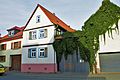
Category:Frankfurter Straße 21 (Ober-Mörlen)
Jump to navigation
Jump to search
| Object location | | View all coordinates using: OpenStreetMap |
|---|
This is the category of the Hessian Kulturdenkmal (cultural monument) with the ID 7352 (Wikidata)
|
| Upload media | |||||
| Instance of | |||||
|---|---|---|---|---|---|
| Location | Ober-Mörlen, Wetteraukreis, Darmstadt Government Region, Hesse, Germany | ||||
| Heritage designation | |||||
 | |||||
Media in category "Frankfurter Straße 21 (Ober-Mörlen)"
This category contains only the following file.
-
 Ober-Mörlen Frankfurter Straße 21.jpg 6,016 × 4,000; 3.85 MB
