Category:Franziskanerkloster Lügde
Jump to navigation
Jump to search
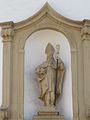
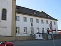
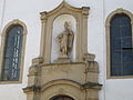
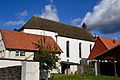
Deutsch: Ehemaliges Franziskanerkloster mit Kirche St. Liborius in Lügde
| Object location | | View all coordinates using: OpenStreetMap |
|---|
This is the category for an architectural monument.
It is on the list of cultural monuments of Lügde, no. 56+57.
It is on the list of cultural monuments of Lügde, no. 56+57.
| Upload media | |||||
| Instance of | |||||
|---|---|---|---|---|---|
| Location |
| ||||
| Inception |
| ||||
| Dissolved, abolished or demolished date |
| ||||
 | |||||
Media in category "Franziskanerkloster Lügde"
The following 17 files are in this category, out of 17 total.
-
 2011-04-24 Lügde (13).JPG 4,000 × 3,000; 2.28 MB
-
 2011-04-24 Lügde (19).JPG 3,000 × 4,000; 1.54 MB
-
 2011-04-24 Lügde (20).JPG 3,000 × 4,000; 1.68 MB
-
 2011-04-24 Lügde (21).JPG 3,000 × 4,000; 2.35 MB
-
 2011-04-24 Lügde (22).JPG 4,000 × 3,000; 2 MB
-
 2011-04-24 Lügde (24).JPG 3,000 × 4,000; 1.63 MB
-
 2011-04-24 Lügde (25).JPG 4,000 × 3,000; 2.48 MB
-
 2011-04-24 Lügde (27).JPG 4,000 × 3,000; 2.7 MB
-
 2011-04-24 Lügde (32).JPG 4,000 × 3,000; 2.63 MB
-
 2011-04-24 Lügde (35).JPG 4,000 × 3,000; 2.35 MB
-
 Lüdge ehem Kloster.jpg 823 × 597; 265 KB
-
 Lügde - 2022-06-16 - Franziskanerkloster (DSC 8619).jpg 4,500 × 3,480; 8.9 MB
-
 Lügde - 2022-06-16 - Franziskanerkloster (DSC 8620).jpg 2,871 × 4,500; 7.26 MB
-
 Lügde - 56 - Mittlere Str. 2 (1).jpg 4,340 × 3,120; 3.2 MB
-
 Lügde - 56 - Mittlere Str. 2 (3).jpg 4,608 × 3,072; 2.64 MB
-
 Lügde - 56 - Mittlere Str. 2.jpg 4,608 × 3,072; 4.09 MB
-
 Lügde, ehemaliges Franziskanerkloster.jpg 795 × 597; 158 KB
.JPG)
.JPG)
.JPG)
.JPG)
.JPG)
.JPG)
.JPG)
.JPG)
.JPG)
.JPG)

.jpg)
.jpg)
.jpg)
.jpg)


Categories:
- Cultural heritage monuments in Lügde
- Churches in Lügde
- Franciscan friaries in North Rhine-Westphalia
- Former monasteries in North Rhine-Westphalia
- Baroque architecture in North Rhine-Westphalia
- Saint Liborius churches in Germany
- Franz Christoph Nagel
- Lügde (district)
- 12th-century churches in Ostwestfalen-Lippe
- Romanesque churches in Ostwestfalen-Lippe
- 18th-century churches in Ostwestfalen-Lippe
- Baroque churches in Ostwestfalen-Lippe