Category:Frating
Aller à la navigation
Aller à la recherche
English: Frating is a village and small civil parish of the Tendring district of Essex. It is about northwest of Clacton-on-Sea. The parish includes the settlements of Frating Green and Hockley.
village britannique  | |||||
| Téléverser des médias | |||||
| Nature de l’élément | |||||
|---|---|---|---|---|---|
| Lieu | Tendring, Essex, Angleterre de l'Est, Angleterre | ||||
 | |||||
Sous-catégories
Cette catégorie comprend 2 sous-catégories, dont les 2 ci-dessous.
F
- Frating Church (3 F)
Média dans la catégorie « Frating »
Cette catégorie comprend 27 fichiers, dont les 27 ci-dessous.
-
 B1029 at Slough House Farm - geograph.org.uk - 302558.jpg 640 × 426 ; 97 kio
-
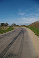
 B1029 towards Brightlingsea - geograph.org.uk - 2942941.jpg 640 × 480 ; 80 kio
-
 Burr's Farm - geograph.org.uk - 2942970.jpg 640 × 480 ; 68 kio
-
 Church House, Frating - geograph.org.uk - 2234970.jpg 4 000 × 3 000 ; 2,91 Mio
-
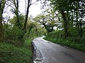
 A bend in Church Road Bites Back^ - geograph.org.uk - 395385.jpg 426 × 640 ; 76 kio
-
 Close up, Elizabeth II postbox, Frating Hill - geograph.org.uk - 5376425.jpg 1 224 × 2 562 ; 574 kio
-
 Crossroads on Main Road, Frating Green - geograph.org.uk - 5336682.jpg 3 264 × 2 448 ; 2,11 Mio
-

-
 Elizabeth II postbox, Frating Hill - geograph.org.uk - 5376424.jpg 2 136 × 2 848 ; 1,21 Mio
-
 Entrance to Frating Hall Farm - geograph.org.uk - 2234971.jpg 4 000 × 3 000 ; 2,91 Mio
-
 Farm on Main Road, Frating - geograph.org.uk - 5340708.jpg 3 164 × 2 310 ; 2 Mio
-
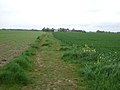
 Farm track off Rectory Road - geograph.org.uk - 2942946.jpg 640 × 480 ; 67 kio
-
 Farmland off Frating Road - geograph.org.uk - 2942965.jpg 640 × 480 ; 64 kio
-
 Farmland, Frating Green - geograph.org.uk - 2942931.jpg 640 × 480 ; 76 kio
-
 Farmland, The Cedars Farm - geograph.org.uk - 2942937.jpg 640 × 480 ; 67 kio
-
 Frating Hill - geograph.org.uk - 123131.jpg 480 × 640 ; 69 kio
-
 Frating Hill - geograph.org.uk - 5376426.jpg 2 848 × 2 136 ; 1,19 Mio
-
 Frating Road (B1029), towards Brightlingsea - geograph.org.uk - 2942968.jpg 640 × 480 ; 85 kio
-
 Frating Village Hall - geograph.org.uk - 123147.jpg 640 × 480 ; 79 kio
-
 Frating Village Sign - geograph.org.uk - 2752378.jpg 2 000 × 1 500 ; 959 kio
-
 Gated track into woodland - geograph.org.uk - 2942957.jpg 640 × 480 ; 137 kio
-
 Rectory Road towards Frating - geograph.org.uk - 2942950.jpg 640 × 480 ; 121 kio
-
 Rectory Road towards Frating - geograph.org.uk - 2942962.jpg 640 × 480 ; 122 kio
-
 Track to Morehams Hall - geograph.org.uk - 2942929.jpg 640 × 480 ; 68 kio
-
 Track to The Cedars Farm - geograph.org.uk - 2942934.jpg 640 × 480 ; 79 kio
-
 Tree at bend in Church Road, Frating - geograph.org.uk - 2234969.jpg 4 000 × 3 000 ; 2,86 Mio
-
 Morehams Hall - geograph.org.uk - 196631.jpg 640 × 480 ; 119 kio


.jpg)


,_towards_Brightlingsea_-_geograph.org.uk_-_2942968.jpg)


