Category:Front Range
Zur Navigation springen
Zur Suche springen
Gebirgszug in den USA, Teil der Rocky Mountains  | |||||
| Medium hochladen | |||||
| Ist ein(e) | |||||
|---|---|---|---|---|---|
| Ist Teil von |
| ||||
| Ort | |||||
| Gebirgszug | |||||
| Höchster Punkt | |||||
| Höhe über dem Meeresspiegel |
| ||||
| Verschieden von | |||||
 | |||||
English: The Front Range — located in central Colorado and southeastern Wyoming, in the western United States.
Español: Cordillera Front — de las Montañas Rocosas.
Unterkategorien
Es werden 62 von insgesamt 62 Unterkategorien in dieser Kategorie angezeigt:
In Klammern die Anzahl der enthaltenen Kategorien (K), Seiten (S), Dateien (D)
- Platte River Mountains (6 D)
*
A
- Arapahoe Basin (14 D)
B
- Mount Bailey (Colorado) (2 D)
- Mount Bethel (Colorado) (2 D)
C
D
E
- Eldorado Mountain (22 D)
- Engelmann Peak (3 D)
F
G
- Mount Guyot (Colorado) (5 D)
H
- Hallett Peak (18 D)
- Horsetooth Mountain (9 D)
J
- Mount Jasper (3 D)
K
- Kenosha Pass (18 D)
L
M
- Mount Morrison (Colorado) (9 D)
- Mount Cutler (Colorado) (3 D)
N
- Mount Neva (Colorado) (4 D)
P
- Parry Peak (4 D)
R
- Rocky Mountains (MFA NNL) (5 D)
S
- The Sawtooth (7 D)
- Mount Silverheels (4 D)
- Mount Sniktau (4 D)
- Southwest Lenawee (3 D)
- Mount Spalding (7 D)
T
- Thorodin Mountain (4 D)
- Torreys Peak (18 D)
- Trout Creek Pass (1 D)
- Twin Sisters Peaks (4 D)
W
Z
Medien in der Kategorie „Front Range“
Folgende 198 Dateien sind in dieser Kategorie, von 198 insgesamt.
-
 1-Carter-Lake-larimer-county.JPG 3.264 × 2.448; 1,98 MB
-
 1-carter-lake-waterpipe.JPG 3.264 × 2.448; 1,93 MB
-
 13ers CO.JPG 4.320 × 2.797; 1,81 MB
-
 2001-06 - Echo Lake Park from above.jpg 800 × 600; 140 KB
-
 2007-06-17-evans-dusk.jpg 708 × 500; 108 KB
-
 2010 Denver and Front Range 01.jpg 2.816 × 2.112; 2,07 MB
-
 2010 Denver and Front Range 02.jpg 2.816 × 2.112; 1,98 MB
-
 Air Force comes to table with First Nations (3346427).jpeg 4.833 × 2.521; 2,39 MB
-
 Air Force comes to table with First Nations (3346432).jpeg 4.816 × 2.578; 2,79 MB
-
 Air Force comes to table with First Nations (3346434).jpeg 1.800 × 1.200; 821 KB
-
 Along the Peak to Peak Highway.jpg 4.527 × 2.631; 2,57 MB
-
 Argentine Central Summit.jpg 553 × 325; 68 KB
-
 Argentine Peak (Colorado) - 2006-07-16.jpg 3.008 × 2.000; 5,51 MB
-
 Baker Mountain on the way to Grizzly Peak.jpg 3.008 × 2.000; 2,37 MB
-
 Baseline Road (Colorado).JPG 5.522 × 3.706; 12,27 MB
-
 Bear Creek Canyon Scenic Mountain Drive.JPG 3.450 × 2.107; 5,13 MB
-
 Berrian Mountain from Meyer Ranch Park.jpg 2.848 × 2.136; 2,12 MB
-
 Bighorn Flats Aug 016.jpg 5.152 × 3.864; 9,86 MB
-

-
 Bison herd at Genesee Park-2012 03 10 0599.jpg 4.272 × 2.848; 3,85 MB
-
 Bison herd at Genesee Park-2012 03 10 0601.jpg 4.272 × 2.848; 2,98 MB
-
 Bison herd at Genesee Park-2012 03 10 0605.jpg 4.272 × 2.848; 5,7 MB
-
 Bison herd at Genesee Park-2012 03 10 0606.jpg 4.272 × 2.848; 3,14 MB
-
 Boreas Mountain from Boreas Pass.jpg 4.330 × 1.479; 1,61 MB
-
 Boulder CO at twilight.jpg 800 × 533; 73 KB
-
 Breckinridge Peak, Clear Creek Co, CO.jpg 2.848 × 2.136; 1,81 MB
-
 Broadmoor lake panorama to west.jpg 3.631 × 1.312; 1.015 KB
-
 Chatfield State Park.JPG 6.000 × 4.000; 14,86 MB
-

-
 Cherry Creek State Park (2837173960).jpg 2.047 × 1.365; 366 KB
-
 Chiefs Head Peak from Longs Peak.jpg 4.937 × 1.718; 1,94 MB
-
 Chiefs Head Peak.jpg 2.432 × 1.614; 1,44 MB
-
 CHPark4.jpg 1.280 × 960; 579 KB
-
 Churches Ranch.JPG 5.184 × 3.001; 11,54 MB
-
 Citadel Peak on the way to Grizzly Peak.jpg 3.008 × 2.000; 3,09 MB
-
 Co mount.JPG 4.320 × 3.240; 2 MB
-
 CO SH-72 SawtoothMt PeacefulValley 20090825.jpg 2.592 × 1.944; 4,89 MB
-
 CO SH-72 SawtoothMt PeacefulValley2 20090825.jpg 1.894 × 1.382; 2,6 MB
-
 Colfax Avenue West, Denver - NARA - 544793.jpg 2.960 × 1.980; 2,19 MB
-
 Colorado - Berthoud Pass.jpg 1.050 × 647; 367 KB
-
 Colorado Front Range View from Route 119.JPG 3.072 × 2.048; 2,45 MB
-
 Colorado Peak to Peak Highway 1.JPG 3.888 × 2.592; 2,93 MB
-
 Colorado rocky mtns.JPG 2.048 × 1.536; 1,02 MB
-
 Colorado State Highway 42.jpg 1.280 × 960; 359 KB
-
 Colorado's Front Range from Barr Lake - Part 2 (25825261276).jpg 4.272 × 1.201; 2,23 MB
-
 Condiv.JPG 4.320 × 2.746; 1,87 MB
-
 Cone Mtn, Clear Creek Co, CO.jpg 1.936 × 1.456; 430 KB
-
 Continental divide seen from Gold Hill, Colorado.jpg 4.608 × 2.592; 4,77 MB
-
 Cooper Mountain from near the summit of Grays Peak.jpg 2.053 × 1.373; 832 KB
-
 Crest of Front Range south of Arapaho Park, 1904.tif 2.906 × 2.302; 19,16 MB
-
 Dakota Hogback from US 287 w-Jelm Formation.jpg 640 × 345; 99 KB
-
 Dakota Hogback from US 287 w-Lytle Formation.jpg 571 × 266; 56 KB
-
 Daniels Park.jpg 3.840 × 2.160; 2,13 MB
-
 Denver Colorado 1898 - LOC - restoration1.jpg 5.996 × 1.916; 16,02 MB
-
 Denver Colorado 1898 - LOC - restoration1.png 5.996 × 1.916; 21,8 MB
-
 Denver Colorado 1898 LOC 09570u.jpg 5.836 × 1.788; 2,14 MB
-
 Denver Skyline in Winter.JPG 2.779 × 966; 700 KB
-
 Denver-mountains.jpg 1.280 × 960; 479 KB
-
 Descent from Kenosha Pass, south side.jpg 1.800 × 1.350; 632 KB
-
 Dinosaur Ridge Open Space Park 01.jpg 907 × 777; 295 KB
-
 Dinosaur Ridge Open Space Park 02.jpg 1.600 × 1.200; 480 KB
-
 Dinosaur Ridge Open Space Park 03.jpg 1.600 × 1.200; 450 KB
-
 Dinosaur Ridge Open Space Park 04.jpg 1.600 × 1.200; 622 KB
-
 Doublehead Mountain from Legault Mountain.jpg 2.848 × 2.136; 1,79 MB
-
 Downtown Winter Park, Colorado 2005.jpg 2.160 × 1.440; 662 KB
-
 DSCN3707 frontrangeandsouthpark e 600.jpg 600 × 331; 54 KB
-
 DSCN5380 horsetoothmountainwithhorse e.jpg 600 × 369; 68 KB
-
 EchoLake2.JPG 604 × 451; 65 KB
-
 Eldorado Canyon State Park.JPG 5.184 × 3.395; 12,78 MB
-
 Eldorado Springs, Colorado.JPG 4.912 × 2.902; 12,99 MB
-
 Elitch gardens from Denver.jpg 3.199 × 1.762; 4,52 MB
-
 Entrance to Coal Creek Canyon.JPG 4.593 × 2.526; 7,52 MB
-

-
 Fireworks in Fort Collins Colorado for Independence Day.jpg 4.816 × 1.979; 1,28 MB
-
 Flag Staff Fire from South Boulder 104pm.jpg 5.760 × 3.840; 4,28 MB
-
 Flag Staff Fire from South Boulder 109pm.jpg 5.760 × 3.840; 3,35 MB
-
 Flatiron Crossing Village Broomfield.jpg 3.648 × 2.736; 3,94 MB
-
 Flatirons and frontrange - panoramio.jpg 9.371 × 2.004; 2,62 MB
-
 Folsom Field panorama from club level seats 2007.jpg 8.123 × 1.728; 1,94 MB
-
 FoothillsCO.JPG 4.000 × 3.000; 2,64 MB
-
 Fort Lupton, Colorado.JPG 3.975 × 2.247; 7,31 MB
-
 Fraser Valley zoom.jpg 1.048 × 736; 320 KB
-
 Fraser Valley.jpg 2.592 × 1.944; 1,55 MB
-
 Front Range Airmen graduates with CCAF (5535453).jpeg 7.055 × 5.039; 1,76 MB
-
 Front Range and I-70 from Genesee Park.jpg 3.808 × 2.096; 3,57 MB
-
 Front Range Denver, CO.gif 620 × 430; 130 KB
-
 Front range divide.JPG 4.320 × 2.803; 1,58 MB
-
 Front Range of the Rockies from United 793 (6305381628).jpg 1.600 × 1.200; 316 KB
-
 Front Range of the Rocky Mountains in Wyoming and Colorado.jpg 673 × 667; 144 KB
-
 Front Range south of Arapaho Peak.tif 2.906 × 2.322; 19,33 MB
-
 Front Range, Near Fairplay, Colorado (14024041559).jpg 4.000 × 3.000; 7,59 MB
-
 Front Range, Near Fairplay, Colorado (14024043069).jpg 4.000 × 3.000; 2,63 MB
-
 Front Range, Near Fairplay, Colorado (14024078530).jpg 4.000 × 3.000; 3,12 MB
-
 Front Range, Near Fairplay, Colorado (14207416111).jpg 4.000 × 3.000; 7,11 MB
-
 Front Range, Near Fairplay, Colorado (14207417801).jpg 4.000 × 3.000; 2,81 MB
-
 Frontrange2.jpg 3.264 × 1.832; 1,92 MB
-
 GasWellDenverBasinCO.jpg 625 × 388; 23 KB
-
 GeeseatSloanslake.jpg 2.008 × 1.187; 831 KB
-
 Going up Turkey Creek Canyon, US 285 southbound.jpg 600 × 800; 149 KB
-
 Grant, Colorado.JPG 3.391 × 1.464; 3,74 MB
-
 Guanella pass from bierstadt.jpg 3.072 × 2.304; 565 KB
-
 Harriman Lake Park sign.jpg 758 × 571; 132 KB
-
 High Park Fire, 2012020-FS-UNK-0017.jpg 2.272 × 1.704; 1,73 MB
-
 High Park Fire, 20120616-OSEC-DS-0013.jpg 4.288 × 2.848; 7,26 MB
-
 High Rockies SRTM30.JPG 500 × 607; 64 KB
-
 Horsetooth Mountain 10-10 (21530756194).jpg 5.677 × 3.783; 7 MB
-
 Horsetooth Mountain 10-10 (21530761154).jpg 5.709 × 3.805; 6,51 MB
-
 Horsetooth Mountain 10-10 (21530807234).jpg 4.883 × 3.255; 5,09 MB
-
 Horsetooth Mountain 10-10 (21532486713).jpg 4.890 × 3.260; 5,81 MB
-
 Horsetooth Mountain 10-10 (21532498673).jpg 5.760 × 3.840; 7,55 MB
-
 Horsetooth Mountain 10-10 (21532508913).jpg 5.760 × 3.840; 9,55 MB
-
 Horsetooth Mountain 10-10 (22140962762).jpg 4.415 × 3.036; 4,83 MB
-
 Horsetooth Mountain 10-10 (22140993012).jpg 2.209 × 2.132; 1,09 MB
-
 Horsetooth Mountain Park 12-4 (31337641390).jpg 5.256 × 3.504; 4,81 MB
-
 Horsetooth Mountain Park 12-4 (31337656000).jpg 5.760 × 3.840; 7,25 MB
-
 Horsetooth Mountain Park 12-4 (31337668190).jpg 3.840 × 5.760; 6,91 MB
-
 Horsetooth Mountain Park 12-4 (31564025472).jpg 5.760 × 3.840; 6,46 MB
-
 Horsetooth Mountain Park 12-4 (31564029692).jpg 3.674 × 2.981; 3,5 MB
-
 Horsetooth Mountain Park 12-4 (31594985741).jpg 5.760 × 3.840; 9,44 MB
-
 Horsetooth Mountain Park 12-4 (31673344186).jpg 5.760 × 3.840; 7,49 MB
-
 Image Wpdms nasa topo front range.jpg 356 × 345; 36 KB
-
 Indianpeakspanorama.jpg 1.520 × 368; 150 KB
-
 James Peak at dawn.jpg 2.168 × 928; 207 KB
-
 Kelso Mountain from Grays Peak, snow.jpg 480 × 640; 102 KB
-
 Ken Caryl, Colorado.JPG 4.282 × 2.055; 7,19 MB
-
 Kenosha2.jpg 800 × 600; 372 KB
-
 Keystone Peak(Mountain).jpg 2.816 × 2.112; 2,53 MB
-
 Legault Mountain at Meyer Ranch Park.jpg 2.848 × 2.136; 1,83 MB
-
 Lone Rock US285.jpg 800 × 600; 62 KB
-
 Longs Peak group (Colorado).jpg 2.487 × 1.139; 769 KB
-
 Longs Peak, Chiefs Head Peak, Thatchtop.jpg 2.895 × 1.647; 1,4 MB
-
 Looking back toward the summit of The Outback, Keystone.jpg 2.816 × 2.112; 2,63 MB
-
 Lookout Moutain West View.jpg 1.650 × 683; 892 KB
-
 Loveland Pass, Colorado.jpg 1.280 × 960; 530 KB
-
 LovelandSkiAreaLift1.jpg 2.848 × 2.136; 1,47 MB
-
 LP over resorts.jpg 14.025 × 2.125; 7,54 MB
-
 Lunar eclipse of 2015 April 4.JPG 4.847 × 2.407; 2,82 MB
-
 Martin Marietta Materials.JPG 5.123 × 2.784; 8,85 MB
-
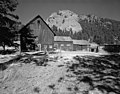 McGraw Ranch barn.jpg 908 × 711; 187 KB
-
 Mount Bethel (Colorado).jpg 2.681 × 1.705; 933 KB
-
 Mount Bierstadt, Sawtooth, Mount Evans (10579983656).jpg 4.272 × 2.848; 5,07 MB
-
 Mount Evans Scenic Byway.jpg 4.000 × 3.000; 3,01 MB
-
 Mount Jasper in Colorado.jpg 1.726 × 921; 634 KB
-
 Mount Parnassus from Loveland Ski Area.jpg 2.848 × 2.136; 1,96 MB
-
 Mount Silverheels and Volz from the NE.jpg 5.184 × 3.456; 2,03 MB
-

-

-

-
 Mountains from westlands.jpg 13.433 × 2.649; 4,23 MB
-
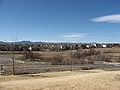 Mountains viewed from Westminster.jpg 2.816 × 2.112; 1,63 MB
-
 Mt Edwards from the NE.jpg 2.848 × 2.136; 2 MB
-
 Mt Morrison from Mt Glennon.jpg 1.280 × 960; 400 KB
-
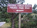 National Forest Access Pingree Park Road sign.jpg 2.592 × 1.944; 1,29 MB
-
 National Forest road sign in Colorado's Front Range.jpg 2.592 × 1.944; 1,26 MB
-
 Never Summer is True (5917638894).jpg 2.376 × 1.584; 1,26 MB
-
 North Fork South Platte River.JPG 5.184 × 3.456; 9,38 MB
-
 Oak (RTD).JPG 5.184 × 3.224; 7,48 MB
-
 OuzelLake Colorado.jpg 768 × 1.144; 748 KB
-
 Panorama Point Oct 16.jpg 5.152 × 3.864; 8,51 MB
-
 Peaktopeak.JPG 3.072 × 2.107; 1,07 MB
-
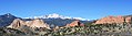 Pikes Peak and Garden of the Gods (25846068782).jpg 3.547 × 977; 2,06 MB
-
 Planes lined up at Denver International Airport.JPG 5.176 × 2.853; 12,49 MB
-
 Ppgog.JPG 4.000 × 2.611; 2,1 MB
-
 Rain clouds near the Front Range.jpg 3.864 × 3.162; 4,28 MB
-
 Rampart Range.JPG 3.750 × 2.431; 1,24 MB
-
 Rockies visible from CU Boulder.jpg 1.597 × 743; 232 KB
-
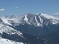
 Rocky Mountains CO summer.jpg 1.904 × 1.391; 1,04 MB
-
 Rocky Mountains West of Pikes Peak.JPG 2.592 × 1.944; 1,43 MB
-
 Rocky mtn panorma.jpg 4.140 × 1.086; 806 KB
-
 Ruby Mountain, Colorado.jpg 2.689 × 1.754; 1,41 MB
-
 Ruby Mountain, north aspect.jpg 4.746 × 1.886; 1,8 MB
-
 Salida Depot 1910.jpg 518 × 300; 27 KB
-
 Shawnee, Colorado.JPG 3.367 × 1.783; 5,85 MB
-
 Slate Creek Bridge.jpg 500 × 333; 64 KB
-
 Sloanslakewinter.gif 2.252 × 1.344; 1,42 MB
-
 Snow Creek Fire, Mt Lindo, Morrison, CO 2022-07-12.jpg 1.772 × 1.110; 209 KB
-
 Snowdrift Tundra Aug 016.jpg 5.152 × 3.864; 9,37 MB
-
 Snowy Mountains.jpg 3.072 × 2.048; 3,89 MB
-

-
 South Park from Kenosha Pass.jpg 5.202 × 3.465; 12,58 MB
-
 South-arapaho-pass.jpg 2.048 × 1.365; 1.018 KB
-
 Squaw Mountain from the entrance to Echo Mountain.jpg 1.944 × 2.592; 740 KB
-
 Standley Lake.JPG 5.184 × 2.801; 11,09 MB
-
 Sugarloaf Mountain in Colorado.jpg 2.048 × 1.365; 642 KB
-
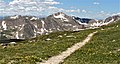
 Trail on the way to Grizzly Peak.jpg 3.008 × 2.000; 3,09 MB
-
 Tremont Mountain, Golden Gate Canyon State Park.jpg 1.280 × 851; 595 KB
-
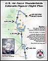 US Air Force Thunderbirds Colorado Flyover Flight Plan 18 April 2020.jpg 767 × 960; 129 KB
-
 US285SBCOSimmsbridgeview.jpg 730 × 533; 72 KB
-
 US36WBCO47.2.jpg 800 × 600; 62 KB
-
 US6westboundGoldenClearCreekCanyon.jpg 800 × 600; 119 KB
-
 USRoute24WestOfColoradoSpringsColoradoSeptember2011.JPG 3.264 × 2.448; 3,01 MB
-
 View from Colorado Trail, overlooking South Park, near Kenosha Pass.jpg 2.592 × 1.944; 1,65 MB
-
 View of a storm moving through Mount Evans - Abyss Lake - panoramio.jpg 5.616 × 3.744; 12,4 MB
-
 Westminster station (RTD).JPG 4.183 × 2.212; 6,46 MB
-
 Winter Park, CO, Feb'84.JPG 1.330 × 1.039; 138 KB
-
 Decatur Mountain from Peru Fork, by James Collier.jpg 2.737 × 1.581; 1,65 MB
-

-


.jpeg)
.jpeg)
.jpeg)


_-_2006-07-16.jpg)

.JPG)


.jpg)


.jpg)


.jpeg)


.jpg)

.jpg)
.jpg)
.jpg)
.jpg)
.jpg)


.jpg)
.jpg)
.jpg)
.jpg)
.jpg)
.jpg)
.jpg)
.jpg)
.jpg)
.jpg)
.jpg)
.jpg)
.jpg)
.jpg)
.jpg)


.jpg)


.jpg)


.jpg)
.jpg)


.jpg)

.JPG)


.JPG)


.jpg)
.jpg)