Category:Fyfield, Essex
Vai alla navigazione
Vai alla ricerca
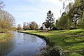
English: Fyfield is a village in the County of Essex, England. It is located 1.5 miles (2.4 km) north-east of Chipping Ongar, 7.9 miles (12.7 km) south-east of Harlow and 8.3 miles (13.3 km) west of Chelmsford.

village in Essex, United Kingdom  | |||||
| Carica un file multimediale | |||||
| Istanza di | |||||
|---|---|---|---|---|---|
| Luogo | Epping Forest, Essex, Est dell'Inghilterra, Inghilterra | ||||
| Considerato essere uguale a | Fyfield (pagina Wikimedia duplicata, parrocchia civile dell'Inghilterra) | ||||
| sito web ufficiale | |||||
 | |||||
Sottocategorie
Questa categoria contiene le 7 sottocategorie indicate di seguito, su un totale di 7.
B
- Black Bull, Fyfield, Essex (6 F)
C
- Cannon's Green (2 F)
F
- Fyfield in April 2015 in Essex (21 F)
L
- Lampetts (1 F)
N
- Norwood End (1 F)
Q
S
File nella categoria "Fyfield, Essex"
Questa categoria contiene 111 file, indicati di seguito, su un totale di 111.
-
 Fyfield Grange from The Black Bull, Fyfield, Essex, England.jpg 6 162 × 2 465; 13,14 MB
-
 A listed cottage at Fyfield, Essex, England - Glebe Cottage, south-west from the church.jpg 5 367 × 3 528; 11,16 MB
-

-

-
 A listed cottage at Fyfield, Essex, England - Walker's Cottage, south-east from the church.jpg 5 472 × 3 648; 14,26 MB
-
 A millpond on the River Roding at Fyfield, Essex, England 01.jpg 5 472 × 3 648; 9,46 MB
-
 A millpond on the River Roding at Fyfield, Essex, England 02.jpg 5 472 × 3 648; 9,25 MB
-
 A new country mansion, Fyfield, Essex - geograph.org.uk - 78843.jpg 640 × 480; 107 KB
-
 A north view of the River Roding at Fyfield, Essex, England.jpg 3 648 × 5 472; 15,24 MB
-
 Agricultural machinery sales, Fyfield - geograph.org.uk - 4202741.jpg 4 320 × 3 240; 3,03 MB
-
 B184 Ongar Road near Fyfield - geograph.org.uk - 6373379.jpg 1 024 × 768; 114 KB
-
 Cannon Green - geograph.org.uk - 5935171.jpg 5 184 × 3 456; 7,41 MB
-
 Church of St Nicholas, Fyfield - geograph.org.uk - 5490175.jpg 640 × 480; 77 KB
-
 Church of St Nicholas, Fyfield - geograph.org.uk - 5943769.jpg 3 776 × 2 520; 3,18 MB
-
 Clatterford End - geograph.org.uk - 5505419.jpg 2 048 × 1 536; 1,51 MB
-
 Crop field off Willingale Road - geograph.org.uk - 5488944.jpg 640 × 480; 68 KB
-

-
 Driveway and footpath near Fyfield - geograph.org.uk - 6373350.jpg 1 024 × 768; 218 KB
-
-
 Driveway near Fyfield - geograph.org.uk - 6373385.jpg 1 024 × 768; 102 KB
-
 Dunmow Road, Fyfield - geograph.org.uk - 5488939.jpg 640 × 480; 57 KB
-
 Dusk on the River Roding at Fyfield - geograph.org.uk - 6373362.jpg 1 024 × 768; 146 KB
-
 Elizabeth II postbox, Fyfield - geograph.org.uk - 5490174.jpg 2 136 × 2 848; 1,15 MB
-
 Environment Agency building, Fyfield - geograph.org.uk - 5488937.jpg 640 × 480; 60 KB
-
 Essex Way Crossing a Large Ploughed Field near Witney Green - geograph.org.uk - 5935185.jpg 5 184 × 3 456; 5,27 MB
-
 Essex Way following the River Roding Upstream - geograph.org.uk - 5934726.jpg 5 184 × 3 456; 5,37 MB
-
 Essex Way heading towards Cannon's Green - geograph.org.uk - 5934734.jpg 5 184 × 3 456; 7,61 MB
-

-
 Field corner relic - geograph.org.uk - 3506200.jpg 640 × 480; 162 KB
-
 Finger post, Norwood End , Essex - geograph.org.uk - 1974713.jpg 640 × 480; 77 KB
-
 Footpath near Miller's Farm - geograph.org.uk - 3506184.jpg 640 × 480; 110 KB
-
 Footpath, Fyfield - geograph.org.uk - 3506489.jpg 640 × 480; 127 KB
-
 Ford across the River Roding - geograph.org.uk - 5943760.jpg 3 776 × 2 520; 4,26 MB
-
 Fyfield as seen from the Essex Way - geograph.org.uk - 5935162.jpg 5 184 × 3 456; 5,78 MB
-
 Fyfield Mill Race, with ducks - geograph.org.uk - 2227009.jpg 640 × 480; 88 KB
-
 Fyfield village entrance - geograph.org.uk - 2226998.jpg 640 × 480; 104 KB
-
 Fyfield village sign - geograph.org.uk - 4202700.jpg 4 320 × 3 240; 3,46 MB
-
 Fyfield village, Essex - geograph.org.uk - 144804.jpg 640 × 480; 57 KB
-
 Fyfield, Post Office and Shops - geograph.org.uk - 4202688.jpg 4 320 × 3 240; 5,2 MB
-
 Glebe Cottage - geograph.org.uk - 3506510.jpg 640 × 480; 100 KB
-
 Hedgerow trees - geograph.org.uk - 3506213.jpg 640 × 480; 91 KB
-
 Herons Lane at the junction of Ongar Road - geograph.org.uk - 5505425.jpg 2 048 × 1 536; 1,48 MB
-
 Herons Lane, near Fyfield - geograph.org.uk - 6373375.jpg 1 024 × 768; 184 KB
-
 House on Moreton Road - geograph.org.uk - 5488931.jpg 640 × 480; 53 KB
-
 House on Moreton Road, Clatterford End - geograph.org.uk - 5505415.jpg 2 048 × 1 536; 1,49 MB
-
 House with Strange Chimney - geograph.org.uk - 4202736.jpg 4 320 × 3 240; 4,17 MB
-
 Houses at Clatterford End - geograph.org.uk - 4202500.jpg 4 320 × 3 240; 5,61 MB
-
 Houses on Moreton Road, Clatterford End - geograph.org.uk - 5610459.jpg 2 000 × 1 470; 864 KB
-
 Houses on Ongar Road, Fyfield - geograph.org.uk - 5488934.jpg 640 × 480; 62 KB
-
 Line of Poplars conceal Willingale Road - geograph.org.uk - 5935159.jpg 5 184 × 3 456; 4,69 MB
-
 Little Forge, Fyfield - geograph.org.uk - 4202725.jpg 4 320 × 3 240; 4,28 MB
-
 Model cyclist, The Black Bull, Fyfield - geograph.org.uk - 4202728.jpg 4 320 × 3 240; 4,7 MB
-
 Moreton Road at the junction of Ongar Road - geograph.org.uk - 5505422.jpg 2 048 × 1 536; 1,5 MB
-
 Moreton Road towards Fyfield - geograph.org.uk - 5488933.jpg 640 × 480; 57 KB
-
 Moreton Road, Clatterford End - geograph.org.uk - 5508393.jpg 2 048 × 1 536; 1,5 MB
-
 National Cycle Route 1 - geograph.org.uk - 5488930.jpg 640 × 480; 100 KB
-
 New footbridge on the Essex Way - geograph.org.uk - 5943755.jpg 3 776 × 2 520; 3,12 MB
-
 Norwood End - geograph.org.uk - 3506207.jpg 640 × 480; 99 KB
-
 Oil-seed rape field, Norwood End - geograph.org.uk - 177966.jpg 640 × 480; 103 KB
-
 Ongar Road, Clatterford End - geograph.org.uk - 5610454.jpg 2 048 × 1 536; 1,54 MB
-
 Ongar Road, Clatterford End - geograph.org.uk - 5610455.jpg 2 048 × 1 536; 1,52 MB
-
 Ongar Road, Fyfield - geograph.org.uk - 5505426.jpg 1 990 × 1 454; 806 KB
-
 Ongar Road, Fyfield - geograph.org.uk - 6373369.jpg 1 024 × 768; 97 KB
-
 Ongar Road, Fyfield, near Ongar - geograph.org.uk - 6373371.jpg 1 024 × 768; 165 KB
-
 Ongar Road, Shelley - geograph.org.uk - 5509056.jpg 2 048 × 1 536; 957 KB
-
 Path towards Envilles Farm - geograph.org.uk - 3509197.jpg 640 × 480; 112 KB
-
 Queen Street, Fyfield - geograph.org.uk - 177985.jpg 640 × 475; 74 KB
-
 Queen's Head, Fyfield, near Ongar - geograph.org.uk - 6373366.jpg 1 024 × 768; 114 KB
-
 Rape field near Fyfield - geograph.org.uk - 3506167.jpg 640 × 480; 114 KB
-
 Rape field north of Pennyfeathers Farm - geograph.org.uk - 3506177.jpg 640 × 480; 137 KB
-
 River Roding - near Miller's Green - geograph.org.uk - 178879.jpg 640 × 480; 142 KB
-
 River Roding at Fyfield - geograph.org.uk - 178875.jpg 640 × 480; 108 KB
-
 Riverside scene at Fyfield - geograph.org.uk - 1334748.jpg 640 × 480; 105 KB
-
 Road junction, Clatterford End - geograph.org.uk - 3506465.jpg 640 × 480; 113 KB
-
 Road to Witney Green - geograph.org.uk - 5488954.jpg 640 × 480; 69 KB
-
 ROC nuclear monitoring post - geograph.org.uk - 3506458.jpg 640 × 480; 141 KB
-
 Sign for the Queens Head, Fyfield - geograph.org.uk - 5488942.jpg 418 × 640; 49 KB
-
 St Nicholas, Fyfield - Ledger slab - geograph.org.uk - 3490463.jpg 1 000 × 706; 258 KB
-

-

-
 The Essex Way 24, footbridge - geograph.org.uk - 1876757.jpg 640 × 426; 136 KB
-
 The Essex Way 26, Tun Bridge - geograph.org.uk - 1876768.jpg 640 × 426; 125 KB
-
 The Essex Way 28 - geograph.org.uk - 1876780.jpg 640 × 426; 91 KB
-
 The Essex Way 29 - geograph.org.uk - 1876786.jpg 640 × 426; 57 KB
-
 The farmhouse at Pennyfeathers Farm - geograph.org.uk - 704516.jpg 640 × 405; 61 KB
-
 The Queens Head, Fyfield - geograph.org.uk - 5488940.jpg 640 × 480; 60 KB
-
 The river Roding at Fyfield - geograph.org.uk - 1334734.jpg 640 × 480; 130 KB
-
 The way to the end of Norwood End - geograph.org.uk - 3509186.jpg 640 × 480; 146 KB
-
 Track to Dunstans Farm - geograph.org.uk - 5488928.jpg 640 × 480; 125 KB
-
 Track to Hall - geograph.org.uk - 964353.jpg 640 × 426; 70 KB
-
 Tun Bridge - geograph.org.uk - 5934730.jpg 5 184 × 3 456; 6,98 MB
-
 Westwood House - geograph.org.uk - 3506196.jpg 640 × 480; 92 KB
-
 Willingale Road - geograph.org.uk - 5488945.jpg 640 × 480; 101 KB
-
 Willingale Road - geograph.org.uk - 5488958.jpg 640 × 480; 113 KB
-
 Willingale Road, Fyfield - geograph.org.uk - 6373353.jpg 1 024 × 768; 184 KB
-
 Willingale Road, Fyfield, near Ongar - geograph.org.uk - 6373357.jpg 1 024 × 768; 186 KB
-
 Witney Green - geograph.org.uk - 5488952.jpg 640 × 480; 55 KB
-
 Witney Green - geograph.org.uk - 5935197.jpg 5 184 × 3 456; 5,2 MB
-
 A view of Witney Green, close to Fyfield - geograph.org.uk - 715543.jpg 640 × 480; 113 KB
-
 Clatterford End, Fyfield, Essex - geograph.org.uk - 78849.jpg 640 × 480; 88 KB
-
 Compost Production, Fyfield, Essex - geograph.org.uk - 78860.jpg 640 × 480; 87 KB
-
 Cross Lees Farm - geograph.org.uk - 105077.jpg 640 × 480; 75 KB
-
 Farm Cottage, Norwood End - geograph.org.uk - 177964.jpg 640 × 480; 163 KB
-
 Farm Track near Witney Woods - geograph.org.uk - 177959.jpg 640 × 480; 79 KB
-
 Fyfield Millpond - geograph.org.uk - 177983.jpg 640 × 480; 121 KB
-
 Heron's Farm, near Fyfield - geograph.org.uk - 177953.jpg 640 × 480; 59 KB
-
 Heron's Lane near Fyfield - geograph.org.uk - 177955.jpg 640 × 480; 89 KB
-
 Linking Footpath, Canon's Green - geograph.org.uk - 177958.jpg 640 × 480; 87 KB
-
 Nor Wood and wheatfield - geograph.org.uk - 178873.jpg 640 × 480; 97 KB
-
 Remnants of an airfield - geograph.org.uk - 105079.jpg 640 × 480; 77 KB
-
 Tun Bridge, near Fyfield - geograph.org.uk - 422813.jpg 506 × 640; 101 KB


_off_Willingale_Road_-_geograph.org.uk_-_5488961.jpg)


.jpg)
.jpg)


