Category:Gammel Kongsgård (Lejre Kommune)
Jump to navigation
Jump to search
building in Lejre Municipality, Denmark  | |||||
| Upload media | |||||
| Instance of | |||||
|---|---|---|---|---|---|
| Part of | |||||
| Location | Gammel Lejre, Lejre Municipality, Region Zealand, Denmark | ||||
| Street address |
| ||||
 | |||||
Media in category "Gammel Kongsgård (Lejre Kommune)"
The following 12 files are in this category, out of 12 total.
-
 G Lejre Kongsgaard P3190031.JPG 2,288 × 1,712; 2.13 MB
-
 Gammel Kongsgård - nordfløj 01.jpg 5,184 × 3,888; 7.08 MB
-
 Gammel Kongsgård - udhus 02.jpg 2,534 × 1,901; 1.12 MB
-
 Gammel Kongsgård - udhus 04.jpg 2,694 × 2,020; 1.22 MB
-
 Gammel Kongsgård - udhus 05.jpg 4,401 × 3,301; 3.27 MB
-
 Gammel Kongsgård - udhus.jpg 2,236 × 1,677; 923 KB
-
 Gammel Kongsgård 01.jpg 3,948 × 2,961; 3.46 MB
-
 Gammel Kongsgård 02.jpg 3,795 × 2,846; 2.56 MB
-
 Gammel Kongsgård 03.jpg 3,380 × 2,536; 2.5 MB
-
 Gammel Kongsgård 05.jpg 3,977 × 2,983; 3.21 MB
-
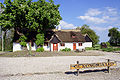
 Gl Kongsgaard.jpg 900 × 477; 465 KB
-
 Gl-Kongsgaard.jpg 1,200 × 796; 1,004 KB


