Category:Gardenstown
Vai alla navigazione
Vai alla ricerca
località della Scozia  | |||||
| Carica un file multimediale | |||||
| Istanza di | |||||
|---|---|---|---|---|---|
| Luogo |
| ||||
| Popolazione |
| ||||
| sito web ufficiale | |||||
 | |||||
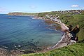
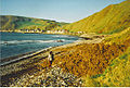
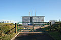
English: Gardenstown is a small village in en:Aberdeenshire, Northeast Scotland. It is known locally as 'Gamrie', from the name of the parish in which it stands. Gardenstown was founded in 1720 by Alexander Garden as a coastal fishing village. Nearby are the remains of the Church of St John the Evangelist which was built in 1513, and celebrates the defeat of the Danes at this site in 1004 in the 'Battle of the Bloody Pits'. A permanent meteorological station is situated at Gardenstown. The village's main economic base is fishing; within the village are a pub,and a prof and a bakery, a butcher, a post-office (now closed in the recent closure rounds), an art gallery and a fish restaurant (now also closed).
Sottocategorie
Questa categoria contiene un'unica sottocategoria, indicata di seguito.
G
- Gardenstown Harbour (20 F)
File nella categoria "Gardenstown"
Questa categoria contiene 170 file, indicati di seguito, su un totale di 170.
-

-
 Beach at Gardenstown - geograph.org.uk - 3749447.jpg 640 × 480; 103 KB
-
 Beach at Gardenstown - geograph.org.uk - 3749450.jpg 640 × 480; 76 KB
-
 Beach at Gardenstown - geograph.org.uk - 3749451.jpg 640 × 480; 68 KB
-
 Beach, Seatown - geograph.org.uk - 4520188.jpg 800 × 534; 222 KB
-
 Cat in Gardenstown - geograph.org.uk - 1060443.jpg 640 × 480; 62 KB
-
 Craigandargity, off Gardenstown - geograph.org.uk - 4625979.jpg 640 × 405; 59 KB
-
 Crovie from the Gardenstown shore - geograph.org.uk - 4271594.jpg 1 600 × 1 200; 314 KB
-
 Crovie, Banffshire - geograph.org.uk - 1267831.jpg 454 × 640; 56 KB
-
 Enjoying the Beach - geograph.org.uk - 4021239.jpg 640 × 417; 371 KB
-
 Gamrie - geograph.org.uk - 374741.jpg 640 × 427; 199 KB
-
 Gamrie Bay - geograph.org.uk - 4020700.jpg 640 × 377; 364 KB
-
 Gamrie Bay - geograph.org.uk - 4021126.jpg 640 × 427; 420 KB
-
 Gamrie Bay and Crovie Head from the seashore at Gardenstown - geograph.org.uk - 2252564.jpg 3 504 × 1 971; 3,79 MB
-
 Gamrie Beach - geograph.org.uk - 4021159.jpg 640 × 427; 349 KB
-
 Gamrie Parish Church - geograph.org.uk - 285019.jpg 640 × 426; 85 KB
-
 Gamrie Parish Kirk - geograph.org.uk - 374811.jpg 640 × 313; 164 KB
-
 Gardenstown - geograph.org.uk - 4021144.jpg 640 × 427; 392 KB
-
 Gardenstown - geograph.org.uk - 594004.jpg 640 × 332; 188 KB
-
 Gardenstown - geograph.org.uk - 6444876.jpg 4 032 × 1 960; 3,2 MB
-
 Gardenstown Aberdeenshire - geograph.org.uk - 3237971.jpg 2 272 × 1 704; 903 KB
-
 Gardenstown and harbour - geograph.org.uk - 5050645.jpg 4 200 × 1 657; 6,22 MB
-
 Gardenstown and its Harbour - geograph.org.uk - 6323750.jpg 4 000 × 3 000; 2,89 MB
-
 Gardenstown and St John's Kirk - geograph.org.uk - 434571.jpg 640 × 427; 281 KB
-
 Gardenstown Beach - geograph.org.uk - 4021140.jpg 640 × 427; 402 KB
-
 Gardenstown beach 3.JPG 1 000 × 750; 167 KB
-
 Gardenstown beach and cliff.JPG 1 000 × 750; 71 KB
-
 Gardenstown beach and cliffs.JPG 1 000 × 750; 111 KB
-
 Gardenstown beach cave.JPG 3 968 × 2 976; 4,06 MB
-
 Gardenstown beach landscape.JPG 3 968 × 2 976; 4,36 MB
-
 Gardenstown beach rocks.JPG 1 000 × 750; 153 KB
-
 Gardenstown beach scenery.JPG 1 000 × 750; 164 KB
-
 Gardenstown beach stream 4.JPG 3 968 × 2 976; 7,07 MB
-
 Gardenstown beach stream.JPG 200 × 150; 16 KB
-
 Gardenstown beach-2.JPG 1 000 × 750; 107 KB
-
 Gardenstown beach.JPG 1 000 × 750; 154 KB
-
 Gardenstown Church of Scotland - geograph.org.uk - 594013.jpg 640 × 416; 242 KB
-
 Gardenstown from the Sea.jpg 640 × 314; 160 KB
-
 Gardenstown Harbour - geograph.org.uk - 106553.jpg 384 × 640; 130 KB
-
 Gardenstown Harbour - geograph.org.uk - 3749442.jpg 1 600 × 1 200; 755 KB
-
 Gardenstown Harbour - geograph.org.uk - 593921.jpg 474 × 640; 273 KB
-
 Gardenstown Harbour - geograph.org.uk - 6484939.jpg 1 799 × 1 199; 325 KB
-
 Gardenstown Harbour - geograph.org.uk - 6484940.jpg 1 799 × 1 199; 400 KB
-
 Gardenstown Harbour from above - geograph.org.uk - 593981.jpg 640 × 399; 233 KB
-
 Gardenstown harbour seen from St Johns - geograph.org.uk - 1060464.jpg 640 × 480; 112 KB
-
 Gardenstown harbour, Aberdeenshire - geograph.org.uk - 6257876.jpg 4 608 × 3 456; 3,03 MB
-
 Gardenstown in winter, high tide.JPG 3 968 × 2 976; 4,13 MB
-
 Gardenstown in winter, waves.JPG 3 968 × 2 976; 4,19 MB
-
 Gardenstown in winter.JPG 3 968 × 2 976; 4,61 MB
-
 Gardenstown Old Red Sandstone - geograph.org.uk - 178600.jpg 640 × 480; 116 KB
-
 Gardenstown School. - geograph.org.uk - 285025.jpg 640 × 426; 83 KB
-
 Gardenstown sea and rocks.JPG 1 000 × 750; 98 KB
-
 Gardenstown sea weeds.JPG 1 000 × 750; 146 KB
-
 Gardenstown sea.JPG 1 000 × 750; 147 KB
-
 Gardenstown seaside.JPG 3 968 × 2 976; 4,21 MB
-
 Gardenstown village - geograph.org.uk - 6209571.jpg 2 592 × 1 944; 1,52 MB
-
 Gardenstown – Houses by Gamrie Bay seashore (Seatown) - geograph.org.uk - 2252714.jpg 3 504 × 1 971; 3,69 MB
-
 Gardenstown, harbour pollution - geograph.org.uk - 945452.jpg 640 × 480; 44 KB
-
 Gardenstown, January 2005. - geograph.org.uk - 37343.jpg 640 × 480; 63 KB
-
 Gardenstown, low water - geograph.org.uk - 1375122.jpg 640 × 480; 526 KB
-
 Gardenstown-Too close for comfort^^^^ - geograph.org.uk - 47893.jpg 640 × 480; 43 KB
-
 Gardenstown.JPG 3 968 × 2 976; 3,88 MB
-
 God is love at Gardenstown - geograph.org.uk - 4057642.jpg 640 × 391; 174 KB
-

-
 Houses at Gardenstown - geograph.org.uk - 4057638.jpg 640 × 427; 173 KB
-
 Looking down on Gardenstown - geograph.org.uk - 3749453.jpg 640 × 480; 75 KB
-
 Muckle Rock - geograph.org.uk - 593932.jpg 640 × 235; 122 KB
-
 Old Red Sandstone - geograph.org.uk - 4021276.jpg 640 × 416; 409 KB
-
 Rocks outside Gardenstown Harbour - geograph.org.uk - 4619048.jpg 640 × 406; 60 KB
-
 Rocky Shore - geograph.org.uk - 4021132.jpg 640 × 424; 413 KB
-
 Rocky shore at Gardenstown - geograph.org.uk - 178594.jpg 640 × 480; 110 KB
-
 Seatown - Gardenstown - geograph.org.uk - 4266119.jpg 1 800 × 1 164; 1,54 MB
-
 Secularised old church near Gamrie - geograph.org.uk - 14988.jpg 640 × 480; 69 KB
-
 Silverford - geograph.org.uk - 434882.jpg 640 × 427; 250 KB
-
 St John's Church - geograph.org.uk - 4619059.jpg 640 × 322; 97 KB
-
 St John's Kirk - geograph.org.uk - 374745.jpg 640 × 427; 214 KB
-
 St John's Kirk - geograph.org.uk - 434521.jpg 640 × 427; 248 KB
-
 St John's Kirk - geograph.org.uk - 434554.jpg 427 × 640; 219 KB
-
 St John's Kirkyard - geograph.org.uk - 374749.jpg 640 × 427; 254 KB
-
 St John's Kirkyard - geograph.org.uk - 434545.jpg 640 × 408; 237 KB
-
 St John's Kirkyard - geograph.org.uk - 434550.jpg 640 × 427; 265 KB
-
 Street scene in Gardenstown - geograph.org.uk - 569818.jpg 480 × 640; 201 KB
-
 The beach at Gardenstown - geograph.org.uk - 2418069.jpg 712 × 1 024; 211 KB
-
 Wards of Afforsk - geograph.org.uk - 1298827.jpg 640 × 427; 260 KB
-
 West End of the Beach - geograph.org.uk - 4021154.jpg 640 × 427; 321 KB
-
 A grey day in Aberdeenshire - geograph.org.uk - 480354.jpg 640 × 408; 67 KB
-
 A house in Crovie and its guardian - geograph.org.uk - 1052040.jpg 640 × 480; 110 KB
-
 Burn through the Den of Muck - geograph.org.uk - 679386.jpg 640 × 426; 108 KB
-
 Cattle on Law Hill, Crovie Head - geograph.org.uk - 565777.jpg 640 × 480; 78 KB
-
 Cliffs at Whitehill - geograph.org.uk - 434659.jpg 640 × 400; 243 KB
-
 Collie Head - geograph.org.uk - 434444.jpg 640 × 331; 194 KB
-
 Copses on the Hill of Troup - geograph.org.uk - 679401.jpg 640 × 426; 92 KB
-
 Cowper's Craig - geograph.org.uk - 434501.jpg 640 × 387; 231 KB
-
 Cowper's Craig - geograph.org.uk - 434504.jpg 640 × 380; 211 KB
-
 Craigandargity - geograph.org.uk - 593943.jpg 640 × 199; 105 KB
-

-
 Cross-slacks - geograph.org.uk - 374790.jpg 640 × 427; 226 KB
-
 Cross-slacks - geograph.org.uk - 374795.jpg 640 × 340; 185 KB
-
 Crovie Farm - geograph.org.uk - 556838.jpg 640 × 480; 99 KB
-
 Crovie from across Gardenstown Bay - geograph.org.uk - 178605.jpg 640 × 480; 69 KB
-
 Crovie from Crovie Head - geograph.org.uk - 559796.jpg 637 × 640; 131 KB
-
 Crovie from the Pier - geograph.org.uk - 251765.jpg 430 × 640; 124 KB
-
 Crovie Head - geograph.org.uk - 556839.jpg 640 × 480; 104 KB
-
 Crovie houses from above - geograph.org.uk - 565751.jpg 640 × 480; 121 KB
-
 Crovie Mudslide - geograph.org.uk - 251773.jpg 640 × 439; 176 KB
-
 Crovie seafront - geograph.org.uk - 106556.jpg 640 × 431; 115 KB
-
 Crovie Village - geograph.org.uk - 34805.jpg 640 × 480; 87 KB
-
 Crovie, Gamrie Bay - geograph.org.uk - 251769.jpg 640 × 378; 136 KB
-
 Darshill - geograph.org.uk - 593846.jpg 640 × 404; 225 KB
-

-
 Downie Bay - geograph.org.uk - 434484.jpg 640 × 282; 160 KB
-

-
 Easter Cushnie Farm - geograph.org.uk - 679346.jpg 640 × 426; 89 KB
-
 Easter Silverford - geograph.org.uk - 434927.jpg 640 × 427; 281 KB
-
 Easter Silverford - geograph.org.uk - 434940.jpg 640 × 427; 295 KB
-
 Entering Gardenstown from the south. - geograph.org.uk - 285023.jpg 640 × 426; 113 KB
-
 Farm road to Cushnie - geograph.org.uk - 679353.jpg 640 × 426; 76 KB
-
 From the track to Troup Head - geograph.org.uk - 596130.jpg 640 × 481; 93 KB
-
 Gamrie - geograph.org.uk - 374778.jpg 640 × 427; 251 KB
-
 Gamrie Bay - geograph.org.uk - 434564.jpg 640 × 427; 242 KB
-
 Gamrie Bay - geograph.org.uk - 593974.jpg 640 × 305; 165 KB
-
 Gardenstown - geograph.org.uk - 13066.jpg 640 × 423; 207 KB
-
 Gardenstown - geograph.org.uk - 434527.jpg 640 × 427; 275 KB
-
 Gardenstown from the Harbour - geograph.org.uk - 593907.jpg 471 × 640; 283 KB
-
 Gardenstown Seatown - geograph.org.uk - 684938.jpg 640 × 426; 199 KB
-
 Guidyden of Draidland - geograph.org.uk - 593879.jpg 640 × 427; 246 KB
-
 Hill of Draidland - geograph.org.uk - 593838.jpg 640 × 427; 261 KB
-
 Hill of Draidland - geograph.org.uk - 593855.jpg 640 × 422; 252 KB
-
 Hole of Whitecraig - geograph.org.uk - 434892.jpg 436 × 640; 282 KB
-
 House at Findon south of Gardenstown. - geograph.org.uk - 285014.jpg 640 × 426; 89 KB
-
 Lane and copse north of the Den of Muck - geograph.org.uk - 679393.jpg 640 × 426; 110 KB
-
 Lane sou'west of Darfash Farm - geograph.org.uk - 679349.jpg 640 × 426; 100 KB
-
 Logiefair Farm buildings - geograph.org.uk - 679354.jpg 640 × 426; 89 KB
-
 Looking across Gamrie Bay to Crovie. - geograph.org.uk - 285036.jpg 640 × 426; 113 KB
-
 Looking sou'west from the Den of Muck - geograph.org.uk - 679389.jpg 640 × 426; 65 KB
-
 Meran Licks - geograph.org.uk - 434899.jpg 640 × 427; 305 KB
-
 Meran Licks - geograph.org.uk - 434905.jpg 640 × 427; 294 KB
-
 Meran Licks - geograph.org.uk - 434909.jpg 640 × 398; 248 KB
-
 Meran Licks - geograph.org.uk - 434917.jpg 640 × 409; 232 KB
-
 Meran Licks - geograph.org.uk - 434922.jpg 640 × 411; 252 KB
-
 Mink Howe, Crovie - geograph.org.uk - 565761.jpg 640 × 480; 99 KB
-
 More Head - geograph.org.uk - 434578.jpg 640 × 427; 303 KB
-
 More Head - geograph.org.uk - 434584.jpg 640 × 417; 238 KB
-
 More Head - geograph.org.uk - 434608.jpg 640 × 418; 270 KB
-
 More Head - geograph.org.uk - 434626.jpg 640 × 427; 276 KB
-
 More Head - geograph.org.uk - 434636.jpg 640 × 427; 265 KB
-
 More Head - geograph.org.uk - 434643.jpg 640 × 419; 244 KB
-
 Muckle Wife - geograph.org.uk - 434573.jpg 640 × 427; 288 KB
-
 Mudslide at Crovie, Gamrie Bay - geograph.org.uk - 106558.jpg 640 × 432; 169 KB
-

-
 NATS aerial array on Troup Hill - geograph.org.uk - 679400.jpg 640 × 426; 71 KB
-
 Northeast Scottish farms. - geograph.org.uk - 285048.jpg 640 × 426; 85 KB
-
 Old Red Sandstone exposure - geograph.org.uk - 174996.jpg 640 × 480; 119 KB
-
 Palace Farm - geograph.org.uk - 594021.jpg 640 × 427; 226 KB
-
 Ravels Den and Downie Bay - geograph.org.uk - 434507.jpg 640 × 374; 217 KB
-
 Rehoboth Free Presbyterian Church - geograph.org.uk - 593888.jpg 640 × 378; 194 KB
-
 Salix Pottery, near Troup Head - geograph.org.uk - 556835.jpg 640 × 480; 103 KB
-
 Shore at Whitehill - geograph.org.uk - 434682.jpg 443 × 640; 297 KB
-
 Silverford - geograph.org.uk - 434897.jpg 640 × 427; 260 KB
-
 Silverford - geograph.org.uk - 434913.jpg 640 × 427; 280 KB
-
 South End of Muckle Rock - geograph.org.uk - 593951.jpg 640 × 320; 172 KB
-
 Stream into Crovie - geograph.org.uk - 565770.jpg 480 × 640; 102 KB
-
 The Coves - geograph.org.uk - 434475.jpg 438 × 640; 250 KB
-
 The Main Street Crovie - geograph.org.uk - 333590.jpg 640 × 480; 470 KB
-
 The South Pole, Crovie - geograph.org.uk - 34818.jpg 480 × 640; 87 KB
-
 Whins and Rushes - geograph.org.uk - 434632.jpg 640 × 358; 238 KB
-
 Whitehill - geograph.org.uk - 434668.jpg 640 × 427; 282 KB
-
 Whitehill - geograph.org.uk - 434677.jpg 640 × 427; 272 KB
-
 Whitehill - geograph.org.uk - 434885.jpg 640 × 427; 256 KB
-
 Whitehill and Greenskares - geograph.org.uk - 434894.jpg 640 × 427; 236 KB


_-_geograph.org.uk_-_2252714.jpg)


_-_geograph.org.uk_-_1052014.jpg)


