Category:Gare de Bois-le-Roi
Jump to navigation
Jump to search
| Object location | | View all coordinates using: OpenStreetMap |
|---|
railway station in Bois-le-Roi, France  | |||||
| Upload media | |||||
| Instance of | |||||
|---|---|---|---|---|---|
| Location | Bois-le-Roi, Seine-et-Marne, Île-de-France, Metropolitan France, France | ||||
| Transport network | |||||
| Architect | |||||
| Owned by | |||||
| Operator | |||||
| Date of official opening |
| ||||
| Elevation above sea level |
| ||||
| Connecting line | |||||
| Adjacent station | |||||
 | |||||
Media in category "Gare de Bois-le-Roi"
The following 11 files are in this category, out of 11 total.
-
 Abri voyageurs quai 1 BLR.jpg 960 × 540; 173 KB
-
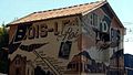
 Gare Bois-le-Roi1.jpg 1,024 × 768; 323 KB
-
 Gare-de Bois-le-Roi IMG 8424.jpg 4,272 × 2,848; 1.43 MB
-
 Gare-de Bois-le-Roi IMG 8425.jpg 4,272 × 2,848; 1.47 MB
-
 Gare-de Bois-le-Roi IMG 8426.jpg 4,272 × 2,848; 1.25 MB
-
 Gare-de Bois-le-Roi IMG 8427.jpg 4,272 × 2,848; 1.3 MB
-
 Gare-de Bois-le-Roi IMG 8428.jpg 4,272 × 2,848; 1.23 MB
-
 Gare-de Bois-le-Roi IMG 8429.jpg 4,272 × 2,848; 1.75 MB
-
 Gare-de Bois-le-Roi IMG 8430.jpg 4,272 × 2,848; 2.15 MB
-
 Gare-de Bois-le-Roi IMG 8431.jpg 4,272 × 2,848; 1.25 MB
-
 Gare-de-Bois-le-Roi-Carte-postale-2.jpg 1,580 × 980; 1.41 MB


