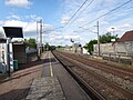
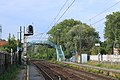
Category:Gare de Daours
Jump to navigation
Jump to search
| Object location | | View all coordinates using: OpenStreetMap |
|---|
railway station in Aubigny, France  | |||||
| Upload media | |||||
| Instance of | |||||
|---|---|---|---|---|---|
| Location | Aubigny, Somme, Hauts-de-France, Metropolitan France, France | ||||
| Transport network | |||||
| Owned by | |||||
| Operator | |||||
| Elevation above sea level |
| ||||
| Connecting line | |||||
| Adjacent station | |||||
 | |||||
Media in category "Gare de Daours"
The following 5 files are in this category, out of 5 total.
-
 DAOURS.JPG 4,608 × 3,456; 4.02 MB
-
 Gare de Daours (1) par Cramos.JPG 4,000 × 2,667; 1.98 MB
-
 Gare de Daours (2) par Cramos.JPG 4,000 × 2,667; 1.86 MB
-
 Gare de Daours (3) par Cramos.JPG 4,000 × 2,667; 3.51 MB
-
 Gare de Daours (4) par Cramos.JPG 4,000 × 2,667; 3.86 MB
_par_Cramos.JPG)
_par_Cramos.JPG)
_par_Cramos.JPG)
_par_Cramos.JPG)