Category:Garlinge
Aller à la navigation
Aller à la recherche
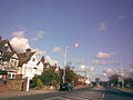
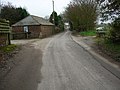
English: Garlinge is a village in the suburbs of Margate in Kent, United Kingdom, situated 2 km southwest of the centre of the town. It is in the Thanet local government district. There is a small selection of shops in the village, such as a bakery, newsagents, barbers and also a petrol station. There are also two car workshops.
village britannique  | |||||
| Téléverser des médias | |||||
| Nature de l’élément | |||||
|---|---|---|---|---|---|
| Lieu | Thanet, Kent, Angleterre du Sud-Est, Angleterre | ||||
 | |||||
Sous-catégories
Cette catégorie comprend 2 sous-catégories, dont les 2 ci-dessous.
J
O
- Oasts in Garlinge (1 F)
Média dans la catégorie « Garlinge »
Cette catégorie comprend 24 fichiers, dont les 24 ci-dessous.
-
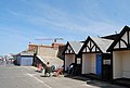
 Beach Huts, Westbrook Bay - geograph.org.uk - 1473078.jpg 640 × 430 ; 131 kio
-
 Beach Huts, Westbrook Bay - geograph.org.uk - 1473102.jpg 640 × 430 ; 117 kio
-
 Dent De Lion Castle (The Remains Of ) - geograph.org.uk - 331972.jpg 640 × 480 ; 98 kio
-
 Garlinge newsagents - geograph.org.uk - 743977.jpg 640 × 480 ; 148 kio
-
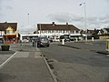
 High Street, Garlinge - geograph.org.uk - 743940.jpg 640 × 480 ; 166 kio
-
 Hussar Hotel, Garlinge - geograph.org.uk - 743987.jpg 640 × 480 ; 182 kio
-
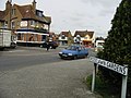
 Junction of High Street with A28 Canterbury Road - geograph.org.uk - 743981.jpg 640 × 480 ; 146 kio
-
 Looking E along Birds Avenue, Garlinge - geograph.org.uk - 743577.jpg 640 × 480 ; 146 kio
-
 Looking N along High Street, Garlinge - geograph.org.uk - 743570.jpg 640 × 480 ; 144 kio
-
 The outskirts of Garlinge viewed from High Street - geograph.org.uk - 743566.jpg 640 × 480 ; 157 kio
-
 View along High Street towards Garlinge - geograph.org.uk - 743509.jpg 640 × 480 ; 190 kio
-
 View along High Street, Garlinge - geograph.org.uk - 743532.jpg 640 × 480 ; 249 kio
-
 A28 Canterbury Road heading to Margate - geograph.org.uk - 1495995.jpg 640 × 480 ; 64 kio
-
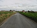
 Bridleway to Garlinge - geograph.org.uk - 742835.jpg 640 × 480 ; 163 kio
-
 Buildings on Zeila Farm, High Street, Garlinge - geograph.org.uk - 743520.jpg 640 × 480 ; 146 kio
-
 Cafe on the promenade at Westbrook Bay - geograph.org.uk - 1473098.jpg 640 × 430 ; 115 kio
-
 Closes Cottages on Minster Road - geograph.org.uk - 742818.jpg 640 × 480 ; 143 kio
-
 Entrance To Spratling Court Farm - geograph.org.uk - 341074.jpg 640 × 480 ; 123 kio
-
 Farm and Horses - geograph.org.uk - 332049.jpg 640 × 480 ; 75 kio
-
 Flete Road, Near Manston - geograph.org.uk - 341078.jpg 480 × 640 ; 77 kio
-

-
 Shottendane Road, Margate - geograph.org.uk - 341091.jpg 480 × 640 ; 55 kio
-
 The Road To Woodchurch - geograph.org.uk - 341098.jpg 480 × 640 ; 65 kio
-
 Water Tower - geograph.org.uk - 332052.jpg 640 × 480 ; 87 kio


_-_geograph.org.uk_-_331972.jpg)


