Category:Garthorpe, Leicestershire
Jump to navigation
Jump to search
village and civil parish in Leicestershire, UK | |||||
| Upload media | |||||
| Instance of | |||||
|---|---|---|---|---|---|
| Location | Melton, Leicestershire, East Midlands, England | ||||
| Different from | |||||
 | |||||

Cebuano: Garthorpe maoy parokya sa Hiniusang Gingharian. Ang Garthorpe nahimutang sa kondado sa Leicestershire ug apil sa nasod sa Inglatera, sa habagatan-sidlakang bahin sa nasod, km sa amihanan sa ulohang dakbayan London.
Cymraeg: Pentref a chymuned yn Lloegr ydy Garthorpe, Swydd Gaerlŷr; saif yn .
English: Garthorpe is a village and civil parish (called Garthorpe and Fockerby) in Leicestershire, England, in the Melton district. It is about five miles east of Melton Mowbray. The parish includes the villages of Garthorpe and Coston, and is near Saxby (in Freeby parish), Wymondham, Buckminster and Sproxton. The parish has a population of about 100 [1]
Polski: Garthorpe – wieś w Anglii, w hrabstwie Leicestershire, w dystrykcie Melton. Leży 30 km na północny wschód od miasta Leicester i 148 km na północ od Londynu.
Svenska: Garthorpe är en parish i Storbritannien. Den ligger i grevskapet Leicestershire och riksdelen England, i den sydöstra delen av landet, km norr om huvudstaden London.
Subcategories
This category has the following 2 subcategories, out of 2 total.
C
G
- St Mary's Church, Garthorpe (31 F)
Media in category "Garthorpe, Leicestershire"
The following 200 files are in this category, out of 207 total.
(previous page) (next page)-
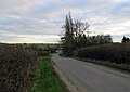
 A road to Garthorpe - geograph.org.uk - 5541233.jpg 3,776 × 2,520; 3.52 MB
-
 Approaching Garthorpe - geograph.org.uk - 1353978.jpg 640 × 426; 65 KB
-

-
 B676 at Garthorpe village boundary - geograph.org.uk - 3604415.jpg 640 × 480; 47 KB
-
 B676 east of Coston - geograph.org.uk - 3606414.jpg 640 × 480; 45 KB
-
 B676 east of Garthorpe - geograph.org.uk - 3606407.jpg 640 × 481; 46 KB
-
 B676 eastbound - geograph.org.uk - 3652071.jpg 640 × 484; 95 KB
-
 B676 towards Coston - geograph.org.uk - 3078164.jpg 640 × 480; 80 KB
-
 B676 towards Coston - geograph.org.uk - 3078251.jpg 640 × 480; 62 KB
-
 B676 towards Saxby - geograph.org.uk - 3016476.jpg 640 × 480; 65 KB
-
 B676 towards Saxby - geograph.org.uk - 3016549.jpg 640 × 480; 62 KB
-
 B676, Garthorpe - geograph.org.uk - 3651951.jpg 640 × 497; 62 KB
-
 Barn, Wymondham Road, Garthorpe - geograph.org.uk - 5197192.jpg 1,280 × 960; 356 KB
-
 Bench mark, St Mary's Church, Garthorpe - geograph.org.uk - 5197148.jpg 1,021 × 1,280; 598 KB
-
 Bench mark, Wymondham Road, Garthorpe - geograph.org.uk - 5197189.jpg 1,180 × 1,280; 626 KB
-
 Bridge over River Eye tributary - geograph.org.uk - 1854714.jpg 2,970 × 2,075; 2.73 MB
-
 Bridge over River Eye, Coston - geograph.org.uk - 3590584.jpg 1,024 × 769; 176 KB
-
 Bridge over the River Eye, Garthorpe - geograph.org.uk - 5197195.jpg 1,280 × 960; 344 KB
-

-
 Byway off Gipsy Nook - geograph.org.uk - 3288211.jpg 640 × 427; 62 KB
-
 Byway through the plantations - geograph.org.uk - 1854761.jpg 3,036 × 2,235; 2.98 MB
-
 Concrete gas pipeline marker in hedge - geograph.org.uk - 5100076.jpg 640 × 577; 171 KB
-
 Coston Ford - geograph.org.uk - 2627128.jpg 1,024 × 770; 888 KB
-
 Coston ford - geograph.org.uk - 3349704.jpg 640 × 478; 80 KB
-
 Coston Ford - geograph.org.uk - 5110755.jpg 640 × 360; 89 KB
-
 Coston in September - geograph.org.uk - 2627129.jpg 1,024 × 768; 919 KB
-
 Coston Lodge - geograph.org.uk - 3078167.jpg 640 × 480; 90 KB
-
 Coston Lodge - geograph.org.uk - 5514958.jpg 3,776 × 2,520; 3.44 MB
-
 Coston Road (B676) leaving Garthorpe - geograph.org.uk - 5541429.jpg 3,776 × 2,520; 3.61 MB
-
 Coston Road - geograph.org.uk - 3566090.jpg 2,256 × 1,504; 2.43 MB
-
 Coston, Mill Farm - geograph.org.uk - 2627123.jpg 1,024 × 768; 939 KB
-
 Cottage near to the ford at Coston - geograph.org.uk - 3350188.jpg 640 × 475; 64 KB
-
 Countryside north of Wymondham - geograph.org.uk - 1853234.jpg 3,264 × 2,196; 2.91 MB
-
 Countryside north of Wymondham - geograph.org.uk - 1853235.jpg 3,153 × 2,211; 2.95 MB
-
 Crop field near Garthorpe - geograph.org.uk - 3016465.jpg 640 × 480; 91 KB
-
 Crop field near Old Close Plantation - geograph.org.uk - 3078281.jpg 640 × 480; 95 KB
-
 Crossroads on Butt Lane - geograph.org.uk - 5100068.jpg 640 × 380; 55 KB
-
 Entrance to a field - geograph.org.uk - 5100077.jpg 640 × 422; 74 KB
-
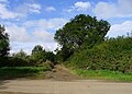
 Entrance to Coston - geograph.org.uk - 3651960.jpg 640 × 431; 69 KB
-

-
 Entrance to Garthorpe - geograph.org.uk - 3651939.jpg 640 × 418; 70 KB
-
 Entrance to King street lane near the B676 - geograph.org.uk - 5514981.jpg 3,776 × 2,520; 4.01 MB
-
 Farm track near Garthorpe - geograph.org.uk - 3078259.jpg 640 × 480; 82 KB
-
 Farm track off Melton Road - geograph.org.uk - 3078284.jpg 640 × 480; 83 KB
-
 Farm track, Gypsy Nook - geograph.org.uk - 3016463.jpg 640 × 480; 71 KB
-
 Farmland near Coston - geograph.org.uk - 3078175.jpg 640 × 480; 74 KB
-
 Farmland near Garthorpe - geograph.org.uk - 3016469.jpg 640 × 468; 38 KB
-
 Farmland near Garthorpe - geograph.org.uk - 3016547.jpg 640 × 480; 59 KB
-
 Farmland near Garthorpe - geograph.org.uk - 3078255.jpg 640 × 480; 74 KB
-
 Farmland near Garthorpe and Saxby - geograph.org.uk - 68881.jpg 640 × 480; 131 KB
-
 Farmland near Garthorpe and Saxby - geograph.org.uk - 74462.jpg 640 × 427; 129 KB
-
 Farmland north of Coston - geograph.org.uk - 3078233.jpg 640 × 480; 77 KB
-
 Farmland north of Garthorpe - geograph.org.uk - 1854728.jpg 2,472 × 1,886; 2.01 MB
-
 Farmland north of Garthorpe - geograph.org.uk - 1854729.jpg 3,212 × 2,337; 3.22 MB
-
 Farmland north of Garthorpe - geograph.org.uk - 1854747.jpg 2,370 × 1,343; 1.28 MB
-
 Farmland north of Garthorpe - geograph.org.uk - 1854756.jpg 2,582 × 1,796; 1.64 MB
-
 Farmland towards Strifts Plantation - geograph.org.uk - 3016461.jpg 640 × 480; 63 KB
-
 Farmland, Garthorpe Lodge - geograph.org.uk - 3078265.jpg 640 × 480; 91 KB
-
 Field entrance, Coston - geograph.org.uk - 3078241.jpg 640 × 480; 137 KB
-

-
 Footbridge over the River Eye - geograph.org.uk - 5187420.jpg 1,280 × 960; 519 KB
-
 Footpath through Strifts Plantation - geograph.org.uk - 5456245.jpg 3,776 × 2,520; 3.85 MB
-
 Footpath through wheat to Strifts Plantation - geograph.org.uk - 5456240.jpg 3,776 × 2,520; 4.2 MB
-
 Footpath towards Buckminster - geograph.org.uk - 1853239.jpg 2,409 × 2,199; 2.22 MB
-
 Ford at Coston - geograph.org.uk - 5187413.jpg 1,280 × 960; 408 KB
-
 Ford at Sproxton Lane, Coston - geograph.org.uk - 2518856.jpg 640 × 428; 76 KB
-
 Ford near Coston - geograph.org.uk - 3078236.jpg 640 × 480; 115 KB
-
 Ford on the River Eye at Garthorpe - geograph.org.uk - 2518882.jpg 3,872 × 2,592; 2.3 MB
-
 From Coston Lodge towards Wymondham - geograph.org.uk - 5100087.jpg 640 × 432; 72 KB
-
 Garthorpe Ford in Flood - geograph.org.uk - 6295679.jpg 3,823 × 2,463; 2.45 MB
-
 Garthorpe Lodge - geograph.org.uk - 1853240.jpg 2,823 × 2,280; 2.65 MB
-
 Garthorpe Lodge farm - geograph.org.uk - 2596690.jpg 640 × 419; 72 KB
-
 Garthorpe Lodge farm sign - geograph.org.uk - 2596691.jpg 640 × 434; 84 KB
-
 Gas pipeline marker in hedge - geograph.org.uk - 5100078.jpg 640 × 462; 79 KB
-
 Gates on track to Strifts Plantation - geograph.org.uk - 4931758.jpg 640 × 367; 53 KB
-
 Gipsy Nook into Garthorpe - geograph.org.uk - 4931779.jpg 640 × 451; 65 KB
-
 Gipsy Nook towards Garthorpe - geograph.org.uk - 4931761.jpg 640 × 446; 70 KB
-

-

-

-
 Gipsy Nook-Coston Road junction - geograph.org.uk - 4931778.jpg 640 × 422; 84 KB
-
 Grange Lane, near Coston - geograph.org.uk - 3141090.jpg 640 × 480; 124 KB
-
 Gypsy Nook leading off Coston Road, Garthorpe - geograph.org.uk - 5541423.jpg 3,776 × 2,520; 4.07 MB
-
 Harvested field on the road to Coston Lodge - geograph.org.uk - 5514937.jpg 3,776 × 2,520; 3.96 MB
-
 Hedge-field boundary - geograph.org.uk - 5100080.jpg 640 × 416; 64 KB
-
 Honey Pot Plantation - geograph.org.uk - 1854754.jpg 3,046 × 2,177; 2.16 MB
-
 House by the church - geograph.org.uk - 3349696.jpg 640 × 472; 81 KB
-
 Houses in Garthorpe - geograph.org.uk - 3016473.jpg 640 × 480; 70 KB
-
 King Street Lane - geograph.org.uk - 3078178.jpg 640 × 480; 75 KB
-
 King Street Lane at Sproxton Thorns - geograph.org.uk - 1873691.jpg 2,652 × 1,766; 1.91 MB
-

-
 King Street Lane eastwards - geograph.org.uk - 3349718.jpg 640 × 478; 52 KB
-
 King Street Lane westwards - geograph.org.uk - 3349719.jpg 640 × 481; 63 KB
-
 King Street Lane, Buckminster Estate - geograph.org.uk - 3288272.jpg 427 × 640; 84 KB
-
 Kings Street Lane north of Coston - geograph.org.uk - 5541442.jpg 2,970 × 2,138; 1.75 MB
-
 Lane heading north towards Sproxton - geograph.org.uk - 3078183.jpg 640 × 480; 79 KB
-
 Lane to Hall Farm - geograph.org.uk - 3078171.jpg 640 × 480; 64 KB
-
 Lane to Hall farm near Coston - geograph.org.uk - 4434337.jpg 1,024 × 707; 98 KB
-
 Lane towards Coston Lodge - geograph.org.uk - 3078277.jpg 640 × 480; 66 KB
-
 Lane towards Coston Lodge - geograph.org.uk - 3078283.jpg 640 × 480; 64 KB
-
 Large puddle on King Street Lane - geograph.org.uk - 3288274.jpg 640 × 427; 54 KB
-
 Leaving Coston on the B676 - geograph.org.uk - 4434340.jpg 1,024 × 768; 156 KB
-

-

-
 Melton Road heading west - geograph.org.uk - 3078288.jpg 640 × 480; 75 KB
-
 Melton Road towards Wymondham - geograph.org.uk - 784530.jpg 640 × 405; 104 KB
-
 Mill Farm, Coston - geograph.org.uk - 5187411.jpg 1,280 × 960; 419 KB
-
 Minor road into Garthorpe - geograph.org.uk - 3016472.jpg 640 × 480; 55 KB
-
 Minor road towards Garthorpe - geograph.org.uk - 3016464.jpg 640 × 480; 41 KB
-
 Minor road towards Garthorpe - geograph.org.uk - 3016468.jpg 640 × 480; 46 KB
-
 Minor road towards Wymondham - geograph.org.uk - 3078260.jpg 640 × 480; 72 KB
-
 Minor road towards Wymondham - geograph.org.uk - 3078271.jpg 640 × 480; 84 KB
-
 Newly resurfaced byway - geograph.org.uk - 3141028.jpg 640 × 480; 85 KB
-
 Newly resurfaced byway towards Sproxton - geograph.org.uk - 3141021.jpg 640 × 480; 117 KB
-
-
 Oak leaves hanging on in January - geograph.org.uk - 3288253.jpg 640 × 427; 119 KB
-
 Old Close Plantation - geograph.org.uk - 1853232.jpg 2,448 × 3,104; 3.02 MB
-
 Old ford, Garthorpe - geograph.org.uk - 5197186.jpg 1,280 × 880; 439 KB
-
 On the byway between Gypsy Nook and Sproxton - geograph.org.uk - 5456249.jpg 3,776 × 2,520; 4.03 MB
-
 On the minor road from Garthorpe to Waltham on the Wolds - geograph.org.uk - 5520119.jpg 3,776 × 2,520; 2.93 MB
-
 OS Trig Point near Wymondham - geograph.org.uk - 3078275.jpg 640 × 480; 102 KB
-
 Protecting the crops - geograph.org.uk - 2318773.jpg 1,024 × 768; 182 KB
-

-
 Public byway to Sproxton - geograph.org.uk - 1856410.jpg 3,011 × 2,374; 2.84 MB
-
 Public byway to Sproxton - geograph.org.uk - 1873709.jpg 2,704 × 1,861; 2.2 MB
-
 Public footpath and Estate track - geograph.org.uk - 3288278.jpg 640 × 427; 57 KB
-

-
 Public footpath to Garthorpe - geograph.org.uk - 1854750.jpg 2,722 × 1,842; 2.12 MB
-
 Public footpath to Stonesby - geograph.org.uk - 3288275.jpg 640 × 427; 88 KB
-
 Public footpath to Strifts Plantation - geograph.org.uk - 1854758.jpg 3,107 × 1,867; 2.36 MB
-
 Public footpath to Strifts Plantation - geograph.org.uk - 1854759.jpg 2,781 × 1,710; 1.82 MB
-
 Recent planting by the Byway - geograph.org.uk - 3288237.jpg 640 × 427; 61 KB
-
 Road downhill from Garthorpe - geograph.org.uk - 3566095.jpg 2,256 × 1,504; 2.86 MB
-
 Road to Waltham on the Wolds - geograph.org.uk - 1854732.jpg 2,075 × 1,483; 1.51 MB
-
 Road towards Coston Lodge - geograph.org.uk - 5100082.jpg 640 × 454; 71 KB
-
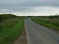
 Road towards Wymondham - geograph.org.uk - 5100083.jpg 640 × 463; 58 KB
-
 Small pond beside the Byway - geograph.org.uk - 3288242.jpg 427 × 640; 114 KB
-
 Small woodland off King Street Lane - geograph.org.uk - 1873641.jpg 3,051 × 1,908; 2.46 MB
-
 Stall waste near Wymondham - geograph.org.uk - 5514460.jpg 3,776 × 2,520; 3.89 MB
-
 Stonecroft, Garthorpe - geograph.org.uk - 5197118.jpg 1,280 × 850; 495 KB
-
 Stream by Strifts Plantation - geograph.org.uk - 3288220.jpg 427 × 640; 95 KB
-
 Summer rain - geograph.org.uk - 2542183.jpg 2,592 × 1,944; 2.01 MB
-
 Sunset at Gipsy Nook - geograph.org.uk - 2491147.jpg 640 × 427; 67 KB
-

-
 The B676 between Coston and Buckminster - geograph.org.uk - 5515004.jpg 3,776 × 2,520; 3.11 MB
-
 The B676 between Garthorpe and Coston - geograph.org.uk - 5541432.jpg 3,776 × 2,520; 2.86 MB
-

-

-
 The B676 towards Melton Mowbray - geograph.org.uk - 3349708.jpg 640 × 478; 63 KB
-

-
 The ford near Coston - geograph.org.uk - 3349709.jpg 640 × 456; 61 KB
-
 The ford near Coston - geograph.org.uk - 3350190.jpg 640 × 475; 71 KB
-
 The ford near Coston - geograph.org.uk - 3350191.jpg 640 × 475; 54 KB
-
 The Midnight Steeplechase (cropped).JPG 1,531 × 801; 599 KB
-
 The Midnight Steeplechase.JPG 1,674 × 1,271; 922 KB
-
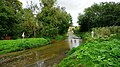
 The River Eye alongside Wymondham Road, Garthorpe - geograph.org.uk - 5541262.jpg 3,776 × 2,520; 3.4 MB
-
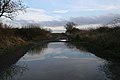
 The River Eye at Garthorpe - geograph.org.uk - 68884.jpg 640 × 480; 172 KB
-

-
 The Row, Garthorpe - geograph.org.uk - 5197112.jpg 1,280 × 960; 367 KB
-
 The village of Garthorpe in Leicestershire - geograph.org.uk - 1854725.jpg 3,045 × 1,509; 1.81 MB
-
-
 Towards Coston - geograph.org.uk - 3349720.jpg 640 × 473; 51 KB
-
 Towards Coston Lodge - geograph.org.uk - 5100088.jpg 640 × 436; 62 KB
-
 Towards Garthorpe - geograph.org.uk - 2596692.jpg 640 × 471; 84 KB
-
 Towards Sproxton - geograph.org.uk - 3349721.jpg 640 × 471; 54 KB
-

-
 Towards Sproxton on 3 October 2012 - geograph.org.uk - 3349710.jpg 640 × 471; 45 KB
-

-
 Towards Wymondham - geograph.org.uk - 2596693.jpg 640 × 557; 92 KB
-
 Towards Wymondham - geograph.org.uk - 5100064.jpg 640 × 438; 74 KB
-
 Towards Wymondham - geograph.org.uk - 5100092.jpg 640 × 486; 94 KB
-

-
 Track junctions - geograph.org.uk - 3141006.jpg 640 × 480; 84 KB
-
 Track to Garthorpe Lodge - geograph.org.uk - 3078267.jpg 640 × 480; 65 KB
-
 Track to Honey Pot Plantation - geograph.org.uk - 1854741.jpg 3,057 × 2,202; 2.77 MB
-
 Track to Strifts Plantation - geograph.org.uk - 4931760.jpg 640 × 450; 68 KB
-
 Track towards East Plantation - geograph.org.uk - 3566101.jpg 2,256 × 1,504; 1.76 MB
-
 Track towards Strifts Plantation - geograph.org.uk - 3016466.jpg 640 × 480; 59 KB
-
 Trees along the field boundary - geograph.org.uk - 2318769.jpg 1,024 × 768; 209 KB
-
 Trig point north of Wymondham - geograph.org.uk - 5915602.jpg 1,600 × 1,200; 901 KB
-
 Trig point on the road to Coston Lodge - geograph.org.uk - 5514911.jpg 3,776 × 2,520; 3.21 MB
-

-
 View across Garthorpe - geograph.org.uk - 1854724.jpg 2,864 × 1,973; 2.61 MB
-
 View across Garthorpe and Hall Farm - geograph.org.uk - 1854735.jpg 3,003 × 1,771; 2.37 MB
-
 View from the edge of Coston Vicarage Wood - geograph.org.uk - 5672460.jpg 4,447 × 2,968; 1.36 MB
-
 View through a gate - geograph.org.uk - 840179.jpg 640 × 480; 103 KB
-
 View towards Coston Church - geograph.org.uk - 812570.jpg 640 × 539; 99 KB
-
 View towards Strifts Plantation - geograph.org.uk - 1873552.jpg 3,002 × 1,566; 1.79 MB
-
 View towards the Waltham on the Wolds Transmitter - geograph.org.uk - 1854708.jpg 2,014 × 1,969; 1.3 MB
-
 Wymondham Road entering Garthorpe - geograph.org.uk - 5541254.jpg 3,776 × 2,520; 3.46 MB
-
 Wymondham Road in Garthorpe - geograph.org.uk - 1854727.jpg 2,792 × 1,703; 2.08 MB
-
 Wymondham Road towards Garthorpe - geograph.org.uk - 5100065.jpg 640 × 468; 76 KB
-
 Wymondham Road towards Wymondham - geograph.org.uk - 5100066.jpg 640 × 435; 65 KB
-
 Wymondham to Coston Road - geograph.org.uk - 710889.jpg 640 × 480; 77 KB
-
 Wymondham triangulation pillar - geograph.org.uk - 5100071.jpg 640 × 429; 121 KB
-
 Wymondham triangulation pillar damage - geograph.org.uk - 5100070.jpg 640 × 470; 167 KB
-

-

-

-
 Wymondham triangulation pillar top - geograph.org.uk - 5100075.jpg 640 × 457; 154 KB


_leaving_Garthorpe_-_geograph.org.uk_-_5541429.jpg)


.JPG)


