Category:Gaunt's Earthcott
Jump to navigation
Jump to search
hamlet in Gloucestershire, England, UK   | |||||
| Upload media | |||||
| Instance of | |||||
|---|---|---|---|---|---|
| Location | Almondsbury, South Gloucestershire, Gloucestershire, South West England, England | ||||
 | |||||
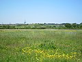
English: Gaunts Earthcott is a hamlet in South Gloucestershire, England, consisting of a ruined chapel, a few houses and two farms. Green Farm and Court Farm. The village is located approxomately 2.5 miles from Rudgeway and the A38 road and about the same distance from Frampton Cotterell and Winterbourne. The village is also located close to the interchange between the M4 and M5 motorways. There is no real industry as such and the main economic activity in the area is farming.
Bahasa Indonesia: Gaunts Earthcott adalah sebuah hamlet di South Gloucestershire, Inggris, terdiri dari sebuah reruntuhan kapel, beberapa rumah dan dua pertanian, Green Farm dan Court Farm. Desa ini terletak sekitar 2.5 mil dari Rudgeway dan A38 road dan jaraknya sama dengan Frampton Cotterell dan Winterbourne. Desa ini juga dekat dengan persimpangan motorway M4 dan M5. Tidak ada industri besar dan aktivitas ekonomi utamanya adalah bertani.
Media in category "Gaunt's Earthcott"
The following 5 files are in this category, out of 5 total.
-
 Gauntsearthcott.JPG 1,280 × 960; 656 KB
-
 Grazing pasture at Court Farm, Gaunt's Earthcott - geograph.org.uk - 3493188.jpg 3,648 × 2,736; 3.25 MB
-
 Water Trough - geograph.org.uk - 376855.jpg 640 × 480; 53 KB
-
 Court Farm, Gaunt's Earthcott - geograph.org.uk - 489731.jpg 640 × 480; 76 KB
-
 Field and willows, Gaunt's Earthcott - geograph.org.uk - 489732.jpg 640 × 480; 62 KB


