Category:Geography of Africa
नेविगेशन पर जाएँ
खोज पर जाएँ
geographical features of Africa | |||||
| मीडिया अपलोड करें | |||||
| जिसका उदाहरण है |
| ||||
|---|---|---|---|---|---|
| जिसका उपवर्ग है | |||||
| इसका विषय है | |||||
| |||||

समशीतोष्ण क्षेत्र : उत्तर अमेरिका · दक्षिण अमेरिका · अफ्रीका · यूरोप · एशिया · ओशिआनिया – ध्रुवीय क्षेत्र : Antarctic · अंटार्कटिका · आर्कटिक – Other regions : यूरेशिया
Geography of Africa.
उपश्रेणियाँ
इस श्रेणी की कुल १९ में से १९ उपश्रेणियाँ निम्नलिखित हैं।
*
+
?
B
C
E
F
H
L
P
R
T
W
"Geography of Africa" श्रेणी में पृष्ठ
इस श्रेणी में सिर्फ निम्नलिखित पृष्ठ है।
"Geography of Africa" श्रेणी में मीडिया
इस श्रेणी की कुल २८७ में से २०० चित्र निम्नलिखित हैं।
(पिछला पृष्ठ) (अगला पृष्ठ)-
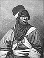
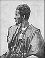
 AFR V1 D008 Bishari camel-driver.jpg २,०४४ × २,९८३; ८५० KB
-
 AFR V1 D041 Group of Nubian women.jpg २,०६४ × ३,०४०; ८५० KB
-
 AFR V1 D047 Bishari gum-dealers at Korosko.jpg २,०४६ × २,९९३; ८११ KB
-
 AFR V1 D063 View of Victoria Nyanza taken from Murchison Bay.jpg २,९८३ × २,०५१; ७८१ KB
-
 AFR V1 D072 The Nile at Khartum.jpg १,९०१ × १,५८९; ५२६ KB
-
 AFR V1 D073 General view of Khartoum.jpg ३,०२२ × २,०७८; ७९९ KB
-
 AFR V1 D087 The Nile at the second cataract.jpg २,९९९ × २,०५६; १ MB
-
 AFR V1 D126 U-Ganda, Rubaga, principal residence of the M'Tesa.jpg १,९०५ × २,४२५; ८३२ KB
-
 AFR V1 D129 Natives of Uganda.jpg ३,०२३ × २,०९६; ७७२ KB
-
 AFR V1 D133 Murchison Falls.jpg ३,००९ × २,०५९; ८३७ KB
-
 AFR V1 D140 Shuli musicians.jpg १,९०२ × १,५८७; ६४४ KB
-
 AFR V1 D142 Bari smiths.jpg १,९३३ × १,६२८; ४५६ KB
-
 AFR V1 D147 Group of Makrakas.jpg ३,०१४ × २,०७१; ७८३ KB
-
 AFR V1 D155 General view of Dem Suleiman.jpg ३,००० × २,०८२; ७४६ KB
-
 AFR V1 D164 Shilluk type.jpg १,३११ × १,७८५; ३७९ KB
-
 AFR V1 D176 Davezut Falls near Samara (Debra-Tabor).jpg २,०२१ × ३,०१६; १.३६ MB
-
 AFR V1 D399 Lybian desert-mirage on the horizon.jpg ३,०२६ × २,०६८; ६५३ KB
-
 AFR V1 D453 Suez canal at the Serapeum.jpg ३,०५१ × २,१०७; ८५२ KB
-
 AFR V2 D008 Arabs, Sudanese negro, and female Shilluk slave.jpg २,००७ × २,९७४; ९१३ KB
-
 AFR V2 D027 Zawya of Mazuna, in the Algerian Dahra.jpg २,०७३ × २,८१५; १.३६ MB
-
 AFR V2 D033 View from the Necropolis of Cyrene.jpg ३,०३१ × २,०९७; १.५८ MB
-
 AFR V2 D046 The Kufra oasis.jpg २,०४० × २,९७२; १.०६ MB
-
 AFR V2 D057 The Kasr-El-Jebel cirque.jpg ३,०३२ × २,०८६; ८९१ KB
-
 AFR V2 D083 Tripoli from the roadstead.jpg २,९८० × २,०२९; ९१९ KB
-
 AFR V2 D101 General view of Murzuk.jpg ३,०२७ × २,०९१; ९२२ KB
-
 AFR V2 D108 General view of the Ghadames.jpg २,९६८ × २,०३०; १.१४ MB
-
 AFR V2 D119 Tunisian landscape view taken from the Tellat pass.jpg ३,०२३ × २,०६७; ८७१ KB
-
 AFR V2 D127 Taraka island, view taken from the coast.jpg ३,००८ × २,०६१; ७९८ KB
-
 AFR V2 D161 Khumir man, women and child.jpg २,०५५ × ३,०३०; ७८३ KB
-
 AFR V2 D167 Tunisian Jewess.jpg १,३०१ × १,९३२; २७९ KB
-
 AFR V2 D170 Houses at Kasr El-Mudenin.jpg १,८७६ × १,५८३; ५७६ KB
-
 AFR V2 D172 Jerba Island Castle near Humt Suk.jpg २,९८१ × २,०४२; ९११ KB
-
 AFR V2 D175 Cabes-View taken from the Jara gardens.jpg ३,००९ × २,०२७; ६६५ KB
-
 AFR V2 D181 Nafta and the Shott-El-Jerid.jpg २,९७४ × २,०३३; ७६३ KB
-
 AFR V2 D187 Sfakes-View taken in the Leonec street.jpg २,०२३ × ३,०२३; ६७३ KB
-
 AFR V2 D189 Amphitheatre of El-Jem, viewed from the ruined side.jpg १,९७२ × १,४८०; ३८९ KB
-
 AFR V2 D194 Kasbah of Susa, viewed from the French consulate.jpg १,८५७ × १,३४७; ३२२ KB
-
 AFR V2 D196 Kairwan, the Mosque of the Swords.jpg १,८७० × १,५६५; ४१६ KB
-
 AFR V2 D197 General view of Kairwan.jpg ३,०४० × २,०८९; ८७१ KB
-
 AFR V2 D201 Ruins of Sbeitla, the ancient Suffetla.jpg ३,०२१ × २,०५८; १.२१ MB
-
 AFR V2 D211 Tunis-street in the Suk district.jpg २,०५३ × ३,०१६; ७७१ KB
-
 AFR V2 D217 Old ports of Carthage.jpg ३,००१ × २,०३७; ९१७ KB
-
 AFR V2 D223 General view of El-Kef.jpg ३,०३६ × २,१०३; १.०७ MB
-
 AFR V2 D230 Bizerta viewed from the Kasbah.jpg २,९८० × २,०३५; ९१९ KB
-
 AFR V2 D232 Cork tree of Fernana.jpg १,८५० × १,५५८; ४३८ KB
-
 AFR V2 D291 Saharian landscape, nomad encampment.jpg ३,०११ × २,०६४; ७२४ KB
-
 AFR V2 D305 The natural arch of Constantine.jpg २,०६२ × ३,०३६; ९५८ KB
-
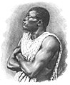
 AFR V2 D376 Emancipated negress, Biskra.jpg १,८७६ × २,५१४; १.०९ MB
-
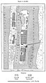
 AFR V2 D415 Relative population of the Algerian communes.jpg १,७३१ × ९८८; ९७ KB
-
 AFR V2 D428 Jebel Tiza - view taken from the Tagherut pass.jpg २,९९७ × २,०६४; १.०७ MB
-
 AFR V2 D434 The Sherat river.jpg ३,०२६ × २,०६०; ९८५ KB
-
 AFR V2 D446 A Tangier Arab.jpg १,५४५ × १,९६४; ५०२ KB
-
 AFR V2 D447 Arab woman of Tangier.jpg १,६५२ × १,९९७; ३५४ KB
-
 AFR V2 D450 Arab camel driver.jpg १,५९० × १,९४८; ५६४ KB
-
 AFR V2 D455 General view of Tetuan.jpg ३,००४ × २,०५७; ६९९ KB
-
 AFR V2 D461 Tangier, view taken from the east.jpg ३,०१२ × २,०५१; ७१९ KB
-
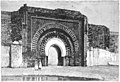
 AFR V2 D466 A gateway in Fez.jpg १,८९४ × २,५३७; ८७३ KB
-
 AFR V2 D470 Mulai Tayeb, sherif of Wezzan.jpg १,७२३ × १,८८६; ४९४ KB
-
 AFR V2 D472 Rbat and mouth of the Bu-Regrag, view tken from Sla.jpg २,९६७ × २,०२७; १.१७ MB
-
 AFR V2 D477 Marocco, the Christian's Gate.jpg ३,०४४ × २,०८८; ७०५ KB
-
 AFR V2 D491 Wed El-Haluf near Figuig.jpg ३,००४ × २,०७०; ७०८ KB
-
 AFR V2 D497 General view of Fez.jpg ३,०६८ × २,१०८; ५९८ KB
-
 AFR V2 D499 A school in Fez.jpg १,९४३ × १,६२०; ४०१ KB
-
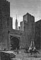 AFR V2 D501 Fez, gateway of the Kasbah.jpg २,०२१ × २,९७४; ५८३ KB
-
 AFR V2 D523 Group of Tibbus.jpg ३,०५५ × २,०८५; ६१३ KB
-
 AFR V2 D537 Jebel Khanfusa.jpg ३,०५६ × २,०७७; ५९६ KB
-
 AFR V2 D546 Targui type.jpg १,५८७ × २,०९४; ८२२ KB
-
 AFR V2 D547 Tuaregs on a journey.jpg २,०६२ × ३,०२५; ६९१ KB
-
 AFR V2 D559 The Egueri gorge.jpg ३,०३७ × २,०९८; ६४१ KB
-
 AFR V2 D579 Mouth of the Wed Draa, view taken from the sea.jpg २,९९१ × २,०५७; ५६९ KB
-
 AFR V2 D589 Appendix statistical data.jpg २,२२१ × ३,५७०; २९१ KB
-
 AFR V2 D590 Appendix statistical data.jpg २,०५४ × ३,४३५; ४०७ KB
-
 AFR V2 D591 Appendix statistical data.jpg २,१५७ × ३,५५१; ४०९ KB
-
 AFR V2 D592 Appendix statistical data.jpg २,१५२ × ३,५०६; ३७७ KB
-
 AFR V2 D593 Appendix statistical data.jpg २,१४५ × ३,५६३; ३०९ KB
-
 AFR V2 D594 Appendix statistical data.jpg २,०६० × ३,४३०; ४२१ KB
-
 AFR V2 D595 Appendix statistical data.jpg २,०४९ × ३,४४१; ३८३ KB
-
 AFR V2 D596 Appendix statistical data.jpg २,०६५ × ३,४२५; ४५१ KB
-
 AFR V2 D597 Appendix statistical data.jpg २,०७६ × ३,४३६; ३३० KB
-
 AFR V2 D598 Appendix statistical data.jpg २,०५५ × ३,४३५; ४७२ KB
-
 AFR V2 D599 Appendix statistical data.jpg २,१५८ × ३,५४९; ४०० KB
-
 AFR V2 D600 Appendix statistical data.jpg २,१५० × ३,४९६; ४७३ KB
-
 AFR V3 D008 Woman and children of Porto-Grande.jpg २,३४१ × ३,४३२; १.५२ MB
-
 AFR V3 D019 Cape Sam Lourenço Madeira.jpg ३,४८५ × २,३८६; ३.२५ MB
-
 AFR V3 D022 Depths of the Azorian Atlantic.jpg ४५७ × ६०३; ४९ KB
-
 AFR V3 D025 Fall of the Temperature in Deep Water.jpg २,१११ × १,३१४; १३० KB
-

-
 AFR V3 D029 Atlantic Winds and Currents.jpg २,००९ × २,४२७; ८६६ KB
-
 AFR V3 D032 Depths of the South African Atlantic.jpg २,१२५ × ३,१२६; १.७४ MB
-
 AFR V3 D034 Mean Annual Direction of the Winds in the South African Atlantic.jpg २,०५७ × १,६१८; ३९५ KB
-
 AFR V3 D035 Summer Winds in the South African Atlantic.jpg २,०५५ × १,६४३; ४४२ KB
-
 AFR V3 D036 Currents of the South Atlantic and Lines of Icebergs.jpg २,०८८ × २,२८७; ६३३ KB
-
 AFR V3 D044 Island of San Miguel - View Taken in a Garden near Ponta-Delgada - Azores.jpg ३,४५४ × २,३५७; २.१९ MB
-
 AFR V3 D047 Women of Fayal and San-Miguel - Azores.jpg १,९२६ × २,२५९; १.२१ MB
-
 AFR V3 D053 Lake of the Sete Cidades - Azores.jpg ३,५०२ × २,३८९; १.८७ MB
-
 AFR V3 D070 Dracona of Icod in Teneriffe.jpg २,२०६ × १,९९७; १.२२ MB
-
 AFR V3 D073 Funchal - East View - Madeira.jpg ३,४५४ × २,३३९; २.१५ MB
-
 AFR V3 D117 General View of Porto-Grande St Vincent Island.jpg ३,४९२ × २,३९१; २.२९ MB
-
 AFR V3 D127 Tristao de Cunha - view taken on the north coast.jpg ३,४६१ × २,३७३; १.९८ MB
-
 AFR V3 D135 Jamestown - St-Helena.jpg ३,४७७ × २,३७४; १.९२ MB
-
 AFR V3 D142 Cascade of Blu-Blu on the Agoa Grande.jpg २,४१५ × ३,५२७; २.११ MB
-
 AFR V3 D154 View on the Bakhoy Ford of Mokaia Fara.jpg ३,५१२ × २,३८९; १.२१ MB
-
 AFR V3 D165 Confluence of the Bafing and Bakhoy.jpg ३,४७१ × २,३७५; १.४३ MB
-
 AFR V3 D168 Floods of the Senegal.jpg २,०१३ × १,१७७; ३५१ KB
-
 AFR V3 D172 Baobab on the Kotubadinta River South-West of Bamaku.jpg ३,४४९ × २,३६७; १.८८ MB
-
 AFR V3 D175 Trarza Type.jpg १,५६९ × २,०२१; ७११ KB
-
 AFR V3 D180 Wolof Girl Sixteen Years of Age.jpg १,७९८ × २,२३९; ८१८ KB
-
 AFR V3 D181 Serer Youth Twenty-One Year Old.jpg १,८८४ × २,२९७; १.०१ MB
-
 AFR V3 D184 Fulah Type.jpg १,९७० × २,३३५; ९७६ KB
-
 AFR V3 D187 Toucouleur Types - The Interpreter Alpha Sega and his Sisters.jpg ३,४०९ × २,३१५; २.३१ MB
-
 AFR V3 D195 Saint-Louis in 1700.jpg १,२२२ × २,२९८; ५५१ KB
-
 AFR V3 D196 Saint-Louis in 1880.jpg १,२५७ × २,२८४; ५९७ KB
-
 AFR V3 D199 Goree - Landing Stage and Fort.jpg ३,५११ × २,३९६; २.११ MB
-
 AFR V3 D203 Kayes Railway Station.jpg ३,४६२ × २,३६५; १.४९ MB
-
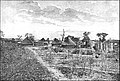 AFR V3 D207 Village of Bafulabé.jpg ३,४३३ × २,३२५; १.७२ MB
-
 AFR V3 D210 Medina - General View.jpg ३,५२७ × २,३३५; २.५५ MB
-
 AFR V3 D223 Felup Types.jpg ४४५ × ६०८; ६६ KB
-
 AFR V3 D229 Valley of the Tominé.jpg ३,५१६ × २,३९७; १.७७ MB
-
 AFR V3 D233 Landscape at Guiné - View Taken near Bolama.jpg ३,४३९ × २,३४४; २.११ MB
-
 AFR V3 D235 Bujago Types and Termites' nest.jpg २,३७१ × ३,४७४; २.०७ MB
-
 AFR V3 D249 Freetown. The Sea-breeze prevail along the coast.jpg ३,४१४ × २,३४५; २.२ MB
-
 AFR V3 D257 Sawpit Bay near Freetown.jpg ३,४७४ × २,३४३; २.२८ MB
-
 AFR V3 D262 Monrovia and Cape Mensurado.jpg ३,४९५ × २,३७९; १.७४ MB
-
 AFR V3 D265 Kroomen.jpg २,३३४ × ३,४७६; १.९७ MB
-
 AFR V3 D276 Cape Palmas.jpg ३,५०७ × २,४०४; २.५८ MB
-
 AFR V3 D282 Women of Grand Bassam.jpg २,४१४ × २,७२२; १.१७ MB
-
 AFR V3 D283 The King of Assini.jpg २,३२९ × ३,४४४; २.१४ MB
-
 AFR V3 D286 Agni Type.jpg २,०८३ × २,५१७; ८८१ KB
-
 AFR V3 D293 The Bar at the Mouth of the Volta.jpg ३,४१७ × २,३२५; २.१८ MB
-
 AFR V3 D303 Cape Coast - Seaward View.jpg ३,४९५ × २,३९९; २.१३ MB
-
 AFR V3 D305 General View of Elmina Ghana.jpg ३,४४२ × २,३५१; २.३३ MB
-
 AFR V3 D315 Lagos-European Quarters.jpg ३,५०५ × २,४०४; २.२३ MB
-
 AFR V3 D319 A Mohammedan Yoruba Trader.jpg २,२१७ × २,९८०; २.२६ MB
-
 AFR V3 D320 Inland Scenery Slave Coast.jpg २,३९२ × ३,४९८; २.४५ MB
-
 AFR V3 D325 Porto-Novo Group of Natives.jpg ३,४८४ × २,३७४; १.६५ MB
-
 AFR V3 D331 Rock of Abeokuta.jpg ३,४६५ × २,३६६; २.२३ MB
-
 AFR V3 D337 The Tembi-Kundu Hill and Source of the Niger.jpg ७९९ × ५५४; १८९ KB
-
 AFR V3 D349 Interior of the Bambara House.jpg २,२५४ × १,५३३; ९६९ KB
-
 AFR V3 D352 Cascade Near Bamaku.jpg ३,४७२ × २,३९०; २.८६ MB
-
 AFR V3 D357 Fillani or Fulah Types.jpg ३,४८७ × २,३७६; २.१९ MB
-
 AFR V3 D360 The Hombori Mountains.jpg २,०५५ × १,३८७; ३४४ KB
-
 AFR V3 D362 El-Haj Abd-el-Kader Envoy of Timbuktu.jpg १,९२८ × २,७४६; १.३९ MB
-
 AFR V3 D367 Sokoto - View Taken in the Interior.jpg ३,४९० × २,३७९; २.६ MB
-
 AFR V3 D371 A Sokoto Fulah - Brother of the Sultan.jpg १,८१६ × २,२०५; ८८२ KB
-
 AFR V3 D377 Wurno - View Taken in the Interior.jpg ३,४७८ × २,३७२; २.३९ MB
-
 AFR V3 D390 Mac-Iver Peak.jpg ३,४८१ × २,३४२; २.३७ MB
-
 AFR V3 D397 Yola Nigeria.jpg २,०१६ × २,३५४; १.०७ MB
-
 AFR V3 D398 View Taken in Demsa Poha.jpg ३,५१५ × २,४०७; २.४२ MB
-
 AFR V3 D400 Dwelling in Nupé.jpg ३,४९२ × २,३९४; २.२३ MB
-
 AFR V3 D401 Nupé Woman.jpg २,३८२ × ३,४८५; २.५१ MB
-
 AFR V3 D407 Barge on the Calabar River.jpg ३,४८० × २,३८१; १.९१ MB
-
 AFR V3 D413 Shores of Lake Tsad.jpg ३,५१५ × २,४०७; २.६७ MB
-
 AFR V3 D415 The Ba Busso, or Eastern Shari, at Miskin, South East of Logon.jpg २,३३५ × १,४६५; १,०१३ KB
-
 AFR V3 D418 View taken on the banks of the Sari.jpg ३,७६६ × २,४९३; १.९६ MB
-
 AFR V3 D425 Group of Kanem Bu Warriors.jpg ३,४८६ × २,३७५; २.२४ MB
-
 AFR V3 D431 Kuka (Kukawa), Nigeria.jpg २,०६४ × १,६७५; ४१३ KB
-
 AFR V3 D435 The Logon Birni General view.jpg ३,४८६ × २,३७६; २.५९ MB
-
 AFR V3 D439 Palace of the Sultan of Massena.png ३,५०० × २,३७४; ६.८२ MB
-
 AFR V3 D448 View taken at the Foot of the Cameroons.png ३,४६२ × २,३६०; ७.९८ MB
-
 AFR V3 D471 The Fetish Stones of Samba, on the Ogoway.png ३,४५२ × २,३६७; ५.६९ MB
-
 AFR V3 D479 Mpongwe House Near Libreville.png ३,४६० × २,३५०; ४.९४ MB
-
 AFR V3 D482 Fan Woman.png १,५४९ × २,२१२; १.३९ MB
-
 AFR V3 D485 Fan Women and Child on the Banks of the Ogoway.png २,३४८ × ३,४६६; ४.४७ MB
-
 AFR V3 D489 A Cabinda.png १,७४६ × २,२३९; २.३ MB
-
 AFR V3 D493 American Mission on the Ogoway Between Njolé and Lambaréné.png ३,४८६ × २,३४६; ६.९४ MB
-
 AFR V3 D509 The Traveller Giraud Amid the Reeds of Lake Bangweolo.png २,३२० × ३,४२५; ५.३ MB
-
 AFR V3 D514 View taken from Mpala on the West Coast of Tankanyika.png ३,४७८ × २,३५९; ५.८ MB
-
 AFR V3 D519 The U Banghi View taken at the Nkunja Station.png ३,५०३ × २,३८६; ५.४५ MB
-
 AFR V3 D523 The Yellala Falls Lower Congo.png ३,४५९ × २,३६३; ४.६६ MB
-
 AFR V3 D536 Bangala, a Station of the Independent Congo state.png ३,४८५ × २,३८३; ५.९७ MB
-
 AFR V3 D547 The Lu Kuga Emissary of Tanganyika.png ३,४६७ × २,३८८; ४.७७ MB
-
 AFR V3 D551 View Taken at Ujiji.png ३,४९४ × २,३६७; ६.४२ MB
-
 AFR V3 D555 Ma Rungu Fetishes.png १,८२२ × २,०३१; ४.०२ MB
-
 AFR V3 D557 Tippo Tip.png १,१८६ × १,२५६; २४६ KB
-
 AFR V3 D559 Stanley Falls Fishing at the Seventh Cataract.png ३,४६७ × २,३४४; ५.२४ MB
-
 AFR V3 D561 Under Chief of Iboko and Head Chief of the Ba Ngala.png २,१८३ × २,५५४; ५.६४ MB
-
 AFR V3 D569 Akka Man and Woman.png ३,४५६ × २,३७५; ५.५६ MB
-
 AFR V3 D573 Niam Niam Woman.png १,९२० × २,२९०; १.३८ MB
-
 AFR V3 D574 Niam-Niam Man.png १,९७७ × २,२८९; १.७१ MB
-
 AFR V3 D575 Group of Niam Niams and their Dwellings.png ३,५६० × २,४३५; ४.८६ MB
-
 AFR V3 D580 Dead Trunks of Palms near M'suala on the Congo.png २,२१६ × १,८४१; ३.०४ MB
-
 AFR V3 D587 Group of Kalundas.png २,३५६ × ३,४८६; ५.८ MB
-
 AFR V3 D607 Stanley Pool View taken from Brazzaville.png ३,४७३ × २,३७१; ५.८९ MB
-
 AFR V3 D611 General View of Boma.png ३,४८३ × २,३८५; ६.०३ MB
-
 AFR V3 D613 Kakongo Type.png १,४९३ × १,७८२; ८९६ KB
-
 AFR V4 D006 Group of Zulus.jpg २,०६१ × २,९९९; १.२२ MB
-
 AFR V4 D021 View taken on the banks of the Rio Dandé.png ३,०३३ × २,०७१; ४.०५ MB
-
 AFR V4 D033 Landscape near Quissama south of the Congo.png ३,०७४ × २,१२६; ४.९७ MB
-
 AFR V4 D036 Mu-Sorongo woman.png १,५२० × २,२४६; ३.०५ MB
-
 AFR V4 D043 Quissama man and Quissama woman.jpg ३,०४२ × २,०८२; २७३ KB
-
 AFR V4 D054 The king of the Kingdom of Kongo.png १,९३१ × २,४२९; १.६३ MB
-
 AFR V4 D059 Loanda general view.png ३,०२५ × २,०६९; ३.६५ MB
-
 AFR V4 D066 Black stones of Pungo Ndongo.png १,८०५ × १,४६१; ५२३ KB
-
 AFR V4 D073 Mossamedes general view.png ३,०४३ × २,०८४; ४.१५ MB
-
 AFR V4 D089 View taken at Walvisch Bay.png ३,०४० × २,०८८; ३.०४ MB
-
 AFR V4 D103 Angra Pequena view taken from Nautilus Point.png ३,०६२ × २,०९८; ४.१२ MB
-
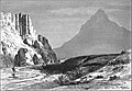
 AFR V4 D115 The Lion's head Capetown.png ३,०५७ × २,११५; ४.२ MB
-
 AFR V4 D123 The Falls of the Oranje.png १,४०८ × २,१६०; २.०६ MB
-
 AFR V4 D129 Scene on the Limpopo - the Malikoe Marico ford in Transvaal.png ३,०२४ × २,०६४; ४.२ MB
-
 AFR V4 D145 Bushmen encampment.png ३,०२१ × २,०५७; ३.९७ MB


.jpg)


,_Nigeria.jpg)


