Category:Geography of British Columbia
Zur Navigation springen
Zur Suche springen
Provinzen und Territorien Kanadas: Alberta · British Columbia · Manitoba · New Brunswick · Newfoundland and Labrador · Nova Scotia · Ontario · Prince Edward Island · Quebec · Saskatchewan · Northwest Territories · Nunavut · Yukon
overview of the geography of British Columbia, Canada | |||||
| Medium hochladen | |||||
| Ist ein(e) |
| ||||
|---|---|---|---|---|---|
| Aspekt von | |||||
| Ort | British Columbia, Kanada | ||||
| |||||
Unterkategorien
Es werden 16 von insgesamt 16 Unterkategorien in dieser Kategorie angezeigt:
In Klammern die Anzahl der enthaltenen Kategorien (K), Seiten (S), Dateien (D)
*
F
G
L
O
P
R
V
W
Medien in der Kategorie „Geography of British Columbia“
Folgende 86 Dateien sind in dieser Kategorie, von 86 insgesamt.
-
 Barnards Express at Yale.gif 554 × 303; 87 KB
-
 BC Express sled at Quesnel.gif 590 × 366; 77 KB
-
 BC Express stage at Ashcroft.gif 597 × 404; 93 KB
-
 BC Express stage at Clinton.gif 590 × 346; 94 KB
-
 Bc2005.PNG 741 × 956; 44 KB
-
 Burnaby—Douglas.png 717 × 482; 13 KB
-
 Burnaby—New Westminster.png 717 × 482; 13 KB
-
 BX Cars at 149 Mile House.gif 554 × 288; 65 KB
-
 BX ranch at Vernon.gif 584 × 429; 116 KB
-
 Cadborobay2.jpg 900 × 675; 172 KB
-
 CanadianDogwoodGrowingTrailSide.jpg 863 × 1.299; 351 KB
-
 Cascadia earthquake sources fr.png 580 × 575; 55 KB
-
 Cascadia earthquake sources.png 580 × 575; 25 KB
-
 Chilcotinampitheatre.jpg 2.592 × 1.944; 742 KB
-
 Chilko River, Lava Canyon.jpg 2.816 × 1.880; 2,36 MB
-
 Chipmunk Mountain.jpg 2.048 × 1.536; 1,31 MB
-

-
 Cordova St looking east from cambie 1890s.jpg 3.000 × 2.365; 662 KB
-
 Delta—Richmond East.png 717 × 482; 13 KB
-
 Dufferin coach at Barkerville.gif 598 × 500; 134 KB
-
 Dunsmuir Tunnel.jpg 2.304 × 3.072; 3,4 MB
-
 Elem Dickens 0.jpg 350 × 228; 32 KB
-
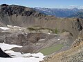
 ElfinPano.jpg 1.599 × 1.066; 527 KB
-
 FilPlaza 1.jpg 480 × 718; 116 KB
-
 Georgia @ Burrard.JPG 675 × 900; 213 KB
-
 Gray Jay in Roche Lake PP.JPG 2.816 × 2.112; 1,99 MB
-
 GTP Bridge at Mile 142.gif 554 × 464; 83 KB
-
 Horseshoe Lake, Roche Lake PP.JPG 2.816 × 2.112; 2,08 MB
-
 Ice cave Illecillewaet Glacier Photo A (HS85-10-19328) original.tif 2.109 × 1.220; 8 MB
-
 Ice cave Illecillewaet Glacier Photo A (HS85-10-19328).jpg 1.797 × 960; 1,89 MB
-
 Ice cave Illecillewaet Glacier Photo B (HS85-10-19329) original.tif 2.109 × 1.220; 8 MB
-
 Ice cave Illecillewaet Glacier Photo B (HS85-10-19329).jpg 1.797 × 966; 2,02 MB
-
 Ice cave Illecillewaet Glacier Photo C (HS85-10-19330) original.tif 2.109 × 1.219; 7,99 MB
-
 Ice cave Illecillewaet Glacier Photo C (HS85-10-19330).jpg 1.797 × 963; 1,96 MB
-
 JH Sullivan.gif 410 × 620; 75 KB
-
 Kensington-Cedar Cottage Multi-cultural festival 2004.jpg 2.048 × 1.536; 962 KB
-
 Kootenayboundaries.jpg 400 × 332; 51 KB
-
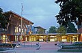
 LangleyEducationCentre.jpg 220 × 175; 58 KB
-
 Liard Hotspring Steam.JPG 800 × 600; 260 KB
-
 Liard Hotsprings pool.JPG 800 × 1.066; 488 KB
-
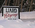 Liard Hotsprings sign.JPG 800 × 644; 336 KB
-
 Lynn Canyon forest.jpg 4.901 × 2.392; 6,02 MB
-
 Lynn canyon park lynn creek.jpg 1.536 × 2.048; 911 KB
-
 Main Endeavour black smoker.jpg 220 × 283; 45 KB
-
 Main Endeavour hydrothermal plume.jpg 269 × 184; 5 KB
-
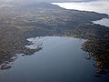
 Mayne Island from water.jpg 5.184 × 3.456; 7,28 MB
-
 Mount Galiano.jpg 5.184 × 3.456; 6,71 MB
-
 Mount Gavreau-Muskwa Range.JPG 2.000 × 634; 930 KB
-
 Mount Ludington-Muskwa Range.JPG 2.000 × 683; 977 KB
-
 Multicultural festival, East Vancouver.jpg 480 × 640; 90 KB
-
 Muskwa Mountains-Alaska Highway.JPG 1.500 × 826; 953 KB
-
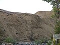
 Nechako Cutbanks.jpg 1.704 × 1.136; 695 KB
-
 New Westminster—Coquitlam.png 717 × 482; 13 KB
-
 Newton—North Delta.png 717 × 482; 13 KB
-
 Nk'mip Desert.JPG 640 × 480; 203 KB
-
 Nodales Channel, British Columbia (HS85-10-42150) original.tif 3.105 × 2.487; 22,73 MB
-
 Nodales Channel, British Columbia (HS85-10-42150).jpg 1.924 × 1.380; 3,2 MB
-
 North Pender Island from water.jpg 5.184 × 3.456; 7,3 MB
-
 North Shore over exposed Spanish Banks.JPG 3.008 × 2.000; 1,46 MB
-
 Oak Bay High School - Grad Prank 1979.jpg 1.024 × 768; 320 KB
-
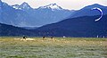
 Panoramic view of mountains and water (12817479313).jpg 2.500 × 1.101; 435 KB
-
 Rannikkovuoret sijainti.png 271 × 249; 28 KB
-
 Régions physiographiques Colombie-Britannique.svg 539 × 587; 42 KB
-
 Régions physiographiques de Colombie-Britannique.png 536 × 580; 71 KB
-
 Sardis BC 1943.jpg 920 × 1.248; 247 KB
-
 Sardis BC 2.jpg 920 × 1.252; 197 KB
-

-

-
 Skeena—Bulkley Valley.png 364 × 397; 46 KB
-
 Smugglersinnblaineborder.jpg 2.048 × 1.536; 1,45 MB
-
 South BC-NW USA-relief CaribooplusChilcotin.png 708 × 600; 961 KB
-
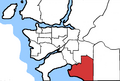 South Surrey—White Rock—Cloverdale.png 717 × 482; 12 KB
-
 Spanish Banks Sports.jpg 3.116 × 1.700; 7,71 MB
-
 Stage with driver Stephen Tingley.gif 588 × 329; 122 KB
-
 Stawamish Chief panorama 01.jpg 18.465 × 2.032; 20,79 MB
-
 Stone Mountains-Muskwa Range.JPG 2.048 × 1.536; 1,7 MB
-
 Stream near Kamloops.JPG 3.072 × 2.304; 3,1 MB
-
 Sunrise Uplands Park.jpg 2.517 × 1.254; 1,12 MB
-
 SWBC Vancouver-Kamloops.jpg 1.600 × 1.200; 1,46 MB
-
 Telkbulk.jpg 767 × 433; 140 KB
-
 Thompson River Kamloops.jpg 5.766 × 1.259; 4,71 MB
-
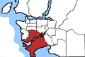
 Vancouver area map.png 801 × 477; 102 KB
-
 Victoria Harbour, Canada.jpg 1.024 × 682; 838 KB
-
 Vue des reliefs du Plateau Bonaparte.png 873 × 720; 1,76 MB
-
 Whistler bowl+lake.JPG 3.072 × 2.304; 1,79 MB
-
 Wpdms nasa topo columbia river gorge.jpg 1.710 × 1.704; 322 KB


.jpg)
.jpg)
.jpg)


.jpg)


.jpg)


