Category:Landscapes of British Columbia
Jump to navigation
Jump to search
Provinces and territories of Canada: Alberta · British Columbia · Newfoundland and Labrador · Nova Scotia · Ontario · Quebec · Saskatchewan · Northwest Territories · Nunavut · Yukon
Subcategories
This category has only the following subcategory.
M
- Mount Benson (British Columbia) (29 F)
Media in category "Landscapes of British Columbia"
The following 84 files are in this category, out of 84 total.
-
 A Bare Hillside - panoramio.jpg 2,560 × 1,920; 727 KB
-
 Arriving in plumpe rharbour.png 640 × 480; 114 KB
-
 Ashcroft 042.jpg 640 × 480; 113 KB
-
 BC-landscape.JPG 2,816 × 1,762; 1.58 MB
-
 Beached Boat.jpg 1,476 × 1,131; 350 KB
-
 Bedford Channel.jpg 4,608 × 3,072; 3.93 MB
-
 Bernard Lake, British Columbia.jpg 3,073 × 1,735; 1.87 MB
-
 Whistler bowl+lake.JPG 3,072 × 2,304; 1.79 MB
-
 Brooks peninsula.JPG 2,272 × 1,704; 896 KB
-
 Brooks peninsula2.JPG 2,272 × 1,704; 867 KB
-
 Burns Lake BC.jpg 1,280 × 960; 312 KB
-
 Canada - BC - 01 - hiking in Kootenay National Park (4035517884).jpg 3,264 × 2,448; 2.49 MB
-
 Canada - BC - 02 - hiking in Kootenay National Park (4034764883).jpg 3,264 × 2,448; 2.93 MB
-
 Canada - BC - 03 - hiking in Kootenay National Park (4034766445).jpg 3,264 × 2,448; 2.5 MB
-
-
 Canada near vancouver1.JPG 1,676 × 1,126; 919 KB
-
 Canada near vancouver7.JPG 1,684 × 1,126; 1.12 MB
-
 Canada near vancouver8.JPG 1,693 × 1,076; 1.03 MB
-
 Canada near vancouver9.JPG 1,667 × 1,126; 1.15 MB
-
 Canion-near Ashcraft.jpg 4,032 × 3,024; 1.68 MB
-
 Canyon on Moorracker Creek S of Golden (8002172486).jpg 2,121 × 1,414; 2.98 MB
-
 Capricious weather.jpg 2,592 × 1,936; 1.53 MB
-
 Capricious.jpg 2,592 × 1,936; 1.44 MB
-
 ChaseWaterfront.JPG 3,648 × 2,736; 2.47 MB
-
 CheolquoitLake.png 1,280 × 960; 1.44 MB
-
 Coast at Fort Rodd Hill looking towards Coburg Peninsula.jpg 1,024 × 768; 132 KB
-
 Cold Place.jpg 5,152 × 3,864; 5.37 MB
-
 Coquihalla River.jpg 2,012 × 3,038; 1.12 MB
-
 Cortes Island sunrise.jpg 6,000 × 4,000; 14.12 MB
-
 Dome Creek - lake.jpg 5,503 × 3,095; 7.47 MB
-
 Downtown Vancouver Skyline.jpg 3,438 × 1,934; 1.34 MB
-
 Fernie BC.jpg 2,560 × 1,920; 1.37 MB
-
 Fernie mtproctor.jpg 3,296 × 2,472; 1.73 MB
-
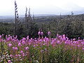
 Fireweed on the Klondike Highway, British Columbia 10.jpg 3,072 × 2,304; 2.39 MB
-
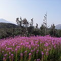
 Fireweed on the Klondike Highway, British Columbia 2.jpg 3,072 × 2,304; 2.24 MB
-
 Fireweed on the Klondike Highway, British Columbia 3.jpg 3,072 × 2,304; 2.18 MB
-
 Fireweed on the Klondike Highway, British Columbia 4.jpg 3,072 × 2,304; 2.53 MB
-
 Fireweed on the Klondike Highway, British Columbia 5.jpg 3,072 × 2,304; 2.15 MB
-
 Fireweed on the Klondike Highway, British Columbia 6.jpg 2,297 × 2,303; 1.72 MB
-
 Fireweed on the Klondike Highway, British Columbia 7.jpg 2,804 × 2,303; 2.27 MB
-
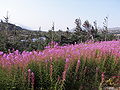
 Fireweed on the Klondike Highway, British Columbia 8.jpg 3,072 × 2,304; 2.31 MB
-
 Fireweed on the Klondike Highway, British Columbia 9.jpg 3,072 × 2,304; 2.28 MB
-
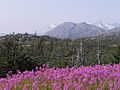
 Fireweed on the Klondike Highway, British Columbia.jpg 3,072 × 2,304; 2.13 MB
-
 Fraser valley viewed from Sumas Mountain.jpg 9,440 × 3,400; 12.9 MB
-
 Frontedgetofinocoxbaykjfmartin.jpg 2,848 × 4,272; 6.16 MB
-
 Klondike Highway, British Columbia 2.jpg 3,067 × 1,859; 2.12 MB
-
 Klondike Highway, British Columbia 3.jpg 3,072 × 2,304; 2.47 MB
-
 Klondike Highway, British Columbia 4.jpg 3,072 × 2,304; 2.16 MB
-
 Klondike Highway, British Columbia 5.jpg 3,067 × 2,099; 2.43 MB
-
 Klondike Highway, British Columbia 6.jpg 3,067 × 1,979; 2.21 MB
-
 Klondike Highway, British Columbia 7.jpg 3,072 × 2,304; 2.34 MB
-
 Klondike Highway, British Columbia.jpg 3,072 × 2,304; 2.56 MB
-
 Lake from Klondike Highway, British Columbia 2.jpg 3,016 × 1,701; 1.68 MB
-
 Lake from Klondike Highway, British Columbia 3.jpg 3,072 × 2,304; 2.18 MB
-
 Lake from Klondike Highway, British Columbia.jpg 3,067 × 1,739; 1.75 MB
-
 Lake in Dome Creek.jpg 4,928 × 3,264; 9.92 MB
-
 Leaping across the mountains, bounding over the hills - Flickr - Crusty Da Klown.jpg 5,712 × 3,728; 2.94 MB
-
 Level Mountain valley.jpg 600 × 400; 100 KB
-
 Looking across frozen Kalamalka Lake from Kaloya Regional Park.png 4,560 × 3,380; 21 MB
-
 Lower Myra Falls Upper Waterfall and Swimming Hole.jpg 4,000 × 3,000; 6.23 MB
-
 Merritt BC 20190510.jpg 4,304 × 2,227; 2.15 MB
-
 MG 4395.JPG 1,008 × 792; 259 KB
-
 Mission Hills in the winter.jpg 2,960 × 1,926; 1.73 MB
-

-
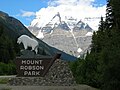 Mount Robson Park-British Columbia-Canada.JPG 2,592 × 1,944; 1.07 MB
-
 P1000489 (7041488209).jpg 3,648 × 1,800; 5.87 MB
-
 Pcpp sa.jpg 720 × 480; 49 KB
-
 Peace River Valley Site C Flooding Area.jpg 6,000 × 4,000; 11.91 MB
-
 Rocky landscape from Klondike Highway near Alaska British Columbia border 4.jpg 2,824 × 2,300; 2.25 MB
-
 Rocky landscape from Klondike Highway near Alaska British Columbia border 5.jpg 3,072 × 2,304; 2.54 MB
-
 Rocky landscape from Klondike Highway near Alaska British Columbia border 6.jpg 3,069 × 1,863; 1.96 MB
-
 Rocky landscape from Klondike Highway, British Columbia.jpg 3,069 × 1,687; 1.74 MB
-
 Sea to Sky Gondola 02.jpg 4,032 × 3,024; 2.83 MB
-
 Seven Sisters Mountain from Cassiar.jpg 1,227 × 807; 870 KB
-
 Site C Dam Construction Site.jpg 6,000 × 4,000; 9.78 MB
-
 Tofinobeachkjfmartin.jpg 4,272 × 2,848; 2.17 MB
-
 Turtlelake13-1617 HDR (8661097102).jpg 1,024 × 685; 540 KB
-
 Tutshi Lake from Klondike Highway, British Columbia.jpg 3,072 × 2,304; 2.44 MB
-
 Vegetation Induced Circular Snowmelt.jpg 1,360 × 2,048; 1.29 MB
-
 View from the top of Whistler Mountain.jpg 3,072 × 2,048; 2.01 MB
-

-
 Walking through the winter woods towards Winfield.png 4,600 × 3,456; 22.32 MB
-
 Whistler panorama.jpg 2,518 × 1,350; 4.51 MB
-
 Wonder why they call it Sandspit (386750420).jpg 2,272 × 1,704; 1.25 MB


.jpg)
.jpg)
.jpg)
.jpg)


.jpg)


.jpg)


.jpg)


_(2).jpg)


.jpg)