Category:Geography of Canada
Zur Navigation springen
Zur Suche springen
geographische Eigenschaften des Landes Kanada | |||||
| Medium hochladen | |||||
| Ist ein(e) |
| ||||
|---|---|---|---|---|---|
| Unterklasse von | |||||
| Aspekt von | |||||
| Ort |
| ||||
| |||||
Unterkategorien
Es werden 32 von insgesamt 32 Unterkategorien in dieser Kategorie angezeigt:
In Klammern die Anzahl der enthaltenen Kategorien (K), Seiten (S), Dateien (D)
Medien in der Kategorie „Geography of Canada“
Folgende 18 Dateien sind in dieser Kategorie, von 18 insgesamt.
-
 Report of the Geographic Board of Canada containing all decisions to 30th June, 1910. (IA 1911v45i13p21a 0745).pdf 570 × 912, 460 Seiten; 29,53 MB
-
-
 Altitudes in the dominion of Canada (IA altitudesindomi00whit).pdf 935 × 1.435, 652 Seiten; 34,62 MB
-
 Canadianshield.gif 500 × 520; 98 KB
-
 Comparison Size with Canada map.GIF 519 × 1.369; 24 KB
-
 Dictionary of altitudes in the Dominion of Canada (IA dictionaryofalt00whit).pdf 995 × 1.456, 272 Seiten; 15,24 MB
-
 Dictionary of altitudes in the Dominion of Canada with a relief map of Canada (IA dictionaryofalti00whit).pdf 922 × 1.447, 168 Seiten; 11,47 MB
-
 Dominion-land-survey-township.png 400 × 540; 28 KB
-
 Dominion-land-system-overview.png 400 × 250; 20 KB
-
 Notes on the Physical Geography of Vancouver Island (IA jstor-1798470).pdf 1.050 × 1.500, 23 Seiten; 6,01 MB
-
 LG3 Reservoir Rocks - panoramio.jpg 3.072 × 2.304; 2,69 MB
-
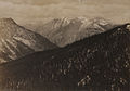
 Northwest-relief MuskwaRanges.jpg 609 × 597; 404 KB
-
Pass over Canada and Central United States at Night.ogv 32 s, 840 × 560; 7,06 MB
-
 Pokrywa lodowa 1999.jpg 648 × 486; 28 KB
-
 Sheep Mountain (HS85-10-20115) original.tif 3.315 × 2.700; 26,25 MB
-
 Sheep Mountain (HS85-10-20115).jpg 1.896 × 1.320; 3,16 MB
-
 US east coast ne appalachian physio map.jpg 269 × 500; 39 KB
-
 US-Canadian border along the 49th parallel.png 2.108 × 708; 64 KB


.jpg)
