Category:Geography of Chile
ナビゲーションに移動
検索に移動
physical and political forms of the South American nation.  | |||||
| メディアをアップロード | |||||
| 分類 |
| ||||
|---|---|---|---|---|---|
| 上位クラス | |||||
| 親項目 | |||||
| 場所 |
| ||||
| |||||
チリ | ||
|---|---|---|
| ||
|
下位カテゴリ
このカテゴリに属する 25 個のサブカテゴリのうち、 25 個を表示しています。
*
- Paleogeography of Chile (3ファイル)
A
- Altitude signs in Chile (2ファイル)
- Atlantic Time Zone (Americas) (1ファイル)
B
C
D
E
G
H
L
M
N
P
T
W
カテゴリ「Geography of Chile」にあるメディア
このカテゴリに属する 16 個のファイルのうち、 16 個を表示しています。
-
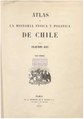 Atlas de la historia física y política de Chile, tomo 1.pdf 1,422 × 2,033、186 ページ;79.82メガバイト
-
 Atlas of the Physical and Political History of Chile (Plates, Volume 2) WDL3980.pdf 900 × 1,139、136 ページ;10.67メガバイト
-
 Campiña Domestica y Silvestre del Reino de Chile en 1744 - AHG.jpg 8,746 × 5,641;6.12メガバイト
-
 Chile 2 018.jpg 2,592 × 1,944;1.38メガバイト
-
 Chilean Central Valley (Historical).svg 300 × 570;75キロバイト
-
 DiccionarioJeograficodeChileRisopatron.pdf 993 × 1,450、992 ページ;352.15メガバイト
-
 Ernestoelicura.JPG 1,280 × 960;587キロバイト
-
 Geomorfologiadechile2.svg 606 × 1,965;519キロバイト
-
 Karte von Chile in 2 Blättern.jpg 3,730 × 10,576;5.53メガバイト
-
 La cebada; Erotion landscape.jpg 2,272 × 1,280;1.05メガバイト
-
 Los Andes 23 juli 08.JPG 889 × 596;71キロバイト
-
 Mapa de Valdivia-Chiloé, por Mariano de Pusterla, Valdivia, 10 de enero de 1791.png 1,297 × 1,851;4.08メガバイト
-
 Matorral Octubre.JPG 4,000 × 3,000;2.47メガバイト
-
 Plantaciones-Monte Patria.jpg 500 × 329;51キロバイト
-
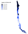 Regions of Chile by HDI.png 2,340 × 2,833;168キロバイト
-
 Revista Chilena de Historia y Geografía 1911.png 440 × 745;634キロバイト


.svg)


