Category:Geography of Puerto Rico
Vai alla navigazione
Vai alla ricerca
Stati degli USA: Alabama · Alaska · Arizona · Arkansas · California · Carolina del Nord · Carolina del Sud · Colorado · Connecticut · Dakota del Nord · Dakota del Sud · Delaware · Florida · Georgia · Hawaii · Idaho · Illinois · Indiana · Iowa · Kansas · Kentucky · Louisiana · Maine · Maryland · Massachusetts · Michigan · Minnesota · Mississippi · Missouri · Montana · Nebraska · Nevada · New Hampshire · New Jersey · New York · Nuovo Messico · Ohio · Oklahoma · Oregon · Pennsylvania · Rhode Island · Tennessee · Texas · Utah · Vermont · Virginia · Virginia Occidentale · Washington · Wisconsin · Wyoming – Distretto di Columbia: Washington
aree insulari degli Stati Uniti d'America: Guam · Isole Marianne Settentrionali · Isole Vergini Americane · Porto Rico · Samoa Americane – Atollo di Midway · Atollo Johnston · isola Baker · isola di Wake · Isola Howland · isola Jarvis · isola Navassa · Kingman Reef · Palmyra
aree insulari degli Stati Uniti d'America: Guam · Isole Marianne Settentrionali · Isole Vergini Americane · Porto Rico · Samoa Americane – Atollo di Midway · Atollo Johnston · isola Baker · isola di Wake · Isola Howland · isola Jarvis · isola Navassa · Kingman Reef · Palmyra
Geography of the island in the Caribbean  | |||||
| Carica un file multimediale | |||||
| Istanza di |
| ||||
|---|---|---|---|---|---|
| Sottoclasse di | |||||
| Parte di | |||||
| Aspetto di | |||||
| Luogo |
| ||||
| Superficie |
| ||||
 | |||||
Sottocategorie
Questa categoria contiene le 16 sottocategorie indicate di seguito, su un totale di 16.
File nella categoria "Geography of Puerto Rico"
Questa categoria contiene 32 file, indicati di seguito, su un totale di 32.
-
 300-year-old Ceiba tree, Vieques, Puerto Rico.jpg 2 304 × 3 456; 3,52 MB
-
 A MOUNTAIN FARMHOUSE - NARA - 546367.jpg 3 000 × 2 037; 1,16 MB
-
 Atlantic-trench.JPG 1 500 × 1 076; 331 KB
-
 Bosque Estatal de Guajataca, Puerto Rico.jpg 2 048 × 2 264; 1,97 MB
-
 Caimito.jpg 1 628 × 1 632; 662 KB
-
 Caribbean-map.png 420 × 230; 13 KB
-
 El Cinco.jpg 1 628 × 1 632; 411 KB
-
 El Toro Wilderness.jpg 500 × 303; 62 KB
-
 Guayacán Centenario, Guánica, Puerto Rico.jpg 2 304 × 3 456; 4,04 MB
-
 Hato Rey Central Barrio.jpg 1 628 × 1 632; 408 KB
-
 Isla de Cabras en Puerto Rico.jpg 2 744 × 2 059; 1,34 MB
-
 Isla de Cabras, Puerto Rico.jpg 800 × 533; 82 KB
-
 Lago Cerrillos 2.JPG 2 604 × 1 662; 645 KB
-
 Lago Cerrillos.JPG 3 072 × 2 304; 526 KB
-
 Lagoon port.jpg 640 × 480; 143 KB
-
 Laterite formation on serpentinite. C 008.jpg 968 × 1 492; 1,47 MB
-
 Levittown PR Census Map.gif 575 × 425; 48 KB
-
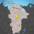
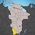
 Moca, Puerto Rico locator map.png 847 × 630; 84 KB
-
 Mona passage.jpg 874 × 480; 85 KB
-
 Monacillo Barrio.jpg 1 628 × 1 632; 411 KB
-
 PRtrenchlocation.jpg 600 × 471; 128 KB
-
 Puerto Rico Beaches 01 (cropped).jpg 2 133 × 305; 689 KB
-
 Puerto Rico Beaches 01.jpg 3 780 × 2 500; 6,96 MB
-
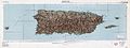 Puerto Rico Map Topographic fixed.jpg 16 032 × 6 026; 15,57 MB
-
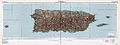 Puerto Rico Map Topographic.jpg 16 061 × 6 048; 19,86 MB
-
 Quebrada Arenas Barrio.jpg 1 628 × 1 632; 412 KB
-
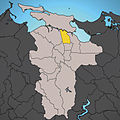
 Rincon, Puerto Rico locator map.png 847 × 630; 72 KB
-
 Rio La Plata, Puerto Rico.jpg 1 519 × 1 031; 344 KB
-
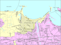
 SanJuanMetroArea.gif 448 × 247; 22 KB
-
 Soil moisture regimes of Puerto Rico.gif 3 657 × 2 088; 189 KB
-
 Steps Beach Rincon.JPG 2 816 × 2 112; 2,27 MB
-
 View from Guánica State Forest, Puerto Rico.jpg 3 456 × 2 304; 3,05 MB


.jpg)