Category:Geography of Florida
Jump to navigation
Jump to search
States of the United States: Alabama · Alaska · Arizona · Arkansas · California · Colorado · Connecticut · Delaware · Florida · Georgia · Hawaii · Idaho · Illinois · Indiana · Iowa · Kansas · Kentucky · Louisiana · Maine · Maryland · Massachusetts · Michigan · Minnesota · Mississippi · Missouri · Montana · Nebraska · Nevada · New Hampshire · New Jersey · New Mexico · New York · North Carolina · North Dakota · Ohio · Oklahoma · Oregon · Pennsylvania · Rhode Island · South Carolina · South Dakota · Tennessee · Texas · Utah · Vermont · Virginia · Washington · West Virginia · Wisconsin · Wyoming – District of Columbia: Washington, D.C.
insular area of the United States: American Samoa · Guam · Northern Mariana Islands · Puerto Rico · United States Virgin Islands – Baker Island · Howland Island · Jarvis Island · Johnston Atoll · Kingman Reef · Midway Atoll · Navassa Island · Palmyra Atoll · Wake Island
insular area of the United States: American Samoa · Guam · Northern Mariana Islands · Puerto Rico · United States Virgin Islands – Baker Island · Howland Island · Jarvis Island · Johnston Atoll · Kingman Reef · Midway Atoll · Navassa Island · Palmyra Atoll · Wake Island
peninsula between the Gulf of Mexico, the Atlantic Ocean | |||||
| Upload media | |||||
| Instance of |
| ||||
|---|---|---|---|---|---|
| Subclass of | |||||
| Facet of | |||||
| Location |
| ||||
| |||||
Subcategories
This category has the following 32 subcategories, out of 32 total.
B
- Buttonwood Bay (52 F)
C
D
E
G
I
L
M
- Miami Beach tidal flooding (137 F)
N
P
R
S
T
V
- Vacant lots in Florida (6 F)
Media in category "Geography of Florida"
The following 26 files are in this category, out of 26 total.
-
 308th Armament Systems Wing - standown.jpg 2,635 × 1,882; 863 KB
-
 Boca Raton AAF - Hurricane 1947 - 1.jpg 500 × 245; 25 KB
-
 Capesanblas.png 525 × 437; 11 KB
-
 Choctawhatchee Bay.JPG 3,216 × 1,236; 1.2 MB
-
 Cross City Air Force Station - Florida.jpg 600 × 475; 57 KB
-
 Florida formed from multicolored hexagons.svg 512 × 492; 232 KB
-
 Floridan Aquifer USGS.gif 402 × 408; 19 KB
-
 Floridian seagrass bed.jpg 400 × 267; 47 KB
-
 Francis Eppes Plantation.png 469 × 300; 12 KB
-
 Hendricks AAF Easter Sunrise Service 1944.jpg 733 × 556; 79 KB
-
 Hurricane Dora 1964 Florida track.png 2,599 × 2,057; 1.33 MB
-
 Johnsons seagrass bed.jpg 365 × 224; 21 KB
-
 Kice Island chart.png 684 × 565; 439 KB
-
 KingsBay.jpg 547 × 410; 150 KB
-
 LeHeup Hill FL elev sign01.jpg 3,216 × 4,288; 2.25 MB
-
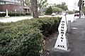 Monument Avenue and Church Street.jpg 5,472 × 3,648; 1.61 MB
-
 Orchard Pond Plantation01.png 469 × 300; 12 KB
-
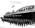
 Orlando AAB 1943 Postcard.jpg 591 × 373; 72 KB
-
 Ponce de leon inlet map.jpg 810 × 540; 72 KB
-
 Prijon Seayak on the Silver River , FL.jpg 1,200 × 1,201; 953 KB
-
 Riddle Field - FL - Cadets training in PT-17 Stearman.jpg 600 × 468; 50 KB
-
 Riddle Field - FL - Cadets with AT-6 Texans.jpg 600 × 476; 63 KB
-
 Riddle Field - FL - Sign.jpg 600 × 404; 53 KB
-
 Riddle Field FL - RAF Cadets on Parade.jpg 600 × 485; 66 KB
-
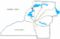
 South Atlantic Route Map.jpg 800 × 613; 109 KB
-
 Temple Crest.JPG 836 × 823; 333 KB


