Category:George F. Cram
Jump to navigation
Jump to search
American map publisher (1842-1928) | |||||
| Upload media | |||||
| Date of birth | 20 May 1842 Lowell | ||||
|---|---|---|---|---|---|
| Date of death | 24 May 1928 Spokane | ||||
| Place of burial | |||||
| Country of citizenship | |||||
| Occupation | |||||
| |||||
Pages in category "George F. Cram"
This category contains only the following page.
Media in category "George F. Cram"
The following 46 files are in this category, out of 46 total.
-
 1888 Cram map of Chicago.jpg 4,363 × 5,475; 12.51 MB
-
 1889 map of Central Asia, Comprising Turkestan, Afghanistan. Beluchistan, & N.W. India.jpg 4,146 × 6,591; 6.83 MB
-
 1891 Cram Goldthwaite Chicago map.jpg 3,170 × 4,308; 5.87 MB
-
 1898 map of Charleston, South Carolina.jpeg 2,807 × 3,756; 1.26 MB
-
 1901 Cram map of Chicago.jpg 6,423 × 10,700; 14.12 MB
-
 1901 Kingston Jamaica map Cram's Modern Atlas.jpg 2,740 × 1,918; 1.87 MB
-
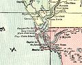 1901CharlotteHarborMap.jpg 500 × 400; 53 KB
-
 Allegheny City map.jpg 1,586 × 1,077; 770 KB
-
 Allegheny City.jpg 500 × 353; 36 KB
-
 Atlanta Street Map, 1888.jpg 2,092 × 2,563; 1.99 MB
-
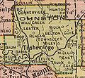
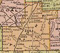 AtokaCounty1909.jpg 486 × 428; 84 KB
-
 Bermuda Islands 1901 atlas page.jpg 5,958 × 4,532; 6.65 MB
-
 Birds Eye View of the Holy Land.jpg 8,149 × 6,503; 17.7 MB
-
 BryanCounty1909.jpg 623 × 412; 86 KB
-
 ChoctawCounty1909.jpg 516 × 247; 47 KB
-
 CoalCounty1909.jpg 296 × 292; 35 KB
-
 Cochise-county-1884.jpg 996 × 1,045; 326 KB
-
 Cram's map of Wisconsin (NBY 15551).jpg 2,656 × 3,600; 2.66 MB
-
 Cram's township and railroad map of Wyoming. LOC 98688571.jpg 7,152 × 5,376; 7.61 MB
-
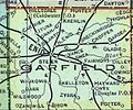 Garfield county.jpg 600 × 500; 82 KB
-
 George Cram, Paris, 1893 - David Rumsey.jpg 9,598 × 6,350; 26.93 MB
-
 George F. Cram, Ancient Jerusalem New Testament period (FL45582201 3918152).jpg 2,529 × 3,251; 2.3 MB
-
 George F. Cram, Distribution of nations after the deluge (FL37128249 3904087).jpg 4,037 × 2,942; 6.57 MB
-
 George F. Cram, Historical bird eye view of the Holy Land (FL45582226 3918156).jpg 5,037 × 3,216; 5.42 MB
-

-
 George F. Cram, Judea according to the Apocryphal books (FL46962050 3904375).jpg 3,561 × 4,950; 16.91 MB
-
 George F. Cram, Kingdoms of Judah and Israel (FL46962059 3904339).jpg 3,667 × 4,956; 17.12 MB
-

-
 George F. Cram, Map of Solomon's kingdom and phoenicia (FL37128277 3904310).jpg 4,267 × 3,018; 6.23 MB
-
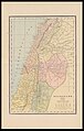
 George F. Cram, Palestine (FL37128259 3904077).jpg 3,302 × 4,317; 6.19 MB
-
 George F. Cram, Palestine (FL37821483 3923145).jpg 8,289 × 13,012; 157.07 MB
-
 George F. Cram, The half tribe of Manasseh beyond the Jordan (FL46962026 3904338).jpg 3,743 × 4,980; 18.19 MB
-
 George F. Cram, Tribe of Asher and Naphtali (FL46962032 3904316).jpg 3,719 × 4,968; 17.37 MB
-
 George F. Cram, Tribe of Gad & Reuben (FL37128299 3904337).jpg 3,115 × 3,821; 5.5 MB
-

-
 HughesCounty1909.jpg 411 × 420; 66 KB
-
 JohnstonCounty1909.jpg 356 × 330; 50 KB
-
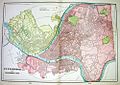
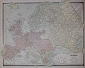 Map of Europe 1884 Cram's Family Atlas.jpg 4,291 × 3,442; 4.36 MB
-
 MarshallCounty1909.jpg 309 × 304; 40 KB
-
 McCurtainCounty1909.jpg 478 × 678; 111 KB
-
 Puerto Rico 1901.jpg 9,467 × 7,038; 6.26 MB
-
 PushmatahaCounty1909.jpg 537 × 421; 83 KB
-
 Samoa Cram Map 1896.jpg 2,165 × 1,621; 787 KB
-
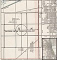 Stickney Circle from Cram map of Chicago 1901.jpg 2,366 × 2,487; 3.26 MB
-
 Union Grove Township from map of Iredell County in 1917.jpg 524 × 589; 97 KB
-
 Worlds tallest buildings, 1884.jpg 1,859 × 1,391; 1.18 MB


.jpg)


.jpg)
.jpg)
.jpg)
.jpg)
.jpg)
.jpg)
.jpg)
.jpg)
.jpg)
.jpg)
.jpg)
.jpg)
.jpg)


