Category:Georgia State Route 520
Jump to navigation
Jump to search
 | number: | (five hundred twenty-) |
|---|---|---|
| State highways in Georgia (U.S. state): | 515 · 520 |
highway in Georgia  | |||||
| Upload media | |||||
| Instance of | |||||
|---|---|---|---|---|---|
| Location | Georgia | ||||
| Transport network | |||||
| Owned by | |||||
| Maintained by | |||||
| Inception |
| ||||
| Length |
| ||||
| |||||
English: State Route 520 (SR 520), also known as the South Georgia Parkway, is a state highway in the southern part of the U.S. state of Georgia. It runs from the Alabama state line, at the Chattahoochee River to Jekyll Island. It has many concurrencies along its route, including U.S. Route 280 (US 280) from the Alabama state line to Richland; US 27 from Columbus to Cusseta; and especially US 82 from Dawson to a point southwest of Brunswick.
Subcategories
This category has the following 11 subcategories, out of 11 total.
B
G
Media in category "Georgia State Route 520"
The following 16 files are in this category, out of 16 total.
-
 Georgia 520 Business.svg 750 × 600; 13 KB
-
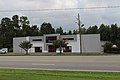 Badcock & More Home Furniture, Dawson.jpg 5,184 × 3,456; 6.54 MB
-
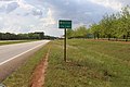
 Dawson city limit GA520 EB.jpg 5,068 × 3,456; 7.79 MB
-
 Dawson limit, US82 EB.JPG 4,320 × 3,240; 4.53 MB
-
 EB US 82 near E End of US 1-23 Concurrency.jpg 3,648 × 2,736; 2.06 MB
-
 GA green route concurrency.png 318 × 335; 140 KB
-
 GA45sRoadTurnLeftOntoGA520signs (25372786579).jpg 2,400 × 1,600; 2.22 MB
-
 GA520eRoad-NearUS82jct-GA32-GA45-ToGA55Signs (30707001160).jpg 2,400 × 1,600; 1.85 MB
-
 Georgia 520.svg 750 × 600; 8 KB
-
 Georgia state route 520 map.png 1,734 × 1,101; 498 KB
-
 Int185sRoad-Exit1AB-US27nsGA1nsUS280ewGA520ew (32754674602).jpg 2,400 × 1,600; 1.45 MB
-
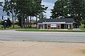 One South Bank, Dawson.jpg 5,184 × 3,456; 7.55 MB
-
 Sasser city limit US82 WB.jpg 5,184 × 3,456; 5.58 MB
-
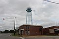 Sasser Water Tower on US82.jpg 5,184 × 3,456; 4.86 MB
-
 South Georgia Parkway shield.svg 2,161 × 2,161; 10 KB
-
 Weston city limit, GA520 WB.jpg 5,184 × 3,456; 7.45 MB


.jpg)
.jpg)
.jpg)


