Category:Girnitz 4 (Schwarzhofen)
Jump to navigation
Jump to search
| Object location | | View all coordinates using: OpenStreetMap |
|---|
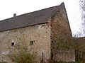
building in Schwarzhofen, Upper Palatinate, Germany  | |||||
| Upload media | |||||
| Instance of | |||||
|---|---|---|---|---|---|
| Location | Schwarzhofen, Schwandorf, Upper Palatinate, Bavaria, Germany | ||||
| Street address |
| ||||
| Heritage designation | |||||
 | |||||
This is the category of the Bavarian Baudenkmal (cultural heritage monument) with the ID D-3-76-164-30 (Wikidata)
|
Media in category "Girnitz 4 (Schwarzhofen)"
The following 8 files are in this category, out of 8 total.
-
 Girnitz 4 Schwarzhofen 15 06 2017 03.JPG 5,184 × 3,456; 5.6 MB
-
 Girnitz 4 Schwarzhofen 15 06 2017 06.JPG 3,456 × 5,184; 6.09 MB
-
 Girnitz Schwarzach Schwarzhofen 2011 01.jpg 4,000 × 3,000; 2.41 MB
-
 Girnitz4 01.jpg 2,304 × 1,704; 748 KB
-
 Girnitz4 02.jpg 2,304 × 1,704; 822 KB
-
 Girnitz4 03.jpg 2,304 × 1,704; 857 KB
-
 Girnitz4 04.jpg 2,304 × 1,704; 893 KB
-
 Girnitz4 05.jpg 2,304 × 1,704; 874 KB


