Category:Glarus Süd
Vai alla navigazione
Vai alla ricerca
Esperanto: Glaruso Sudo estas politika komunumo en Kantono Glaruso, kiu estiĝis kun efiko de la 1-a de januaro 2011 per kunigo de la ĝis tiamaj malnovaj politikaj komunumoj Betschwanden, Braunwald, Elm, Engi, Haslen, Linthal, Luchsingen, Matt, Mitlödi, Rüti, Schwanden, Schwändi, kaj Sool.
comune svizzero     | |||||
| Carica un file multimediale | |||||
| Istanza di |
| ||||
|---|---|---|---|---|---|
| Luogo | Glarona, Svizzera | ||||
| Situato sul mare / lago / fiume |
| ||||
| Lingua ufficiale | |||||
| Capo del governo |
| ||||
| Data di fondazione o creazione |
| ||||
| Popolazione |
| ||||
| Superficie |
| ||||
| Altezza sul mare |
| ||||
| Ha sostituito |
| ||||
| sito web ufficiale | |||||
 | |||||
Sottocategorie
Questa categoria contiene le 31 sottocategorie indicate di seguito, su un totale di 31.
B
- Bifertenstock (1 P, 63 F)
C
- Cavistrau (27 F)
D
- Durnachtal (11 F)
G
- Garichti Stausee (7 F)
- Grünhornhütte (5 F)
L
M
N
R
- Risetenpass (4 F)
S
- Segnespass (28 F)
- Selbsanft (14 F)
- Sool (22 F)
T
W
- Weissenberge (3 F)
File nella categoria "Glarus Süd"
Questa categoria contiene 51 file, indicati di seguito, su un totale di 51.
-
 CHE Glarus Süd COA.svg 550 × 630; 4 KB
-
 Glarus Sud-coat of arms.svg 603 × 763; 12 KB
-
 GW-GL-Glarus Sued.png 184 × 220; 11 KB
-
 Wappen der Gemeinde Glarus Süd.svg 175 × 210; 9 KB
-
 C1631-080.png 80 × 80; 4 KB
-
 CHE Glarus Süd Flag.svg 512 × 512; 5 KB
-
 Chli Kärpf Gross Kärpf.jpg 4 000 × 3 000; 4,41 MB
-
 Elm in Glarus Süd, Kanton Glarus.jpg 14 737 × 4 005; 60,78 MB
-
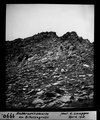 ETH-BIB-Anthracitscharte am Bifertengrätli-Dia 247-01990.tif 2 846 × 3 422; 9,39 MB
-
 ETH-BIB-Aufstieg zum Bifertengletscher von Hinter-Sand-Alp-Dia 247-05219.tif 3 488 × 2 794; 9,39 MB
-
 ETH-BIB-Bifertengletscher, oberer Teil vom Ochsenstock-Dia 247-01857.tif 3 335 × 2 826; 9,11 MB
-
 ETH-BIB-Bifertengletscher, unterer Teil vom Ochsenstock-Dia 247-01858.tif 3 351 × 2 835; 9,18 MB
-
 ETH-BIB-Bifertengrätli-Dia 247-01860.tif 3 479 × 2 841; 9,52 MB
-
 ETH-BIB-Falte mit Clivage, Thierfehd Linthal-Dia 247-00031.tif 3 397 × 2 850; 9,34 MB
-
 ETH-BIB-Limmerntobel, Selbsanft-Dia 247-00174.tif 2 850 × 3 356; 9,22 MB
-
 ETH-BIB-Mettmen Niederental, Blick nach Süden, Kärpf-LBS H1-012431.tif 6 252 × 4 302; 77,14 MB
-
 ETH-BIB-Piz Cazarauls, Piz Cambrialas, Düssi, Oberalpstock-Inlandflüge-LBS MH05-14-09.tif 2 316 × 3 508; 23,34 MB
-
 ETH-BIB-Piz Cazarauls, Piz Medel, Furcla v. N. aus 2600 m-Inlandflüge-LBS MH01-003939.tif 6 341 × 4 377; 79,55 MB
-
 ETH-BIB-Piz Cazarauls-Inlandflüge-LBS MH05-03-19.tif 3 508 × 2 318; 23,32 MB
-
 ETH-BIB-Risetenhoren, Glärnisch v. O. aus 2200 m-Inlandflüge-LBS MH01-003503.tif 6 420 × 4 379; 80,59 MB
-
 ETH-BIB-Saasberg-Absturz zum Durnachtal-Dia 247-00071.tif 3 595 × 2 769; 9,59 MB
-

-

-
 ETH-BIB-Sandalp, Tödi v. N. N. O. aus 2500 m-Inlandflüge-LBS MH01-006922.tif 4 860 × 6 609; 92,04 MB
-
 ETH-BIB-Sandgipfel, Sandpass, Kleiner Tödi v. N. aus 3500 m-Inlandflüge-LBS MH01-004760.tif 6 725 × 4 573; 88,14 MB
-
 ETH-BIB-Sandpass, Tödi-Westwand v. W. aus 3400 m-Inlandflüge-LBS MH01-006337.tif 4 665 × 6 197; 82,87 MB
-

-
 ETH-BIB-Teufelstöcke, Tödi v. N. aus 3700 m-Inlandflüge-LBS MH01-006521.tif 3 961 × 2 883; 32,83 MB
-
 ETH-BIB-Val Rusein, Alp Cavrein, Oberalpstock, Gr. Windgälle-Inlandflüge-LBS MH01-003565.tif 6 498 × 4 552; 84,77 MB
-
 ETH-BIB-Wasserberg, Bisigtal, Clariden-Inlandflüge-LBS MH01-006885.tif 6 606 × 4 955; 93,75 MB
-

-

-
-
 ETH-BIB-Zwölfihorn, Vorabfirn, Vorab v. N. aus 3500 m-Inlandflüge-LBS MH01-003022.tif 6 240 × 4 481; 80,14 MB
-
 Fanenstock (2237).jpg 4 032 × 3 024; 3,78 MB
-
 Flag of Glarus Süd.png 216 × 216; 13 KB
-
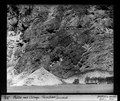
 A Kies-Mettmen drótkötélpálya. Svájc, Glarus 1966. Fortepan 62009.jpg 3 557 × 5 528; 10,86 MB
-
 Gandstock, Plattengrat, Guldergrat.jpg 6 537 × 4 910; 7,38 MB
-

-
 Herbst im Glarnerland.jpg 2 048 × 1 364; 468 KB
-
 Karte Gemeinde Glarus Süd 2011.png 1 476 × 1 992; 522 KB
-
 Langlauf auf dem Töditritt bei Leuggelbach in Glarus Süd, Kanton Glarus.jpg 19 004 × 4 100; 71,14 MB
-
 Limmernsee und Muttsee Mauer fertig.JPG 3 072 × 2 304; 3,05 MB
-
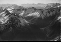
 Mountain perspective.jpg 1 890 × 1 181; 1,79 MB
-
 Nussbüel - panoramio.jpg 2 048 × 1 536; 1,3 MB
-
 Ofen vom Bündner Vorab.jpg 1 318 × 849; 280 KB
-
 Paraglider in Swiss sky.jpg 3 840 × 2 160; 3,48 MB
-
 Sud Gl.jpg 800 × 600; 156 KB
-
 Swiss Farm House - panoramio.jpg 1 459 × 1 094; 691 KB
-
 View at Chüebodensee.jpg 4 032 × 3 024; 1,8 MB
-
 Zwischen Schilt und Roterd, Kanton Glarus.jpg 11 699 × 3 485; 42,25 MB


.jpg)


