Category:Linthal
Jump to navigation
Jump to search
village in the municipality Glarus Süd in the canton of Glarus, Switzerland    | |||||
| Upload media | |||||
| Instance of | |||||
|---|---|---|---|---|---|
| Part of |
| ||||
| Location | Glarus, Switzerland | ||||
| Area |
| ||||
| Elevation above sea level |
| ||||
| Replaced by | |||||
| Different from | |||||
| official website | |||||
 | |||||
Esperanto: Linthal estis komunumo en Kantono Glaruso en Svislando. Esta parte di kommuno Glarus Sudo.
Subcategories
This category has the following 20 subcategories, out of 20 total.
A
B
C
- Claridenhütte (12 F)
F
- Fridolinshütte (4 F)
H
- Hausstock (1 P, 43 F)
K
- Katholische Kirche Linthal (3 F)
- Kistenpasshütte (2 F)
L
- Limmernsee (22 F)
- Linthal railway station (8 F)
M
- Muttsee (21 F)
- Muttseehütte (17 F)
R
- Reformierte Kirche Linthal (9 F)
S
- Scheidstöckli (6 F)
- Selbsanft (14 F)
T
U
- Piz Urlaun (13 F)
Media in category "Linthal"
The following 102 files are in this category, out of 102 total.
-
 1173 Linthal.jpg 14,000 × 9,600; 131.56 MB
-
 2005-Linthal-Kirche.jpg 1,920 × 1,280; 2.38 MB
-
 2005-Linthal.jpg 1,920 × 1,280; 2.63 MB
-
 Alpiner Salamander.jpg 2,368 × 5,120; 4.67 MB
-
 Bifertenstock3425m.JPG 3,008 × 2,000; 1.08 MB
-
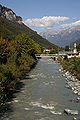
 Braunwaldbahn Fusssteg über die Linth, Linthal GL 20180815-jag9889.jpg 3,611 × 2,889; 7.77 MB
-
 Bächi Kamm2006.JPG 3,008 × 2,000; 1.06 MB
-
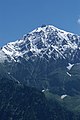
 BündnerTödi3124m.JPG 1,998 × 2,664; 889 KB
-
 Climbing out of Linthal - panoramio.jpg 1,600 × 1,200; 312 KB
-
 Clé de linteau datée de 1710. Linthal.jpg 4,000 × 3,000; 3.24 MB
-
 Edmund Bebie Linthal 1908 GWA2012.jpg 1,492 × 801; 138 KB
-
 ETH-BIB-Chilchenstock, Linthal, Rüti-Inlandflüge-LBS MH01-006859.tif 6,281 × 5,013; 90.17 MB
-
 ETH-BIB-Chilchenstock-Inlandflüge-LBS MH01-006857.tif 5,095 × 6,594; 96.26 MB
-
 ETH-BIB-Chilchenstock-Inlandflüge-LBS MH01-006858.tif 6,335 × 5,004; 90.83 MB
-
 ETH-BIB-Chilchenstock-Inlandflüge-LBS MH01-006860.tif 6,577 × 4,940; 93.08 MB
-
 ETH-BIB-Klettergruppe am Ochsenstock (Glarus)-Dia 247-00226.tif 2,929 × 3,595; 10.14 MB
-
 ETH-BIB-Limmernbach-Sandbach, Zusammenfluss-Dia 247-12570.tif 3,658 × 2,798; 9.87 MB
-
 ETH-BIB-Limmerntobel am Sandbach-Dia 247-12571.tif 2,992 × 3,452; 9.96 MB
-
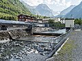
 ETH-BIB-Linthal bei Schwanden, Übersicht-LBS H1-015243.tif 6,480 × 4,446; 82.63 MB
-
 ETH-BIB-Linthal v. S. aus 300 m-Inlandflüge-LBS MH01-003496.tif 5,813 × 4,109; 68.44 MB
-
 ETH-BIB-Linthal, Braunwald, Glärnisch-LBS H1-015266.tif 6,452 × 4,443; 82.17 MB
-
 ETH-BIB-Linthal, Braunwald, Ortstock-LBS H1-015263.tif 6,462 × 4,453; 82.5 MB
-
 ETH-BIB-Linthal, Braunwald-LBS H1-015264.tif 6,488 × 4,453; 82.88 MB
-
 ETH-BIB-Linthal, Durnachtal, Bachverbauung-LBS H1-015260.tif 6,464 × 4,465; 82.74 MB
-
 ETH-BIB-Linthal, Kilchenstock-LBS H1-019974.tif 4,509 × 6,470; 83.57 MB
-
 ETH-BIB-Linthal, Tödi-LBS H1-015262.tif 6,459 × 4,451; 82.41 MB
-
 ETH-BIB-Linthal, Übersicht-LBS H1-015242.tif 6,447 × 4,450; 82.18 MB
-
 ETH-BIB-Linthal-LBS H1-024194.tif 6,696 × 4,717; 90.41 MB
-
 ETH-BIB-Linthal-LBS H1-024195.tif 6,699 × 4,707; 90.26 MB
-
 ETH-BIB-Linthal-LBS H1-024198.tif 6,712 × 4,695; 90.21 MB
-
 ETH-BIB-Moräne zur Vorder- und Hinter-Sand (Glarus)-Dia 247-05218.tif 3,572 × 2,754; 9.47 MB
-
 ETH-BIB-Obere Sandalp, Claridenfirn-Dia 247-01993.tif 2,862 × 2,591; 7.17 MB
-
 ETH-BIB-Sandalp, Tödi-Inlandflüge-LBS MH01-006923.tif 6,690 × 4,849; 92.92 MB
-
 ETH-BIB-Sandbach-Cańon (Rötidolomit) von Oberhalb Sandalp auswärts-Dia 247-01854.tif 2,875 × 3,448; 28.46 MB
-
 ETH-BIB-Schreyenbachfall, Linthal-Dia 247-12563.tif 3,051 × 3,410; 10.01 MB
-
 ETH-BIB-Talstufe Unter-Ober-Sand-Alp-Dia 247-05220.tif 3,764 × 2,848; 10.31 MB
-
 ETH-BIB-Vorder-Spitzälplistock mit Ober-Sandalp-Dia 247-01855.tif 3,263 × 2,836; 8.92 MB
-

-
-
 ETH-BIB-Wasserflugzeug über Linthal, Glärnisch v. O. aus 4000 m-Inlandflüge-LBS MH01-001469.tif 5,890 × 4,049; 68.31 MB
-

-

-

-

-
 Fotografi av berget Tödi och Linthfloden i Schweiz - Hallwylska museet - 103162.tif 3,248 × 2,724; 25.34 MB
-
 FruttbergeGlarus Pano.jpg 5,851 × 2,826; 4.05 MB
-
 Fätschli Brücke über die Linth, Linthal GL 20180727-jag9889.jpg 4,608 × 3,456; 11.41 MB
-
 Fätschli Steg über die Linth, Linthal GL 20180727-jag9889.jpg 4,608 × 3,456; 12.38 MB
-

-

-

-

-
 Glacial Milk - panoramio.jpg 1,600 × 1,200; 509 KB
-
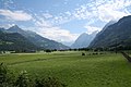
 Glarner Alpen Auengüter.JPG 3,008 × 2,000; 1.43 MB
-
 GlarnerAlpen 01.JPG 3,008 × 2,000; 1.48 MB
-
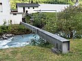
 Hydrometrische Messstation Steg über die Linth, Linthal GL 20180727-jag9889.jpg 4,608 × 3,456; 12.25 MB
-
 Karte Gemeinde Linthal 2007.png 1,476 × 1,992; 539 KB
-
 Karte Gemeinde Linthal.png 885 × 1,222; 279 KB
-
 Klausenstrasse Brücke über die Linth, Linthal GL 20180727-jag9889.jpg 4,608 × 3,456; 8.09 MB
-
 Laueli Brücke über die Linth, Linthal GL 20180727-jag9889.jpg 4,608 × 3,456; 11.38 MB
-
 Leger Brücke über den Sandbach, Linthal-Tierfehd GL 20180727-jag9889.jpg 4,608 × 3,456; 12.36 MB
-
 Legerwäldli Brücke über den Sandbach, Linthal-Tierfehd GL 20180727-jag9889.jpg 4,608 × 3,456; 10.31 MB
-
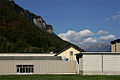
 Linthal Fabrik Kunz AG SIK 01-055961.jpg 4,226 × 2,786; 10.37 MB
-
 Linthal katolika preghejo 140.jpg 3,872 × 2,592; 3.62 MB
-
 Linthal katolika preghejo kun rigardo al glachero Bifertenfirn 143.jpg 3,872 × 2,592; 3.47 MB
-
 Linthal Kirche.jpg 500 × 333; 40 KB
-
 Linthal protestanta preghejo 145.jpg 3,872 × 2,592; 3.96 MB
-
 Linthal Stachelberg Spinnerei Kunz SIK 01-055961.jpg 3,072 × 2,025; 1,020 KB
-
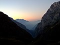 Linthal twilight.jpg 1,600 × 1,200; 178 KB
-
 Linthal vilagheniro 138.jpg 3,872 × 2,592; 3.69 MB
-
 Linthal, Zwitserland, RP-F-00-6187.jpg 3,342 × 2,706; 1.1 MB
-
 Linthal-coat of arms.png 187 × 210; 28 KB
-
 Linthal.jpg 1,024 × 683; 214 KB
-
 Linthtal.jpg 2,496 × 1,664; 1.17 MB
-
 Mitlödi Trümpy, Schaeppy & Cie SIK 01-055887.jpg 4,215 × 2,794; 4.17 MB
-
 Picswiss GL-11-01.jpg 500 × 333; 58 KB
-
 Picswiss GL-11-02.jpg 300 × 450; 45 KB
-
 Picswiss GL-11-03.jpg 500 × 333; 57 KB
-
 Picswiss GL-11-06.jpg 500 × 333; 50 KB
-
 Picswiss GL-11-07.jpg 500 × 333; 58 KB
-
 Picswiss GL-11-11.jpg 500 × 333; 51 KB
-
 Picswiss GL-11-12.jpg 300 × 450; 47 KB
-
 Picswiss GL-11-13.jpg 300 × 450; 42 KB
-
 Picswiss GL-11-14.jpg 300 × 450; 54 KB
-
 Picswiss GL-11-15.jpg 500 × 333; 50 KB
-
 Picswiss GL-11-16.jpg 502 × 333; 42 KB
-
 Picswiss GL-11-17.jpg 500 × 333; 58 KB
-
 Picswiss GL-11-18.jpg 296 × 450; 47 KB
-
 Picswiss GL-11-19.jpg 500 × 333; 62 KB
-
 Picswiss GL-11-20.jpg 500 × 333; 57 KB
-
 Rohrleitungsbrücke über die Linth, Linthal GL 20180727-jag9889.jpg 4,608 × 3,456; 11.25 MB
-
 Sandrisi Brücke über den Sandbach, Linthal-Tierfehd GL 20180727-jag9889.jpg 4,608 × 3,456; 10.73 MB
-
 Sandwiti Brücke über den Sandbach, Linthal-Tierfehd GL 20180727-jag9889.jpg 4,608 × 3,456; 7.76 MB
-
 Scheidstöckli2810m.JPG 2,000 × 3,008; 1.5 MB
-
 Schürstrasse Brücke über die Linth, Linthal GL 20180815-jag9889.jpg 4,608 × 3,456; 10.74 MB
-
 Stachelbergstrasse Brücke über die Linth, Linthal GL 20180815-jag9889.jpg 4,608 × 3,456; 9.46 MB
-
 Stauwehr Steg über die Linth, Linthal GL 20180727-jag9889.jpg 4,608 × 3,456; 11.34 MB
-
 The Valley of Linth (Lintthal) and the Todi Glarus Switzerland.jpg 762 × 1,024; 221 KB
-
 Turm der ehemaligen Katholischen Kirche, Linthal GL 20230911-jag9889.jpg 3,336 × 4,448; 12.65 MB
-
 Vorstegstock2678m.JPG 2,000 × 3,008; 1.39 MB
-
 Vorstegstock2678m1.JPG 3,008 × 2,000; 1.42 MB
-
 Wappen Linthal.png 43 × 50; 2 KB


,_RP-F-F08122.jpg)
,_RP-F-F08123.jpg)
,_RP-F-F08124.jpg)
,_RP-F-F08121.jpg)


_and_the_Todi_Glarus_Switzerland.jpg)


