Category:Goliath, Uithuizermeeden
Jump to navigation
Jump to search
| Object location | | View all coordinates using: OpenStreetMap |
|---|
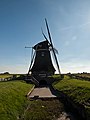
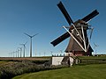
windmill in Eemshaven, Netherlands  | |||||
| Upload media | |||||
| Instance of |
| ||||
|---|---|---|---|---|---|
| Part of | |||||
| Location | Eemshaven, Het Hogeland, Groningen, Netherlands | ||||
| Has use |
| ||||
| Heritage designation |
| ||||
| Inception |
| ||||
| Source of energy | |||||
 | |||||
|
This is a category about rijksmonument number 21311
|
| Address |
|
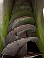
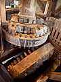
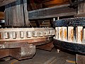
Media in category "Goliath, Uithuizermeeden"
The following 38 files are in this category, out of 38 total.
-
 2995 Uithuizermeeden.JPG 2,288 × 1,712; 2.58 MB
-

-

-

-

-

-
 Close-up van achtkante grondzeiler - AMR Molenfoto - 20540213 - RCE.jpg 1,200 × 900; 240 KB
-
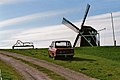 Daf en Goliath (33105029614).jpg 1,536 × 1,024; 1.06 MB
-
 De Goliath. Uithuizermeeden.JPG 3,456 × 4,608; 5.36 MB
-

-
 Goliath 1.jpg 3,831 × 2,873; 838 KB
-
 Goliath 10.jpg 4,032 × 3,024; 1.44 MB
-
 Goliath 11.jpg 4,032 × 3,024; 1,010 KB
-
 Goliath 12.jpg 3,024 × 4,032; 1.14 MB
-
 Goliath 13.jpg 2,671 × 3,562; 1,014 KB
-
 Goliath 14.jpg 2,804 × 3,739; 1.03 MB
-
 Goliath 15.jpg 4,032 × 3,024; 1.27 MB
-
 Goliath 2.jpg 4,032 × 3,024; 919 KB
-
 Goliath 3.jpg 3,024 × 4,032; 836 KB
-
 Goliath 4.jpg 4,032 × 3,024; 1.06 MB
-
 Goliath 5.jpg 2,442 × 3,255; 727 KB
-
 Goliath 6.jpg 4,032 × 3,024; 1.16 MB
-
 Goliath 7.jpg 4,032 × 3,024; 917 KB
-
 Goliath 8.jpg 3,024 × 4,032; 1.42 MB
-
 Goliath 9.jpg 3,560 × 2,671; 949 KB
-
 Goliath Poldermolen.jpg 3,266 × 2,449; 2.35 MB
-
 Interieur van achtkante grondzeiler - AMR Molenfoto - 20540210 - RCE.jpg 1,200 × 900; 184 KB
-
 Interieur van achtkante grondzeiler - AMR Molenfoto - 20540211 - RCE.jpg 1,200 × 900; 200 KB
-
 Interieur van achtkante grondzeiler - AMR Molenfoto - 20540212 - RCE.jpg 1,200 × 900; 194 KB
-
 Polder molen de Goliath.JPG 3,456 × 4,608; 5.26 MB
-
 Polder molen de Goliath.jpg 2,450 × 3,266; 2.49 MB
-
 Vergezicht met achtkante grondzeiler - AMR Molenfoto - 20540203 - RCE.jpg 1,200 × 900; 73 KB
-

-
 Windmill "Goliath" near Eemshaven - panoramio.jpg 2,736 × 3,648; 5.27 MB
-
 Windmolen De Goliath in de Eemshaven.jpg 4,272 × 2,848; 2.89 MB
-
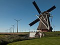
 Windpark versus molen.jpg 3,648 × 2,736; 4.92 MB
-
 Woonhuis bij achtkante grondzeiler - AMR Molenfoto - 20540214 - RCE.jpg 1,200 × 900; 122 KB
-
 Woonhuis bij achtkante grondzeiler - AMR Molenfoto - 20540215 - RCE.jpg 1,200 × 900; 109 KB


.jpg)


