Category:Goodnestone, Dover
Jump to navigation
Jump to search
English: Goodnestone is a civil parish and village in the Dover District of Kent, England. The civil parish also contains the villages of Chillenden and Knowlton, and the hamlets of Rowling and Tickenhurst.

village and civil parish in the Dover district of Kent, UK  | |||||
| Upload media | |||||
| Instance of | |||||
|---|---|---|---|---|---|
| Location | Dover, Kent, South East England, England | ||||
| Population |
| ||||
| Said to be the same as | Goodnestone (Wikimedia duplicated page, civil parish) | ||||
 | |||||
Subcategories
This category has the following 7 subcategories, out of 7 total.
Media in category "Goodnestone, Dover"
The following 200 files are in this category, out of 267 total.
(previous page) (next page)-
 A village history board at Goodnestone.jpg 4,434 × 3,357; 5.19 MB
-
 Ball finial gatepost Goodnestone Dover Kent England.jpg 3,531 × 5,401; 15.07 MB
-
 Bench brambles Goodnestone Dover Kent England.jpg 4,900 × 2,848; 10.77 MB
-
 Border and fence Goodnestone Dover Kent England.jpg 3,648 × 5,472; 18.51 MB
-
 Border and garden Goodnestone Dover Kent England.jpg 5,472 × 3,648; 25.67 MB
-
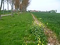
 Bramble footpath Goodnestone Dover Kent England.jpg 5,472 × 3,648; 19.1 MB
-
 Brick chimneys Goodnestone Dover Kent England.jpg 3,521 × 5,378; 14.55 MB
-
 Brick cottages Goodnestone Dover Kent England 1.jpg 5,472 × 3,500; 16.04 MB
-
 Brick cottages Goodnestone Dover Kent England 2.jpg 5,168 × 3,504; 14.1 MB
-
 Brick house front garden Goodnestone Dover Kent England.jpg 5,472 × 3,648; 20.48 MB
-
 Brick house Goodnestone Dover Kent England 1.jpg 5,472 × 3,400; 15.46 MB
-
 Brick house Goodnestone Dover Kent England 2.jpg 5,472 × 3,504; 17.34 MB
-
 Brick house Goodnestone Dover Kent England 3.jpg 4,988 × 3,308; 15.37 MB
-
 Brick house hollyhocks Goodnestone Dover Kent England.jpg 3,648 × 5,127; 14.24 MB
-
 Brick house walnut Goodnestone Dover Kent England.jpg 5,472 × 3,648; 18.78 MB
-
 Cottage and brick steps Goodnestone Dover Kent England.jpg 3,527 × 5,009; 13.89 MB
-
 Cottage hedge Goodnestone Dover Kent England.jpg 3,648 × 4,073; 11.83 MB
-
 Field behind gate and hedge Goodnestone Dover Kent England.jpg 5,472 × 3,648; 23.41 MB
-
 Fitzwalter Arms Goodnestone Dover Kent England.jpg 5,387 × 3,536; 15.9 MB
-
 Fitzwalter Arms sign Goodnestone Dover Kent England.jpg 3,648 × 4,578; 11.31 MB
-
 Flower basket Goodnestone Dover Kent England.jpg 5,215 × 3,575; 12.37 MB
-
 Flowering shrubs and gate Goodnestone Dover Kent England 1.jpg 5,391 × 3,540; 16.37 MB
-
 Flowering shrubs and gate Goodnestone Dover Kent England 2.jpg 3,648 × 4,518; 14.73 MB
-
 A footpath heading southwest towards Goodnestone - geograph.org.uk - 4325583.jpg 3,264 × 2,448; 3.22 MB
-
 A listed pillbox - geograph.org.uk - 4458361.jpg 4,000 × 3,000; 4.3 MB
-
 Access track to solar farm - geograph.org.uk - 4373149.jpg 3,264 × 2,448; 2.27 MB
-
 An orchard on Goodnestone Hill - geograph.org.uk - 667669.jpg 640 × 480; 71 KB
-
 Ancient tree in Goodnestone Park - geograph.org.uk - 4357639.jpg 480 × 640; 130 KB
-
 Avenue Lodge, Goodnestone - geograph.org.uk - 2204848.jpg 3,072 × 2,304; 2.75 MB
-
 Avenue of Trees - geograph.org.uk - 4457058.jpg 4,000 × 3,000; 4.42 MB
-
 Avenue of trees to-from Goodnestone House - geograph.org.uk - 5128311.jpg 3,264 × 2,448; 2.37 MB
-
 Avenue of trees, Goodnestone - geograph.org.uk - 2204850.jpg 3,072 × 2,304; 2.28 MB
-
 Barley field east of Buckland Lane - geograph.org.uk - 6477228.jpg 1,024 × 768; 326 KB
-
 Barley field east of Buckland Lane - geograph.org.uk - 6477315.jpg 1,024 × 768; 352 KB
-
 Barn, Home Farm - geograph.org.uk - 5648806.jpg 3,264 × 2,448; 2.41 MB
-
 Bridleway and footpath junction near Serpentine Wood - geograph.org.uk - 2204872.jpg 3,072 × 2,304; 2.26 MB
-
 Bridleway to Bushy Rough - geograph.org.uk - 2202999.jpg 3,072 × 2,304; 2.34 MB
-
 Bridleway to Cave Lane - geograph.org.uk - 2203005.jpg 3,072 × 2,304; 1.71 MB
-
 Bridleway to Crixhall Court - geograph.org.uk - 2203049.jpg 3,072 × 2,304; 1.66 MB
-
 Bridleway to Crockshard Hill - geograph.org.uk - 2202975.jpg 2,304 × 3,072; 3.03 MB
-
 Bridleway to Loverswalk Wood - geograph.org.uk - 2204862.jpg 3,072 × 2,304; 2.03 MB
-
 Bridleway to Rowling Court - geograph.org.uk - 2204080.jpg 3,072 × 2,304; 1.57 MB
-
 Buckland Lane - geograph.org.uk - 6477204.jpg 1,024 × 768; 423 KB
-
 Buckland Lane - geograph.org.uk - 6477308.jpg 1,024 × 768; 297 KB
-
 Buckland Lane past Long Wood - geograph.org.uk - 2221038.jpg 3,072 × 2,304; 1.88 MB
-
 Buildings on the Knowlton Estate - geograph.org.uk - 2570844.jpg 640 × 480; 203 KB
-
 Byway and lane junction near Nooketts Wood - geograph.org.uk - 2204241.jpg 3,072 × 2,304; 2.35 MB
-
 Cave Lane and Goodnestone Hill Lane junction - geograph.org.uk - 2202993.jpg 3,072 × 2,304; 2.5 MB
-
 Cherrygarden Lane - geograph.org.uk - 6607567.jpg 4,000 × 3,000; 4.91 MB
-
 Cherrygarden Lane - geograph.org.uk - 6607568.jpg 4,000 × 3,000; 4.97 MB
-

-
 Cherrygarden Lane byway - geograph.org.uk - 2204232.jpg 3,072 × 2,304; 2.33 MB
-
 Chillenden Village Hall - geograph.org.uk - 5648848.jpg 3,264 × 2,448; 3.97 MB
-
 Chillenden Windmill - geograph.org.uk - 5437185.jpg 2,304 × 1,728; 1.56 MB
-
 Chillenden Windmill - geograph.org.uk - 5916544.jpg 1,024 × 768; 169 KB
-
 Chillenden Windmill - geograph.org.uk - 6444514.jpg 1,201 × 1,802; 393 KB
-
 Chillenden Windmill without its sails - geograph.org.uk - 6607564.jpg 4,000 × 3,000; 4.61 MB
-
 Chillenden Windmill without its sails - geograph.org.uk - 6607566.jpg 4,000 × 3,000; 4.7 MB
-
 Church Cottages, Goodnestone - geograph.org.uk - 5523161.jpg 640 × 640; 191 KB
-
 Claypits - geograph.org.uk - 5297149.jpg 3,888 × 2,592; 3.66 MB
-
 Claypits footpath at Twitham Hill - geograph.org.uk - 5342894.jpg 3,888 × 2,592; 3.44 MB
-
 Claypits footpath EE190 towards Staple - geograph.org.uk - 5342693.jpg 424 × 640; 180 KB
-
 Claypits path on Twitham Hill - geograph.org.uk - 5342678.jpg 3,888 × 2,592; 4.5 MB
-
 Claypits to Staple path - geograph.org.uk - 5297118.jpg 427 × 640; 194 KB
-
 Country customs... - geograph.org.uk - 156385.jpg 640 × 420; 95 KB
-
 Course of Black Lane - geograph.org.uk - 4639232.jpg 2,592 × 1,936; 2.25 MB
-
 Creation of an access - geograph.org.uk - 4373162.jpg 3,264 × 2,448; 3.95 MB
-
 Cricket pavilion at Goodnestone - geograph.org.uk - 641538.jpg 640 × 480; 229 KB
-
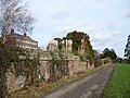
 Crixhall Court - geograph.org.uk - 4458316.jpg 4,000 × 3,000; 4.43 MB
-
 Crixhall Court from Buckland Lane - geograph.org.uk - 4458328.jpg 4,000 × 3,000; 4.47 MB
-
 Crossroads near Chillenden Windmill - geograph.org.uk - 4458375.jpg 4,000 × 3,000; 3.99 MB
-
 Crossroads near Goodnestone - geograph.org.uk - 1500151.jpg 640 × 480; 46 KB
-
 Cut slate memorial Goodnestone Dover Kent England 4.jpg 4,836 × 3,648; 14.26 MB
-
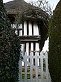
 Elizabethan Cottage - geograph.org.uk - 2203618.jpg 3,072 × 2,304; 2.17 MB
-
 Entering Claypits on Cave Lane - geograph.org.uk - 5437184.jpg 2,174 × 1,629; 856 KB
-
 Equestrian event at Home Farm - geograph.org.uk - 3742367.jpg 1,077 × 807; 203 KB
-
 Erecting a retaining wall - geograph.org.uk - 5648833.jpg 3,264 × 2,448; 4.01 MB
-
 Estate houses in Goodnestone - geograph.org.uk - 4458554.jpg 4,000 × 3,000; 4.31 MB
-

-
 Field by Chillenden windmill - geograph.org.uk - 5443354.jpg 2,304 × 1,728; 840 KB
-
 Field of barley - geograph.org.uk - 4024514.jpg 640 × 480; 95 KB
-
 Field of oats - geograph.org.uk - 6476971.jpg 1,024 × 768; 354 KB
-
 Fingerpost and post box Goodnestone Dover Kent England.jpg 3,648 × 5,121; 13.77 MB
-
 Fitzwalter Arms Pub Sign (close-up) - geograph.org.uk - 2204839.jpg 3,072 × 2,304; 1.91 MB
-
 Fitzwalter Arms pub sign on The Street, Goodnestone - geograph.org.uk - 2204835.jpg 3,072 × 2,304; 2.36 MB
-
 Fitzwalter Wood - geograph.org.uk - 2204879.jpg 3,072 × 2,304; 1.39 MB
-
 Fitzwalters Meadow - geograph.org.uk - 4325557.jpg 2,448 × 3,264; 1.77 MB
-
 Flint Building on Church Lane - geograph.org.uk - 1974986.jpg 1,024 × 768; 279 KB
-
 Flower in Goodnestone Park Gardens - geograph.org.uk - 5031965.jpg 3,480 × 2,971; 1.47 MB
-
 Flowers in the Walled Garden at Goodnestone Park Gardens - geograph.org.uk - 5031954.jpg 4,608 × 3,456; 3.49 MB
-
 Footpath crosses Buckland Lane - geograph.org.uk - 2221046.jpg 3,072 × 2,304; 2.11 MB
-
 Footpath crosses Green Lane - geograph.org.uk - 2203588.jpg 3,072 × 2,304; 3.08 MB
-
 Footpath from Crixhall Court - geograph.org.uk - 4458293.jpg 4,000 × 3,000; 4.34 MB
-
 Footpath junction on the bridleway near Crixhall Court - geograph.org.uk - 2203085.jpg 3,072 × 2,304; 2.21 MB
-
-
 Footpath past Rowling Court - geograph.org.uk - 2203610.jpg 3,072 × 2,304; 1.52 MB
-
 Footpath through Tickenhurst Shave - geograph.org.uk - 2203986.jpg 3,072 × 2,304; 3.35 MB
-
 Footpath to Chillenden - geograph.org.uk - 2221050.jpg 3,072 × 2,304; 2.24 MB
-
 Footpath to Goodnestone - geograph.org.uk - 1500091.jpg 480 × 640; 171 KB
-
 Footpath to Goodnestone - geograph.org.uk - 2221054.jpg 2,304 × 3,072; 3.57 MB
-
 Footpath to Goodnestone - geograph.org.uk - 4458427.jpg 4,000 × 3,000; 4.14 MB
-
 Footpath to Knowlton - geograph.org.uk - 2203997.jpg 3,072 × 2,304; 2.21 MB
-
 Footpath to Knowlton - geograph.org.uk - 2204018.jpg 3,072 × 2,304; 1.7 MB
-
 Footpath to Lower Rowling Farm - geograph.org.uk - 2203578.jpg 3,072 × 2,304; 1.42 MB
-
 Footpath to Staple - geograph.org.uk - 4458303.jpg 4,000 × 3,000; 4.33 MB
-
 Footpath to Summerfield Farm - geograph.org.uk - 2203607.jpg 3,072 × 2,304; 1.54 MB
-
 Footpath to Tickenhurst Shave - geograph.org.uk - 2204041.jpg 3,072 × 2,304; 2.11 MB
-
 Footpath to Waterworks - geograph.org.uk - 2204902.jpg 3,072 × 2,304; 1.72 MB
-
 Footpath towards Uffington Court - geograph.org.uk - 4566034.jpg 4,000 × 3,000; 4.13 MB
-
 Free-range pigs - geograph.org.uk - 4770319.jpg 3,264 × 2,448; 3.57 MB
-
 Frozen pond near Twitham Hill - geograph.org.uk - 2203036.jpg 3,072 × 2,304; 3.49 MB
-
 Gate near Uffington Court - geograph.org.uk - 2204895.jpg 3,072 × 2,304; 1.65 MB
-
 Goodenestone, Kent, UK. - panoramio.jpg 2,048 × 1,536; 644 KB
-
-
 Goodnestone buildings (1) (geograph 7064687).jpg 4,101 × 3,075; 3.05 MB
-
 Goodnestone buildings (12) (geograph 7065785).jpg 4,003 × 3,001; 3.31 MB
-
 Goodnestone buildings (3) (geograph 7064715).jpg 4,069 × 3,051; 4.1 MB
-
 Goodnestone church - geograph.org.uk - 5522947.jpg 640 × 428; 136 KB
-
 Goodnestone House and Gardens (17) (geograph 7064675).jpg 3,909 × 2,932; 3.35 MB
-
 Goodnestone House and Gardens (20) (geograph 7064678).jpg 4,035 × 3,025; 4.03 MB
-
 Goodnestone House and Gardens (5) (geograph 7063801).jpg 4,207 × 3,155; 3.21 MB
-
 Goodnestone House, Goodnestone - geograph.org.uk - 4357660.jpg 640 × 480; 117 KB
-
 Goodnestone houses (1) (geograph 7064679).jpg 3,240 × 4,320; 3.61 MB
-
 Goodnestone houses (10) (geograph 7065783).jpg 4,320 × 3,240; 4.25 MB
-
 Goodnestone houses (14) (geograph 7065788).jpg 3,909 × 2,932; 2.83 MB
-
 Goodnestone houses (15) (geograph 7065789).jpg 4,171 × 3,129; 3.46 MB
-
 Goodnestone houses (16) (geograph 7065790).jpg 4,120 × 3,090; 3.45 MB
-
 Goodnestone houses (17) (geograph 7065795).jpg 4,320 × 3,240; 4.05 MB
-
 Goodnestone houses (2) (geograph 7064681).jpg 4,320 × 3,240; 4.26 MB
-
 Goodnestone houses (3) (geograph 7064683).jpg 3,761 × 2,820; 2.44 MB
-
 Goodnestone houses (4) (geograph 7064685).jpg 3,367 × 2,525; 3.45 MB
-
 Goodnestone houses (5) (geograph 7064688).jpg 4,320 × 3,240; 3.82 MB
-
 Goodnestone houses (6) (geograph 7064690).jpg 4,320 × 3,240; 3.71 MB
-
 Goodnestone houses (7) (geograph 7064692).jpg 4,320 × 3,240; 4.83 MB
-
 Goodnestone houses (8) (geograph 7064705).jpg 4,173 × 3,129; 4.01 MB
-
 Goodnestone houses (9) (geograph 7064710).jpg 4,223 × 3,167; 3.41 MB
-
 Goodnestone housess (geograph 7065784).jpg 3,239 × 4,320; 4.19 MB
-
 Goodnestone housess (geograph 7065796).jpg 4,135 × 3,101; 2.62 MB
-
 Goodnestone post office - geograph.org.uk - 667630.jpg 640 × 480; 83 KB
-
 Goodnestone post office c.1906.jpg 1,473 × 936; 1.41 MB
-
 Goodnestone Road meets Cave Lane - geograph.org.uk - 4458289.jpg 4,000 × 3,000; 4.1 MB
-

-
 Goodnestone, aerial 2015 - geograph.org.uk - 4525165.jpg 445 × 640; 64 KB
-
 Goodnestone, aerial 2015 - geograph.org.uk - 4525168.jpg 640 × 427; 76 KB
-

-
 Green Lane - geograph.org.uk - 2203581.jpg 3,072 × 2,304; 3.49 MB
-
 Hammill Park - geograph.org.uk - 5645909.jpg 3,264 × 2,448; 3.62 MB
-
 Hop Cottage, Saddlers Hill - geograph.org.uk - 6592355.jpg 3,264 × 2,448; 2.38 MB
-
 Hospital Meadow Cottages, sign. - geograph.org.uk - 304133.jpg 640 × 480; 195 KB
-
 House in Chillenden - geograph.org.uk - 5439890.jpg 2,180 × 1,624; 889 KB
-
 House near junction with Green Lane path. - geograph.org.uk - 312013.jpg 640 × 480; 147 KB
-
 House on Catsole Hill - geograph.org.uk - 1385608.jpg 640 × 427; 69 KB
-
 Houses in Chillenden - geograph.org.uk - 5439877.jpg 2,184 × 1,554; 995 KB
-
 Inn sign, Fitzwalter Arms, Goodnestone - geograph.org.uk - 5523184.jpg 640 × 480; 151 KB
-
 Knowlton war memorial, Sandwich Road - geograph.org.uk - 6183337.jpg 684 × 1,024; 280 KB
-
 Lane and farm in Knowlton - geograph.org.uk - 3893685.jpg 640 × 480; 75 KB
-
 Lane junction on Love Lane - geograph.org.uk - 2204254.jpg 3,072 × 2,304; 1.92 MB
-
 Lane junction west of Upper Rowling Farm - geograph.org.uk - 6477125.jpg 1,024 × 768; 395 KB
-
 Lane towards Goodnestone - geograph.org.uk - 6477115.jpg 1,024 × 768; 403 KB
-
 Lane towards Goodnestone - geograph.org.uk - 6477133.jpg 1,024 × 768; 310 KB
-
 Little Twitham Farm cottage - geograph.org.uk - 5342765.jpg 640 × 427; 190 KB
-
 Looking north-northeast along a track - geograph.org.uk - 4778097.jpg 3,264 × 2,448; 3.85 MB
-
 Looking northeast along a footpath - geograph.org.uk - 4008892.jpg 1,109 × 831; 208 KB
-
 Looking northeast along The Street - geograph.org.uk - 5128358.jpg 2,448 × 3,264; 2.75 MB
-
 Looking west towards Chillenden - geograph.org.uk - 3740504.jpg 1,128 × 836; 169 KB
-
 Looking west-northwest across Buckland Lane - geograph.org.uk - 4770298.jpg 3,264 × 2,448; 2.48 MB
-

-
 Lower Rowling Farm - geograph.org.uk - 6184351.jpg 1,024 × 684; 413 KB
-
 Misshapen tree - geograph.org.uk - 4024507.jpg 640 × 480; 116 KB
-
 Misshappen tree - geograph.org.uk - 5737250.jpg 4,320 × 3,240; 4.95 MB
-
 Muddy end to the footpath - geograph.org.uk - 641749.jpg 640 × 480; 240 KB
-
 New gate into Long Wood - geograph.org.uk - 5372336.jpg 3,264 × 2,448; 3.96 MB
-
 Newly planted hedge - geograph.org.uk - 4770259.jpg 3,264 × 2,448; 2.64 MB
-
 Newly planted hedge - geograph.org.uk - 4770267.jpg 3,264 × 2,448; 2.83 MB
-
 Newly-planted hedge - geograph.org.uk - 4372072.jpg 3,264 × 2,448; 3.92 MB
-
 Oast houses at Claypots - geograph.org.uk - 5522956.jpg 640 × 428; 122 KB
-
 Oilseed rape near Chillenden - geograph.org.uk - 4458370.jpg 4,000 × 3,000; 4.19 MB
-
 Outbuildings at Bonnington Farm - geograph.org.uk - 4008875.jpg 1,011 × 758; 209 KB
-
 Outbuildings at Home Farm - geograph.org.uk - 3742380.jpg 946 × 709; 204 KB
-
 Parish church (11) (geograph 7065834).jpg 4,171 × 3,129; 4.99 MB
-
 Path in Loverswalk Wood - geograph.org.uk - 4457055.jpg 4,000 × 3,000; 4.06 MB
-
 Path through Long Wood - geograph.org.uk - 4457051.jpg 4,000 × 3,000; 4.02 MB
-
 Path through Loverswalk Wood - geograph.org.uk - 4458239.jpg 4,000 × 3,000; 4.06 MB
-
 Path to Loverswalk Wood - geograph.org.uk - 4458234.jpg 4,000 × 3,000; 4.03 MB
-
 Pettocks Lane - geograph.org.uk - 5342738.jpg 640 × 427; 186 KB
-
 Pettocks Lane - geograph.org.uk - 5345225.jpg 3,888 × 2,592; 6 MB
-
 Pillbox near Upper Rowling Farm - geograph.org.uk - 2203595.jpg 3,072 × 2,304; 1.67 MB
-
 Pillbox on Buckland Lane - geograph.org.uk - 4024524.jpg 640 × 480; 91 KB
-
 Pillbox on Buckland Lane - geograph.org.uk - 6197176.jpg 1,024 × 768; 363 KB
-
 Pond in Bonnington Wood - geograph.org.uk - 2204803.jpg 3,072 × 2,304; 2.42 MB
-
 Possibly abandoned access - geograph.org.uk - 4770333.jpg 3,264 × 2,448; 3.65 MB
-
 Private drive to-from Goodnestone House - geograph.org.uk - 5372394.jpg 3,264 × 2,448; 2.24 MB
-
 Private road through Goodnestone - geograph.org.uk - 641533.jpg 640 × 480; 240 KB
-
 Private road to Goodnestone House - geograph.org.uk - 641369.jpg 640 × 480; 242 KB
-
 Ramsons in Loverswalk Wood - geograph.org.uk - 4458246.jpg 4,000 × 3,000; 4.03 MB
-
 Recently erected agricultural building-barn - geograph.org.uk - 4373158.jpg 3,264 × 2,448; 3.72 MB
-
 Recently erected hay barn - geograph.org.uk - 5647987.jpg 3,264 × 2,448; 3.6 MB
-
 Renovation of Claypits, Cave Lane - geograph.org.uk - 5370672.jpg 3,264 × 2,448; 3.37 MB
-
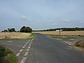
 Road from Eastry towards Goodnestone - geograph.org.uk - 6476975.jpg 1,024 × 768; 288 KB
-
 Road junction near Chillenden - geograph.org.uk - 2204069.jpg 3,072 × 2,304; 1.51 MB


_-_geograph.org.uk_-_2204839.jpg)


_(geograph_7064687).jpg)
_(geograph_7065785).jpg)
_(geograph_7064715).jpg)

_(geograph_7064675).jpg)
_(geograph_7064678).jpg)
_(geograph_7063801).jpg)

_(geograph_7064679).jpg)
_(geograph_7065783).jpg)
_(geograph_7065788).jpg)
_(geograph_7065789).jpg)
_(geograph_7065790).jpg)
_(geograph_7065795).jpg)
_(geograph_7064681).jpg)
_(geograph_7064683).jpg)
_(geograph_7064685).jpg)
_(geograph_7064688).jpg)
_(geograph_7064690).jpg)
_(geograph_7064692).jpg)
_(geograph_7064705).jpg)
_(geograph_7064710).jpg)
.jpg)
.jpg)


_(geograph_7065834).jpg)


