Category:Graaflandse Molen
Jump to navigation
Jump to search
| Object location | | View all coordinates using: OpenStreetMap |
|---|
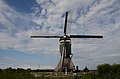
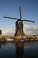
windmill in Groot-Ammers, Netherlands  | |||||
| Upload media | |||||
| Instance of | |||||
|---|---|---|---|---|---|
| Location | Groot-Ammers, South Holland, Netherlands | ||||
| Street address |
| ||||
| Located on street |
| ||||
| Has use |
| ||||
| Heritage designation |
| ||||
| Source of energy | |||||
 | |||||
|
This is a category about rijksmonument number 18769
|
| Address |
|
Media in category "Graaflandse Molen"
The following 26 files are in this category, out of 26 total.
-
 2e molen van af Lekdijk "Graaflandse molen" - Groot-Ammers - 20094663 - RCE.jpg 1,200 × 1,179; 207 KB
-
 Ammerse Kade - panoramio (2).jpg 3,451 × 2,301; 1.94 MB
-
 Ammerse Kade - panoramio (3).jpg 3,696 × 2,448; 2.38 MB
-
 Ammerse Kade - panoramio.jpg 2,187 × 3,280; 2.05 MB
-
 Exterieur OVERZICHT - Groot-Ammers - 20308499 - RCE.jpg 1,200 × 1,197; 292 KB
-
 Groot-Ammers Graaflandse Molen foto 1.jpg 2,100 × 1,400; 1.5 MB
-
 Groot-Ammers Graaflandse Molen foto 2.jpg 1,400 × 2,100; 1.54 MB
-
 Interieur van wipmolen - AMR Molenfoto - 20538423 - RCE.jpg 1,200 × 900; 97 KB
-
 Interieur van wipmolen - AMR Molenfoto - 20538424 - RCE.jpg 1,200 × 900; 127 KB
-
 Interieur van wipmolen - AMR Molenfoto - 20538425 - RCE.jpg 1,200 × 900; 127 KB
-
 Interieur van wipmolen - AMR Molenfoto - 20538426 - RCE.jpg 1,200 × 900; 88 KB
-
 Interieur van wipmolen - AMR Molenfoto - 20538427 - RCE.jpg 1,200 × 900; 119 KB
-
 Interieur van wipmolen - AMR Molenfoto - 20538428 - RCE.jpg 1,200 × 900; 144 KB
-
 Interieur van wipmolen - AMR Molenfoto - 20538429 - RCE.jpg 1,200 × 900; 134 KB
-
 Interieur van wipmolen - AMR Molenfoto - 20538430 - RCE.jpg 1,200 × 900; 153 KB
-
 Interieur van wipmolen - AMR Molenfoto - 20538431 - RCE.jpg 1,200 × 900; 164 KB
-
 Interieur van wipmolen - AMR Molenfoto - 20538432 - RCE.jpg 1,200 × 900; 201 KB
-
 Ondertoren van wipmolen - AMR Molenfoto - 20538422 - RCE.jpg 1,200 × 900; 183 KB
-
 Overzicht - Groot-Ammers - 20363009 - RCE.jpg 1,193 × 1,200; 169 KB
-
 Overzicht van de molen - Groot-Ammers - 20421134 - RCE.jpg 1,200 × 800; 138 KB
-
 Overzicht van de molen - Groot-Ammers - 20421136 - RCE.jpg 1,200 × 800; 147 KB
-

-
 Wipmolen van opzij gefotografeerd - AMR Molenfoto - 20538419 - RCE.jpg 1,200 × 900; 129 KB
-
 Wipmolen van opzij gefotografeerd - AMR Molenfoto - 20538420 - RCE.jpg 1,200 × 900; 152 KB
-
 Wipmolen van opzij gefotografeerd - AMR Molenfoto - 20538421 - RCE.jpg 1,200 × 900; 127 KB
-
 Zijaanzicht - Groot-Ammers - 20363010 - RCE.jpg 1,200 × 1,200; 167 KB

.jpg)
.jpg)


