Category:Granville, County Tyrone
Jump to navigation
Jump to search
English: Granville, known before the Plantation of Ulster as Derrymeen , is a village and townland in County Tyrone, Northern Ireland, approximately 2.5 miles (4km) from Dungannon. It consists of an industrial estate, a shop, a housing estate, a number of private dwellings and several farms.
village in County Tyrone, Northern Ireland, UK  | |||||
| Upload media | |||||
| Instance of | |||||
|---|---|---|---|---|---|
| Location | Northern Ireland | ||||
 | |||||
Media in category "Granville, County Tyrone"
The following 27 files are in this category, out of 27 total.
-
 A4 at the B45 turnoff - geograph.org.uk - 4781647.jpg 1,200 × 799; 191 KB
-
 AA sign for Killybracken - geograph.org.uk - 241821.jpg 640 × 479; 65 KB
-
 Factory, Granville Road - geograph.org.uk - 3779169.jpg 2,592 × 1,936; 1.11 MB
-
 The A4 at the Granville turnoff - geograph.org.uk - 4781642.jpg 1,200 × 799; 193 KB
-
 The A4 towards the M1 - geograph.org.uk - 4781643.jpg 1,200 × 799; 189 KB
-
 Wood Lough - geograph.org.uk - 1289548.jpg 640 × 479; 75 KB
-
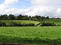
 Cornmullagh Townland - geograph.org.uk - 239202.jpg 640 × 479; 56 KB
-
 Derrygortrevy Townland - geograph.org.uk - 241810.jpg 640 × 479; 77 KB
-
 Drumgormal Townland - geograph.org.uk - 241788.jpg 640 × 479; 95 KB
-
 Dunamony Road - geograph.org.uk - 239214.jpg 640 × 479; 101 KB
-
 Dunseark Townland - geograph.org.uk - 241827.jpg 640 × 479; 70 KB
-
 Eskragh Lough Fishery - geograph.org.uk - 241760.jpg 640 × 479; 58 KB
-
 Eskragh Lough, Dungannon - geograph.org.uk - 241763.jpg 640 × 404; 37 KB
-
 Eskragh Lough, Dungannon - geograph.org.uk - 241767.jpg 640 × 479; 68 KB
-
 Granville Townland - geograph.org.uk - 241795.jpg 640 × 479; 76 KB
-
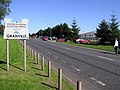 Granville, Co. Tyrone - geograph.org.uk - 241800.jpg 640 × 479; 65 KB
-
 Hollow Lane, Dungannon - geograph.org.uk - 241786.jpg 640 × 479; 79 KB
-
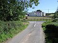 House at Drumgormal - geograph.org.uk - 241790.jpg 640 × 479; 93 KB
-
 Killybracken Road - geograph.org.uk - 241809.jpg 640 × 479; 93 KB
-
 Killybracken Road - geograph.org.uk - 241820.jpg 640 × 479; 108 KB
-
 Killybracken Road, Dungannon - geograph.org.uk - 241792.jpg 640 × 479; 104 KB
-
 Killybracken Townland - geograph.org.uk - 241818.jpg 640 × 479; 84 KB
-
 Mullaghdaly Townland - geograph.org.uk - 241823.jpg 640 × 479; 81 KB
-
 Mullaghdaly Townland - geograph.org.uk - 241826.jpg 640 × 479; 52 KB
-
 Reaskmore Townland - geograph.org.uk - 239236.jpg 640 × 479; 58 KB
-
 Road at Cornmullagh - geograph.org.uk - 239209.jpg 640 × 479; 55 KB
-
 Road at Glenadush - geograph.org.uk - 241776.jpg 640 × 479; 53 KB


