Category:Graphical scales
Jump to navigation
Jump to search
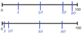
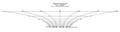
English: Graphical or linear scales are visual elements of maps for determining their scale.
graphical representation of the ratio between distance on a map and distance in the real world | |||||
| Upload media | |||||
| Subclass of | |||||
|---|---|---|---|---|---|
| Facet of | |||||
| |||||
Media in category "Graphical scales"
The following 42 files are in this category, out of 42 total.
-
 1 cartographie comparaison échelles.jpg 1,389 × 957; 463 KB
-
-
 1697 plant cartouche for scales.jpg 2,011 × 1,177; 711 KB
-
 Andree, Richard. Volkerkarte von Russland. 1881 F.jpg 707 × 333; 48 KB
-
 Angel cartouche with scales in a Geographia Sacra map by Janssonius.jpg 2,827 × 1,674; 1.18 MB
-
 Anville, Jean Baptiste Bourguignon. Turkey in Asia. 1794 (GB).jpg 540 × 381; 56 KB
-

-
 Desimaal.gif 270 × 158; 4 KB
-
 Diego-homem-black-sea-ancient-map-1559.jpg 2,900 × 2,180; 2.77 MB
-
 Escalas.png 616 × 173; 3 KB
-
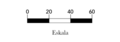 Eskala grafikoa.png 331 × 115; 5 KB
-
 Ethnographic map of the Kars Oblast (1902)-map legend-2.png 815 × 231; 153 KB
-
 Ethnographic map of the Tiflis Governorate (1902)-map legend-3.jpg 949 × 270; 98 KB
-
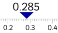
 Graphical scale.gif 285 × 33; 2 KB
-
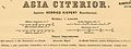 Heinrich Kiepert. Asia citerior.Head.jpg 2,203 × 833; 221 KB
-
 Heinrich Kiepert. Imperia Persarum et Macedonum. 1903 (L).jpg 1,353 × 1,065; 726 KB
-
 Herrschaftskarte Kisslegg 11.jpg 3,552 × 1,439; 1.79 MB
-
 IsraelCVFRscale.jpg 1,674 × 256; 117 KB
-
 Kortmaal M70.jpg 3,088 × 3,158; 11.47 MB
-
 Lead weight with moulded legend in Roman numerals, IV (FindID 65554).jpg 1,131 × 713; 152 KB
-
 Map scale - 8km, 5mi.png 397 × 125; 3 KB
-
 Map scale.jpg 326 × 105; 11 KB
-
 Maßstabsleiste.png 697 × 397; 24 KB
-
 Medusa scale cartouche on a Holy Land map by Schrot.jpg 4,099 × 1,722; 1.93 MB
-
 Metzburg 1782 Maßeinheiten.jpg 2,271 × 1,464; 1.97 MB
-
 Planta da área dos Ilhéus - Mateus Fernandes, 1567.jpg 666 × 919; 133 KB
-
 Podziałka liniowa.png 3,428 × 114; 5 KB
-
 Podziałka transwersalna 1.png 3,661 × 707; 50 KB
-
 Podziałka transwersalna.png 3,463 × 403; 64 KB
-
 Podziałka złożona dla Merkatora.png 3,001 × 1,168; 143 KB
-
 Podziałka złożona dla Ptolemeusza z 30N.png 2,678 × 2,184; 249 KB
-
 Rauch Prospekt Ravensburg und Weißenau 1622 a07.jpg 3,416 × 1,484; 1.96 MB
-
 Rigobert Bonne. Perse. 1787 (M).jpg 454 × 195; 27 KB
-
 Scale from NOAA Chart 13272.png 1,210 × 169; 6 KB
-
-
 Schaal.jpg 1,024 × 768; 129 KB
-

-
 The Battle of the Isle of Wight.jpg 987 × 429; 159 KB
-
 Three people in a rowing boat, possibly Sydney Harbour (7155341666).jpg 1,152 × 1,152; 387 KB
-
 Umysłowa oś liczbowa.png 625 × 273; 5 KB
-
 William Faden. Composite Mediterranean. 1785.M.jpg 949 × 667; 128 KB
-
 World Scale from DMA Series 1150 map.png 3,301 × 890; 14 KB

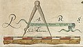
_Comitatus_Regis_Henrici_quinti_nataliys_celeberrimus_Ano_Dm_1577._Chriftophorus_Saxton_defcripfit._RMG_L8559-001_(scale_of_miles_with_compasses).jpg)


.jpg)
.jpg)


.jpg)

.jpg)


.jpg)


.jpg)


-map_legend-2.png)
-map_legend-3.jpg)