Category:Grauwackefelsen am Collmberg
Jump to navigation
Jump to search
| Object location | | View all coordinates using: OpenStreetMap |
|---|
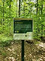
natural monument area in Wermsdorf Municipality; Grauwacke Rock is located in a disused quarry on the south-western slope of the Collmberg in the northeastern part of the Wermsdorf Forest.  | |||||
| Upload media | |||||
| Instance of |
| ||||
|---|---|---|---|---|---|
| Located in protected area | |||||
| Location | Collm, Wermsdorf, Nordsachsen, Saxony, Germany | ||||
| Heritage designation | |||||
| Area |
| ||||
 | |||||
Media in category "Grauwackefelsen am Collmberg"
The following 12 files are in this category, out of 12 total.
-
 Grauwackefelsen am Collmberg (1).jpg 3,000 × 4,000; 3.79 MB
-
 Grauwackefelsen am Collmberg (2).jpg 4,000 × 3,000; 3.92 MB
-
 Grauwackefelsen am Collmberg - Beschilderung.jpg 3,024 × 4,032; 9.02 MB
-
 Grauwackefelsen am Collmberg - Steinbruch Beschilderung.jpg 3,024 × 4,032; 11.65 MB
-
 Grauwackefelsen am Collmberg - Steinbruch Nordhang.jpg 4,032 × 3,024; 13.79 MB
-
 Grauwackefelsen am Collmberg - Steinbruch Panorama.jpg 4,608 × 3,456; 12.51 MB
-
 Grauwackefelsen am Collmberg - Steinbruch Zugang.jpg 4,608 × 3,456; 11.57 MB
-
 Grauwackefelsen am Collmberg - Steinbruch.jpg 4,032 × 3,024; 13.36 MB
-
 Grauwackefelsen am Collmberg, Infotafel (2).jpg 4,000 × 3,000; 2.93 MB
-
 Grauwackefelsen am Collmberg.jpg 4,032 × 3,024; 13.92 MB
-
 Grauwackefelsen Collmberg.jpg 4,128 × 3,096; 6.58 MB
-
 Grauwackefelssteinbruch Collmberg.jpg 3,096 × 4,128; 6.13 MB
.jpg)
.jpg)


.jpg)

