Category:Grave of Sainte-Marie (Père-Lachaise, division 69)
Jump to navigation
Jump to search
| Grave of Sainte-Marie (Père-Lachaise, division 69) | |||||||||||||||||||||||
|---|---|---|---|---|---|---|---|---|---|---|---|---|---|---|---|---|---|---|---|---|---|---|---|
| |||||||||||||||||||||||

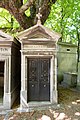
sepulchral chapel located in Paris, in France  | |||||
| Upload media | |||||
| Instance of | |||||
|---|---|---|---|---|---|
| Location | Père-Lachaise Cemetery - Division 69, Quartier du Père-Lachaise, 20th arrondissement of Paris, Paris, Grand Paris, Île-de-France, Metropolitan France, France | ||||
| Collection | |||||
 | |||||
Media in category "Grave of Sainte-Marie (Père-Lachaise, division 69)"
The following 6 files are in this category, out of 6 total.
-
 Père-Lachaise - Division 69 - Miton 01.jpg 5,321 × 3,547; 14.9 MB
-
 Père-Lachaise - Division 69 - Sainte-Marie 01.jpg 3,840 × 5,760; 16.56 MB
-
 Père-Lachaise - Division 69 - Sainte-Marie 02.jpg 5,760 × 3,840; 19.16 MB
-
 Père-Lachaise - Division 69 - Sainte-Marie 03.jpg 3,427 × 5,140; 11.92 MB
-
 Père-Lachaise - Division 69 - Sainte-Marie 04.jpg 5,760 × 3,840; 23.15 MB
-
 Père-Lachaise - Division 69 - Sainte-Marie 05.jpg 5,760 × 3,840; 14.19 MB


