Category:Great Shefford
Vai alla navigazione
Vai alla ricerca
village and civil parish on the River Lambourn in West Berkshire, England  | |||||
| Carica un file multimediale | |||||
| Istanza di | |||||
|---|---|---|---|---|---|
| Luogo | West Berkshire, Berkshire, Sud Est dell'Inghilterra, Inghilterra | ||||
| Popolazione |
| ||||
| Superficie |
| ||||
| sito web ufficiale | |||||
 | |||||
English: Great Shefford (or West Shefford) is a village and civil parish in the English county of Berkshire.
Nederlands: Great Shefford is een dorp (village) en civil parish in het bestuurlijke gebied West Berkshire, in het Engelse graafschap Berkshire. De civil parish telt
Sottocategorie
Questa categoria contiene le 4 sottocategorie indicate di seguito, su un totale di 4.
E
G
S
File nella categoria "Great Shefford"
Questa categoria contiene 178 file, indicati di seguito, su un totale di 178.
-
 A wheatfield near Wickfield Farm, Shefford Woodlands - geograph.org.uk - 2545460.jpg 1 440 × 1 080; 682 KB
-
 A338 approaching M4 junction 14 from the north - geograph.org.uk - 5875363.jpg 1 600 × 1 197; 740 KB
-
 A338 south into Great Shefford - geograph.org.uk - 3012124.jpg 2 560 × 1 920; 1,06 MB
-

-
 Approaching Wickfield - geograph.org.uk - 6416811.jpg 3 541 × 2 281; 1,45 MB
-
 Arable land near Great Shefford - geograph.org.uk - 918495.jpg 640 × 427; 101 KB
-
 Avenue of lime-trees, Great Shefford - geograph.org.uk - 5420081.jpg 768 × 1 024; 316 KB
-
 B4000 approaches junction with A338 - geograph.org.uk - 3067616.jpg 3 648 × 2 736; 1,56 MB
-
 B4000 junction with lane to Wickfield Farm - geograph.org.uk - 3067606.jpg 3 648 × 2 736; 1,4 MB
-
 B4000 passes The Pheasant - geograph.org.uk - 3067802.jpg 3 517 × 2 736; 1,15 MB
-
 Baydon Road, Shefford Woodlands - geograph.org.uk - 5483324.jpg 2 048 × 1 536; 1,51 MB
-
 Beech tree on the byway to the minor road to Great Shefford - geograph.org.uk - 2545834.jpg 1 440 × 1 080; 1,07 MB
-
 Bluebells in Coldridge Copse, Gt Shefford - geograph.org.uk - 158463.jpg 640 × 480; 176 KB
-
 Buckham Hill - geograph.org.uk - 5875342.jpg 1 600 × 1 200; 583 KB
-
 Byway below Wickfield - geograph.org.uk - 257356.jpg 480 × 640; 202 KB
-

-
 Church Street in Great Shefford - geograph.org.uk - 3394561.jpg 3 414 × 2 570; 1,21 MB
-
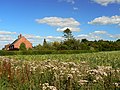
 Colourful farmland, Great Shefford - geograph.org.uk - 887534.jpg 640 × 480; 196 KB
-
 Colourful farmland, Great Shefford - geograph.org.uk - 893140.jpg 640 × 480; 213 KB
-
 Crop Marks beyond the Houses - geograph.org.uk - 5462086.jpg 3 888 × 2 592; 3,37 MB
-
 Crops and Sky - geograph.org.uk - 5462074.jpg 3 888 × 2 592; 3,08 MB
-
 Deliveries dead slow - geograph.org.uk - 918498.jpg 640 × 427; 73 KB
-
 Descent to Great Shefford - geograph.org.uk - 917053.jpg 640 × 418; 102 KB
-
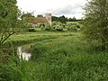
 Double bridge over the River Lambourn at Great Shefford - geograph.org.uk - 3012254.jpg 2 560 × 1 920; 1,12 MB
-
 Drive up to East Shefford House - geograph.org.uk - 3292431.jpg 640 × 480; 75 KB
-
 East Shefford House - geograph.org.uk - 3499278.jpg 800 × 600; 195 KB
-
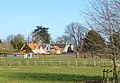
 Elton Farm - geograph.org.uk - 273495.jpg 640 × 480; 121 KB
-
 Elton Wood - geograph.org.uk - 917092.jpg 640 × 427; 93 KB
-
 Entrance to Templars Farm - geograph.org.uk - 6416770.jpg 4 351 × 2 805; 3,18 MB
-
 Entrance to the golf course - geograph.org.uk - 917096.jpg 427 × 640; 114 KB
-
 Entrance to Wickfield Farm - geograph.org.uk - 6416803.jpg 1 600 × 1 031; 840 KB
-
 Ermin Street at the junction of Hungerford Hill - geograph.org.uk - 5481250.jpg 2 048 × 1 536; 1,53 MB
-
 Ermin Street, Shefford Woodlands - geograph.org.uk - 5904938.jpg 1 852 × 1 193; 964 KB
-
 Ermine Street in 2014 - geograph.org.uk - 4008489.jpg 4 752 × 3 168; 2,4 MB
-
 Farm road and farmland, Great Shefford - geograph.org.uk - 4373366.jpg 640 × 480; 175 KB
-
 Farming compound - geograph.org.uk - 3090483.jpg 640 × 480; 119 KB
-
 Farmland north of Great Shefford - geograph.org.uk - 917063.jpg 427 × 640; 67 KB
-
 Farmland north-west of a byway near Weston - geograph.org.uk - 2545843.jpg 1 440 × 1 080; 876 KB
-
 Farmland, East Garston - geograph.org.uk - 497744.jpg 640 × 480; 260 KB
-
 Farmland, Great Shefford - geograph.org.uk - 2866042.jpg 640 × 480; 133 KB
-
 Farmland, Great Shefford - geograph.org.uk - 4373361.jpg 640 × 480; 209 KB
-
 Farmland, Great Shefford - geograph.org.uk - 4373406.jpg 640 × 480; 197 KB
-
 Farmland, Great Shefford - geograph.org.uk - 4373443.jpg 640 × 480; 212 KB
-
 Farmland, Great Shefford - geograph.org.uk - 6193975.jpg 1 024 × 683; 239 KB
-
 Farmland, Great Shefford - geograph.org.uk - 6193976.jpg 1 024 × 683; 164 KB
-
 Farmland, Great Shefford - geograph.org.uk - 892956.jpg 640 × 480; 144 KB
-
 Farmland, Great Shefford - geograph.org.uk - 892964.jpg 640 × 480; 213 KB
-
 Farmland, Great Shefford - geograph.org.uk - 892972.jpg 640 × 480; 135 KB
-
 Farmland, Great Shefford - geograph.org.uk - 892975.jpg 640 × 480; 145 KB
-
 Farmland, Shefford Woodlands - geograph.org.uk - 257342.jpg 640 × 480; 110 KB
-
 Farmland, South Fawley, Berkshire - geograph.org.uk - 4462890.jpg 800 × 496; 93 KB
-
 Farmland, Weston, Berkshire - geograph.org.uk - 4830558.jpg 640 × 415; 91 KB
-
 Farmland, Wickfield - geograph.org.uk - 257349.jpg 640 × 480; 155 KB
-
 Field in Shefford Woodlands - geograph.org.uk - 5483325.jpg 2 048 × 1 536; 918 KB
-
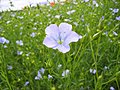 Flax, Great Shefford - geograph.org.uk - 893145.jpg 640 × 480; 113 KB
-
 Flood In The Yard - geograph.org.uk - 3371436.jpg 2 560 × 1 920; 645 KB
-
 Flood-plain of the River Lambourn - geograph.org.uk - 5420002.jpg 1 024 × 768; 172 KB
-

-
 Flooded path by the Animal Sanctuary - geograph.org.uk - 3371617.jpg 2 163 × 1 893; 851 KB
-
 Footbridge over the M4 - geograph.org.uk - 2293119.jpg 640 × 336; 39 KB
-
 Footpath is the Main Feature - geograph.org.uk - 5462078.jpg 3 888 × 2 592; 4,66 MB
-
 Footpath near Weston - geograph.org.uk - 2549293.jpg 1 600 × 1 200; 558 KB
-
 Footpath through the wheat - geograph.org.uk - 917040.jpg 640 × 418; 90 KB
-
 Footpath through the wheat - geograph.org.uk - 917045.jpg 427 × 640; 91 KB
-
 Footpath through the wheat - geograph.org.uk - 917077.jpg 640 × 427; 81 KB
-
 Former B4000, Shefford Woodlands - geograph.org.uk - 6418428.jpg 4 707 × 3 537; 3,67 MB
-
 Grazing Sheep, Great Shefford - geograph.org.uk - 5934737.jpg 4 938 × 3 056; 2,43 MB
-
 Great Shefford - Ivy House - 20210826164413.jpg 4 818 × 3 212; 12,98 MB
-
 Great Shefford - The Swan Inn - 20210826164300.jpg 4 793 × 3 196; 10,19 MB
-
 Great Shefford Church - geograph.org.uk - 2214231.jpg 2 560 × 1 920; 3,6 MB
-
 Great Shefford geograph-3579854-by-Ben-Brooksbank.jpg 2 329 × 1 439; 2,94 MB
-
 Great Shefford Post Office ^ Shop - geograph.org.uk - 4183169.jpg 3 784 × 2 680; 2,1 MB
-
 Great Shefford village entrance - geograph.org.uk - 5875348.jpg 1 600 × 1 000; 548 KB
-
 Great Shefford, beech avenue and arch - geograph.org.uk - 5943221.jpg 712 × 1 024; 261 KB
-

-
 Great Shefford, The Swan Inn - geograph.org.uk - 1660699.jpg 640 × 480; 68 KB
-
 Great Shefford, The War Memorial - geograph.org.uk - 1660653.jpg 640 × 480; 70 KB
-
 Groundwater Flooding at the Animal Sanctuary - geograph.org.uk - 3383985.jpg 2 483 × 1 536; 584 KB
-
 Hillside passes River Mead - geograph.org.uk - 3394559.jpg 3 146 × 2 338; 1,02 MB
-
 Houses at Wickfield - geograph.org.uk - 6419379.jpg 3 962 × 2 626; 1,3 MB
-
 Hungerford Hill at the junction of Ermin Street - geograph.org.uk - 5481755.jpg 2 048 × 1 536; 1,54 MB
-
 Lake at Henley Farm - geograph.org.uk - 3370743.jpg 2 560 × 1 920; 932 KB
-
 Lambourn Valley - geograph.org.uk - 4191673.jpg 640 × 480; 93 KB
-
 Lambourn Valley Way - geograph.org.uk - 3292436.jpg 640 × 480; 111 KB
-

-

-
 M4 footbridge - Breach Copse to Lovelocks path - geograph.org.uk - 2507593.jpg 3 648 × 2 736; 1,47 MB
-
 Maize near Wickfield Farm, Shefford Woodlands - geograph.org.uk - 2545433.jpg 1 440 × 1 080; 868 KB
-

-
 Marsh marigolds by the River Lambourn - geograph.org.uk - 3402775.jpg 1 500 × 953; 353 KB
-

-
 More Shefford Stream - geograph.org.uk - 3387429.jpg 2 375 × 1 677; 845 KB
-

-
 Newbury Road east of Shefford House - geograph.org.uk - 3394563.jpg 3 271 × 2 263; 1,22 MB
-
 Newbury Road enters East Shefford - geograph.org.uk - 3394562.jpg 3 133 × 2 474; 1,09 MB
-
 Northfield Farm OBH - geograph.org.uk - 3383975.jpg 2 325 × 1 728; 1,01 MB
-
 Oakhanger House - geograph.org.uk - 6419397.jpg 1 024 × 710; 287 KB
-

-
 Oilseed rape near Wickfield Farm, Shefford Woodlands - geograph.org.uk - 2545381.jpg 1 440 × 1 080; 699 KB
-

-
 Old Car in Great Shefford - geograph.org.uk - 4183176.jpg 1 600 × 956; 300 KB
-
 Old Pump, Henley Farm - geograph.org.uk - 3370779.jpg 1 567 × 1 600; 977 KB
-
 Old sign entering Shefford Woodlands - geograph.org.uk - 5482822.jpg 2 048 × 1 536; 1,42 MB
-
 One of the fairways - geograph.org.uk - 917104.jpg 640 × 427; 64 KB
-
 Path from church, Great Shefford - geograph.org.uk - 4191662.jpg 480 × 640; 189 KB
-
 Patterned Farmland near Great Shefford - geograph.org.uk - 73752.jpg 640 × 480; 152 KB
-
 Patterns in the wheat - geograph.org.uk - 917071.jpg 640 × 427; 124 KB
-
 Petrol station, Great Shefford - geograph.org.uk - 3012143.jpg 2 560 × 1 920; 1,01 MB
-
 Pumping at Great Shefford - geograph.org.uk - 3383991.jpg 2 429 × 1 797; 828 KB
-
 Pumping at Great Shefford 2 - geograph.org.uk - 3426672.jpg 1 920 × 2 560; 943 KB
-
 Rabbit's eye view - geograph.org.uk - 917085.jpg 640 × 427; 100 KB
-
 River Lambourn - geograph.org.uk - 3292424.jpg 640 × 480; 118 KB
-
 River Lambourn and back of the Swan pub, Great Shefford - geograph.org.uk - 3012260.jpg 2 560 × 1 920; 1,09 MB
-
 River Lambourn at Great Shefford - geograph.org.uk - 1660712.jpg 640 × 480; 119 KB
-

-
 Road to Wickfield - geograph.org.uk - 6416787.jpg 4 117 × 3 255; 1,89 MB
-
 Shefford Stream by Spring Meadows - geograph.org.uk - 6416767.jpg 4 742 × 3 000; 3,92 MB
-
 Shefford Valley Stud - geograph.org.uk - 918489.jpg 640 × 427; 101 KB
-
 Sign for the Pheasant Inn - geograph.org.uk - 1918498.jpg 480 × 640; 124 KB
-
 Snowdrops in the Churchyard - geograph.org.uk - 3371443.jpg 2 560 × 1 920; 1,31 MB
-
 Springburn Childcare, Shefford Woodlands - geograph.org.uk - 5904937.jpg 1 858 × 1 180; 1,06 MB
-
 St Stephen's Church, Shefford Woodlands - geograph.org.uk - 6418454.jpg 4 746 × 3 268; 2,5 MB
-

-
 St Thomas, East Shefford, altar (i) - geograph.org.uk - 4894028.jpg 640 × 480; 63 KB
-
 Stile and footpath, near Weston - geograph.org.uk - 2545851.jpg 1 080 × 1 440; 745 KB
-
 Stripey Sludge - geograph.org.uk - 3370774.jpg 2 560 × 1 920; 1,16 MB
-
 Stubble, Wickfield - geograph.org.uk - 257359.jpg 640 × 480; 128 KB
-
 Thatched cottage on Ermin Street, Shefford Woodlands - geograph.org.uk - 5481757.jpg 2 048 × 1 536; 891 KB
-
 Thatched house by the A338 in Great Shefford - geograph.org.uk - 5875357.jpg 1 600 × 888; 561 KB
-
 The church in Shefford Woodlands - geograph.org.uk - 5483323.jpg 2 048 × 1 536; 1,49 MB
-
 The M4, Shefford Woodlands - geograph.org.uk - 257327.jpg 640 × 480; 131 KB
-
 The Manor House, Church Street, Great Shefford, Berkshire.jpg 2 971 × 1 399; 899 KB
-
 The Pheasant Inn - geograph.org.uk - 6175192.jpg 1 600 × 1 199; 338 KB
-
 The Pheasant Inn from its car park - geograph.org.uk - 6347508.jpg 4 000 × 3 000; 4,58 MB
-
 The Pheasant Inn, Hungerford Newtown - geograph.org.uk - 1918485.jpg 640 × 480; 104 KB
-
 The River Lambourn by Station Road - geograph.org.uk - 3402776.jpg 1 500 × 1 000; 259 KB
-
 The River Lambourn by Station Road - geograph.org.uk - 3402777.jpg 1 500 × 1 000; 289 KB
-
 The Shefford Stream at Henley Farm - geograph.org.uk - 3370720.jpg 2 211 × 1 545; 540 KB
-
 The Shefford Stream at Northfield Farm - geograph.org.uk - 3383962.jpg 2 560 × 1 920; 1,21 MB
-
 The Shefford Stream at Trindledown Farm - geograph.org.uk - 3383980.jpg 2 560 × 1 920; 1,02 MB
-
 The Shefford Valley, East Side - geograph.org.uk - 4183436.jpg 1 024 × 764; 157 KB
-
 The Swan Inn Shefford - geograph.org.uk - 3012156.jpg 2 560 × 1 920; 1,08 MB
-
 The Swan Inn, Great Shefford, West Berkshire - geograph.org.uk - 5420099.jpg 1 024 × 768; 172 KB
-
-
 Top of the wheat field - geograph.org.uk - 917080.jpg 640 × 427; 80 KB
-
 Track to Templars Farm, Shefford Woodlands - geograph.org.uk - 5909745.jpg 1 896 × 1 244; 1,7 MB
-
 Tree by Baydon Road, Wickham - geograph.org.uk - 5901806.jpg 1 920 × 1 280; 1,3 MB
-

-
 View towards Daldridge Barn, near Weston - geograph.org.uk - 2545860.jpg 1 440 × 1 080; 1,07 MB
-
 Wantage Road from Great Shefford - geograph.org.uk - 3861466.jpg 1 500 × 987; 147 KB
-
 Wantage Road in flood - geograph.org.uk - 3861459.jpg 1 500 × 999; 126 KB
-
 Wantage Road in flood - geograph.org.uk - 3861468.jpg 1 500 × 999; 134 KB
-
 West Berkshire , M4 Motorway - geograph.org.uk - 5725422.jpg 6 000 × 4 000; 6,93 MB
-
 West Berkshire , M4 Motorway - geograph.org.uk - 5725423.jpg 6 000 × 4 000; 7,62 MB
-
 West Berkshire , M4 Motorway - geograph.org.uk - 5725424.jpg 6 000 × 4 000; 7,28 MB
-
 West Berkshire , M4 Motorway - geograph.org.uk - 5725425.jpg 6 000 × 4 000; 7,08 MB
-
 West Berkshire golf course - geograph.org.uk - 917110.jpg 640 × 427; 54 KB
-
 West Berkshire golf course - geograph.org.uk - 917113.jpg 640 × 427; 85 KB
-
 Wheat, Great Shefford - geograph.org.uk - 887520.jpg 640 × 480; 171 KB
-
 Wheat, Great Shefford - geograph.org.uk - 893132.jpg 640 × 480; 169 KB
-
 Wheat, near Shefford Woodlands - geograph.org.uk - 922381.jpg 640 × 480; 167 KB
-
 Who's moved my shop^ - geograph.org.uk - 918501.jpg 640 × 427; 71 KB
-
 Bridge over the Lambourn - geograph.org.uk - 74105.jpg 640 × 480; 628 KB
-
 Byway and Elton Lane at Elton Farm - geograph.org.uk - 73721.jpg 640 × 480; 415 KB
-
 Cattle and River Mead - geograph.org.uk - 230016.jpg 640 × 478; 190 KB
-
 Country Road to Great Shefford - geograph.org.uk - 73708.jpg 450 × 600; 350 KB
-
 Countryside near Great Shefford - geograph.org.uk - 73754.jpg 640 × 480; 130 KB
-
 Farm Buildings at East Shefford - geograph.org.uk - 73724.jpg 640 × 264; 256 KB
-
 Farmland above Weston - geograph.org.uk - 273467.jpg 640 × 480; 139 KB
-
 Farmland above Weston - geograph.org.uk - 273469.jpg 640 × 480; 143 KB
-
 Farmland above Weston - geograph.org.uk - 273472.jpg 640 × 480; 107 KB
-
 Farmland in a valley below Wickfield - geograph.org.uk - 257354.jpg 640 × 480; 102 KB
-
 Farmland near Shefford Woodlands - geograph.org.uk - 25869.jpg 450 × 600; 446 KB
-
 Gates and Byway to East Shefford House - geograph.org.uk - 73705.jpg 640 × 480; 132 KB
-
 River Lambourn - geograph.org.uk - 230011.jpg 640 × 478; 198 KB
-
 Stubble. Wickfield - geograph.org.uk - 257526.jpg 640 × 480; 107 KB
-
 Templars Farm - geograph.org.uk - 30368.jpg 640 × 480; 87 KB
-
 The B4000, Shefford Woodlands - geograph.org.uk - 257345.jpg 640 × 480; 135 KB


_-_geograph.org.uk_-_4894028.jpg)


