Category:Great Strickland
Aller à la navigation
Aller à la recherche
English: Great Strickland is a village and civil parish that lies in the Eden Valley between the Cumbrian mountains in the West and the Pennines in the East, it is five miles south east of Penrith, the village itself is in the former county of Westmorland.
localité britannique du comté anglais de Cumbria  | |||||
| Téléverser des médias | |||||
| Nature de l’élément | |||||
|---|---|---|---|---|---|
| Lieu | Eden, Cumbria, Angleterre du Nord-Ouest, Angleterre | ||||
| Réputé identique à | Great Strickland (page en doublon, paroisse civile) | ||||
 | |||||
Sous-catégories
Cette catégorie comprend seulement la sous-catégorie ci-dessous.
B
Média dans la catégorie « Great Strickland »
Cette catégorie comprend 55 fichiers, dont les 55 ci-dessous.
-
 18.07.16 Great Strickland 66110 (28525918852).jpg 5 875 × 3 907 ; 13,08 Mio
-
 A private drive in Great Strickland - geograph.org.uk - 4694577.jpg 2 592 × 1 944 ; 2,24 Mio
-
 Airygill Lane, Great Strickland - geograph.org.uk - 4064446.jpg 640 × 480 ; 104 kio
-
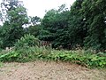
 Bridleway in Melkinthorpe Wood - geograph.org.uk - 4064464.jpg 640 × 480 ; 119 kio
-
 Bridleway to Melkinthorpe - geograph.org.uk - 4064459.jpg 480 × 640 ; 174 kio
-
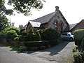 Chapel House, Great Strickland - geograph.org.uk - 4694587.jpg 2 592 × 1 944 ; 1,61 Mio
-
 Crags at Otter Stones - geograph.org.uk - 4064454.jpg 800 × 600 ; 242 kio
-
 Epirrhoe cf alternata - Flickr - S. Rae.jpg 2 233 × 1 809 ; 1,46 Mio
-
 Field south of Great Strickland - geograph.org.uk - 4024326.jpg 640 × 480 ; 481 kio
-
 Fields near Great Strickland - geograph.org.uk - 5499413.jpg 640 × 480 ; 79 kio
-
 Footbridge at Melkinthorpe - geograph.org.uk - 3361046.jpg 1 600 × 798 ; 572 kio
-
 Footbridge over the Leith at Melkinthorpe - geograph.org.uk - 4064471.jpg 640 × 480 ; 178 kio
-
 Footbridge, Greengill Sike - geograph.org.uk - 5499449.jpg 640 × 480 ; 143 kio
-
 Footbridge,River Leith - geograph.org.uk - 5499399.jpg 640 × 480 ; 128 kio
-
 Footpath above Greengill Sike - geograph.org.uk - 4493576.jpg 640 × 480 ; 69 kio
-
 Footpath at Kitt Gill, Melkinthorpe Wood - geograph.org.uk - 4064673.jpg 640 × 480 ; 107 kio
-
 Footpath into Kitt Gill, Melkinthorpe Woods - geograph.org.uk - 4067313.jpg 640 × 480 ; 224 kio
-
 Footpath north of Great Strickland - geograph.org.uk - 4064681.jpg 640 × 480 ; 96 kio
-
 Footpath through pasture, Field Head - geograph.org.uk - 4064701.jpg 640 × 480 ; 104 kio
-
 Footpath to Hodge Wood - geograph.org.uk - 5499409.jpg 640 × 480 ; 109 kio
-
 Ford, Melkinthorpe - geograph.org.uk - 58631.jpg 480 × 360 ; 25 kio
-
 Foundations on edge of Great Strickland^ - geograph.org.uk - 4064686.jpg 640 × 480 ; 118 kio
-
 Giant sycamore in the middle of Great Strickland - geograph.org.uk - 4024331.jpg 480 × 640 ; 474 kio
-
 Grass triangle in the centre of Great Strickland - geograph.org.uk - 4064447.jpg 640 × 480 ; 153 kio
-
 Greystone House Farm - geograph.org.uk - 4024333.jpg 640 × 480 ; 447 kio
-
 Inmoor Road - geograph.org.uk - 5499421.jpg 640 × 480 ; 78 kio
-
 Melkinthorpe Ford - geograph.org.uk - 3894326.jpg 3 872 × 2 592 ; 4,66 Mio
-
 Melkinthorpe Wood - geograph.org.uk - 5499404.jpg 640 × 480 ; 97 kio
-
 Morland Road, Stanley Bank Plantation - geograph.org.uk - 1428006.jpg 640 × 480 ; 124 kio
-
 Mown fields north of Great Strickland - geograph.org.uk - 4024887.jpg 640 × 480 ; 443 kio
-

-

-
 Ordnance Survey Rivet - geograph.org.uk - 5720798.jpg 384 × 640 ; 84 kio
-
 Path to Field Head - geograph.org.uk - 5499424.jpg 640 × 480 ; 100 kio
-
 Pylons and Barn - geograph.org.uk - 201342.jpg 480 × 640 ; 110 kio
-
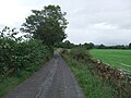
 Road by Street House - geograph.org.uk - 1160805.jpg 640 × 480 ; 46 kio
-
 Roadside field barn - geograph.org.uk - 201339.jpg 640 × 480 ; 113 kio
-
 Rough pastureland south of Field Head - geograph.org.uk - 4064714.jpg 640 × 480 ; 61 kio
-
 Small pond surrounded by shrubs - geograph.org.uk - 5499434.jpg 640 × 480 ; 54 kio
-
 Somebody's pleased with things - geograph.org.uk - 4067318.jpg 502 × 640 ; 221 kio
-
 Stanley Bank Plantation - geograph.org.uk - 1427998.jpg 640 × 480 ; 135 kio
-
 Stile on a footpath to Melkinthorpe Wood - geograph.org.uk - 400646.jpg 600 × 400 ; 95 kio
-
 The lane to Little Strickland - geograph.org.uk - 4694590.jpg 1 944 × 2 592 ; 1,29 Mio
-
 Track south of Field Head - geograph.org.uk - 4064708.jpg 640 × 480 ; 128 kio
-
 Waterfalls Bridge - geograph.org.uk - 4024897.jpg 640 × 480 ; 625 kio
-
 Waterfalls Road - geograph.org.uk - 4694570.jpg 2 592 × 1 944 ; 2,05 Mio
-
 Young cattle on In Moor - geograph.org.uk - 4064695.jpg 640 × 480 ; 109 kio
-
 Bridleway to Melkinthorpe - geograph.org.uk - 113278.jpg 427 × 640 ; 170 kio
-
 Edge of Melkinthorpe Wood - geograph.org.uk - 400651.jpg 600 × 400 ; 93 kio
-
 Inmoor Road, Great Stricklands - geograph.org.uk - 175675.jpg 640 × 480 ; 182 kio
-

-
 Looking North from bridge at Thrimby - geograph.org.uk - 200807.jpg 640 × 480 ; 132 kio
-
 Serious Problem - geograph.org.uk - 175678.jpg 640 × 480 ; 71 kio
-
 Strickland Arms, Great Stricklands - geograph.org.uk - 175674.jpg 640 × 480 ; 88 kio
-
 The road to Melkinthorpe Wood - geograph.org.uk - 566790.jpg 640 × 480 ; 75 kio
.jpg)


