Category:Great Strickland
Jump to navigation
Jump to search
English: Great Strickland is a village and civil parish that lies in the Eden Valley between the Cumbrian mountains in the West and the Pennines in the East, it is five miles south east of Penrith, the village itself is in the former county of Westmorland.
village and civil parish in Cumbria, United Kingdom  | |||||
| Upload media | |||||
| Instance of | |||||
|---|---|---|---|---|---|
| Location | Eden, Cumbria, North West England, England | ||||
| Said to be the same as | Great Strickland (Wikimedia duplicated page, civil parish) | ||||
 | |||||
Subcategories
This category has only the following subcategory.
B
Media in category "Great Strickland"
The following 55 files are in this category, out of 55 total.
-
 18.07.16 Great Strickland 66110 (28525918852).jpg 5,875 × 3,907; 13.08 MB
-
 A private drive in Great Strickland - geograph.org.uk - 4694577.jpg 2,592 × 1,944; 2.24 MB
-
 Airygill Lane, Great Strickland - geograph.org.uk - 4064446.jpg 640 × 480; 104 KB
-
 Bridleway in Melkinthorpe Wood - geograph.org.uk - 4064464.jpg 640 × 480; 119 KB
-
 Bridleway to Melkinthorpe - geograph.org.uk - 4064459.jpg 480 × 640; 174 KB
-
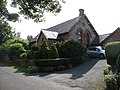 Chapel House, Great Strickland - geograph.org.uk - 4694587.jpg 2,592 × 1,944; 1.61 MB
-
 Crags at Otter Stones - geograph.org.uk - 4064454.jpg 800 × 600; 242 KB
-
 Epirrhoe cf alternata - Flickr - S. Rae.jpg 2,233 × 1,809; 1.46 MB
-
 Field south of Great Strickland - geograph.org.uk - 4024326.jpg 640 × 480; 481 KB
-
 Fields near Great Strickland - geograph.org.uk - 5499413.jpg 640 × 480; 79 KB
-
 Footbridge at Melkinthorpe - geograph.org.uk - 3361046.jpg 1,600 × 798; 572 KB
-

-
 Footbridge, Greengill Sike - geograph.org.uk - 5499449.jpg 640 × 480; 143 KB
-
 Footbridge,River Leith - geograph.org.uk - 5499399.jpg 640 × 480; 128 KB
-
 Footpath above Greengill Sike - geograph.org.uk - 4493576.jpg 640 × 480; 69 KB
-
 Footpath at Kitt Gill, Melkinthorpe Wood - geograph.org.uk - 4064673.jpg 640 × 480; 107 KB
-

-
 Footpath north of Great Strickland - geograph.org.uk - 4064681.jpg 640 × 480; 96 KB
-
 Footpath through pasture, Field Head - geograph.org.uk - 4064701.jpg 640 × 480; 104 KB
-
 Footpath to Hodge Wood - geograph.org.uk - 5499409.jpg 640 × 480; 109 KB
-
 Ford, Melkinthorpe - geograph.org.uk - 58631.jpg 480 × 360; 25 KB
-
 Foundations on edge of Great Strickland^ - geograph.org.uk - 4064686.jpg 640 × 480; 118 KB
-

-

-
 Greystone House Farm - geograph.org.uk - 4024333.jpg 640 × 480; 447 KB
-
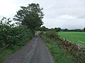 Inmoor Road - geograph.org.uk - 5499421.jpg 640 × 480; 78 KB
-
 Melkinthorpe Ford - geograph.org.uk - 3894326.jpg 3,872 × 2,592; 4.66 MB
-
 Melkinthorpe Wood - geograph.org.uk - 5499404.jpg 640 × 480; 97 KB
-
 Morland Road, Stanley Bank Plantation - geograph.org.uk - 1428006.jpg 640 × 480; 124 KB
-
 Mown fields north of Great Strickland - geograph.org.uk - 4024887.jpg 640 × 480; 443 KB
-

-

-
 Ordnance Survey Rivet - geograph.org.uk - 5720798.jpg 384 × 640; 84 KB
-
 Path to Field Head - geograph.org.uk - 5499424.jpg 640 × 480; 100 KB
-
 Pylons and Barn - geograph.org.uk - 201342.jpg 480 × 640; 110 KB
-
 Road by Street House - geograph.org.uk - 1160805.jpg 640 × 480; 46 KB
-
 Roadside field barn - geograph.org.uk - 201339.jpg 640 × 480; 113 KB
-

-
 Small pond surrounded by shrubs - geograph.org.uk - 5499434.jpg 640 × 480; 54 KB
-
 Somebody's pleased with things - geograph.org.uk - 4067318.jpg 502 × 640; 221 KB
-
 Stanley Bank Plantation - geograph.org.uk - 1427998.jpg 640 × 480; 135 KB
-

-
 The lane to Little Strickland - geograph.org.uk - 4694590.jpg 1,944 × 2,592; 1.29 MB
-
 Track south of Field Head - geograph.org.uk - 4064708.jpg 640 × 480; 128 KB
-
 Waterfalls Bridge - geograph.org.uk - 4024897.jpg 640 × 480; 625 KB
-
 Waterfalls Road - geograph.org.uk - 4694570.jpg 2,592 × 1,944; 2.05 MB
-
 Young cattle on In Moor - geograph.org.uk - 4064695.jpg 640 × 480; 109 KB
-
 Bridleway to Melkinthorpe - geograph.org.uk - 113278.jpg 427 × 640; 170 KB
-
 Edge of Melkinthorpe Wood - geograph.org.uk - 400651.jpg 600 × 400; 93 KB
-
 Inmoor Road, Great Stricklands - geograph.org.uk - 175675.jpg 640 × 480; 182 KB
-

-
 Looking North from bridge at Thrimby - geograph.org.uk - 200807.jpg 640 × 480; 132 KB
-
 Serious Problem - geograph.org.uk - 175678.jpg 640 × 480; 71 KB
-
 Strickland Arms, Great Stricklands - geograph.org.uk - 175674.jpg 640 × 480; 88 KB
-
 The road to Melkinthorpe Wood - geograph.org.uk - 566790.jpg 640 × 480; 75 KB
.jpg)


