Category:Greinton
Aller à la navigation
Aller à la recherche
English: Greinton is a village and parish in Somerset, England, situated on the Somerset Levels and Moors at the foot of the Polden Hills, nine kilometers west southwest of Glastonbury and 7 miles east of Bridgwater in the Sedgemoor district.
localité britannique du comté anglais de Somerset  | |||||
| Téléverser des médias | |||||
| Nature de l’élément | |||||
|---|---|---|---|---|---|
| Lieu | Sedgemoor, Somerset, Angleterre du Sud-Ouest, Angleterre | ||||
| Réputé identique à | Greinton (page en doublon, paroisse civile) | ||||
 | |||||
Sous-catégories
Cette catégorie comprend seulement la sous-catégorie ci-dessous.
Média dans la catégorie « Greinton »
Cette catégorie comprend 29 fichiers, dont les 29 ci-dessous.
-
 2nd hand car dealership, Greinton - geograph.org.uk - 5035186.jpg 1 024 × 768 ; 152 kio
-
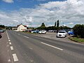
 A361, Greinton - geograph.org.uk - 1887928.jpg 640 × 480 ; 159 kio
-
 A361, Greinton - geograph.org.uk - 2520366.jpg 640 × 480 ; 140 kio
-
 Car approaching a closed layby - geograph.org.uk - 4546180.jpg 640 × 480 ; 174 kio
-
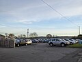 Cars parked at Greinton Service Station - geograph.org.uk - 5612109.jpg 1 600 × 1 200 ; 570 kio
-
 Communications in Greinton - geograph.org.uk - 5611360.jpg 1 600 × 1 199 ; 752 kio
-
 Cottage on the A361 - geograph.org.uk - 5035213.jpg 1 024 × 768 ; 186 kio
-
 Friesians, Greinton - geograph.org.uk - 2520364.jpg 640 × 480 ; 137 kio
-
 Gateway into farm area - geograph.org.uk - 4546177.jpg 640 × 480 ; 172 kio
-
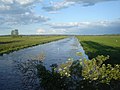
 Greinton Rhyne - geograph.org.uk - 5298304.jpg 1 024 × 768 ; 264 kio
-
 Greylake Inn - geograph.org.uk - 5035180.jpg 1 024 × 855 ; 224 kio
-
 Houses on the A361 - geograph.org.uk - 5035183.jpg 1 024 × 863 ; 168 kio
-
 Track on Briarwood Farm - geograph.org.uk - 5035200.jpg 1 024 × 768 ; 289 kio
-
 A361 Grienton - geograph.org.uk - 1448452.jpg 640 × 480 ; 188 kio
-
 Boundary Rhyne from Greylake Bridge - geograph.org.uk - 450223.jpg 640 × 480 ; 92 kio
-
 Drain on King's Sedgemoor - geograph.org.uk - 485438.jpg 640 × 480 ; 96 kio
-
 Eighteen Foot Rhyne - geograph.org.uk - 485597.jpg 640 × 480 ; 127 kio
-
 Footpath to Greinton - geograph.org.uk - 485608.jpg 640 × 480 ; 122 kio
-
 From Greylake Bridge, over Boundary Rhyne - geograph.org.uk - 450174.jpg 640 × 480 ; 87 kio
-
 Greenway Farm, Greinton - geograph.org.uk - 194189.jpg 640 × 480 ; 65 kio
-
 Greinton Garage and Elm Cafe - geograph.org.uk - 427394.jpg 640 × 343 ; 37 kio
-
 Greinton Rhyne and Lower Nythe Farm - geograph.org.uk - 485704.jpg 480 × 640 ; 123 kio
-
 Greylake RSPB Nature Reserve - geograph.org.uk - 1419595.jpg 640 × 427 ; 77 kio
-
 Greylake RSPB Nature Reserve - geograph.org.uk - 1419597.jpg 640 × 427 ; 68 kio
-
 Kings Sedgemoor Drain - geograph.org.uk - 485604.jpg 640 × 480 ; 138 kio
-
 Not a tree - geograph.org.uk - 196642.jpg 640 × 480 ; 120 kio
-
 Nythe Sluice on the Eighteen Feet Rhyne - geograph.org.uk - 96738.jpg 640 × 472 ; 92 kio
-
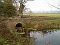 Rhyne and Accommodation Bridge - geograph.org.uk - 96739.jpg 640 × 480 ; 110 kio
-
 Road Junction on the A39 - geograph.org.uk - 115725.jpg 640 × 471 ; 135 kio


