Category:Sedgemoor District
Jump to navigation
Jump to search
| Sedgemoor District |
|---|
|
Deutsch: Sedgemoor ist ein District in der Grafschaft Somerset in England. Verwaltungssitz ist die Stadt Bridgwater; weitere bedeutende Orte sind Burnham-on-Sea, Cheddar und North Petherton.
Français : Sedgemoor est un district non-métropolitain situé dans le comté du Somerset, en Angleterre. Son chef-lieu est Bridgwater.
Nederlands: Sedgemoor is een Engels district in het graafschap Somerset en telt 105.881 inwoners. De oppervlakte bedraagt 564,4 km².
Norsk bokmål: Sedgemoor er et administrativt distrikt i Somerset, England. Administrasjonssenteret er Bridgwater.
Polski: Sedgemoor – dystrykt w Anglii, w hrabstwie Somerset, ze stolicą w Bridgwater. Powierzchnia – 584 km2, 111 000 mieszkańców. Utworzony 1 kwietnia 1974. W dystrykcie znajduje się jedna z najstarszych dróg w Europie, prowadząca przez bagna – The Sweet Track
Română: Sedgemoor este un district nemetropolitan în Regatul Unit, în comitatul Somerset din regiunea South West, Anglia.
|
local government district in Somerset, England   | |||||
| Upload media | |||||
| Instance of | |||||
|---|---|---|---|---|---|
| Location | Somerset, South West England, England | ||||
| Capital | |||||
| Legislative body |
| ||||
| Inception |
| ||||
| Population |
| ||||
| Area |
| ||||
| official website | |||||
 | |||||
Subcategories
This category has the following 55 subcategories, out of 55 total.
Media in category "Sedgemoor District"
The following 36 files are in this category, out of 36 total.
-
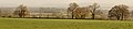
 Along Pincombe Drove - geograph.org.uk - 460940.jpg 640 × 480; 142 KB
-
 Axbridge Parish Boundary Stone - panoramio.jpg 2,736 × 3,648; 3.91 MB
-
 Balancing Act, Wicker Man, M5 Somerset. - panoramio.jpg 2,051 × 1,610; 242 KB
-
 Boat yard - panoramio.jpg 3,888 × 2,592; 4.3 MB
-
 Brent Knoll. - panoramio.jpg 2,816 × 2,112; 2.74 MB
-
 Bridge over River Axe. - panoramio.jpg 2,736 × 3,648; 3.77 MB
-
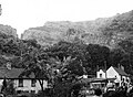 Cheddar Rising at Cheddar Gorge, Cufic Ln, Somerset (050207) (9461105986).jpg 2,846 × 2,097; 2.73 MB
-
 Crooks Peak and drystone wall. - panoramio.jpg 2,592 × 1,952; 953 KB
-
 Elephant Grass, Stubbington Drove, Axbridge. - panoramio.jpg 3,648 × 2,736; 3.94 MB
-
 Finding new space (5178198452).jpg 3,039 × 2,014; 2.34 MB
-
 Flowers and rowan berries (Unsplash).jpg 4,000 × 2,667; 7.98 MB
-
 Humphry, the famous Concrete Camel of the M5. - panoramio.jpg 1,869 × 1,173; 236 KB
-
 Jetty, Burnham on Sea. - panoramio.jpg 3,648 × 1,945; 1.63 MB
-

-
 Lid of the water tank - panoramio.jpg 2,448 × 1,624; 3.31 MB
-

-
-
 Looking across the Somerset Levels from the Polden Hills on a misty morning. - panoramio.jpg 2,448 × 1,624; 2.12 MB
-
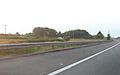
 M5 from Brent Knoll - panoramio.jpg 8,245 × 1,500; 5.92 MB
-
 Path to Brent Knoll. - panoramio.jpg 2,097 × 2,483; 1.08 MB
-
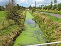 Rhyne on West Sedgemoor - geograph.org.uk - 1400076.jpg 640 × 480; 133 KB
-
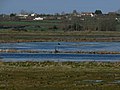 RSPB West Sedgemoor nature reserve - lake.jpg 1,280 × 960; 611 KB
-
 Sedgemoor Old Rhyne - geograph.org.uk - 1400056.jpg 640 × 480; 123 KB
-
 Silver Lining - panoramio (1).jpg 2,592 × 1,944; 2.06 MB
-
 Site of the Battle of Sedgemoor (1685) - geograph.org.uk - 958894.jpg 640 × 480; 217 KB
-
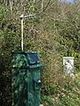 Solar powered transmitting device, Brean Down Water Reservoir. - panoramio.jpg 2,736 × 3,648; 7.23 MB
-
 Somerset, United Kingdom (Unsplash 4aSCchQ1hzk).jpg 3,318 × 2,212; 967 KB
-
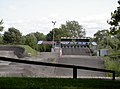 Start and Finish (geograph 3680170).jpg 2,304 × 1,704; 1.67 MB
-
 Steps for the start ramp (geograph 3680157).jpg 2,304 × 1,704; 1.3 MB
-
 Stert Island, in the Parrett Estuary - geograph.org.uk - 3904917.jpg 1,024 × 768; 151 KB
-
 Stubbington Drove, Axbridge. - panoramio.jpg 3,648 × 2,736; 3.76 MB
-
 The Map of Sedgemoor, with adjacent Parts (1662).jpg 5,215 × 3,988; 13.86 MB
-
 Trickle of water from the well - panoramio.jpg 1,624 × 2,448; 2.47 MB
-
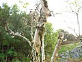 Twisted tree - panoramio (1).jpg 3,264 × 2,448; 3.8 MB
-
 West Sedgemoor, Somerset - geograph.org.uk - 49412.jpg 640 × 480; 358 KB
-
 Weston Super Mare from Brean Down. - panoramio.jpg 2,816 × 2,112; 1.89 MB


_(9461105986).jpg)


.jpg)
.jpg)


.jpg)
_-_geograph.org.uk_-_958894.jpg)
.jpg)
.jpg)
.jpg)


.jpg)

.jpg)


.jpg)
.jpg)