Category:Groninger Straße 7 (Leer)
Jump to navigation
Jump to search
| Object location | | View all coordinates using: OpenStreetMap |
|---|
| Upload media | |||||
| Instance of | |||||
|---|---|---|---|---|---|
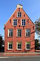
| Location | Leer, Lower Saxony, Germany | ||||
 | |||||
Media in category "Groninger Straße 7 (Leer)"
The following 4 files are in this category, out of 4 total.
-
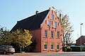 Leer - Groninger Straße - 7 01 ies.jpg 5,616 × 3,744; 17.45 MB
-
 Leer - Groninger Straße - 7 02 ies.jpg 3,744 × 5,616; 17.39 MB
-
 Leer - Groninger Straße - 7 03 ies.jpg 3,743 × 5,616; 18.23 MB
-
 Leer - Groninger Straße - 7 04 ies.jpg 5,616 × 3,745; 18.37 MB


